


I did the Valley of Flowers trek with Roopkund Heaven and it was absolutely amazing! Everything—from the planning to the execution—was smooth and very well-managed. The team was professional, friendly, and genuinely passionate about the mountains.A special shoutout to Sunil and Devendra, our trek leaders, who made the experience even better.Highly recommend booking your next adventure with them. Looking forward to doing another trek soon!

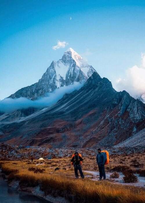
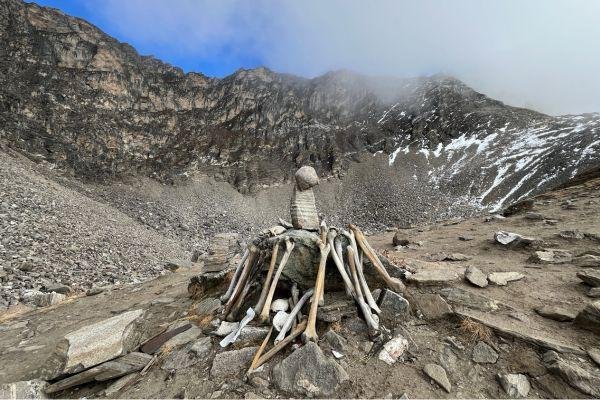
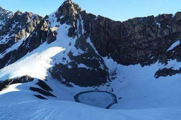
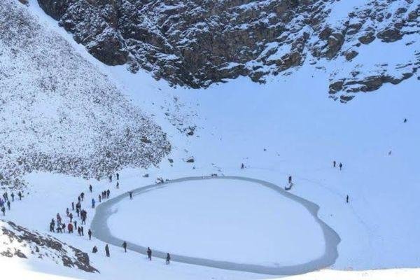
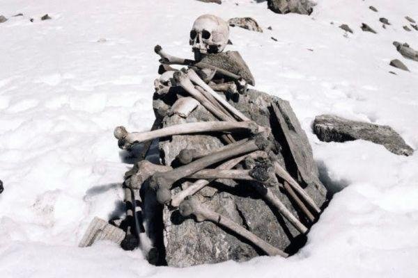
Roopkund isn’t just a trek, it’s a journey into a Himalayan mystery. You start in quiet villages, walk through whispering oak forests, and cross endless meadows that feel like the roof of the world. By the time you reach Skeleton Lake, the air is thin, the world is silent, and you’re standing in a place where history, legend, and nature collide. It’s breathtaking, exhausting, and unforgettable — not for beginners, but worth every step for those ready to test their limitsSpecial thanks tooo Sunilll who makes our trek more amazing and full of funsss 💚💚💚

Had the most amazing time on the brahmatal trek- a massive thank you to Bracash for guiding us all up the mountain! All the staff were so welcoming and lovely, throughout the whole trip. We loved every second of the trip, and can’t wait to do another one.Everything was so well organised throughout the trek from the welcome on the first night, to the tents we slept in and rest stops along the way. Plus the food throughout the trip was delicious!We also hired bags through the company which came with everything we needed to complete the trek.Highly highly recommend booking the trek through these guys - we loved it!

I arrived in Lohajung without a booking and stumbled upon Roopkund Heaven, where the owner graciously helped me decide between the Brahmatal Trek and Ali Bedni Bugyal Trek. I opted for the latter and joined a group tour organized by Roopkund Heaven. They kindly customized the itinerary to accommodate my early descent plans. The trek leader was friendly and welcoming, and the food was delicious. Overall, it was an unforgettable experience, and I'm grateful to Roopkund Heaven for making it happen!

I had the pleasure of trekking with Roopkund Heaven for both my Brahmatal and Roopkund treks, and they truly made the experience exceptional. The entire service, from the cooking staff to the trek leader, was flawless. Every detail was taken care of, ensuring we had a smooth and enjoyable journey. The efficiency of their team allowed us to focus on the beauty of the trek, while they handled everything else seamlessly. I enjoyed every bit of it and highly recommend Roopkund Heaven for anyone looking for a well-organized and memorable trekking experience

Great Experience with Roopkund Heaven. I gave them 5 star .... For their Trek Leaders,Rajendra and Duggu Bhai who gave us freedom to enjoy the trek, For their awesome food, Quality of Camp, Sleeping Bags... My entire experience was awesome... Also I recommend all my friends and colleagues to go for Roopkund Heaven for great experience on Beautiful Treks

I can say Roopkund Heaven is one of the best trip organizer for the mountains Treks. We are group of six people's and they are managing very well. Narendra is an exceptional person, he handles our queries and encourages us to trek the Brahmatal trek. Will plan our next trek soon...😊

We had an incredible experience of valley of flowers and hemkund sahib with Roopkund Heaven on our first trek! The entire journey was totally safe and smooth, thanks to the team's constant availability and support. Special mention to our guide, Kamlesh, who went above and beyond to make us feel like family. His super funny and caring nature ensured that we had an absolute blast! Highly recommend Roopkund Heaven and Kamlesh for a memorable and hassle-free trekking experience."