Trek Grade
Moderate to Difficult
Highest Altitute
15,250 ft / 4,650 m
Best Season
Spring & Autumn
Trek Duration
6 Nights / 7 Days
Trekking Km
42 km
Stays
Guesthouse + Camp
transport
Shimla
trek region
Himachal Pradesh
Base camp
Jiskun
Meals
Veg Meals
Trek Grade
Moderate to Difficult
Highest Altitute
15,250 ft / 4,650 m
Trek Duration
6 Nights / 7 Days
Base camp
Jiskun
Meals
veg meal
Stays
Guesthouse + Camp
transport
Shimla
trek region
Himachal Pradesh
Trekking Km
42 km
Trek Grade
Easy to Moderate
Highest Altitute
15,000 feet
Base camp
Rishikesh
Trek Duration
3D | 2N
Stays
Meals
transport
activities
How to Reach
Trek Grade
Trek Grade
Trek Grade
Trek Grade
Trek Grade
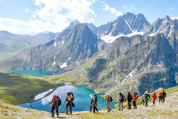
Rupin Pass Overview
Most Himalayan treks ask you to reach something – a pass, a peak, a lake. The Rupin Pass Trek asks you to follow something: a river. From the moment you leave Jiskun village to the moment you stand at 4,650 metres on the pass, the Rupin River is your companion, your guide, and your trail.
It doesn’t just run beside the route – it is the route. The trail follows its mood, its pace, its direction. And that mood changes every single day.
Rupin Pass Trek starts as a wide, calm valley river below the forests of Jiskun, moving slowly through apple orchards and pine slopes. As you climb higher through the forest above Bawta, the river narrows and picks up speed.
By the time you reach the open meadows of Dandreyash Thatch, it has become a small mountain stream – cold, clear, and quiet. Higher still, it drops – 3 stages of waterfalls. And then, close to the pass, it disappears completely into snow. It becomes the ground you are walking on. You don’t cross the river to reach the top. You walk on it.
That one idea following a river all the way from a valley floor to the snowfield where it is still being born is what makes the Rupin Pass Trek one of the most special journeys in the Indian Himalayas.
The Rupin Pass Trek is a 7 day, 42-km trek that crosses from Himachal Pradesh into Uttarakhand and back. It starts at Jiskun village in Himachal Pradesh, crosses the Rupin Pass at 4,650 metres (15,250 feet), briefly touches Uttarakhand on the way down, and ends at Sangla Valley in Himachal.
Along the way, the route passes through thick forests, old mountain villages, wide open grasslands, a massive three-stage waterfall, and steep snow slopes before giving you one of the best summit views in the western Himalayas.
- Day 1 is a long mountain drive from Shimla through the Chainsheel Valley. Most people underestimate this drive. Most people also end up enjoying it more than they expected.
- Day 2 puts you on a steep forest trail climbing to Jhaka, a traditional Kinnauri village sitting so dramatically on a narrow mountain ridge that it looks like it is floating in the air when you see it from the valley below.
- Day 3 takes you above the treeline for the first time, out into the wide grasslands of Dandreyash Thatch at 3,556 metres. On a clear evening here, you can see the Kinner Kailash Range on the southern horizon
- Day 4 is a rest and acclimatisation day. A genuinely necessary pause that your body needs before the altitude push ahead.
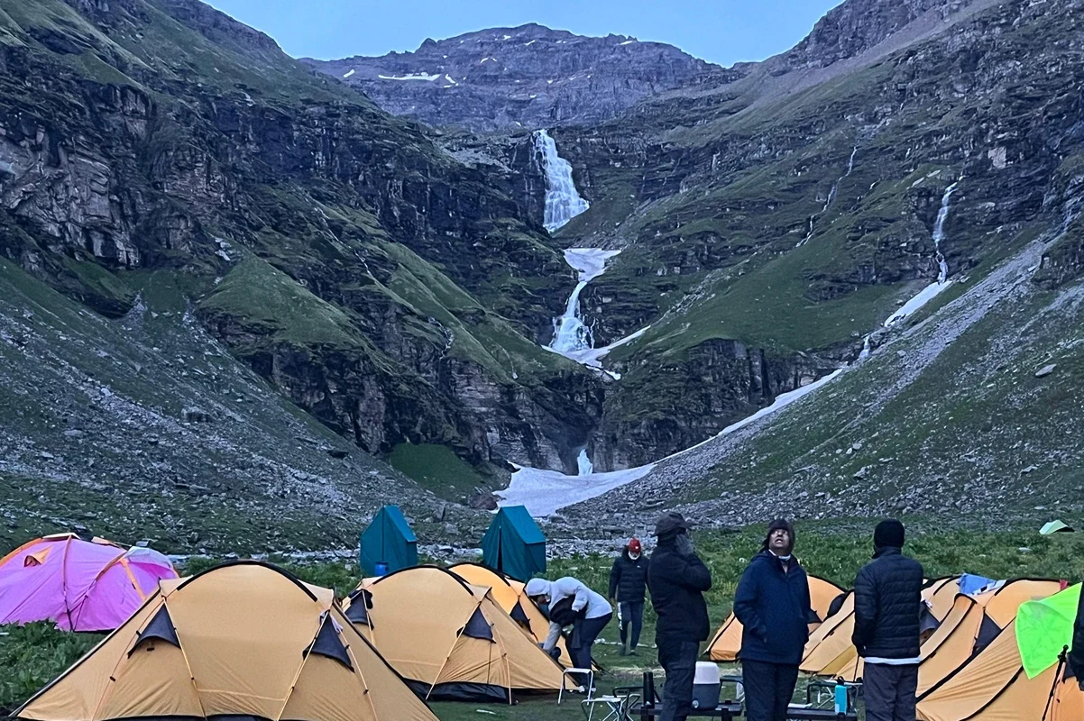
- Day 5 brings you to the Rupin Waterfall and it is difficult to describe the scale of it without overstating things. Three stages of water falling nearly 500 metres down a sheer cliff face into a glacial bowl.
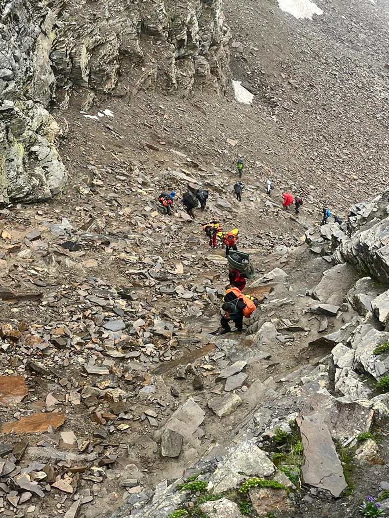
- Day 6 is summit day. It starts before 4 AM, climbs through the Rupin Gully, a steep, snow-packed corridor that demands focused, careful movement and reaches the pass at 4,650 metres after 10 to 11 hours of trekking.
- Day 7 is the walk down into Sangla Valley – green, warm, pine-scented and then the long overnight drive back to Shimla.
What surprises most people who do this route is that it never feels like one long climb to a summit and back. Most multi-day treks give you one big moment at the top and a long walk back down the same path. The Rupin Pass Trek gives you something new at every campsite, right until the last morning.
The villages along the lower route – Jiskun, Bawta, Jhaka are real, living Kinnauri communities. The architecture is Kath-Kuni: stone walls, timber frames, houses that have stood for generations.
In terms of difficulty, the Rupin Pass Trek is rated moderate to difficult. You do not need any technical climbing experience. There are no vertical rock faces, no glacier crossings, no ropes in the mountaineering sense. But you do need to be fit, because the summit day is 10 to 11 hours long. You need to be comfortable in cold conditions, because temperatures near the pass can drop to -5°C or lower.
The right person for this trek is someone who has done at least one moderate Himalayan trek before like Kedarkantha, Brahmatal, or Hampta Pass and is ready to take the next step.
The total distance is 42 km over 7 days. Daily walking distances range from 5 km on the shorter days to 12 km on summit day. And it is exactly why, when you step onto Rupin Pass and the mountains open up in every direction, the moment feels completely and entirely yours.
If you are physically ready for this, there is no reason to wait.
Trek Highlights
- The Hanging Village of Jhaka: a traditional Kath-Kuni settlement perched on a narrow mountain spine, appearing suspended over the valley when seen from below
- Three-Stage Rupin Waterfall: one of the most dramatic natural features on any Himalayan trekking route; nearly 500 metres of cascading water into a glacial amphitheatre
- Dandreyash Thatch: vast open meadow at 3,556 m, surrounded by ridgelines, with views of the Kinner Kailash Range on clear evenings
- The Rupin Gully: steep, snow-filled corridor on summit day; the most technically demanding and most memorable section of the trek
- Summit Panorama at 4,650 m: the full sweep of the Kinner Kailash Range to the south, Uttarakhand’s high ridges ahead, and the valley you’ve spent six days walking through laid out below in complete silence
- Sangla Valley: one of Himachal Pradesh’s most beautiful valleys; your endpoint after the trek, framed by sheer cliff walls with the Baspa River running through it
- Kinnauri Culture: traditional villages, apple orchards, and a way of mountain life that hasn’t changed much despite the decades
Quick Facts
- Trek Location: Himachal Pradesh → Uttarakhand → Himachal Pradesh
- Starting Point: Jiskun Village (drive from Shimla)
- Ending Point: Sangla Valley
- Maximum Altitude: 4,650 m / 15,250 ft
- Total Distance: ~42 km
- Duration: 7 Days / 6 Nights
- Difficulty: Moderate to Difficult
- Best Time: May–June · September–October
- Base Camp: Jiskun, Himachal Pradesh (~2,340 m)
- Trek Type: Point-to-point crossover
- Nearest City: Shimla (~190 km)
Rupin Pass Trek Itinerary
Daily Hiking Schedule Of Rupin Pass trek
Day 1 Shimla to Jiskun
Drive: 190 km | Duration: 8–9 hours | Altitude: 2,340 m | Overnight: Guesthouse at Jiskun
Day 1
Shimla to Jiskun
Drive: 190 km | Duration: 8–9 hours | Altitude: 2,340 m | Overnight: Guesthouse at JiskunYour trek doesn’t begin at the trailhead. It begins the moment you leave Shimla. The drive to Jiskun via Rohru and the Chainsheel Valley is its own quiet introduction to the mountains, apple orchards on terraced hillsides, the highway thinning into mountain roads, towns becoming smaller and further apart. After Rohru, the valley deepens and the world outside the window turns completely wild. Leave Shimla by 6 AM. Arriving at Jiskun by afternoon gives you daylight to settle into the guesthouse, eat a warm meal, and sleep at a sensible hour.
Jiskun is a quiet Himachali village at 2,340 metres. Surrounded by pine slopes and terraced farms, it is unhurried and self-contained. Spend the evening hydrating, resting, and preparing your pack. Tomorrow is a long day.
Before you leave Rohru: Withdraw cash, there are no ATMs beyond this point for the next 7 days. Download offline maps. Reliable mobile network ends here.
Day 2 Jiskun → Bawta → Jhaka
Distance: 10–11 km | Duration: 6–7 hours | Altitude gain: 2,340 m → 2,750 m | Overnight: Camp above Jhaka
Day 2
Jiskun → Bawta → Jhaka
Distance: 10–11 km | Duration: 6–7 hours | Altitude gain: 2,340 m → 2,750 m | Overnight: Camp above JhakaThe trail out of Jiskun climbs immediately. Within the first hour, through dense deodar and walnut forest. The forest is shadowy in the early hours, filled with birdsong and, somewhere below, the sound of the Rupin River. Bawta, a small cluster of homes and tea stalls, arrives as a welcome mid-climb stop. Refill water here. The trail steepens from Bawta onward.
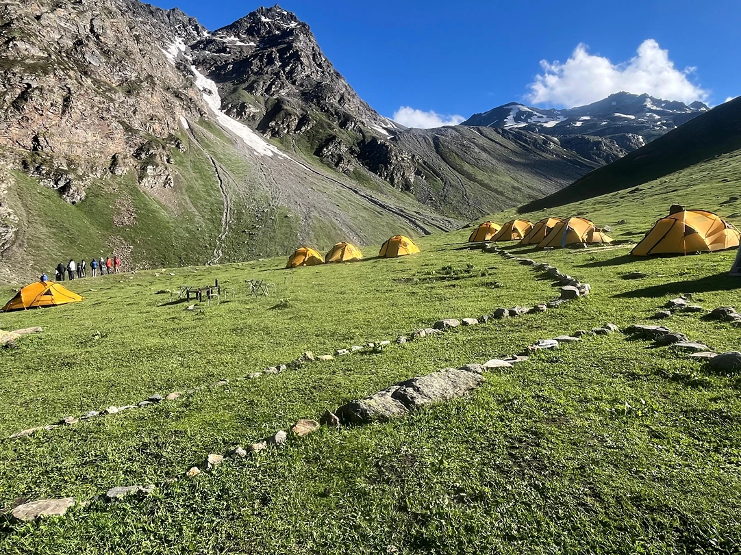
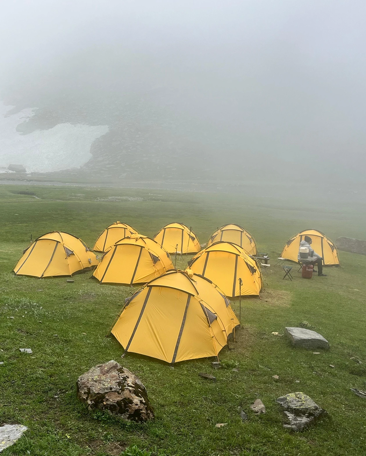
Jhaka is the landmark of the day. This is the famous Hanging Village of the Rupin Pass Trek, a settlement of traditional Kath-Kuni wooden houses built on a narrow mountain spur in a way that makes the entire village appear suspended when viewed from the valley below. Jhaka follows Satsang traditions and is meat-free. There’s a quietness about it that altitude alone doesn’t explain. This is the last inhabited village on the route. Hire a porter here if needed. Buy anything from a local shop you may have forgotten. Beyond Jhaka, there is nothing but trail. Campsites are set on open ground just above the village, with valley views in every direction.
Day 3 Jhaka → Saruwas Thatch → Dandreyash Thatch
Distance: 11–12 km | Duration: 7–8 hours | Altitude gain: 2,750 m → 3,556 m | Overnight: Dandreyash Thatch
Day 3
Jhaka → Saruwas Thatch → Dandreyash Thatch
Distance: 11–12 km | Duration: 7–8 hours | Altitude gain: 2,750 m → 3,556 m | Overnight: Dandreyash ThatchThis is the day the trek stops feeling like a forest walk and starts feeling like a Himalayan expedition. Above Jhaka, the treeline ends. Wide alpine meadows, sweeping, sun-drenched, disproportionately vast – open in front of you. The Rupin River is now far below in the valley. You’ll hear it all day. Saruwas Thatch is a broad plateau meadow that most groups use as a lunch point. In June, wildflowers cover every slope. In October, the grass has turned amber and the ridgelines are crystalline against a blue sky.
From Saruwas Thatch, the trail continues climbing to Dandreyash Thatch at 3,556 m, your home for the next two nights. The campsite sits inside a wide glacial bowl, ringed by ridgelines, with the Kinner Kailash Range visible on clear evenings. Your first proper view of distant snow happens somewhere along this stretch. Nights here are genuinely cold – 0°C to 5°C. Layer up early, drink plenty of fluids, eat well.
Day 4 Rest & Acclimatisation at Dandreyash Thatch
Short walk: 2–3 km | Altitude: 3,556 m | Overnight: Dandreyash Thatch
Day 4
Rest & Acclimatisation at Dandreyash Thatch
Short walk: 2–3 km | Altitude: 3,556 m | Overnight: Dandreyash ThatchThis day is not optional. It is the most important day on the itinerary. At 3,556 metres you are already at altitude. In two days you will be at 4,650 metres. Today exists to give your bloodstream, your lungs, and your red cell count the time they need to adapt before that push. The protocol is simple: wake up, eat, take a short 2–3 km uphill walk, return to camp, rest, hydrate (3–4 litres), eat, sleep early. The “climb high, sleep low” principle at its most basic.
Avoid alcohol entirely. Eat even if your appetite has decreased – appetite suppression is normal at altitude, but your body needs the calories. If a headache develops and doesn’t improve with rest and hydration after two hours, tell your trek leader immediately.
Use this day to check your summit kit: down jacket, gloves, balaclava, headtorch with fresh batteries, trekking poles, microspikes, 2 litres of water in an insulated sleeve (water freezes near the pass in cold months). Tomorrow is a short day. The day after starts before 4 AM.
AMS Symptoms to watch for: Persistent headache, nausea, loss of appetite, dizziness, breathlessness at rest.
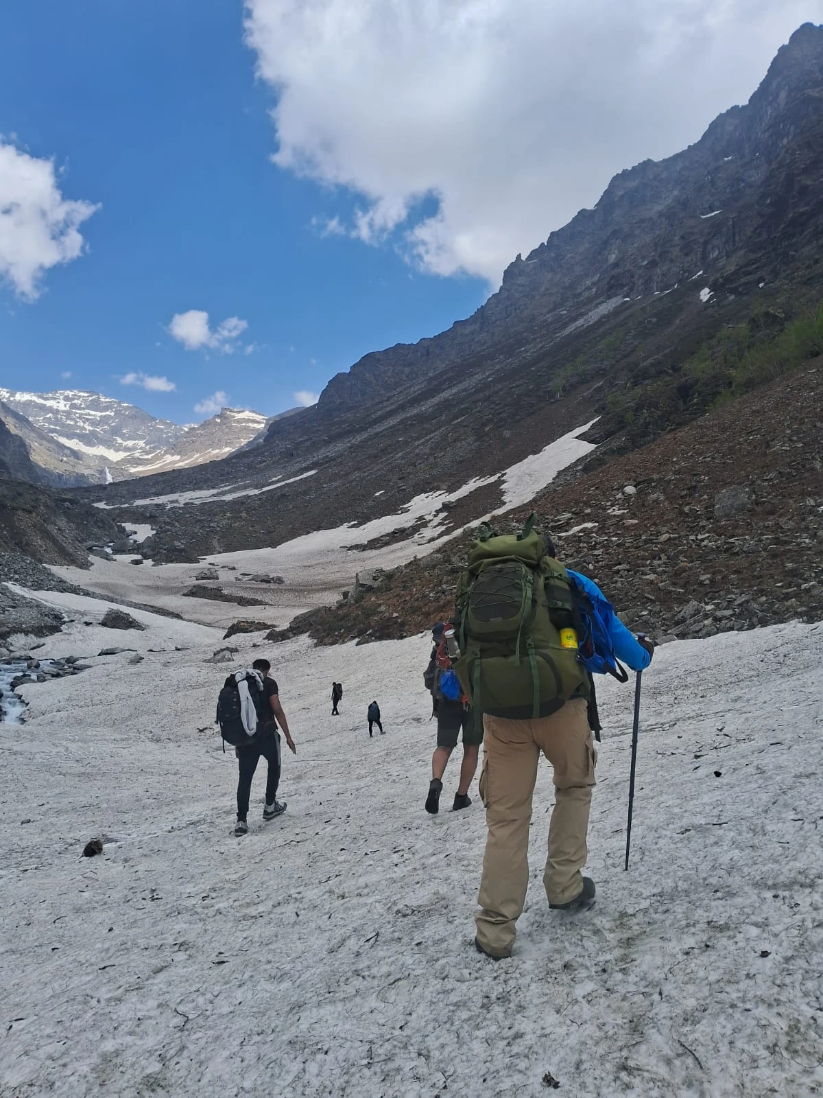
Day 5 Dandreyash Thatch → Upper Waterfall Camp
Distance: 5–6 km | Duration: 4–5 hours | Altitude gain: 3,556 m → 4,060 m | Overnight: Upper Waterfall Camp
Day 5
Dandreyash Thatch → Upper Waterfall Camp
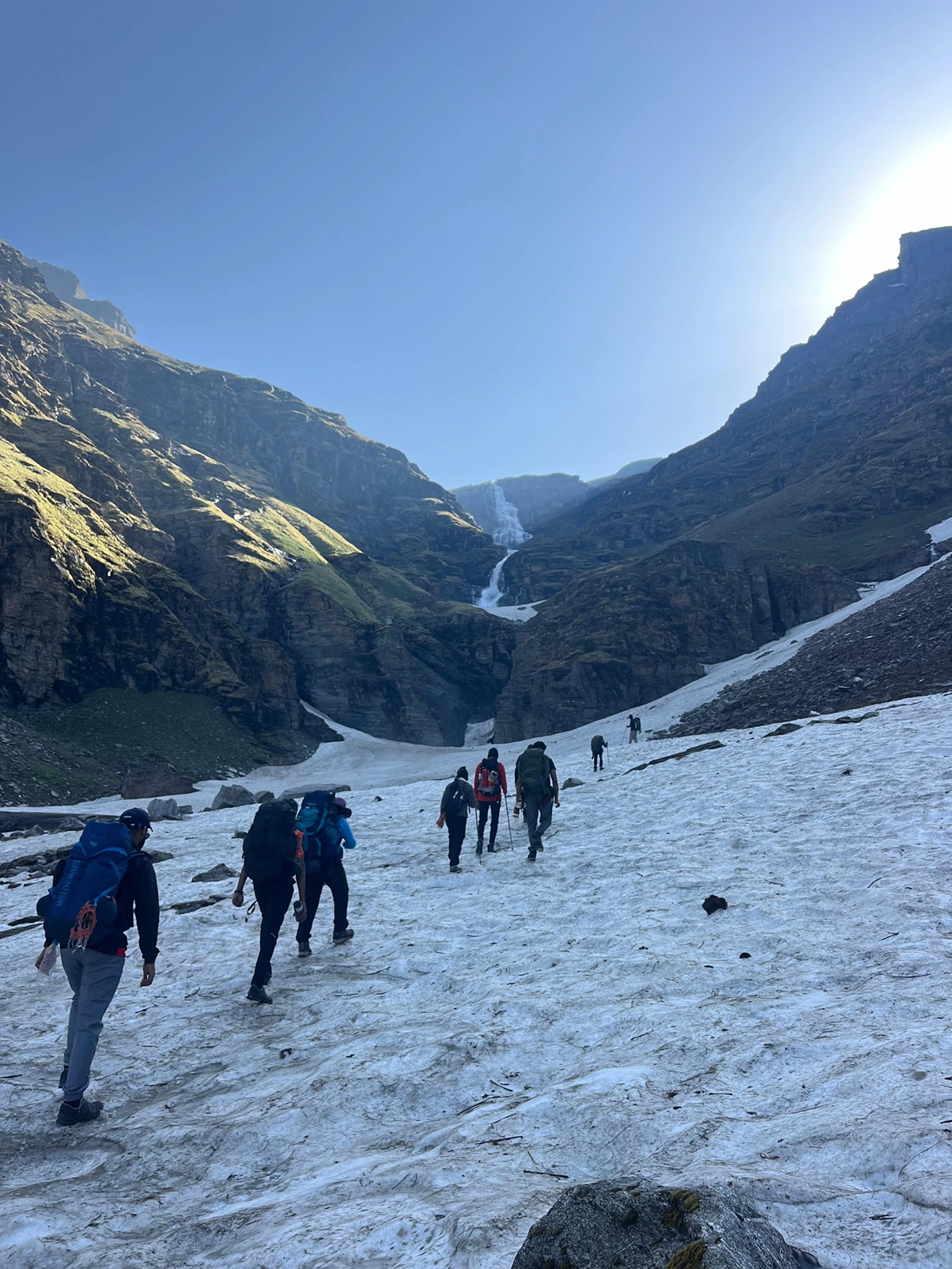
Distance: 5–6 km | Duration: 4–5 hours | Altitude gain: 3,556 m → 4,060 m | Overnight: Upper Waterfall CampThe shortest day by distance but not the easiest. The trail climbs toward the Rupin Waterfall- one of the most dramatic natural sights on any Himalayan trekking route. You hear it before you see it. Three cascading stages dropping nearly 500 metres down a sheer cliff face into a glacial U-shaped valley. No photograph captures the scale. In May and June, fed by snowmelt, the waterfall roars and its mist reaches the trail. In September the flow is gentler, but a 500-metre white streak against black rock needs no amplification. Beyond the lower falls, snow patches become frequent. By the time you reach Upper Waterfall Camp at 4,060 m, the terrain is different entirely – vast, exposed, white on three sides, the summit ridge visible for the first time from directly below.
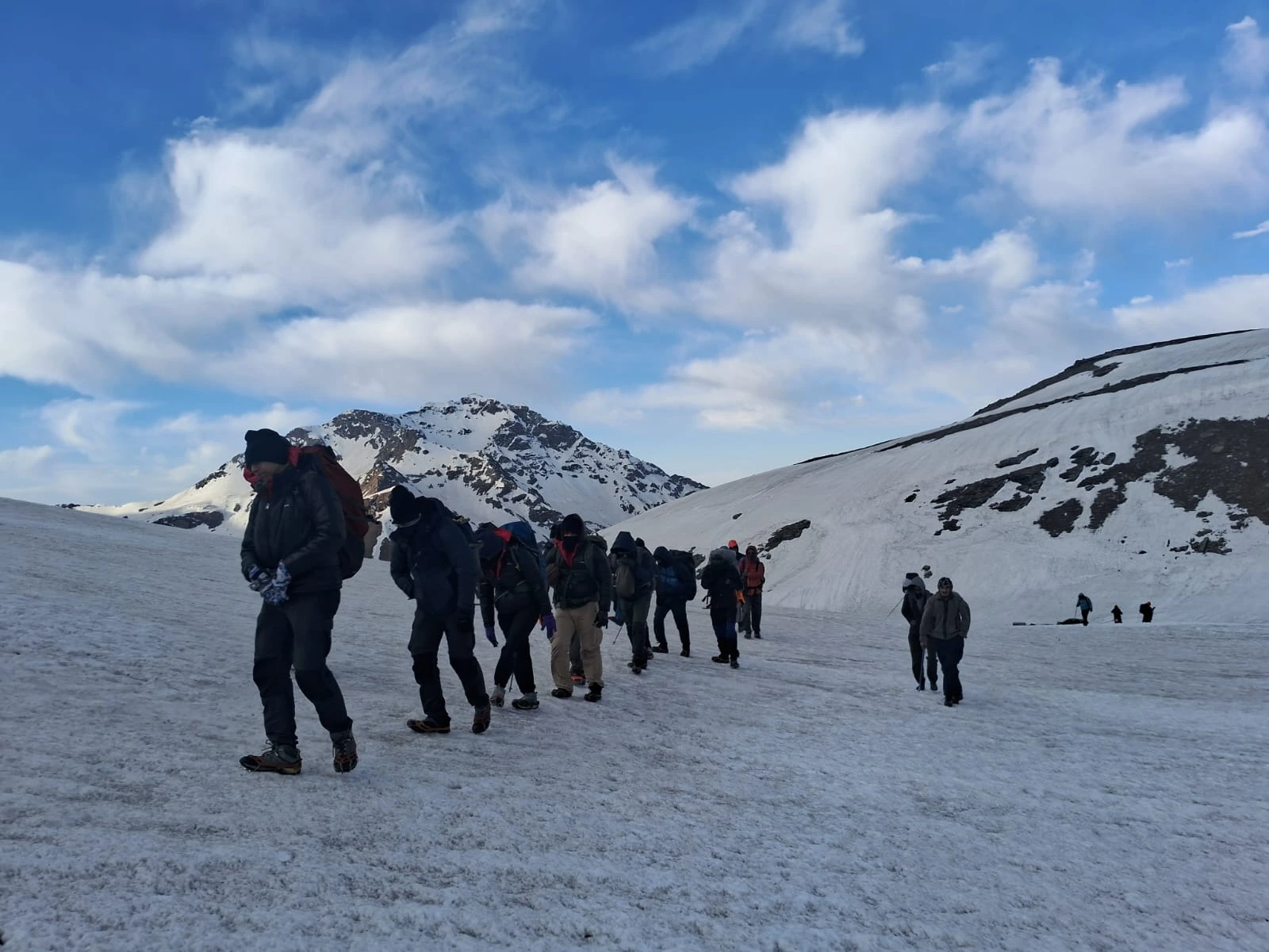
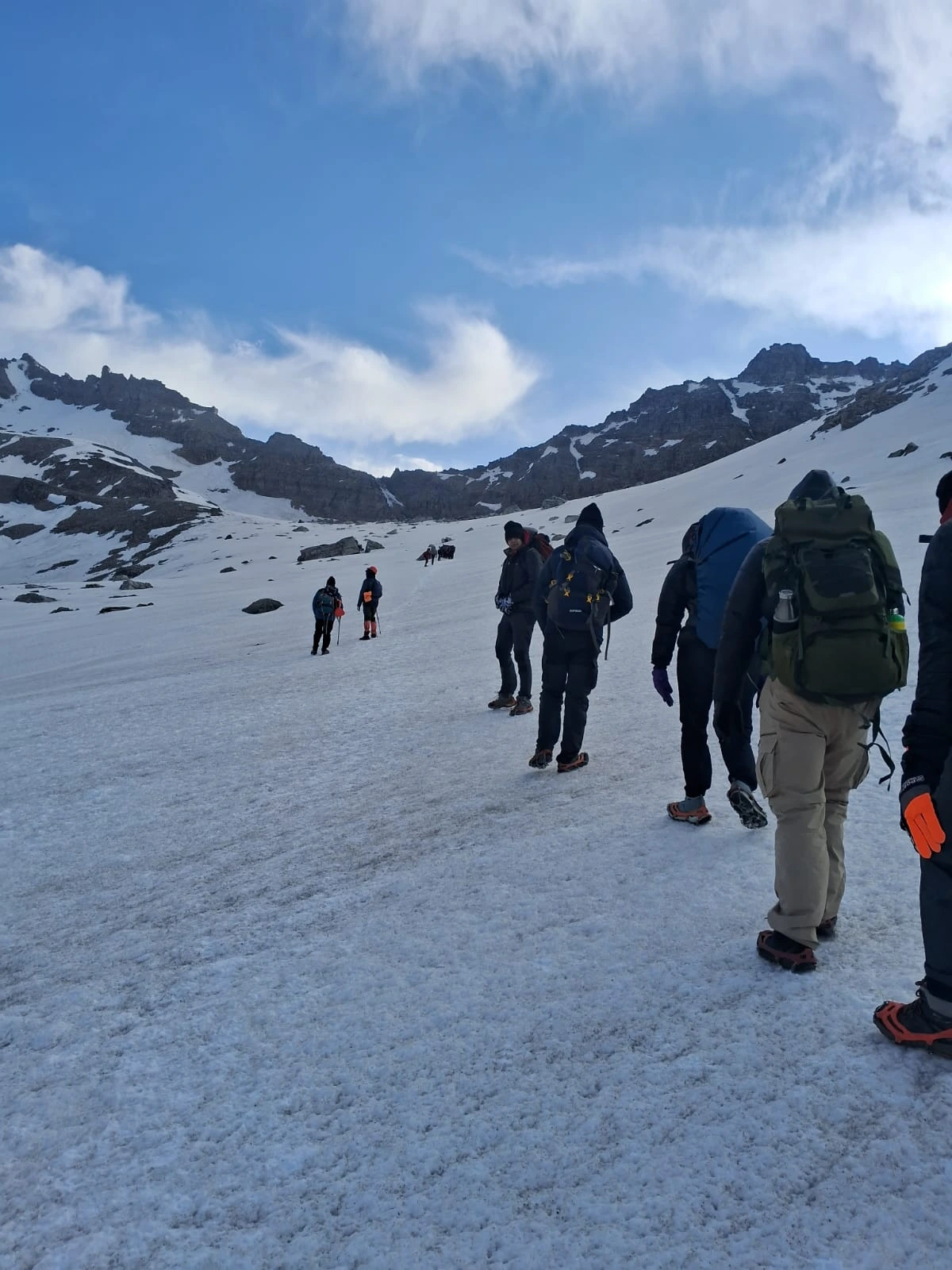
Day 6 Upper Waterfall → Rupin Pass → Ronti Gad — Summit Day
Distance: 12 km | Duration: 10–11 hours | Maximum Altitude: 4,650 m / 15,250 ft | Overnight: Ronti Gad
Day 6
Upper Waterfall → Rupin Pass → Ronti Gad — Summit Day
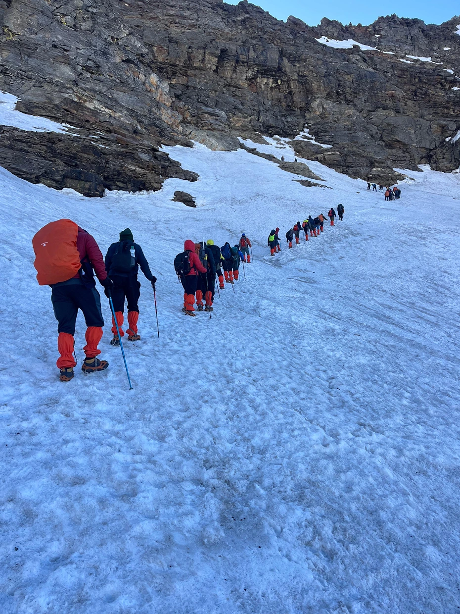
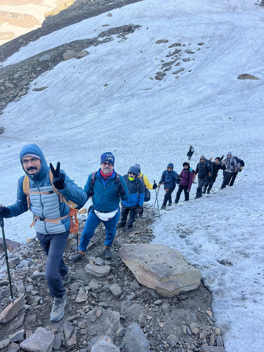
Distance: 12 km | Duration: 10–11 hours | Maximum Altitude: 4,650 m / 15,250 ft | Overnight: Ronti GadThis is the day you trained for. You leave camp in darkness. Head torch on, breath visible in cold air, snowfield catching the light all around. The first section climbs steeply through the Rupin Gully, a narrow, snow-filled corridor that rises at a punishing gradient toward the pass. This is the most physically demanding section of the entire trek. Because it requires every step to be deliberate, every breath to be steady, and every trekker to trust their pace and their team. Above the gully, the gradient eases. You enter Rati Pheri – a wide snowfield that serves as the final rest point before the summit. The views are already extraordinary before you reach the top: ridgelines stacked in all directions, the sky turning from deep blue to pale gold as the sun rises.
The final climb to Rupin Pass at 4,650 metres is steep but short. Prayer flags and cairns mark the summit. When you step up onto the pass, the full sweep of the Kinner Kailash Range opens to the south. Uttarakhand’s high wilderness stretches ahead. The valley you’ve spent six days walking through lies below in complete silence. Stay long enough to feel it. Then begin the descent. The descent into Ronti Gad drops nearly 1,500 metres over 6-7 km. Tired knees will feel every metre of it. Use your poles hard, plant your heels, and take it slowly. Ronti Gad campsite sits in a wide, quiet valley, peaceful after the intensity of the day.
Day 7 Ronti Gad → Sangla Valley → Drive to Shimla
Trek: 8 km | Duration: 4–5 hours trek | Then drive: 9–10 hours
Day 7
Ronti Gad → Sangla Valley → Drive to Shimla
Trek: 8 km | Duration: 4–5 hours trek | Then drive: 9–10 hoursThe last day is long in hours but gentle in effort. The morning trail from Ronti Gad descends through terrain that softens with every kilometre – snowfield to alpine scrub, scrub to conifer forest, forest to the terraced orchards and stone villages that signal Sangla Valley. As altitude drops, the air thickens, the temperature rises, the colours return. Sangla is one of Himachal Pradesh’s most beautiful valley settlements. The Baspa River runs through it, green and cold. After a week of campsites, the sight of a proper village with a tea shop and a paved road feels like re-entering a world you’d nearly forgotten.
After lunch in Sangla, board your vehicle for the long drive back to Shimla. Arrive late at night – typically between 11 PM and 1 AM. Book your onward travel from Shimla accordingly.
- Accommodation: 1 night homestay stay at Jiskun on triple/quad sharing basis + 5 nights tented accommodation during the trek on triple sharing basis.
- Meals: All vegetarian meals from dinner on Day 1 through breakfast on Day 7.
- Snacks: Morning tea, evening tea/coffee with light snacks and soup served daily while on trek.
- Camping Logistics: Camping tent, trekking mat, sleeping bag, dining tent, toilet tent and toilet stool.
- Camping Equipment: Gaiters, microspikes and rope (if required).
- Permits: All necessary fees and permits for Indian nationals.
- Trek Leader: Certified and experienced trek leader for the full duration of the trek.
- Guide & Support Team: Experienced guide and support staff - ratio depends on number of participants.
- Medical Aid: Basic first aid kit, oximeter and oxygen cylinder.
-
Transportation: Surface transfer from Shimla to Shimla by Sumo / Bolero or Tempo Traveller — Non-AC (depends on number of trekkers).
Note: Transportation is not included for participants opting for the Jiskun to Sangla package. - Cloak Room: Cloak room facility at the base camp for storage of extra luggage.
- Any expenses of a personal nature will not be covered under the package.
- Meals during transit are not included.
- The cost of any kind of insurance is not part of the package.
- Any expenses arising due to unforeseen circumstances such as landslides or other natural calamities will have to be borne by the traveler.
- Any cost escalation due to Force Majeure situations, including evacuation charges, is not included.
- Anything not explicitly mentioned under the inclusions will be considered excluded.
Note
- Bag offloading will be charged at ₹3800 per bag.
- The maximum weight per bag should not exceed 10 kg.
Best Time to Visit Rupin Pass Trek
The Rupin Pass Trek is open for two seasons every year. Picking the right season makes a bigger difference on this trek than most.
May to June: Spring & Early Summer
This is the snow season on the Rupin Pass Trek. The lower sections of the trail – Jiskun, Bawta, Jhaka are green and alive with wildflowers. The upper sections from the waterfall camp onward carry significant snowpack. In May, the Rupin Gully can have 4 to 6 feet of snow. The three-stage Rupin Waterfall is at its loudest and most powerful, fed by snowmelt pouring off every ridge above it.
If you want to experience snow trekking without extreme cold, this is your season.
- Daytime temperature at lower camps: 10°C – 20°C
- Daytime temperature at upper camps: 3°C – 12°C
- Night temperature near the pass: -3°C to -5°C
- Snow bridges and heavy snowpack common near the upper waterfall and Rupin Gully
- Microspikes are essential, not optional
September to October: Post-Monsoon & Autumn
Post-monsoon is the clearest season on this route. The monsoon clears out, the skies open up, and the mountains come into full, unobstructed view. Snow is minimal only patches remain in the gully and near the pass. Trail surfaces are firm and dry. Visibility on summit day is often at its best of the entire year. The landscape shifts into autumn tones amber grass, golden slopes, deep blue skies.
If you want the best mountain views and the most stable trail conditions, this is your season.
- Daytime temperature at lower camps: 12°C – 18°C
- Daytime temperature at upper camps: 5°C – 10°C
- Night temperature near the pass: -5°C to -8°C
- Less snow on trail, easier footing on the Rupin Gully ascent and descent
- Best season for photography and summit panoramas
How to Reach Rupin Pass Trek Base Camp
The Rupin Pass Trek starts from Jiskun village in Himachal Pradesh. Shimla is the main transit hub. The journey to base camp happens in two stages.
Step 1: Reach Shimla
By Air: The best-connected airport is Chandigarh International Airport (IXC), 113 km from Shimla. From Chandigarh, take a taxi or HRTC bus to Shimla (3–4 hours). Flying into Delhi (IGI) is also a common option – take an overnight Volvo bus directly to Shimla (350 km, 9–10 hours), or train to Kalka and then the Kalka–Shimla Toy Train.
By Train Kalka Railway Station (KLK) is the nearest mainline rail head, well-connected to Delhi via Kalka Mail and Himalayan Queen. From Kalka, taxi to Shimla (1.5 hours) or the UNESCO-listed Kalka–Shimla Toy Train (5 hours — scenic, worth doing once).
By Road: Direct HRTC and private Volvo buses connect Shimla to Delhi (350 km), Chandigarh (115 km), and Dehradun (230 km).
Step 2: Shimla to Jiskun (Trek Base)
Jiskun is approximately 190 km from Shimla via Rohru and the Chainsheel Pass road.
Route | Shimla → Rampur → Rohru → Chainsheel Pass road → Jiskun |
Drive Time | 8–10 hours |
Vehicle | Private taxi / shared jeep / operator-arranged vehicle |
Last ATM | Rohru – withdraw enough for the full 7 days plus buffer |
Last Network | Rohru – BSNL may work in pockets beyond, but don’t rely on it |
The road beyond Rohru is a narrow mountain road, manageable but slow. Keep snacks and water in the vehicle. The scenery above Chainsheel Pass is exceptional.
Rupin Pass Trek Packing List
Pack for two realities on the same trek: 25°C sunshine on the lower forest trails and -5°C at the pass on summit morning. Both conditions exist within a day of each other.
Keep your pack to 8-10 kg maximum. Anything heavier compounds fatigue on the long summit day.
Clothing
- Base layer: 2 sets of moisture-wicking thermals (top and bottom). Merino wool if budget allows.
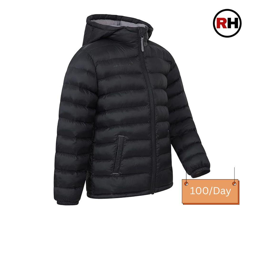
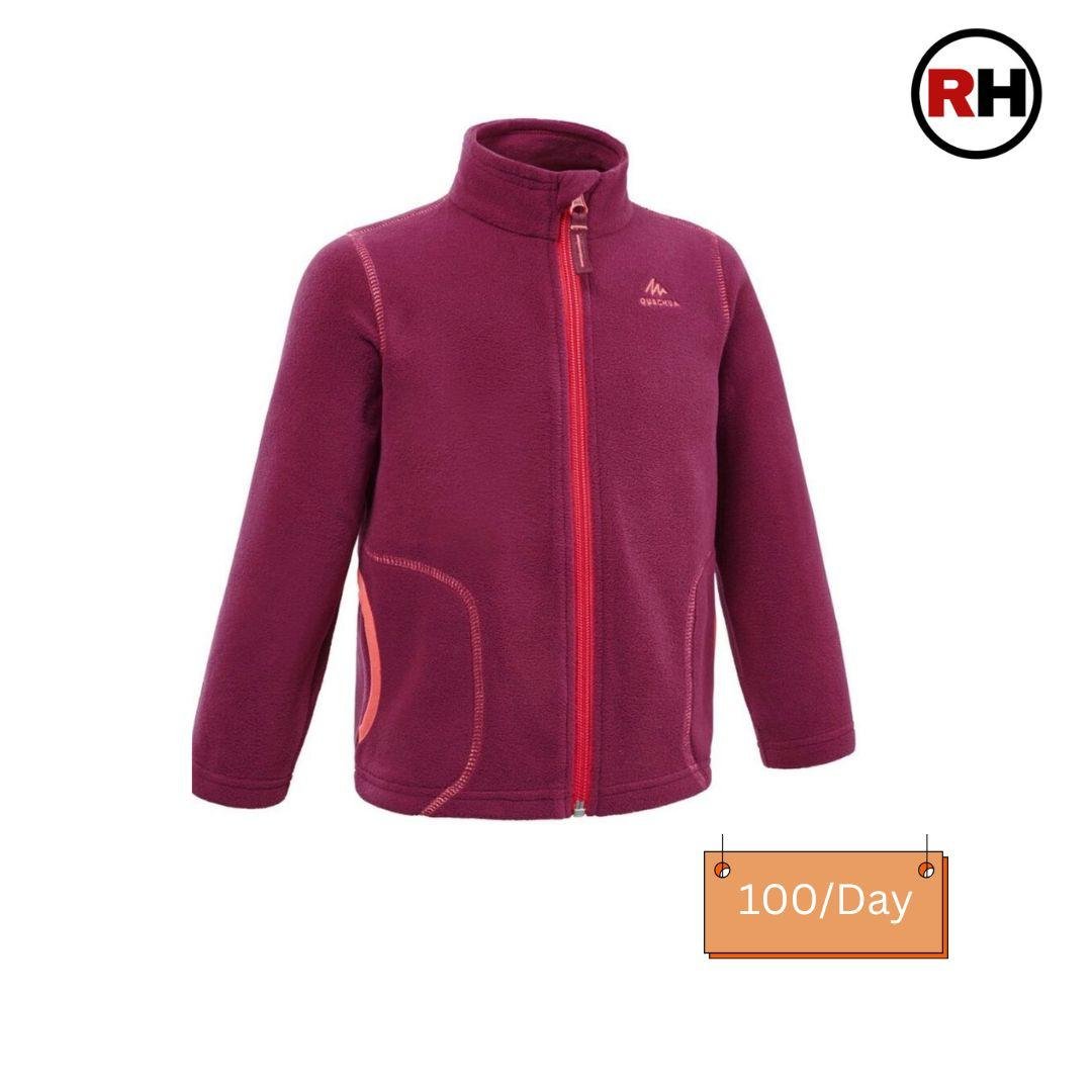
- Mid layer: Fleece jacket + down insulated jacket (600-fill or higher)
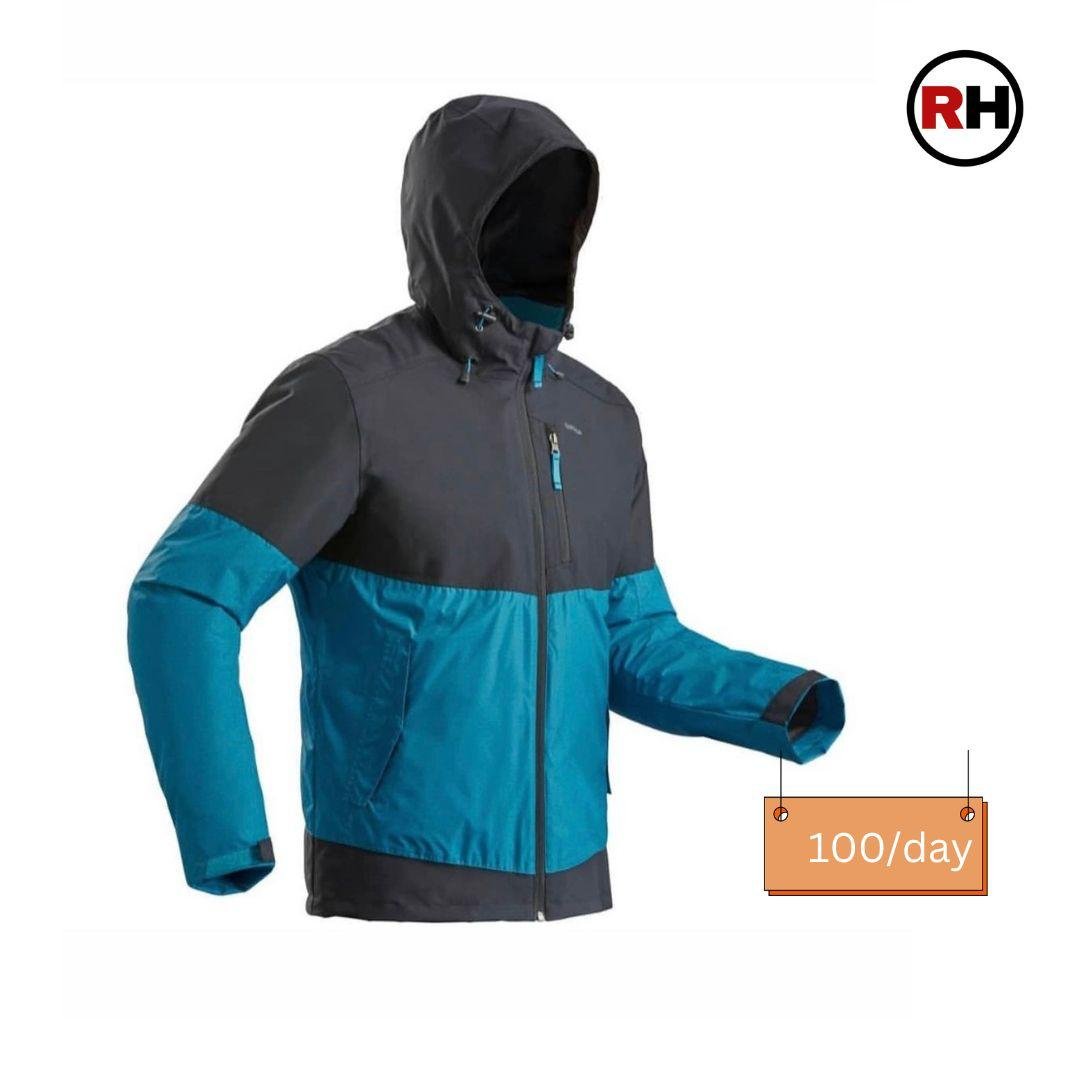
- Outer shell: Windproof, waterproof hardshell jacket
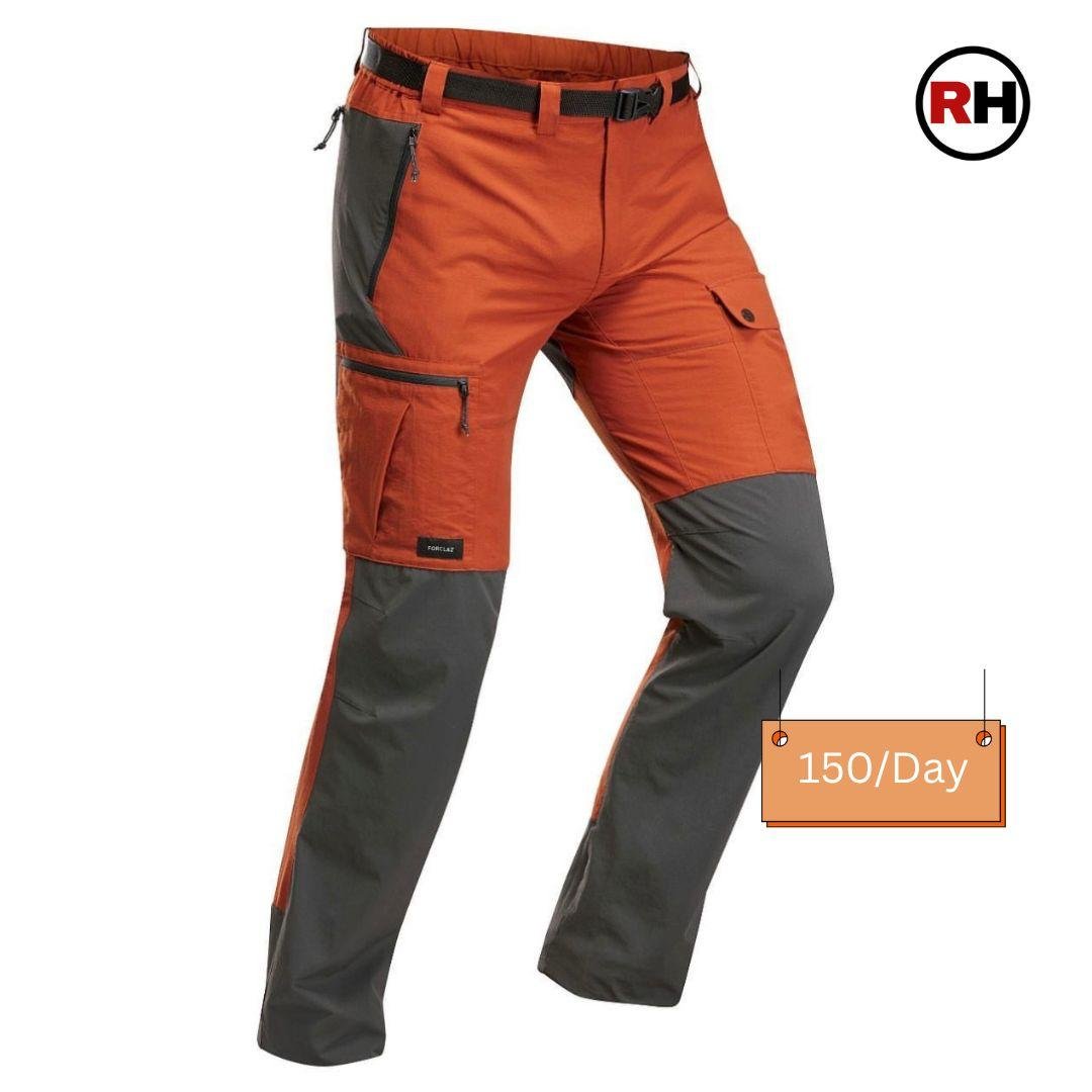
- Trekking trousers: 2 pairs — not jeans, ever
- Warm hat / beanie + wide-brim sun hat (both needed at different sections)
- Balaclava: essential for summit morning
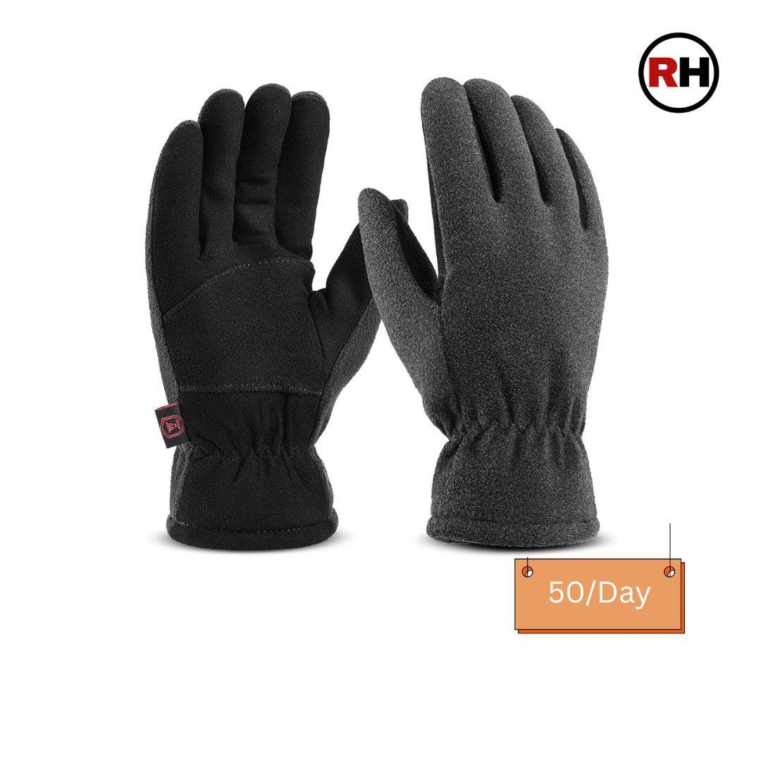
- Gloves: Thin liner gloves + insulated, waterproof outer gloves
- Neck gaiter / buff
- Trekking socks: 3–4 pairs (merino wool preferred)
- Camp footwear: Light sandals or crocs for evenings
Footwear
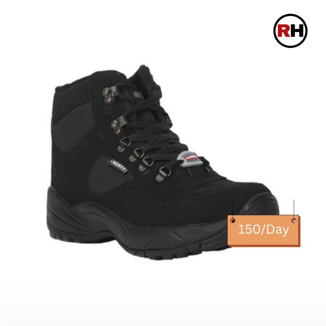
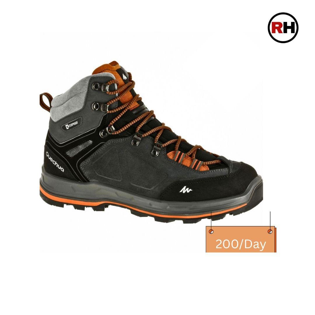
- Trekking boots: Mid-to-high ankle, waterproof
- Microspikes / crampons: Required for May–June; advisable in September too
- Trekking gaiters for snow sections
Equipment
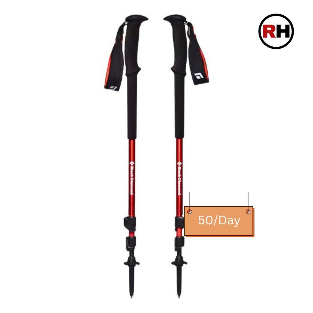
- Trekking poles: Adjustable, with snow baskets — essential on the Rupin Gully descent
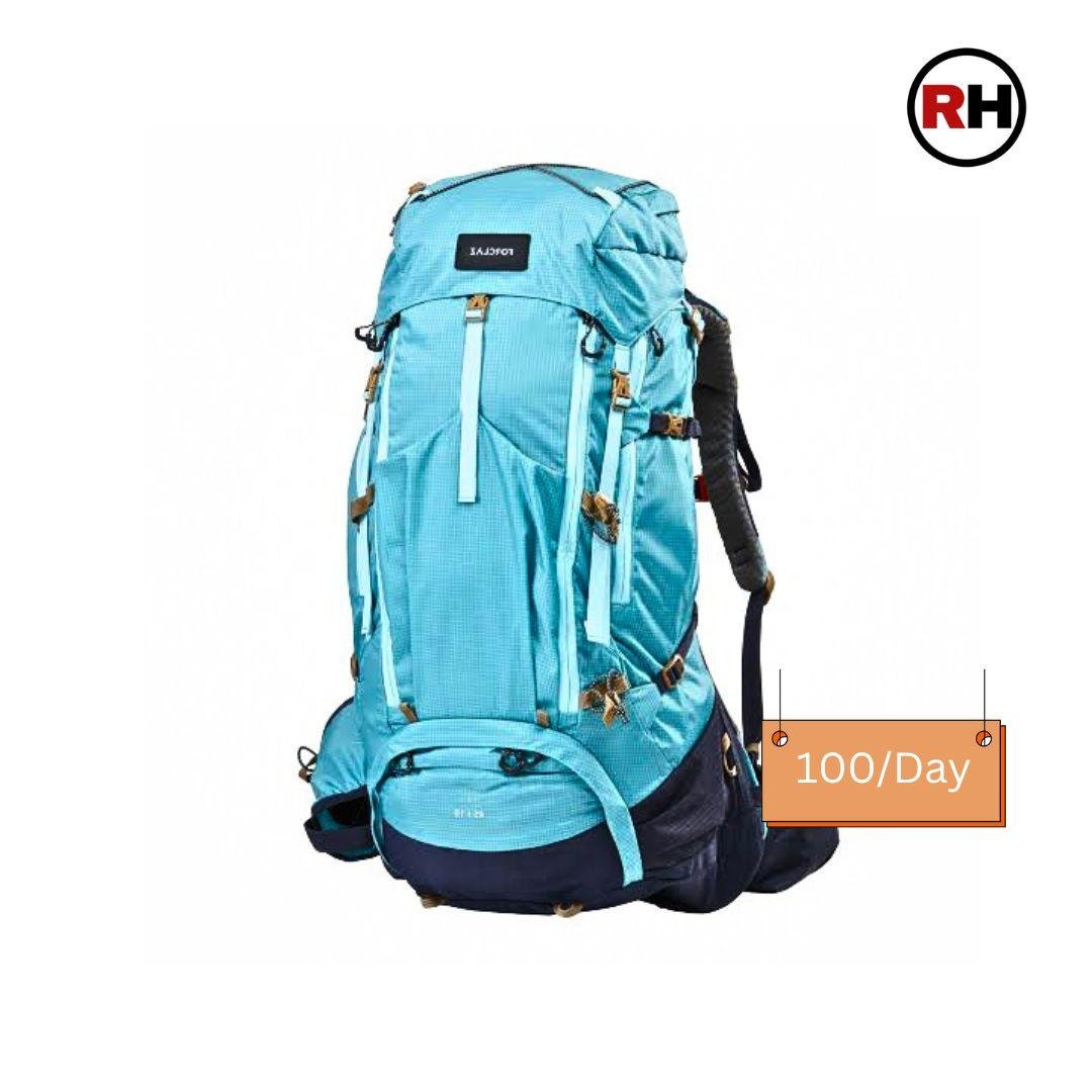
- Backpack: 40–55 litres with rain cover
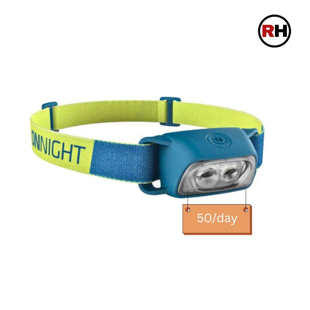
- Headlamp + 2 spare battery sets — Day 6 starts in complete darkness
- Sunglasses: UV400 — snow glare at altitude causes real, lasting eye damage
- Sunscreen: SPF 50+ for face, neck, hands
- Lip balm with SPF
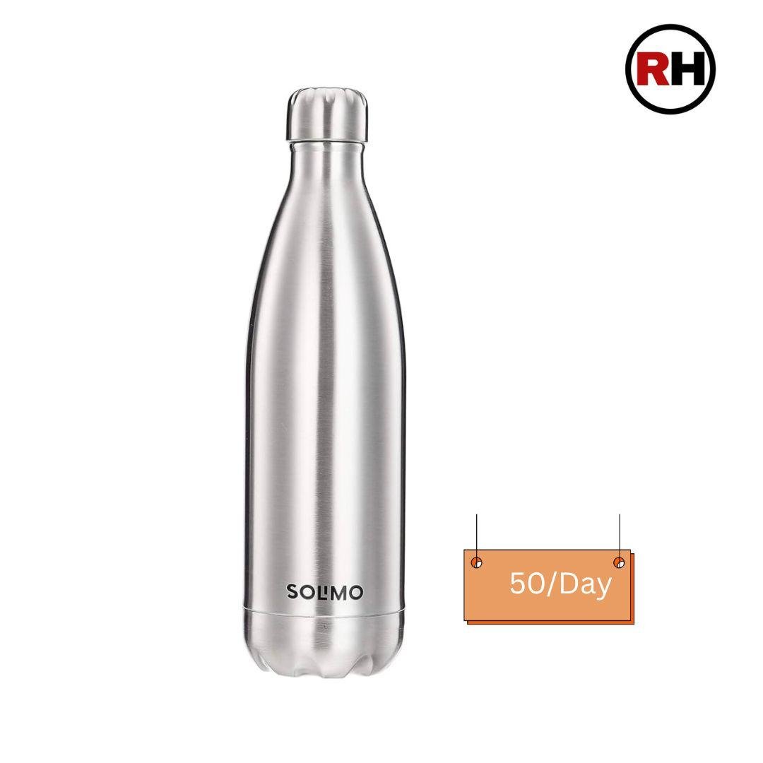
- Reusable insulated water bottle
Health & Hygiene
- Paracetamol, Ibuprofen, Diamox (consult your doctor first), ORS sachets, blister pads, moleskin, antiseptic cream, crepe bandage
- Hand sanitiser
- Biodegradable soap and shampoo only — no regular products near water sources
- Small quick-dry towel
- Toilet roll (carry all waste out)
- Feminine hygiene supplies if required
Documents & Finance
- Original government photo ID (Aadhaar, Voter ID, or Passport — mandatory for permits)
- Cash in small denominations — enough for full trek plus buffer; last ATM is Rohru
- Trek confirmation and emergency contacts — printed copy, not just on your phone
Leave Behind
- Jeans or cotton trousers
- Umbrellas
- Glass bottles
- Excessive electronics

FAQs About Rupin Pass Trek
Everything you need to know About the Rupin Pass Trek
Is the Rupin Pass Trek difficult?
Yes. The Rupin Pass Trek difficulty is rated moderate to difficult. The trek does not require technical climbing, but it involves cumulative altitude gain to 4,650 m, a 10–11 hour summit day, steep snow ascent through the Rupin Gully, and long daily walks on varied terrain. Trekkers who prepare well manage it comfortably. Those who arrive undertrained find it significantly harder from Day 3 onward.
What is the altitude of the Rupin Pass Trek?
The maximum altitude is 4,650 metres (15,250 feet) at Rupin Pass. The trek starts at Jiskun at 2,340 m and climbs gradually over five active days, with a mandatory acclimatisation day at Dandreyash Thatch (3,556 m) before the final summit push.
What is the best time to do the Rupin Pass Trek?
May–June and September–October. May–June offers snow trekking, the Rupin Waterfall at full force, and lush lower trails. September–October delivers clear skies, firm dry trails, and the best summit-day visibility. Avoid July–August (monsoon, dangerous approach roads) and November–April (heavy snowfall, route closed).
How many days does the Rupin Pass Trek take?
7 days, including one acclimatisation rest day. Total trekking distance is approximately 42 km. Add at least one buffer day on each end in Shimla road delays on the approach are common.
Where does the Rupin Pass Trek start and end?
Starts at Jiskun village, Himachal Pradesh, reached by 8–10 hour drive from Shimla. Ends at Sangla Valley, Himachal Pradesh. The route crosses into Uttarakhand at the summit and descends back into Himachal.
Is the Rupin Pass Trek suitable for beginners?
Fit, well-trained first-timers can complete it if they’ve spent 4–6 weeks in proper preparation. It is not recommended as a first-ever Himalayan trek for untrained individuals. If you’ve never trekked before, complete a moderate 4–5 day route first, then return to Rupin Pass.
What are the highlights of the Rupin Pass Trek?
The three-stage Rupin Waterfall (~500 m drop), the Hanging Village of Jhaka, wide alpine meadows at Dandreyash Thatch, the Rupin Gully snow climb on summit day, the 360° panorama from Rupin Pass at 4,650 m including the Kinner Kailash Range, and the final descent into Sangla Valley.
How cold does it get during the Rupin Pass Trek?
Lower camps (Jiskun, Jhaka): days 15–22°C, nights 5–10°C. Dandreyash Thatch: nights 0–5°C. Upper Waterfall Camp: below 0°C at night. Summit morning near the pass: -3°C to -8°C with wind chill. Full winter layering including down jacket and balaclava is required on Day 6 regardless of season.
Do I need to acclimatise for the Rupin Pass Trek?
Yes, and it’s built into the itinerary. A mandatory rest day at Dandreyash Thatch (3,556 m) on Day 4 is non-negotiable. Trekkers should also maintain 3–4 litres of daily water intake, avoid alcohol, eat regularly even without appetite, and report any AMS symptoms headache, nausea, dizziness, breathlessness at rest to their trek leader immediately.
Is there mobile network on the Rupin Pass Trek?
Reliable network ends at Rohru. Beyond that, assume no connectivity for 6–7 days. Download offline maps before leaving Rohru. Inform family of your full itinerary before the trek begins.
What permits are needed for the Rupin Pass Trek?
Indian nationals: forest and route permits are included in trek packages. Foreign nationals: Inner Line Permit for Kinnaur district, obtained at the Shimla SP Office, SDM offices in Rampur or Reckong Peo, or via the Himachal Pradesh government portal. Carry the original and multiple copies. Checkposts on this route verify documents.
What is the Rupin Gully?
The Rupin Gully is the steep, snow-filled corridor that forms the crux ascent to Rupin Pass on summit day. In May–June, snow depth here can be 3–5 feet or more. The gradient is severe. Trek leaders fix ropes on the steepest sections. Trekkers use microspikes or crampons. It is the hardest single section of the trek and the most rewarding when you emerge from it onto Rati Pheri snowfield with the pass visible ahead.
Can I trek Rupin Pass solo?
Solo trekking is strongly discouraged and in some sections not permitted. The route is remote, at high altitude, with no emergency services within reach. Organised group treks with experienced leaders, support staff, safety equipment, and contingency planning are the only responsible way to do this route.
What is the story behind the name Rupin?
Local legend connects the name to Rupmati, a young woman said to have fled into the mountains to escape a powerful king who sought to force her into marriage. In the version passed down through the valley, she was transformed into the Rupin River, preserving her freedom forever in the form of flowing water. It is not a historically documented account, but it is deeply woven into the cultural fabric of this valley. Walking beside the river for six days, you begin to understand why the story has survived.
Rupin Pass Trek Package
₹16,000
₹ 14500
+ 5% GST
From Shimla
Add ons
Total: ₹
Dates & Availability
09-May to 15-May
Available
16-May to 22-May
Available
23-May to 29-May
Available
30-May to 05-Jun
Available
06-Jun to 12-Jun
Available
13-Jun to 19-Jun
Available
20-Jun to 26-Jun
Available
27-Jun to 03-Jul
Available

I did the Valley of Flowers trek with Roopkund Heaven and it was absolutely amazing! Everything—from the planning to the execution—was smooth and very well-managed. The team was professional, friendly, and genuinely passionate about the mountains.A special shoutout to Sunil and Devendra, our trek leaders, who made the experience even better.Highly recommend booking your next adventure with them. Looking forward to doing another trek soon!

Roopkund isn’t just a trek, it’s a journey into a Himalayan mystery. You start in quiet villages, walk through whispering oak forests, and cross endless meadows that feel like the roof of the world. By the time you reach Skeleton Lake, the air is thin, the world is silent, and you’re standing in a place where history, legend, and nature collide. It’s breathtaking, exhausting, and unforgettable — not for beginners, but worth every step for those ready to test their limitsSpecial thanks tooo Sunilll who makes our trek more amazing and full of funsss 💚💚💚

Had the most amazing time on the brahmatal trek- a massive thank you to Bracash for guiding us all up the mountain! All the staff were so welcoming and lovely, throughout the whole trip. We loved every second of the trip, and can’t wait to do another one.Everything was so well organised throughout the trek from the welcome on the first night, to the tents we slept in and rest stops along the way. Plus the food throughout the trip was delicious!We also hired bags through the company which came with everything we needed to complete the trek.Highly highly recommend booking the trek through these guys - we loved it!

I arrived in Lohajung without a booking and stumbled upon Roopkund Heaven, where the owner graciously helped me decide between the Brahmatal Trek and Ali Bedni Bugyal Trek. I opted for the latter and joined a group tour organized by Roopkund Heaven. They kindly customized the itinerary to accommodate my early descent plans. The trek leader was friendly and welcoming, and the food was delicious. Overall, it was an unforgettable experience, and I'm grateful to Roopkund Heaven for making it happen!

I had the pleasure of trekking with Roopkund Heaven for both my Brahmatal and Roopkund treks, and they truly made the experience exceptional. The entire service, from the cooking staff to the trek leader, was flawless. Every detail was taken care of, ensuring we had a smooth and enjoyable journey. The efficiency of their team allowed us to focus on the beauty of the trek, while they handled everything else seamlessly. I enjoyed every bit of it and highly recommend Roopkund Heaven for anyone looking for a well-organized and memorable trekking experience

Great Experience with Roopkund Heaven. I gave them 5 star .... For their Trek Leaders,Rajendra and Duggu Bhai who gave us freedom to enjoy the trek, For their awesome food, Quality of Camp, Sleeping Bags... My entire experience was awesome... Also I recommend all my friends and colleagues to go for Roopkund Heaven for great experience on Beautiful Treks

I can say Roopkund Heaven is one of the best trip organizer for the mountains Treks. We are group of six people's and they are managing very well. Narendra is an exceptional person, he handles our queries and encourages us to trek the Brahmatal trek. Will plan our next trek soon...😊

We had an incredible experience of valley of flowers and hemkund sahib with Roopkund Heaven on our first trek! The entire journey was totally safe and smooth, thanks to the team's constant availability and support. Special mention to our guide, Kamlesh, who went above and beyond to make us feel like family. His super funny and caring nature ensured that we had an absolute blast! Highly recommend Roopkund Heaven and Kamlesh for a memorable and hassle-free trekking experience."


