Highlight
Seven Alpine Lakes: Vishansar, Kishansar, Gadsar, Satsar, Gangabal, Nundkol, and Yamsar, each set in a distinct valley with unique colours and surroundings.
Gadsar Pass Summit: The highest point of the trek at 13,750 ft, offering 360-degree views of the Kashmir Himalayas, with Vishansar and Kishansar visible on one side and Gadsar Lake on the other.
Gangabal and Nundkol Twin Lakes: Sacred glacial lakes at the base of Mount Harmukh, 16,870 ft, with the mountain’s reflection visible in the still water on clear mornings.
Endless Alpine Meadows: Rolling grasslands at Nichnai, Shekdur, and the approach to Satsar, covered in wildflowers in July and August and stretching for kilometres with no villages or roads.
Three High-Altitude Passes: Nichnai Pass, Gadsar Pass, and Zaj Pass, each opening into a new valley with completely different terrain and landscapes.
Mount Harmukh Views: The 16,870-ft peak dominates the skyline from Gangabal camp, with its glaciers hanging over the twin lakes.
Kashmir’s Untouched Wilderness: Days of trekking through valleys with no permanent human settlement, only seasonal shepherd camps and army checkposts near Satsar.
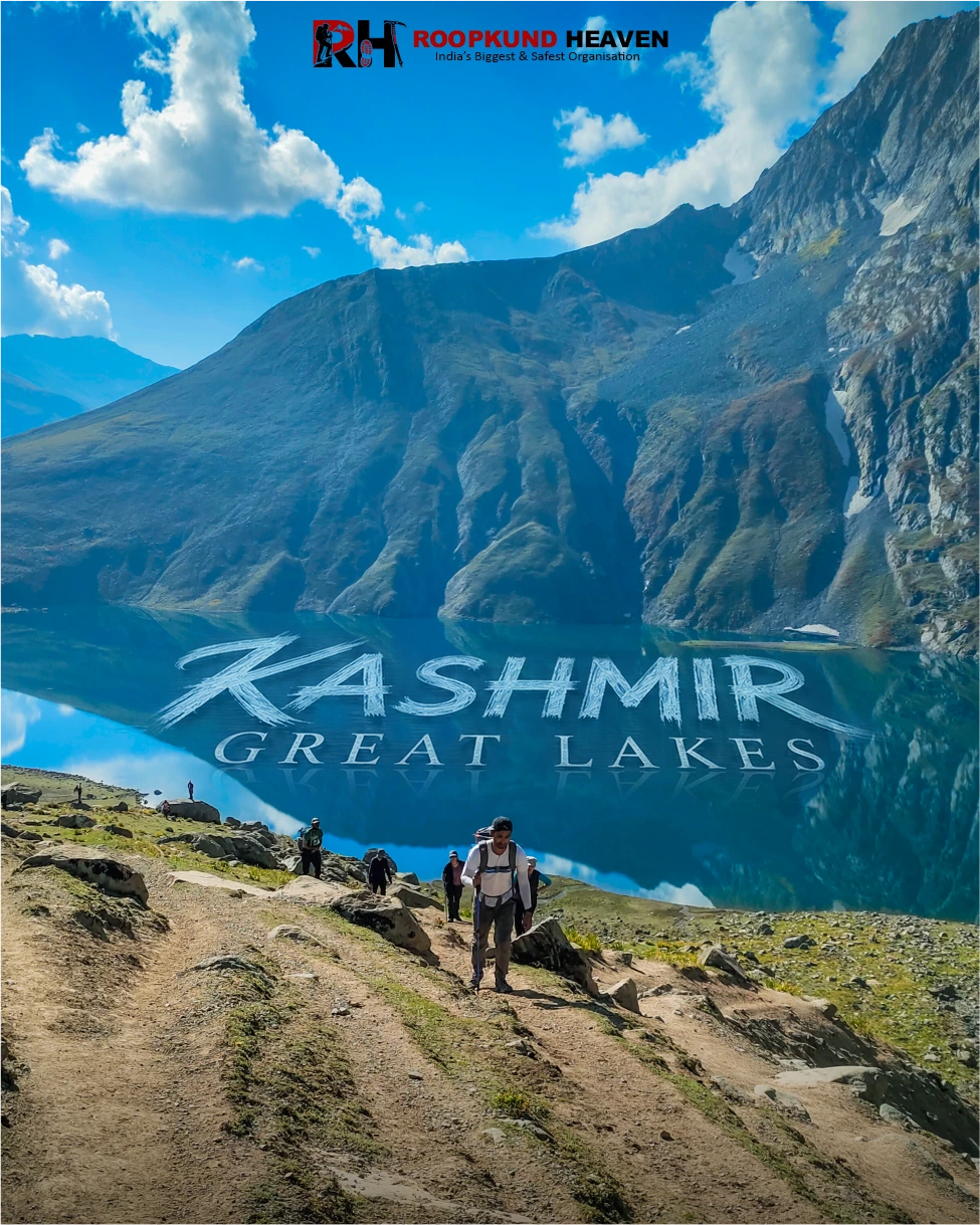
Kashmir Great Lakes Trek
If there is a heaven on earth, it is here, it is here, it is here. That line was written about Kashmir in the 17th century by Mughal emperor Jahangir, and somehow, 400 years later, it still feels inadequate.
The Kashmir Great Lakes Trek does not ask you to climb to a single summit and call it done. It does not promise one spectacular view and then fade into descent. It gives you seven alpine lakes across seven valleys over seven days, and every single one of them looks like someone took the best parts of Switzerland, Patagonia, and New Zealand, mixed them together, and dropped the result into the lap of the Himalayas at 13,000 feet.
This is not hyperbole. This is the trek that makes veteran trekkers pause mid-sentence when they try to describe it and say, “You just have to see it.”
Why Trekkers Love It
The Kashmir Great Lakes Trek, often called the KGL Trek, is a 72-km route that starts near Sonamarg in Kashmir’s Ganderbal district, crosses three high-altitude passes, winds through meadows so vast they feel like they belong on a different planet, and ends at Naranag after passing beside seven of the most absurdly beautiful alpine lakes in India.
Vishansar. Kishansar. Gadsar. Satsar, which is actually seven interconnected lakes on its own. Gangabal. Nundkol. And depending on the route, Yamsar. Each one sits in a different valley. Each one reflects a different set of peaks. Each one has water so clear and blue and cold that it does not look real until you kneel beside it and touch it.
But the lakes are not the only reason people call this the most beautiful trek in India. It is the meadows. Rolling, endless, flower-covered meadows that stretch for kilometres in every direction with no roads, no villages, no sign that humans have ever been here except for the narrow trails carved by shepherds and trekkers. It is the passes, Nichnai Pass, Gadsar Pass, and Zaj Pass, each one opening into a new valley that looks nothing like the one you just left. It is the light. The way the sun hits the ridgelines in the morning and turns the grass gold. The way clouds move across the lakes in the afternoon and change the water from blue to green to grey in minutes.
And it is the silence. The kind of silence you only find in places where the nearest road is two days’ walk away and the only sounds are wind, water, and your own breath.
The trek follows a point-to-point route from Sonamarg to Naranag, crossing from one side of the Kashmir Valley to the other. It does not retrace its steps. You walk forward every day into new terrain, and you do not see the same landscape twice.
Day 1 is the drive from Srinagar to Gagangir, a small mountain town 70 kilometres east, followed by a short drive to Shitkadi, the actual trek starting point.
Day 2 climbs from Shitkadi through dense pine and maple forests alongside the roaring stream to Nichnai, a high meadow at 11,500 feet where the treeline ends and the alpine zone begins.
Day 3 crosses Nichnai Pass at 13,000 feet and descends into the wide valley that holds Vishansar and Kishansar, the twin lakes that sit side by side beneath the Kishansar Peak, their water so blue it looks painted.
Day 4 is the hardest day. A steep climb to Gadsar Pass at 13,750 feet, the highest point of the trek, followed by a long descent past Yamsar Lake into the valley that holds Gadsar Lake, a glacial pool surrounded by snow-covered ridges even in August.
Day 5 crosses rolling meadows and rocky terrain to Satsar, the valley of seven lakes, where you camp beside one of the interconnected pools with views in every direction.
Day 6 climbs Zaj Pass and descends to the twin lakes of Gangabal and Nundkol at the base of Mount Harmukh, a 16,870-foot peak that towers 5,000 vertical feet above the water.
Day 7 is the long descent from Gangabal through forests and villages to Naranag, and then the drive back to Srinagar.
The trek is graded moderate to difficult, which in practical terms means: the trails are well-defined and do not require technical climbing, but you walk 6 to 8 hours a day at altitudes above 11,000 feet, you cross three passes, and you cover distances of 11 to 14 kilometres daily with a daypack on your back. If you are fit and have done at least one high-altitude trek before, you will manage this comfortably. If you are not fit or this is your first trek, you will struggle, because there is no easy day after Day 2.
The right person for this trek is someone who wants to see the Himalayas at their most photogenic without having to be a mountaineer. Someone who is okay with long days, cold nights, and camping at 12,000 feet beside lakes that freeze solid by October. Someone who understands that the effort required to walk 72 kilometres across three mountain passes in seven days is exactly what makes the reward feel real.
The total distance is 72 kilometres. Daily trekking distances range from 9 km on shorter days to 14 km on the longest. The cumulative altitude gain from Shitkadi to Gadsar Pass is nearly 6,000 vertical feet, spread across four days, which is significant but manageable with proper pacing.
If you are ready to walk through the most beautiful alpine landscape in India, there is no reason to wait.
Day wise plan
The Kashmir Great Lakes Trek begins in Srinagar, the summer capital of Jammu & Kashmir, a city built around Dal Lake, Mughal gardens, and rows of houseboats that have drawn tourists for generations. But the lakes you are here to see are not the ones floating beside the boulevard. They are hidden deep in the mountains beyond Sonamarg, reachable only by walking through valleys, passes, and alpine meadows for six days.
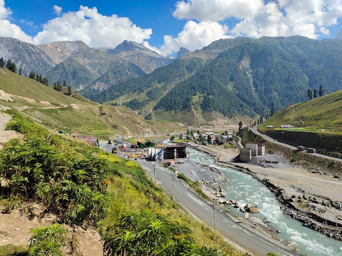
Report at the Tourist Reception Centre (TRC) in Srinagar by 11 AM. From there, the drive to Shitkadi takes around 3 to 4 hours through the Sind Valley, following the Sind River upstream as the landscape slowly changes from crowded city roads to pine forests, mountain villages, and open valleys.
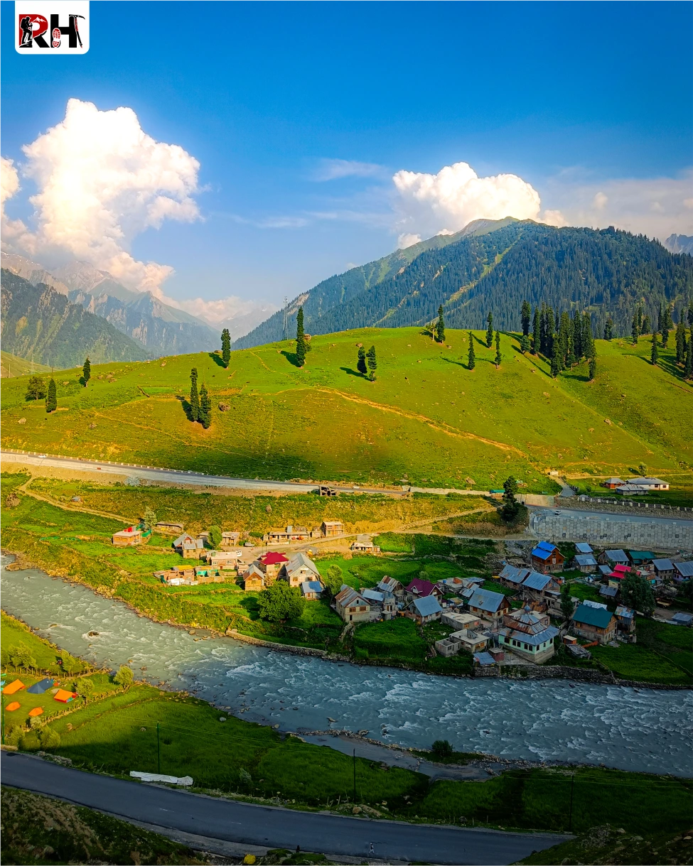
The route passes through Ganderbal and Kangan before reaching Sonamarg, a town whose name literally means “Meadow of Gold.” During summer, the valley lives up to the name. Wide grasslands stretch beneath snow-covered peaks, and the Sind River cuts through the landscape in fast, icy currents.
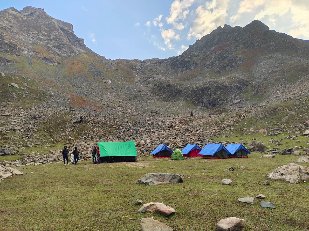
A little beyond Sonamarg lies Shitkadi, the actual base camp of the Kashmir Great Lakes Trek. The campsite sits beside a forest clearing surrounded by pine trees and ridgelines, with cold mountain air replacing the warmth of Srinagar completely. Tents are pitched on open grasslands, and the sound of the nearby stream carries through camp as evening settles in.
This is your first night in the mountains. Use it well. Organize your backpack, hydrate properly, and get enough rest. Tomorrow the trail begins with the climb toward Nichnai, and the comfort of roads disappears behind you.
Tip: Withdraw cash in Srinagar before departure. There are no reliable ATMs beyond Sonamarg. Mobile connectivity weakens significantly after Shitkadi and disappears entirely deeper into the trek.
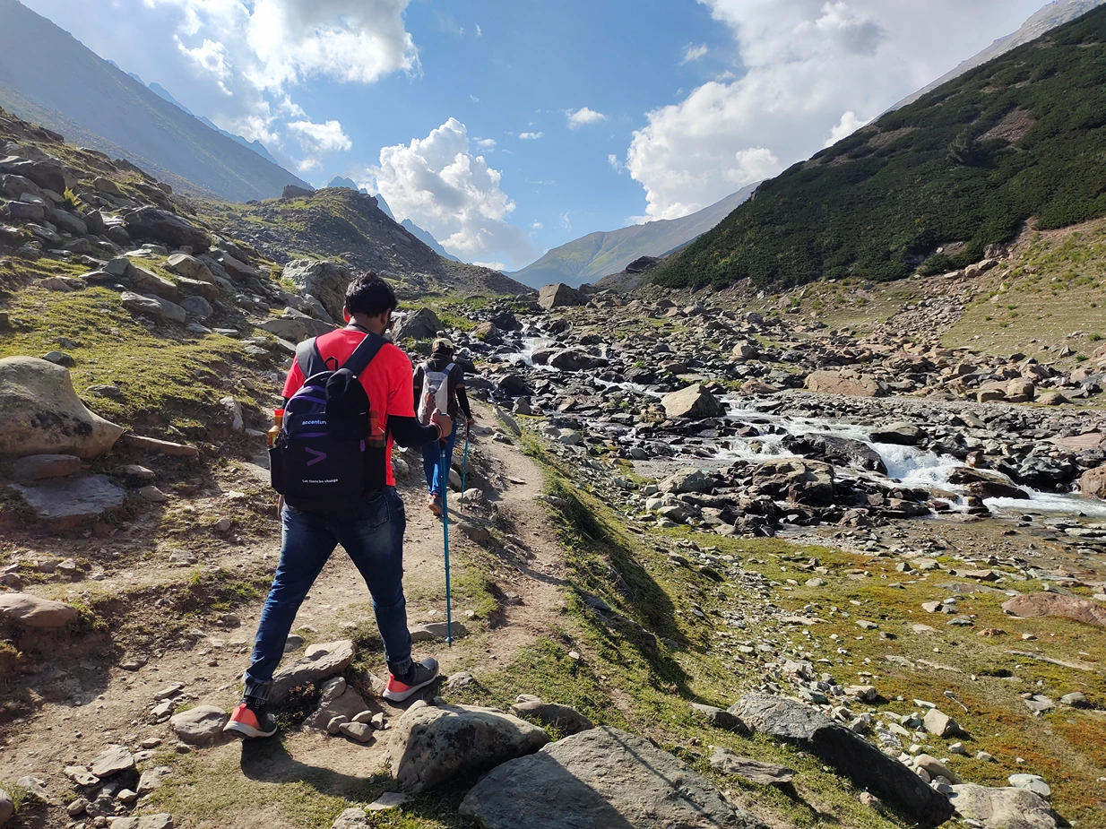
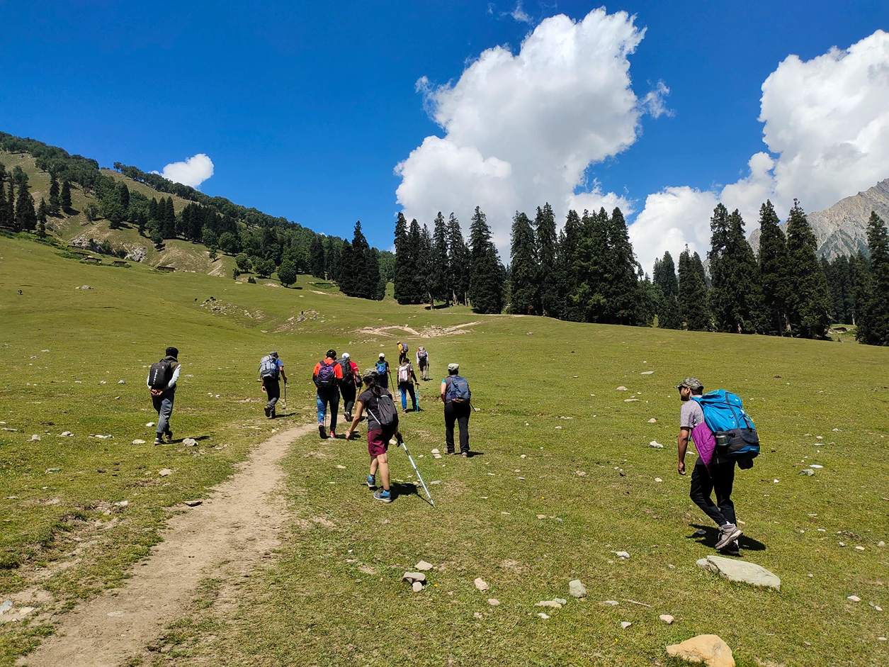
The trail out of Shitkadi follows a stream uphill through dense pine and maple forests. The gradient is steady but not steep. The forest is cool, shaded, and alive with birdsong. After about 2 hours, you reach Shekdur, a wide meadow dotted with shepherd huts. Refill water here. Rest for 10 minutes. The trail continues upward.
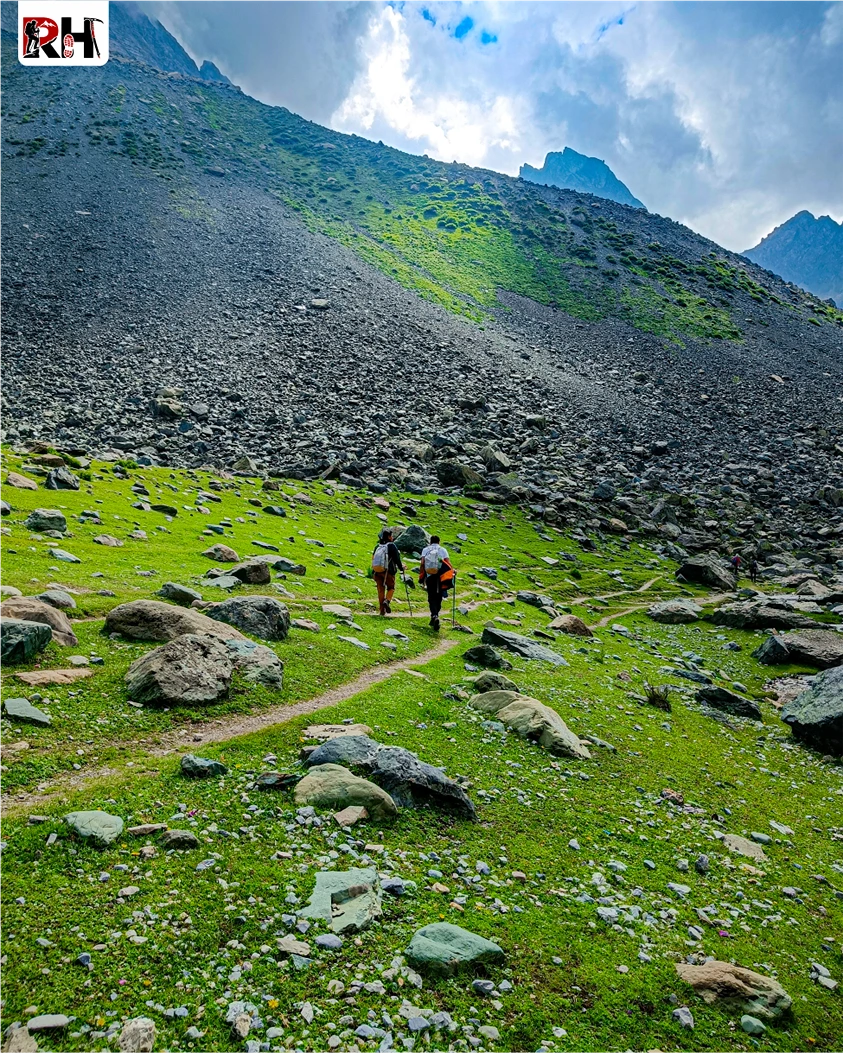
From Shekdur, the trail climbs more steeply through thinning forest. The trees are smaller now, the undergrowth sparser. After another 2 hours, the treeline ends completely. And suddenly, you are standing in an alpine meadow at 11,000 feet with ridgelines stretching in every direction and no trees anywhere.
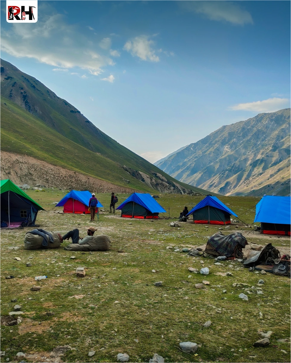
This is Nichnai. A vast, rolling grassland surrounded by peaks, with the Nichnai stream cutting through the valley. The campsite sits at 11,500 feet, high enough that nights are cold even in August. Tents are set up on flat ground near the stream. Views of the ridgelines and distant peaks dominate the landscape.
Rest. Eat well. Tomorrow you cross your first high-altitude pass.
This is the day the trek stops being a forest walk and becomes a high-altitude Himalayan expedition.
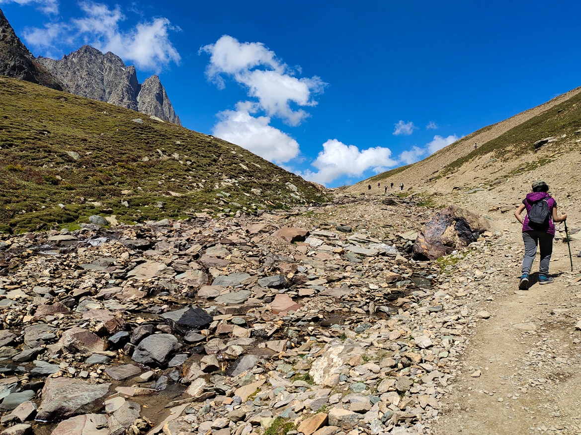
The trail out of Nichnai climbs steadily toward Nichnai Pass at 13,000 feet. The gradient is gentle but sustained. The meadow gives way to rocky terrain. Snow patches appear even in August. After 2 to 3 hours of climbing, you reach the pass.
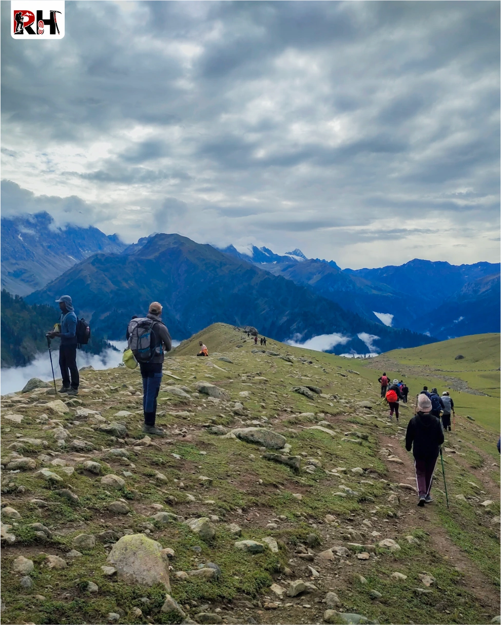
Nichnai Pass does not announce itself with prayer flags or cairns. It is just a wide, rocky ridgeline with views in every direction. Behind you, the valley you just climbed out of. Ahead, the valley that holds Vishansar and Kishansar lakes, a wide basin surrounded by ridgelines and peaks, with the twin lakes visible far below.
The descent from the pass is steep and rocky for the first kilometre, then eases into rolling meadows. Wildflowers cover the ground in July and August, blues, yellows, purples, stretching in every direction. Small streams cut across the trail. The lakes get closer with every step.
Vishansar Lake appears first, a deep blue pool sitting at 12,000 feet beneath the Kishansar Peak. The water is glacial-fed, cold, and so clear you can see the bottom near the shore. Half a kilometre beyond Vishansar, separated by a small ridge, is Kishansar Lake, equally blue, equally still.
The campsite sits between the two lakes on a grassy meadow. When you step out of your tent the next morning and see the peaks reflected in the water while frost covers the grass around you, you will understand why people call this trek the most beautiful in India.
This is the hardest day of the trek. The longest distance. The highest altitude. And the most visually overwhelming.
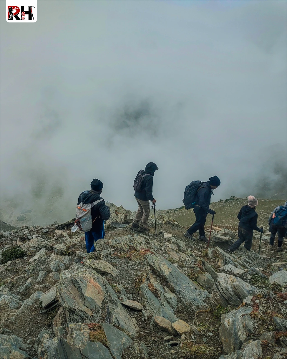
The trail from Vishansar climbs steeply toward Gadsar Pass. The gradient is punishing from the start. Rocky switchbacks. Boulder fields. Snow patches that require careful footing. After 2 hours of continuous climbing, you reach Kishansar Lake, sitting 500 feet above Vishansar on a shelf beneath the ridgeline.
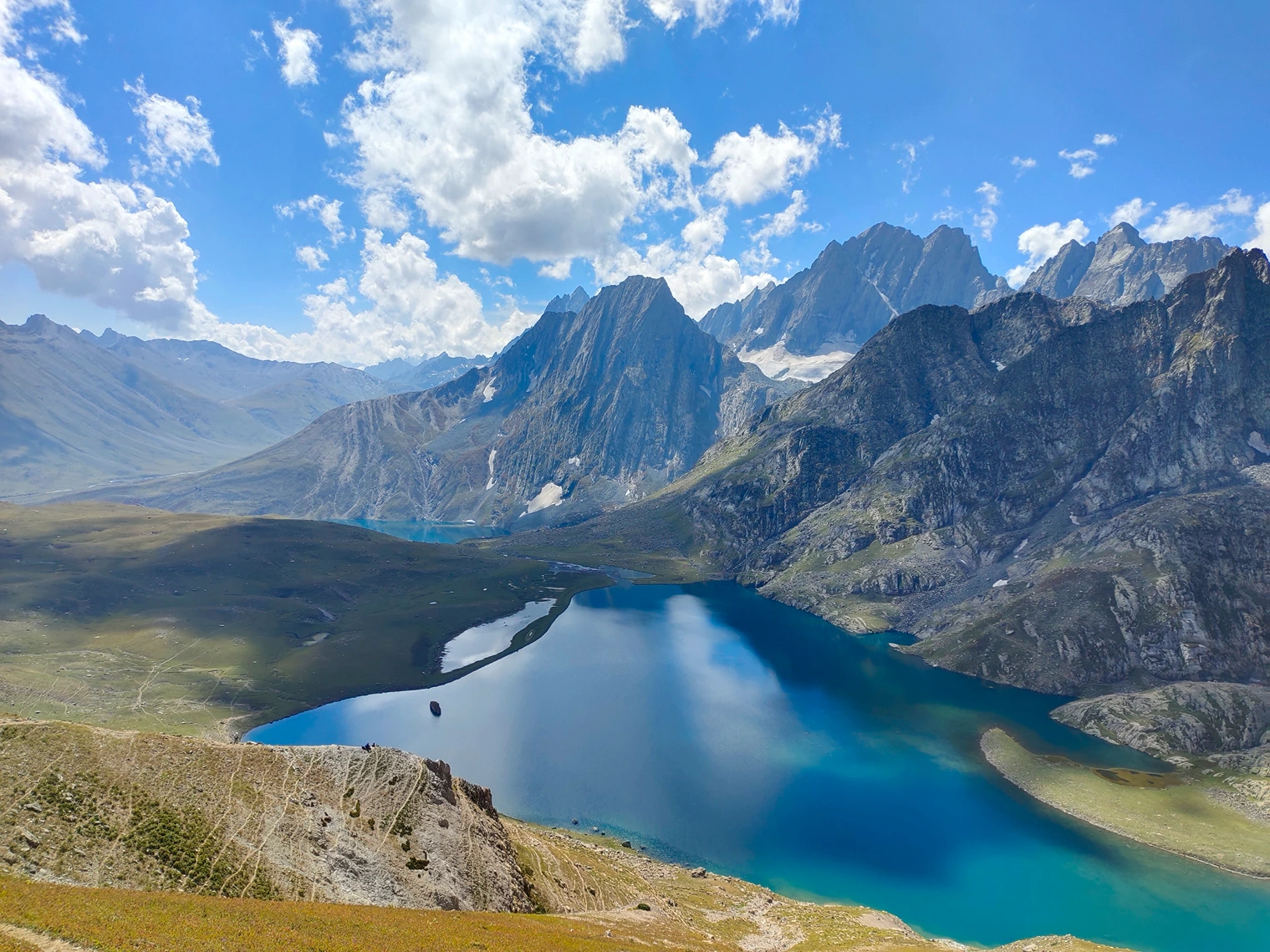
From Kishansar, the trail climbs another 1,500 vertical feet to Gadsar Pass at 13,750 feet. This is the highest point of the Kashmir Great Lakes Trek. The final push to the pass is steep, rocky, and exposed. Your lungs are working harder than they have all week. But when you step onto the pass, the view makes every step worth it.
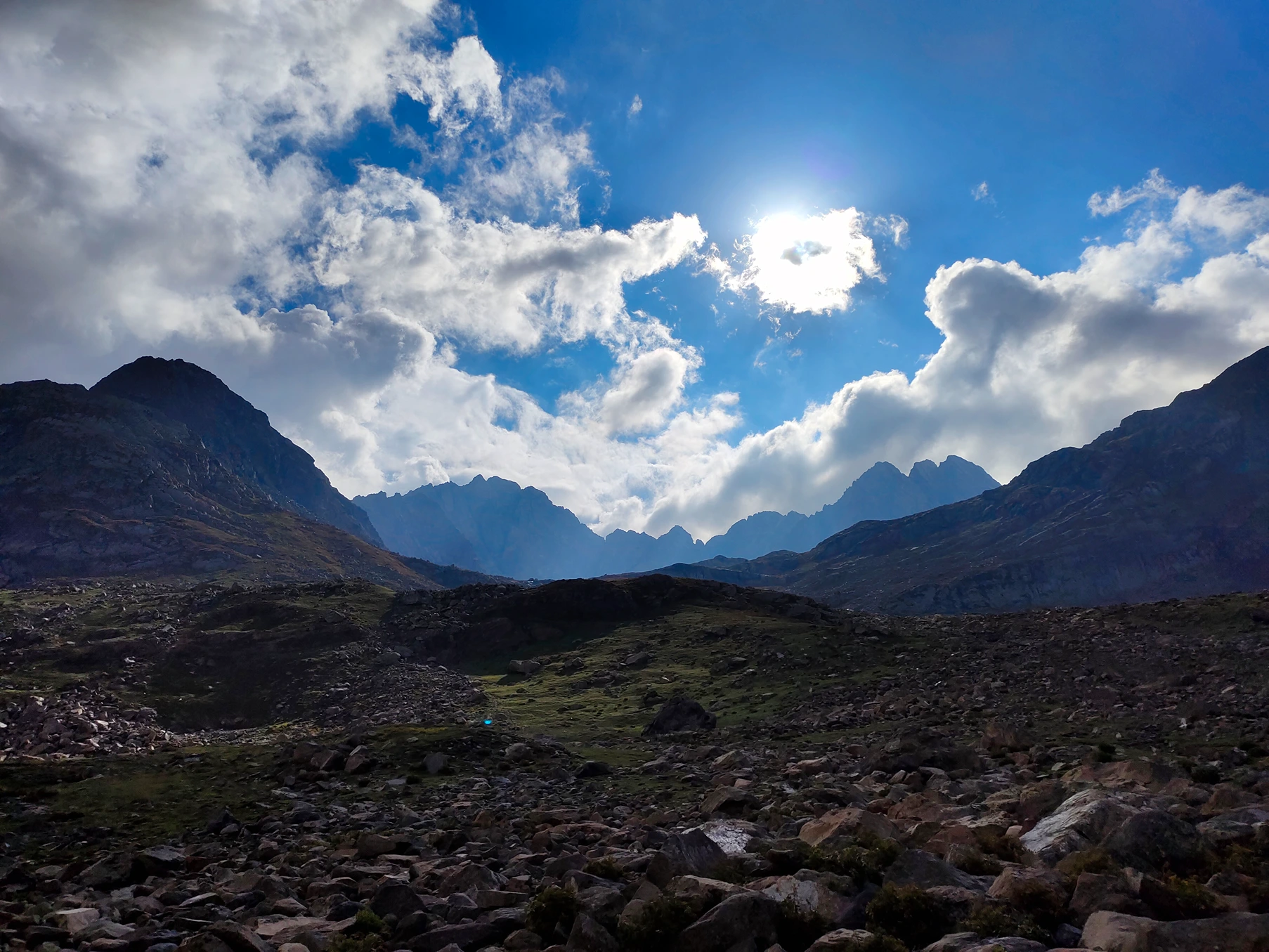
On one side, Vishansar and Kishansar lakes spread out below you, turquoise pools surrounded by green meadows. On the other side, Gadsar Lake sits in a barren glacial valley surrounded by snow-covered ridges. And beyond Gadsar, peaks stretching to the horizon in every direction.
The descent from Gadsar Pass is long. Nearly 1,500 vertical feet over 6 kilometres. The trail drops steeply at first, then eases into rolling terrain. You pass Yamsar Lake, a smaller glacial pool associated in local legend with Yama, the Hindu god of death. Then, after another hour of walking, Gadsar Lake appears.
Gadsar Lake sits at 12,250 feet in a valley that feels like the end of the world. Surrounded by ridgelines, with glaciers hanging above it, the water is emerald green due to algae growth, different from the deep blue of Vishansar and Kishansar. The campsite sits on a meadow beside the lake.
Arrive by mid-afternoon. Rest. Tomorrow is a moderate day.
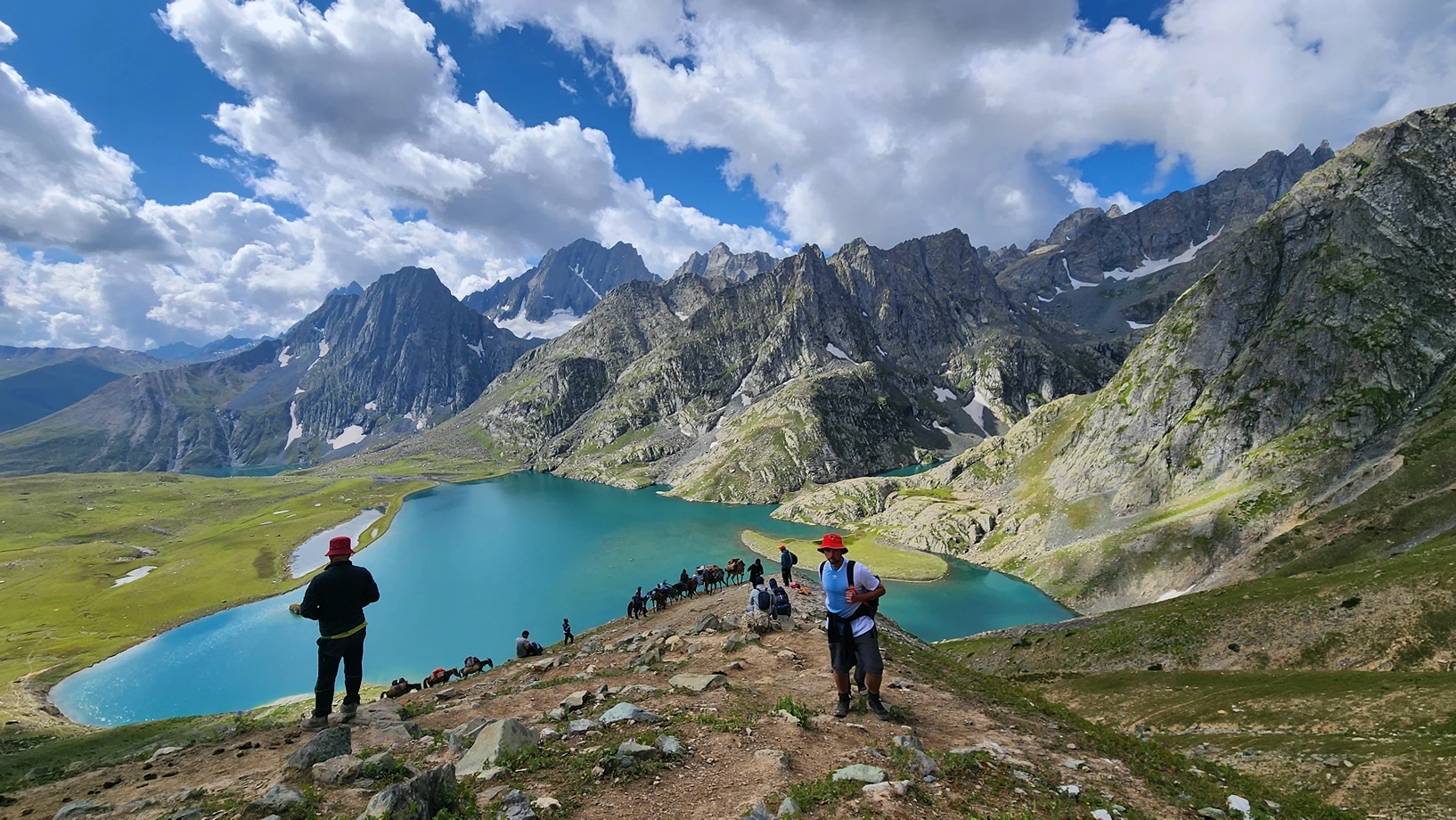
The trail from Gadsar crosses rolling meadows and rocky terrain toward Satsar, the valley of seven lakes. The gradient is gentle, the walking is easier than yesterday, and the landscape changes from barren glacial valley to green meadows dotted with wildflowers.
After about 3 hours of walking, you reach the Satsar Army Camp, the third line of defense from the Line of Control (LoC). Soldiers stationed here check identification documents and verify permits. Original ID proof is mandatory. Photocopies are collected. This is standard protocol and takes 30 minutes to an hour depending on group size.
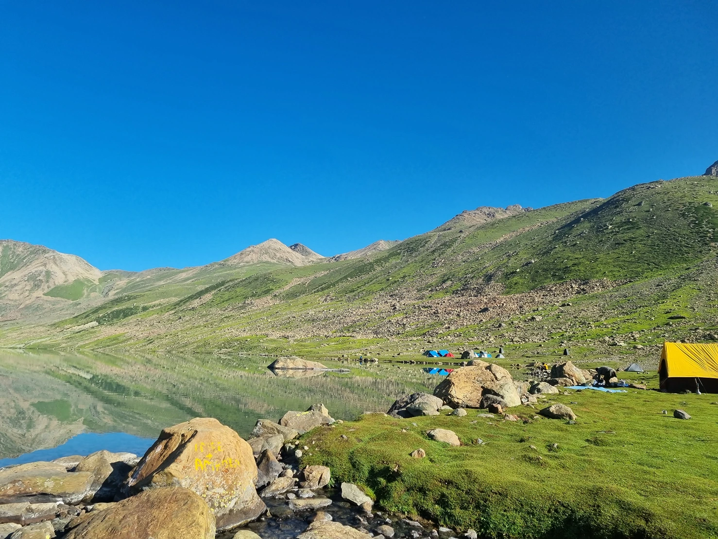
Beyond the army camp, the trail continues for another hour to Satsar, a complex of seven interconnected alpine lakes scattered across a wide valley. Some are large, some are small. Some have water year-round, some are seasonal. The campsite sits beside one of the larger lakes at 12,000 feet.
Satsar feels different from the other campsites. More open. More exposed. More remote. The valleys stretch in every direction with no villages, no roads, no sign of permanent human habitation except for the army camp. At night, the silence is absolute.
Rest. Tomorrow you climb your final pass.
The trail from Satsar climbs toward Zaj Pass, the final high-altitude crossing of the trek. The gradient is moderate, the terrain is rocky, and the altitude gain is noticeable after five days above 11,000 feet. After 2 to 3 hours of climbing, you reach Zaj Pass at 13,400 feet.
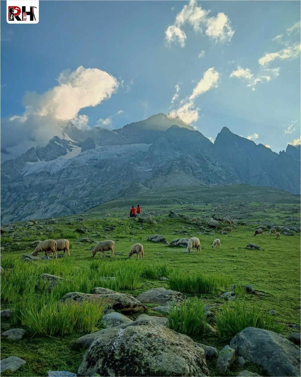
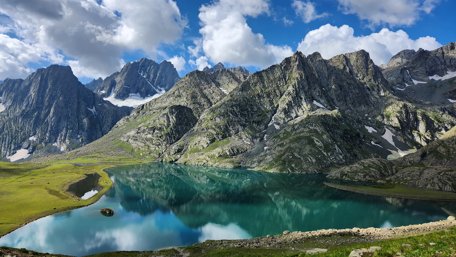
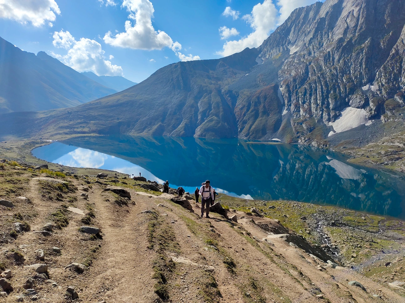
From the pass, the views are extraordinary. Behind you, the Satsar valley and the route you have walked for six days. Ahead, the twin lakes of Gangabal and Nundkol sitting at the base of Mount Harmukh, a 16,870-foot peak that towers 5,000 vertical feet above the water.
The descent from Zaj Pass is steep and rocky. Boulder fields. Narrow trails. Careful footing required. After 2 hours of downhill trekking, the trail eases into rolling meadows, and the twin lakes come into full view.
Gangabal and Nundkol sit side by side at 11,500 feet, separated by a narrow strip of land. Gangabal is the larger of the two, considered sacred by both Hindus and Muslims. Nundkol is smaller but equally beautiful, with Mount Harmukh’s reflection visible in the still water on calm mornings.
The campsite sits on a meadow between the two lakes. When you wake up tomorrow and see Harmukh turning gold in the sunrise while the lakes reflect the sky, you will understand why this place has been sacred for centuries.
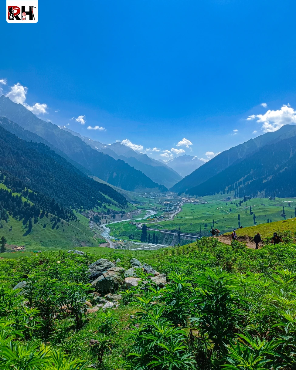
The final day is a long descent from Gangabal through forests and villages to Naranag, and then the drive back to Srinagar.
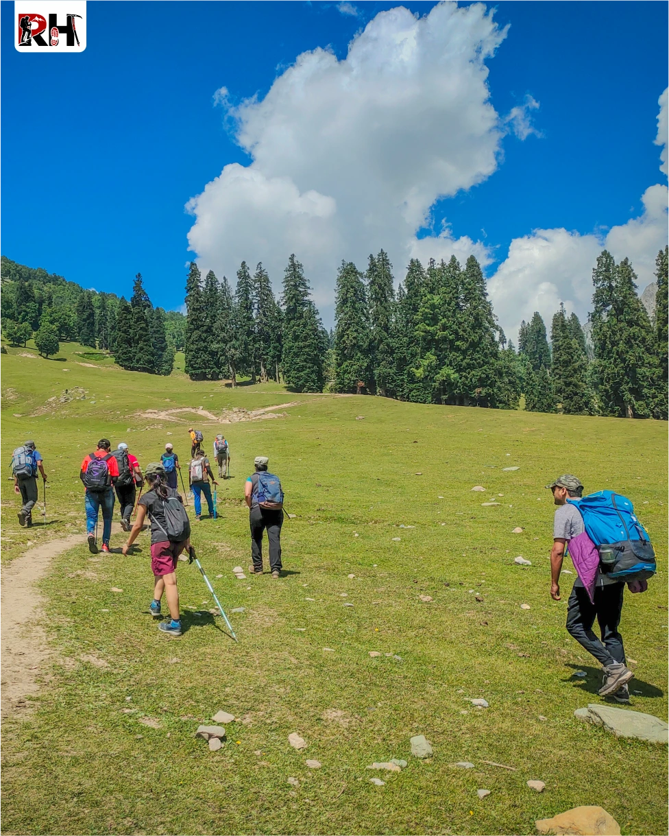
The trail from Gangabal drops steeply at first through boulder fields and rocky terrain, then enters pine and maple forests that grow thicker with every kilometre. The altitude drops quickly. The air gets warmer. The sound of streams and birdsong replaces the silence of the high camps.
After 4 to 5 hours of trekking, the trail reaches Naranag, a small village at 7,800 feet with a roadhead and the ruins of an ancient temple complex. From here, a vehicle brings you back to Srinagar (70 km, 2-3 hours).
Arrive in Srinagar by late afternoon or early evening. Book your onward travel accordingly, with at least a 2-hour buffer for delays.
The Kashmir Great Lakes Trek is over. But the memory of walking beside seven alpine lakes across seven valleys over seven days stays longer than you expect.
Inclusion & exclusion
Inclusions
Exclusions
Note:
- Bag offloading will be charged at ₹3,000 per bag.
- Maximum weight per bag should not exceed 10 kg.
Best Time to Visit Kashmir Great Lakes Trek
The Kashmir Great Lakes Trek is accessible for a short window every year, from early July through mid-September. Timing matters more on this trek than on most others because the landscape changes dramatically depending on when you go.
July to Early August: Peak Bloom Season
This is the best time to see the meadows at their greenest and most flower-covered. The snow melts completely from the lower valleys by early July, leaving the meadows lush and alive with wildflowers. Blues, yellows, purples, covering every slope between Nichnai and Satsar. The alpine lakes are full, fed by snowmelt from the peaks above. The water is at its bluest.
- Daytime temperature at lower camps: 12°C – 18°C
- Daytime temperature at higher camps: 5°C – 12°C
- Night temperature at Vishansar/Gadsar/Satsar: 0°C – 5°C
- Rainfall: Occasional. Brief afternoon showers are common.
- Crowds: High. This is peak trekking season.
Mid-August to Mid-September: Clear Skies Season
This is the best time for mountain views and photography. By mid-August, the monsoon influence weakens. Skies clear. Visibility improves. The mountain views from Gadsar Pass and Zaj Pass are at their sharpest of the entire year. The meadows turn from green to golden-brown, losing the vibrant colour of summer but gaining an austere, otherworldly beauty.
- Daytime temperature at lower camps: 10°C – 15°C
- Daytime temperature at higher camps: 3°C – 10°C
- Night temperature at Vishansar/Gadsar/Satsar: -2°C – 3°C (frost always present)
- Rainfall: Minimal
- Crowds: Moderate in August, low in September.
June and Late September: Early/Late Season
The trek is technically accessible in June and late September, but conditions are not ideal. In June, snow still covers the passes. Trails are unclear. The lakes are partially frozen. Most trekking operators do not run batches in June. In late September, temperatures drop sharply. Night temperatures at high camps can reach -5°C or lower. The meadows are brown. Wildflowers are gone. The trek is still beautiful, but it lacks the visual impact of July and August.
October Onward: Trek Closed
The trek closes in October when the first heavy snowfall makes the passes impassable. The route remains closed until late June.
Kashmir Great Lakes Trek Packing List
Pack for two realities: 18°C sunshine in the meadows and -2°C frost at night. Both exist within the same 24 hours at 12,000 feet. Keep your pack under 10 kg. Anything heavier compounds fatigue on long trekking days.
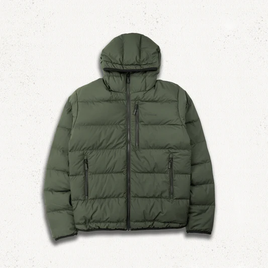
Clothing
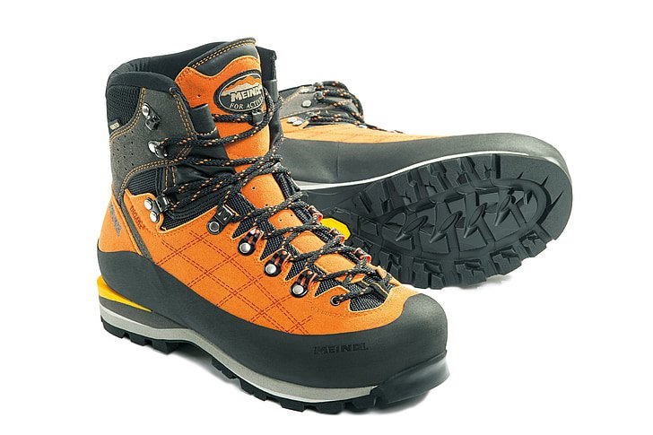
Footwear
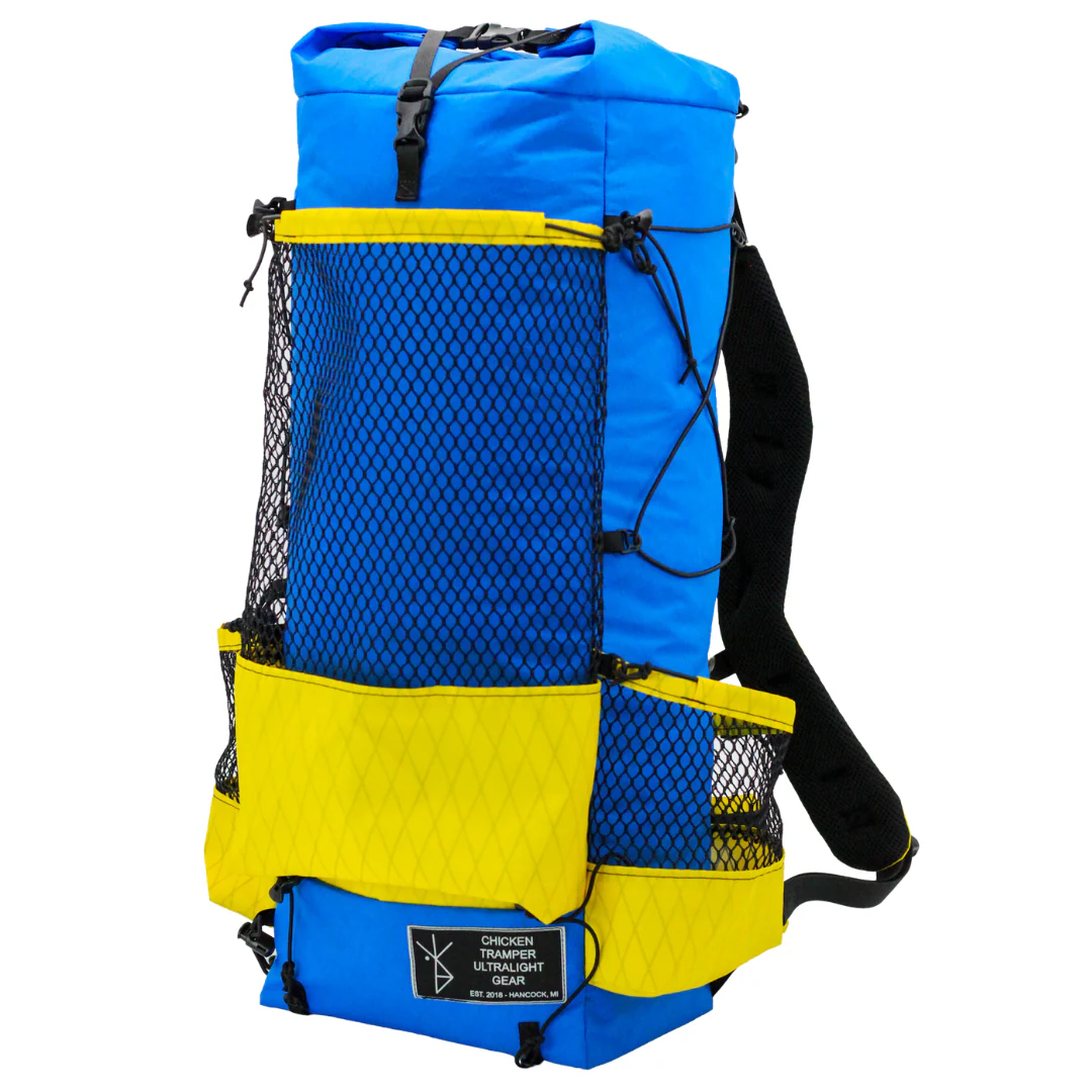
Equipment
Health & Hygiene
Documents & Finance
How to Reach Kashmir Great Lakes Trek Base Camp
The Kashmir Great Lakes Trek starts from Shitkadi village near Sonamarg. Srinagar is the main transit hub.
Reach Srinagar
- By Air: Srinagar International Airport (SXR) has direct flights from Delhi, Mumbai, Bengaluru, and other major cities. This is the fastest and most convenient way to reach Srinagar.
- By Road: Srinagar is connected by road to Jammu (270 km, 8-9 hours). Direct buses and shared taxis are available, but road travel can be affected by weather and landslides.
Srinagar to Gagangir to Shitkadi
Gagangir is approximately 70 km from Srinagar via the Sind Valley road.
-
Route: Srinagar Ganderbal – Kangan – Gagangir – Sonamarg – Shitkadi
-
Drive Time:3-4 hours
-
Vehicle: Shared taxi / private cab / operator-arranged vehicle
-
Last ATM: Srinagar, withdraw enough cash for the full trek
-
Last Reliable Network: Sonamarg, assume no connectivity for 6 days beyond this point
Policy
| Policy Point | Details |
|---|---|
| Booking Confirmation | Your seat is considered confirmed only after the required advance payment is received. |
| Balance Payment | The remaining amount must be cleared before departure or as per the reporting instructions shared by the team. |
| Transport Selection | Pickup from Dehradun is applicable only if that option is selected at the time of booking. |
| ID Requirement | Every participant should carry a valid government photo ID for verification and trek administration. |
| Operational Changes | In case of weather, road, or safety concerns, the itinerary may be adjusted for the well-being of the group. |
| Cancellation Window | Charge / Refund |
|---|---|
| More than 30 days before departure | Minimal processing deduction may apply; remaining amount can be refunded or adjusted as per booking terms. |
| 15 to 30 days before departure | Partial cancellation charge applicable; remaining balance may be refunded or transferred to a future batch if approved. |
| 7 to 14 days before departure | Higher cancellation charge applies because transport, permits, and staffing arrangements are usually already blocked. |
| Less than 7 days before departure | Booking is generally non-refundable due to final operational commitments. |
| No show / Trek departure missed | No refund is usually applicable once reporting is missed without prior written coordination. |
Important: Trek departures and route decisions always remain subject to weather, road access, local administration, and safety conditions. Final operational decisions are taken in the interest of the group.
FAQ's
The Kashmir Great Lakes trek is graded moderate to difficult. It involves long walking days (6-8 hours), three high-altitude passes, and sustained trekking above 11,000 ft. The trails are well-defined and do not require technical climbing, but you need good cardiovascular fitness and stamina. Fit beginners with proper preparation and experienced trekkers complete it comfortably.
The maximum altitude is 13,750 feet (4,191 meters) at Gadsar Pass. Campsites range from 11,500 ft (Nichnai) to 12,250 ft (Gadsar). Base camp at Shitkadi is at 9,000 ft.
July 20 to August 15 for peak wildflower bloom and greenest meadows. Mid-August to mid-September for clearest skies and best mountain views. Avoid June (snow on passes), late September (very cold), and October-June (trek closed).
7 days from Srinagar to Srinagar, including travel days. The actual trekking happens over 6 days (Days 2-7), covering approximately 72 km. Add 1-2 buffer days for potential weather delays.
Starts at Shitkadi village near Sonamarg, reached by road from Srinagar. Ends at Naranag village, from where you drive back to Srinagar. This is a point-to-point trek, not a loop.
Yes, for fit beginners with proper preparation. If you can jog 5 km in 30-35 minutes and have trained for 4-6 weeks before the trek, you will manage it. This should not be your first-ever trek if you have no fitness base. Prior high-altitude experience helps but is not mandatory.
Seven alpine lakes (Vishansar, Kishansar, Gadsar, Satsar, Gangabal, Nundkol, Yamsar); three high-altitude passes (Nichnai, Gadsar, Zaj); endless alpine meadows covered in wildflowers; views of Mount Harmukh from Gangabal; and camping beside glacial lakes at 12,000 ft.
Lower camps (Nichnai): 0°C to 15°C at night. Higher camps (Vishansar, Gadsar, Satsar, Gangabal): -2°C to 5°C at night. Frost is common every morning. Day temperatures range from 5°C to 18°C depending on weather. Full layering including down jacket is essential.
Acclimatization happens gradually as you ascend from Shitkadi (9,000 ft) to Nichnai (11,500 ft) to Gadsar Pass (13,750 ft) over four days. Drink 3-4 litres of water daily. Walk at a steady, slow pace. Report any symptoms of AMS (headache, nausea, dizziness, breathlessness at rest) to your trek leader immediately.
Limited network in Srinagar and Sonamarg. Beyond Shitkadi, assume no network for 6 days. Occasional weak signal may be caught at high points like Nichnai Pass, but do not rely on it. Download offline maps before leaving Srinagar.
Indian nationals: Forest permits are included in trek packages. You must carry original government ID and 2 photocopies for army checkposts at Satsar. Foreign nationals: Check with local authorities for any special permits required for Kashmir trekking.
Yes. Unlike Valley of Flowers, camping is allowed and necessary. You camp beside Vishansar, Gadsar, Satsar, and Gangabal lakes at designated sites. All campsites are in remote valleys with no permanent structures.
Gangabal and Nundkol are twin glacial lakes at 11,500 ft at the base of Mount Harmukh (16,870 ft). Gangabal is considered sacred and associated with the Ganges in Hindu tradition. Nundkol is named after Nandi, the bull of Lord Shiva. Both are pilgrimage sites.
The combination of seven alpine lakes, endless meadows, three high-altitude passes, and the variety of landscapes, from dense forests to barren glacial valleys, makes this trek visually overwhelming. Every day offers new terrain, new lakes, and new mountain views. The landscapes are comparable to the best alpine treks in the world.
Solo trekking is not permitted. The route passes through sensitive areas near the Line of Control with mandatory army checkposts. Permits are issued only to registered trekking companies. The trek is remote, at high altitude, and has no emergency services within reach. Organised group treks are the only responsible way to do this trek.
Yes, when done responsibly with experienced operators. The route passes through secure areas with army checkposts at Satsar. Political tensions exist in Kashmir, but the trekking zones are safe. Weather is the main safety concern, always follow your trek leader’s decisions on pass crossings.
Rental gear for this trek