Highlight
The Crossover: Walking from the green, forested Kullu Valley to the barren, desert landscape of Lahaul in a single day across Hampta Pass
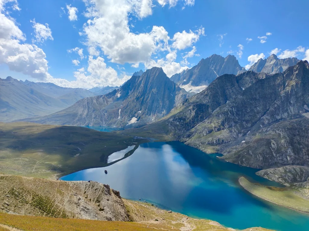
Chandratal Lake: A crescent-shaped alpine lake at 14,100 ft with water so blue and clear it reflects the surrounding peaks perfectly; one of the most photogenic spots in Himachal
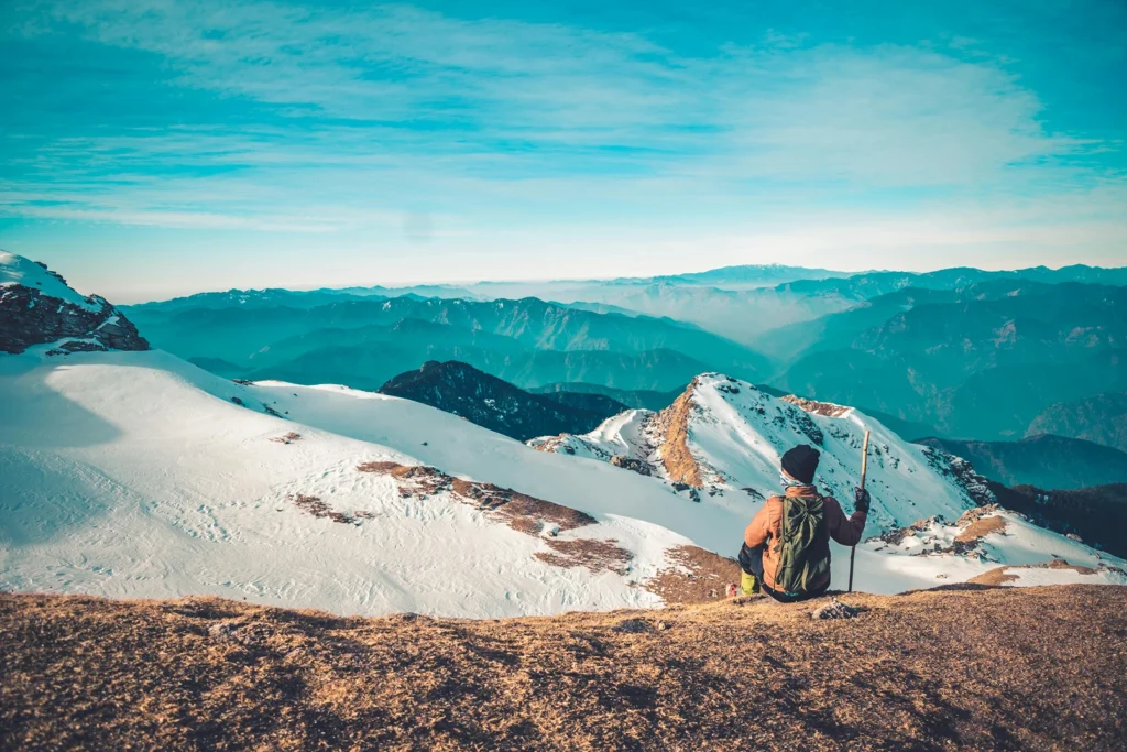
Hampta Pass Summit: Standing at 14,100 ft with views of Indrasan (6,221 m) and Deo Tibba (6,001 m) rising above you, with Kullu Valley behind and Lahaul ahead
River Crossings: Wading through icy, glacier-fed streams at Jwara and Shea Goru, waist-deep in places, using ropes for support
Balu Ka Ghera Campsite: Camping on a glacial moraine at 12,000 ft surrounded by peaks, with the sound of glacial streams and the sight of hanging glaciers above
Wildflower Meadows: The meadows at Chika and Jwara in July and August, covered in geraniums, primulas, and Himalayan bellflowers
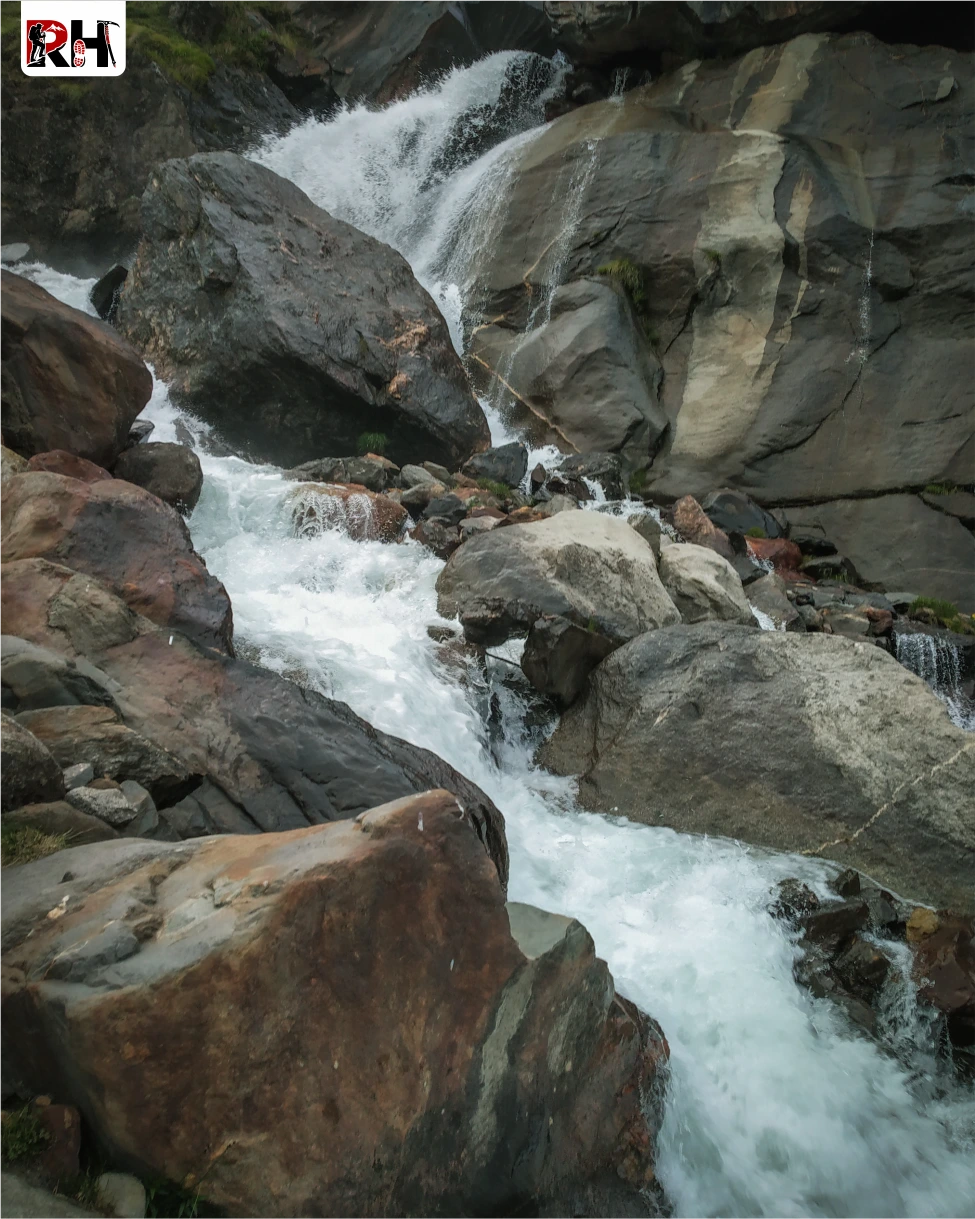
Rani Nalla Stream: Following this glacial stream from Jobra to Balu Ka Ghera, with waterfalls, pools, and turquoise water cutting through the valley
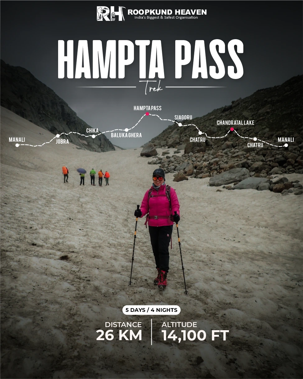
Hampta Pass Trek
Clear trek details, booking dates, inclusions, and rental options.
Most Himalayan treks take you from one valley into another valley that looks roughly the same. Different altitude, maybe. Different views, sure. But the same ecosystem. The same climate. The same world.
The Hampta Pass Trek takes you from one world into a completely different one. In three days.
Why Trekkers Love It
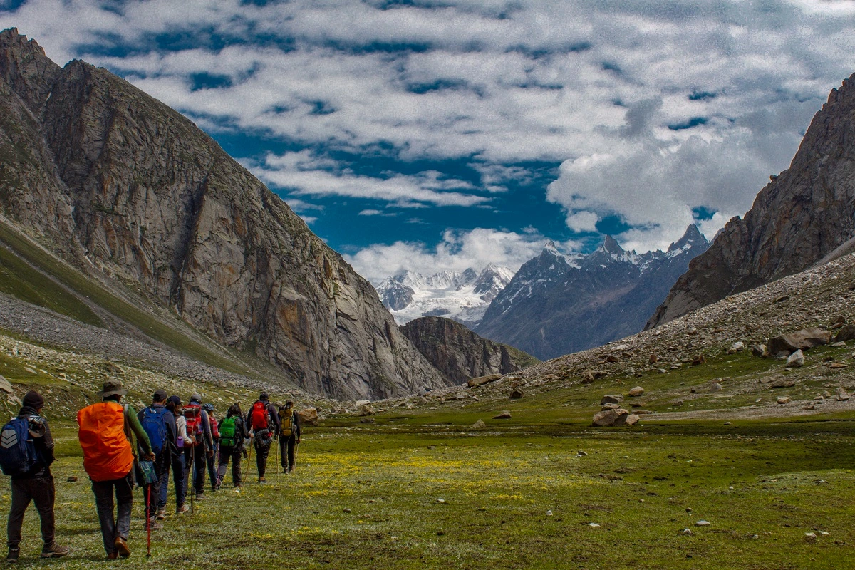
On one side of the pass, you have the Kullu Valley. Green. Forested. Lush with oak, maple, and rhododendron. Rivers cutting through meadows covered in wildflowers. The kind of landscape that looks like it belongs in Scotland or Switzerland, except it sits at 10,000 feet in the Indian Himalayas.
On the other side of the pass, you have Lahaul. Barren. Stark. A cold desert where nothing grows except scattered shrubs and the sky stretches endlessly blue above mountains the colour of rust and gold. The kind of landscape that looks like it belongs on Mars, except it sits 3 kilometres from where you were standing in a green valley an hour ago.
And the pass itself, Hampta Pass at 14,100 feet, is the line between them. You climb it from the Kullu side through forests and flowers. You stand on top and see both worlds at once. And you descend into Lahaul through boulder fields and scree, and within an hour the green is gone completely. Replaced by barren ridges, glacial streams, and a silence so absolute it feels like the mountains swallowed every sound.
This is not a gradual shift. This is not the landscape slowly changing over days. This is two ecosystems separated by a single ridge, and you walk between them in a morning.
The Hampta Pass Trek is a 5-day, 26-km route that starts at Manali in Himachal Pradesh, climbs through the Kullu Valley to Hampta Pass, crosses into Lahaul, descends to Chatru, and ends with a drive to Chandratal Lake, one of the most beautiful high-altitude lakes in India, before returning to Manali.
The trek is short. Most people complete it in 4 trekking days plus 1 day for travel and the Chandratal visit. But short does not mean easy. Day 3, the pass-crossing day, is 9 hours long. You climb 3,400 vertical feet from Balu Ka Ghera to the pass, then drop 2,600 feet down the other side to Shea Goru. Your knees will remember that descent for days.
But the reward is immediate. Every day on this trek delivers something new. Day 1 is a short acclimatization walk to Chika through pine forests alongside the Rani Nalla stream. Day 2 climbs to Balu Ka Ghera, a glacial campsite surrounded by peaks, with views of the Dhauladhar Range opening up behind you. Day 3 is the pass crossing, the day you walk between worlds. Day 4 descends to Chatru and drives to Chandratal Lake, a crescent-shaped alpine pool at 14,100 feet that reflects the sky so perfectly it does not look real. Day 5 is the drive back to Manali.
The trek is graded moderate, which in practical terms means: the trails are well-defined, there is no technical climbing, and fit first-time trekkers complete it successfully. But you walk 6 to 9 hours on some days, you camp at 12,000 feet, and you cross a 14,100-foot pass. If you are not fit, you will struggle.
The right person for this trek is someone who wants to experience a dramatic landscape shift without spending two weeks on the trail. Someone who is comfortable with long days, cold nights, and river crossings that involve wading through icy, waist-deep water while holding a rope. Someone who understands that the best treks are not always the longest ones, and that sometimes the most memorable journeys are the ones that pack the most variety into the shortest distance.
The total distance is 26 kilometres over 5 days. Daily trekking distances range from 2 km on the acclimatization day to 9 km on the pass-crossing day. The cumulative altitude gain from Jobra to Hampta Pass is 4,000 vertical feet, which is significant but spread across three days.
If you are ready to walk between two worlds in three days, there is no reason to wait.
Day wise plan
A detailed day-by-day breakdown of the Hampta Pass Trek covering forest trails, glacial valleys, river crossings, campsite experiences, Hampta Pass summit day, Chandratal Lake visit, altitude changes, and the complete crossover journey from Kullu to Lahaul.
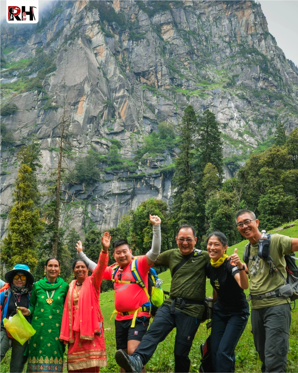
The Hampta Pass Trek begins in Manali, a mountain town that has been overrun by tourists for decades but somehow still manages to feel like it belongs in the mountains. Report at the designated meeting point in Manali by noon. From there, the drive to Jobra takes about 1.5 hours through a road that winds upward through 42 hairpin bends.
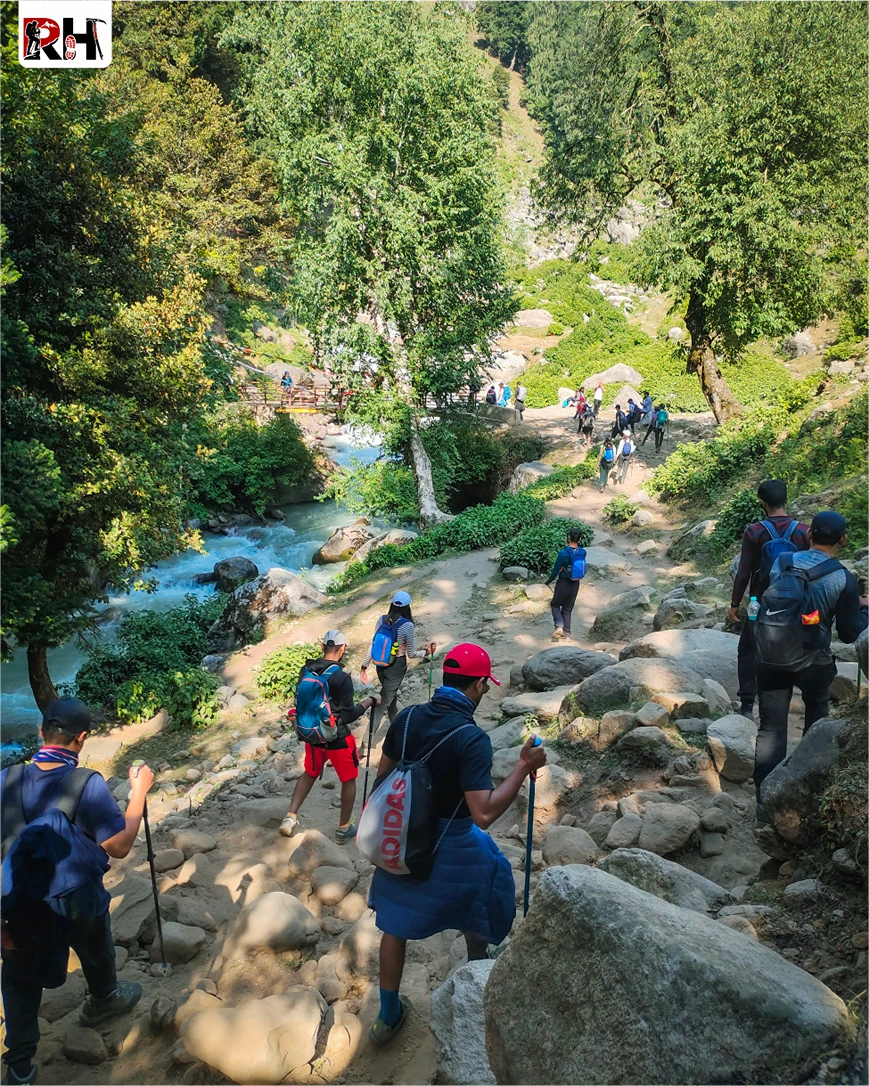
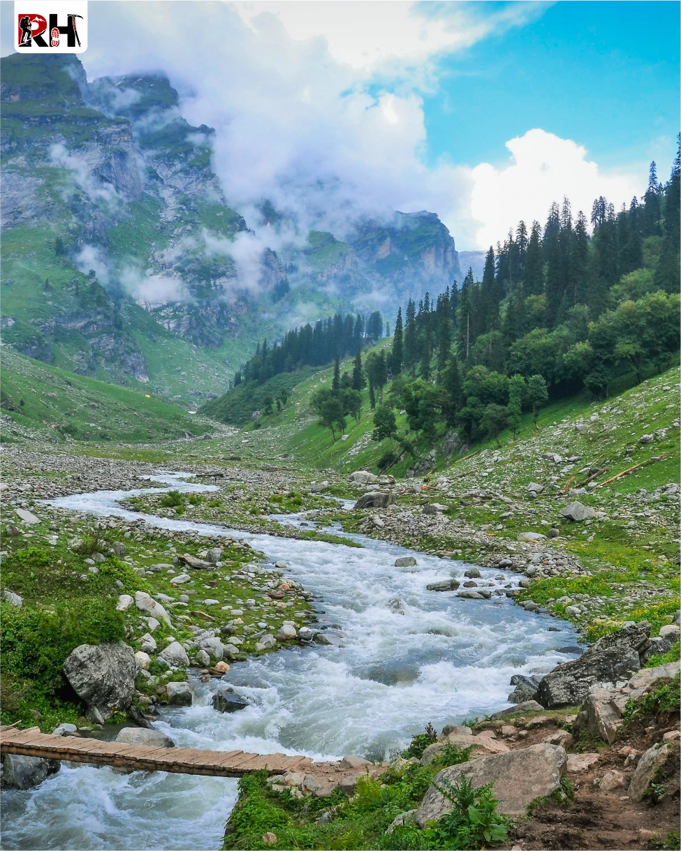
The road follows the Rani Nalla, a glacial stream that will be your companion for the next two days. Pine forests line the route. Apple orchards appear and disappear. And then, after the final hairpin bend, Jobra.
Jobra sits at 9,000 feet, a small clearing beside the stream with a few shepherd huts and nothing else. This is where the road ends and the trail begins.
The trek from Jobra to Chika is short, 2 kilometres, and gentle, a gradual climb through pine and oak forests. The trail follows the Rani Nalla upstream. The sound of water is everywhere. After about an hour, the trail opens into a wide meadow, and Chika appears.
Chika sits at 10,100 feet on a grassy slope beside the stream. Tents are set up on flat ground near the water. Views of the ridgelines and peaks surrounding the valley dominate the landscape. This is an acclimatization day, designed to let your body adjust to the altitude before the harder days ahead.
Rest. Eat. Hydrate. Tomorrow climbs 2,000 vertical feet.
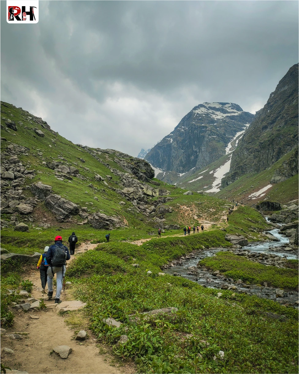
This is the day the trek stops being a forest walk and starts being a Himalayan expedition. The trail out of Chika follows the Rani Nalla upstream through thickening forest. Oak, maple, and birch. In July and August, wildflowers cover the ground, blues, yellows, purples, stretching in every direction. The gradient is steady but not steep. The trail crosses and recrosses the stream several times, sometimes on wooden bridges, sometimes on stepping stones.
After about 2 hours, you reach Jwara, a wide meadow at 11,000 feet where shepherds bring their flocks in summer. Some trekking groups camp here. Others push on to Balu Ka Ghera. Refill water. Rest for 10 minutes. The trail continues upward.
From Jwara, the trail climbs more steeply through thinning forest. The trees are smaller now. The undergrowth sparser. After another 2 hours, the treeline ends completely. And suddenly, you are standing in a glacial valley surrounded by peaks, with boulders and scree covering the ground and the Rani Nalla cutting through the centre.
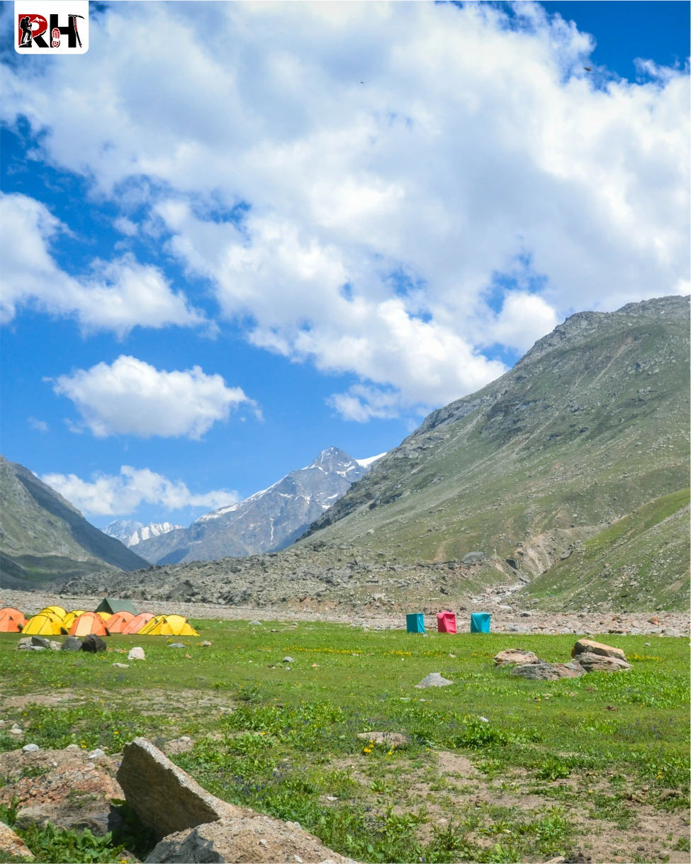
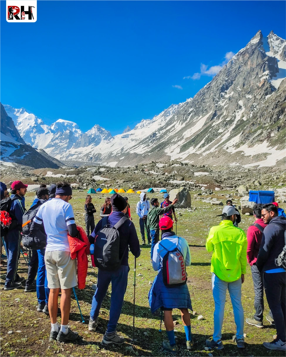
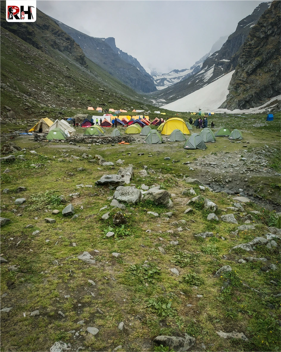
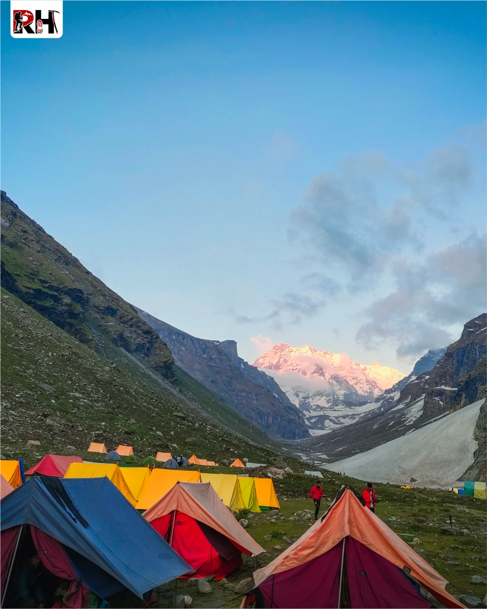
This is Balu Ka Ghera. A U-shaped valley at 12,000 feet, carved by glaciers thousands of years ago. The campsite sits on a moraine beside the stream. Behind you, the Dhauladhar Range rises in a long ridgeline. Ahead, somewhere beyond the valley head, is Hampta Pass, hidden behind ridges and boulder fields.
Nights here are cold, 0°C to 5°C even in summer. The stream is loud. The stars are extraordinary. Tomorrow starts early.
This is the day you trained for. This is the day you cross between worlds.
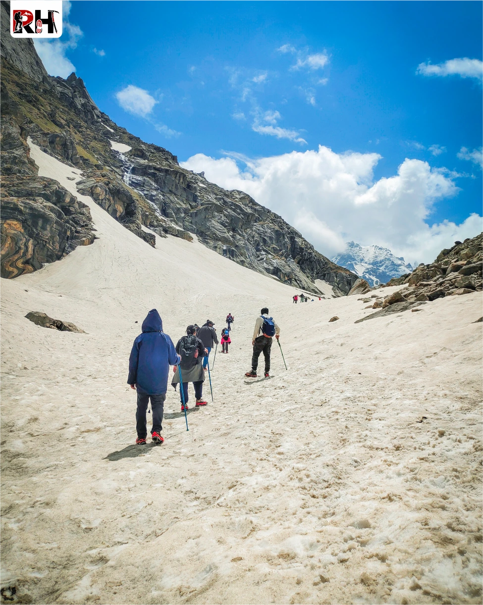
Leave Balu Ka Ghera by 6 AM. The trail climbs immediately, steeply, through boulder fields and scree. The Rani Nalla, which you have followed for two days, is now a thin trickle disappearing into rocks. Snow patches appear even in August. The gradient is punishing. Every step requires effort.
After 2 hours of continuous climbing, you reach a false summit, a ridge that looks like the pass but is not. The pass is still another hour ahead. Keep climbing.
The trail switchbacks through rocks and snow. Your lungs are working harder than they have all week. Your legs are tired from two days of climbing. And the altitude is real, 13,000 feet, 13,500 feet, 14,000 feet, every hundred feet making your breath shorter.
And then, after 3 to 4 hours of climbing from Balu Ka Ghera, you reach Hampta Pass at 14,100 feet.
The pass itself is a wide, rocky saddle. Prayer flags mark the summit. And when you step up onto the pass, the view makes every step worth it.
Behind you, the Kullu Valley spreads out in green ridges and forested slopes, with the Dhauladhar Range rising in the distance. Ahead, Lahaul opens in barren, rust-colored mountains, with the Chandra River valley cutting through the centre. And above you, Indrasan and Deo Tibba, two 6,000-meter peaks, rise with glaciers hanging from their faces.
Stand there as long as you can. Then begin the descent.
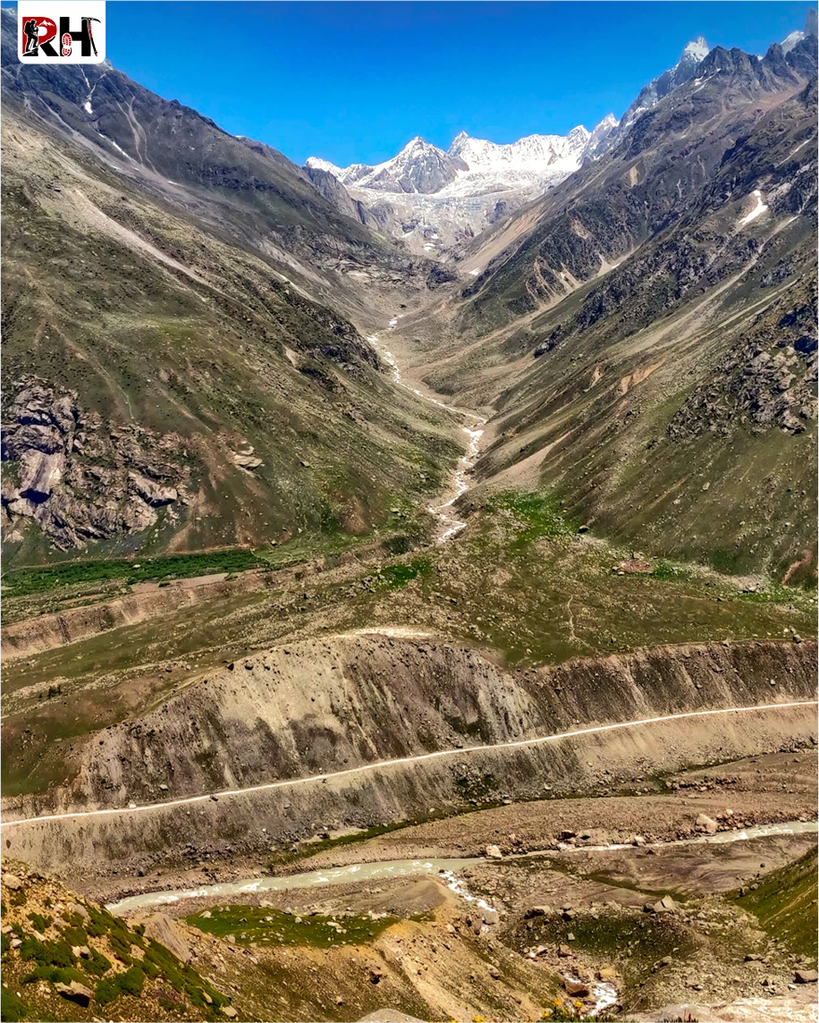
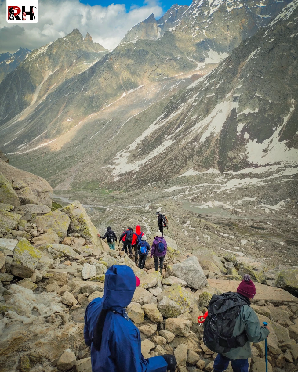
The descent from Hampta Pass is steep. Very steep. Rocky, loose, and exposed. You drop 2,600 vertical feet over 4 kilometres. Your knees will feel every metre of it. Use your trekking poles. Plant your heels. Take it slowly.
After 2 hours of downhill trekking, the gradient eases. The valley opens. And Shea Goru appears, a campsite at 11,400 feet beside a glacial stream in the middle of the Lahaul desert.
Arrive by late afternoon. Rest. The landscape has changed completely. The green is gone. Replaced by barren ridges, scattered shrubs, and a sky so blue it hurts to look at.
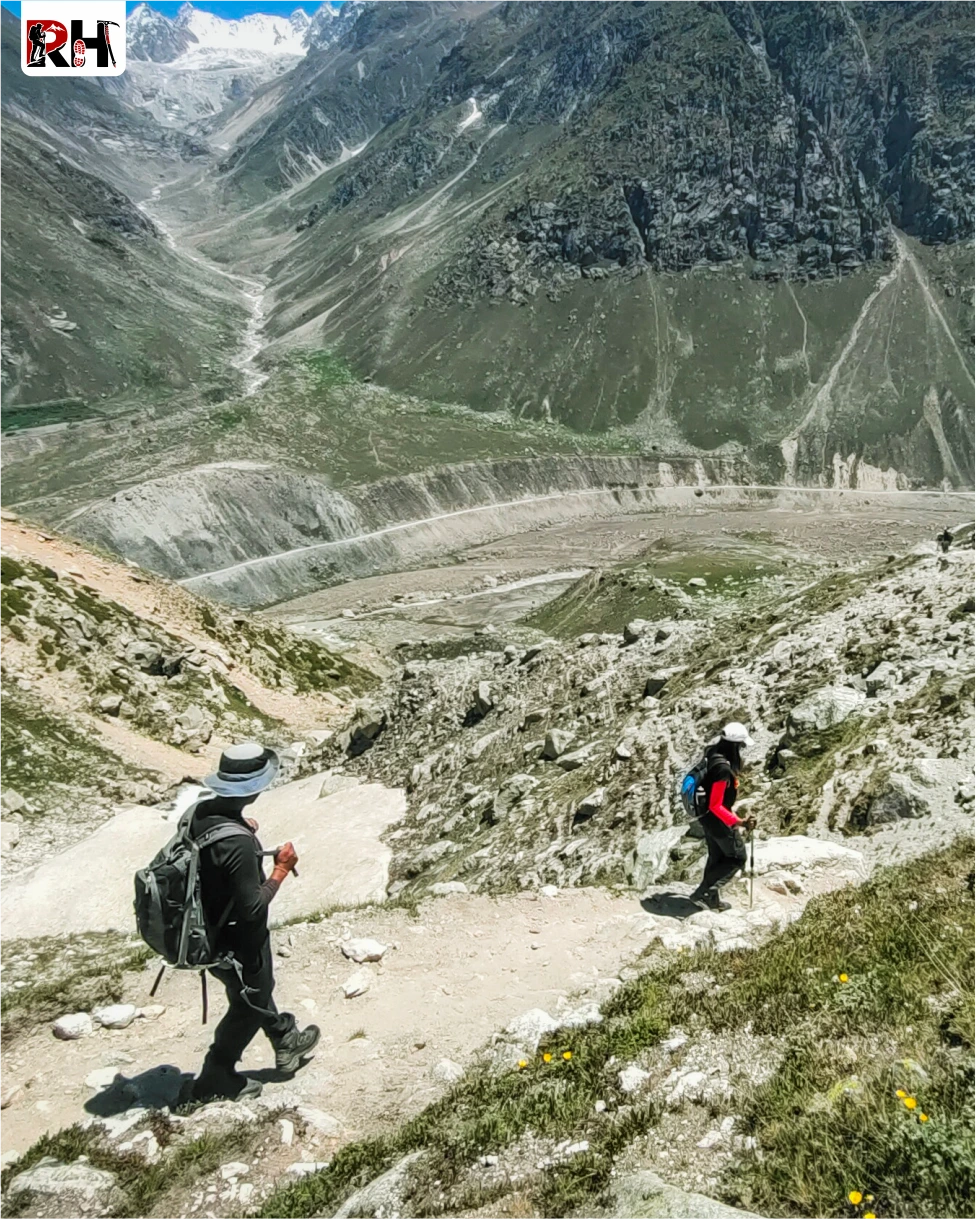
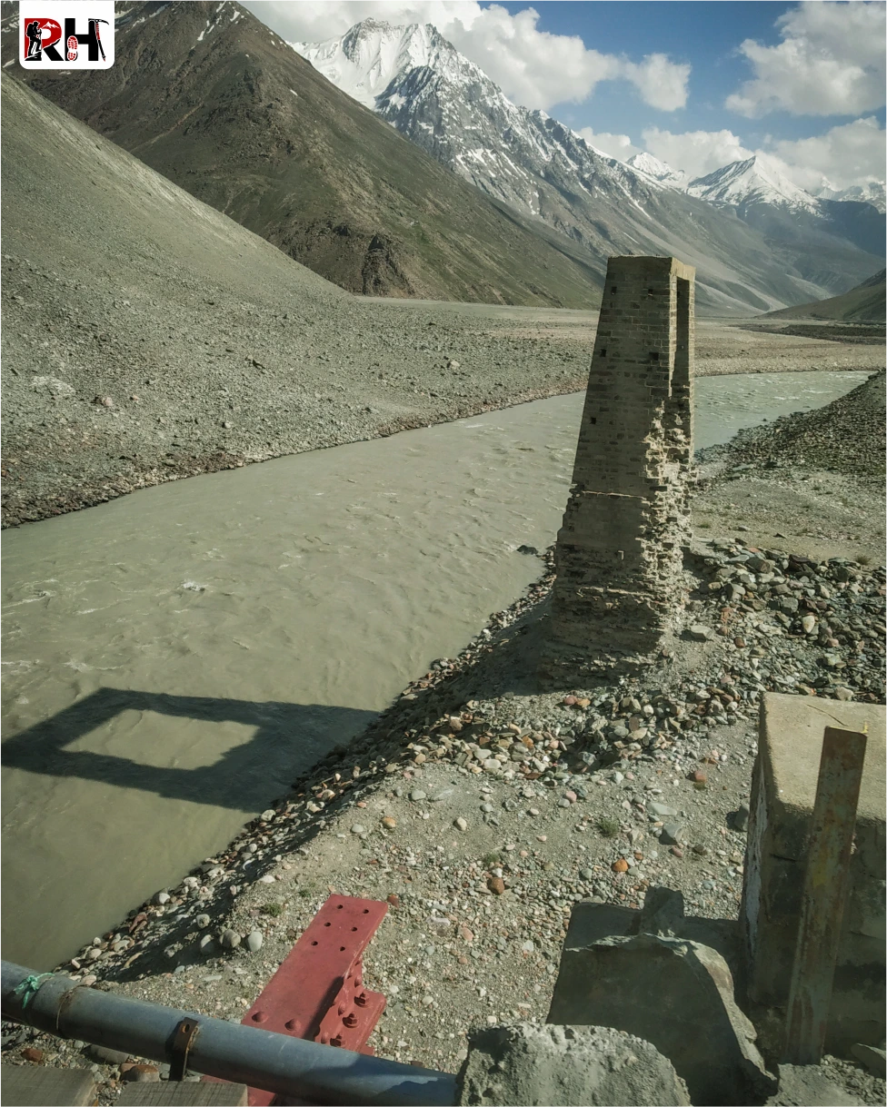
The morning trek from Shea Goru to Chatru follows a gradual descent through the Lahaul valley. The trail is rocky, winding through boulder fields and crossing the Hampta stream several times. After 5 hours of walking, you reach Chatru, a small cluster of dhabas and guesthouses at 10,900 feet where the road from Manali via Rohtang Pass meets the valley.
From Chatru, a vehicle drives you to Chandratal Lake, 48 kilometres through the Lahaul landscape. The drive takes about 3 hours, winding upward through barren mountains, crossing Kunzum Pass at 14,931 feet, and finally descending to the lake.
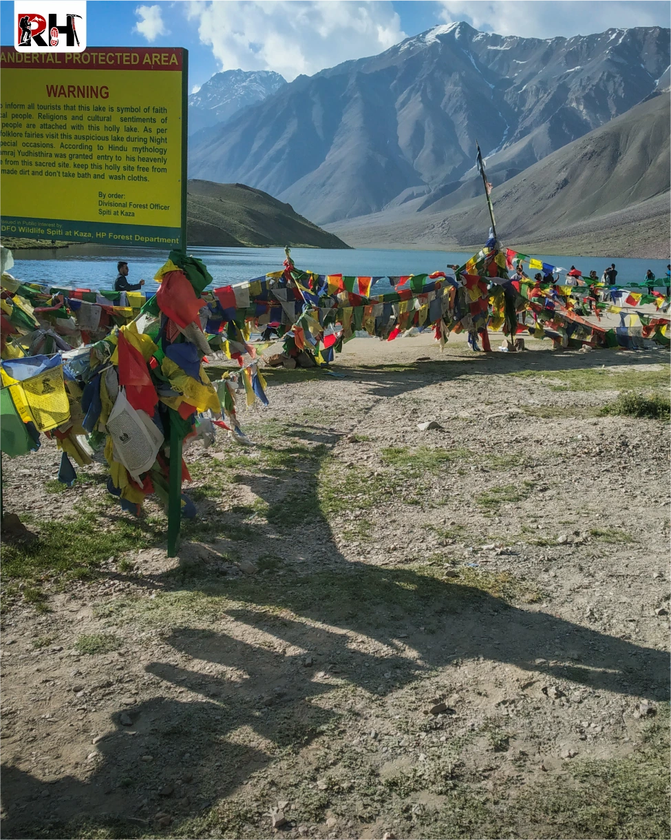
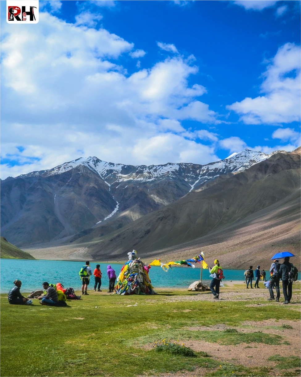
Chandratal Lake sits at 14,100 feet in a wide valley surrounded by peaks. The lake is crescent-shaped, which is why it is called Chandratal, Moon Lake. The water is turquoise, fed by glacial streams, and so clear you can see the bottom near the shore.
Spend an hour beside the lake. Walk around it. Sit by the water. Let the altitude and the beauty and the silence settle into you. Then drive back to Chatru for the night.
The final day is all road. The drive from Chatru to Manali takes 2.5 to 3 hours, either via Rohtang Pass or through the Atal Tunnel, a 9-kilometre tunnel that cuts through the Pir Panjal Range and shaves an hour off the journey.
Arrive in Manali by late morning or early afternoon. Book your onward travel accordingly, with at least a 2-hour buffer for delays. The Hampta Pass Trek is over. But the memory of walking between two worlds in three days stays longer than you expect.
Inclusion & exclusion
A complete overview of all inclusions and exclusions for the Hampta Pass Trek, covering camping accommodation, meals, trek support, permits, safety equipment, Chandratal visit details, and important expenses trekkers should know before planning this Himalayan crossover adventure.
Inclusions
Exclusions
- Bag offloading will be charged at ₹1,600 per bag.
- Maximum weight per bag should not exceed 10 kg.
Best Time to Visit Hampta Pass Trek
The Hampta Pass Trek is accessible from June through September, but the experience changes significantly depending on when you go.
June to Early July: Snow Season
June: Snow Season on Hampta Pass
This is the best time to experience snow on the Hampta Pass Trek.
In June, snow still covers the pass and the upper sections of the trail from Balu Ka Ghera onward. The pass crossing involves walking through snowfields, and the views from the top are dominated by white peaks and glaciers. The lower sections, Jobra to Balu Ka Ghera, are green and alive with early-season wildflowers.
- Daytime temperature at lower camps: 12°C – 18°C
- Daytime temperature at Balu Ka Ghera: 5°C – 12°C
- Night temperature at Balu Ka Ghera: 0°C – 5°C
- Snow coverage: Heavy on pass, moderate at Balu Ka Ghera
- Microspikes: Essential
- Crowds: Moderate
July to August: Green Season and Peak Bloom
July to August: Wildflowers and Green Valleys
This is the best time for wildflowers and lush green meadows. By mid-July, most of the snow has melted except for patches near the pass. The meadows at Chika, Jwara, and the approach to Balu Ka Ghera explode into bloom, with wildflowers covering every slope. The Kullu side is at its greenest, and the contrast with the barren Lahaul side is most dramatic.
July and August are also monsoon months, but the Lahaul side lies in a rain-shadow area and remains dry. The Kullu side gets occasional showers, which makes the landscape even more vibrant.
- Daytime temperature at lower camps: 15°C – 20°C
- Daytime temperature at Balu Ka Ghera: 8°C – 15°C
- Night temperature at Balu Ka Ghera: 3°C – 8°C
- Rainfall: Occasional on Kullu side, rare on Lahaul side
- Crowds: High, this is peak trekking season
September: Clear Skies and Autumn Colors
September: Clear Skies and Autumn Landscapes
This is the best time for mountain views and photography. By September, the monsoon clears. Skies are crisp and blue. Visibility from Hampta Pass is at its best of the entire year. The meadows turn from green to golden-brown, losing the vibrant color of summer but gaining an austere beauty. Nights are colder, frost is common, and the air is thin and dry.
- Daytime temperature at lower camps: 10°C – 15°C
- Daytime temperature at Balu Ka Ghera: 5°C – 10°C
- Night temperature at Balu Ka Ghera: -2°C – 3°C (frost always present)
- Rainfall: Minimal
- Crowds: Moderate to low
October Onward: Trek Closed
The trek closes in October when the first heavy snowfall makes the pass impassable. The route remains closed until late May.
Things to Carry
Pack for two realities: 20°C sunshine at Chika and -2°C frost at Balu Ka Ghera. Both exist within the same 24 hours at 12,000 feet. Keep your pack under 10 kg. Anything heavier compounds fatigue on long trekking days.
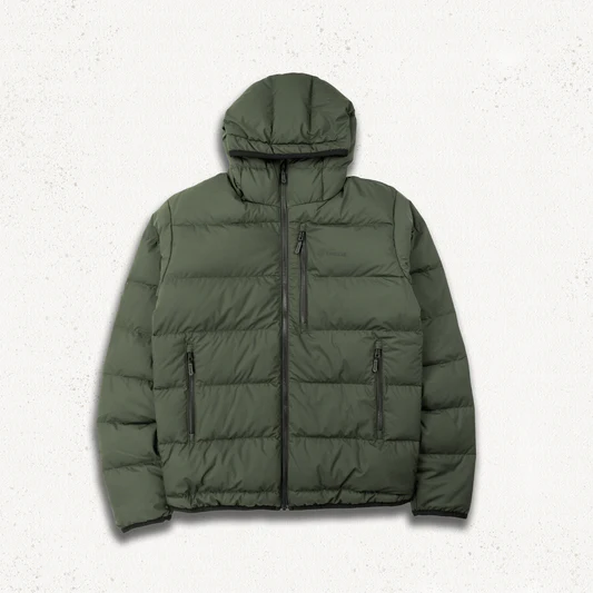
Clothing
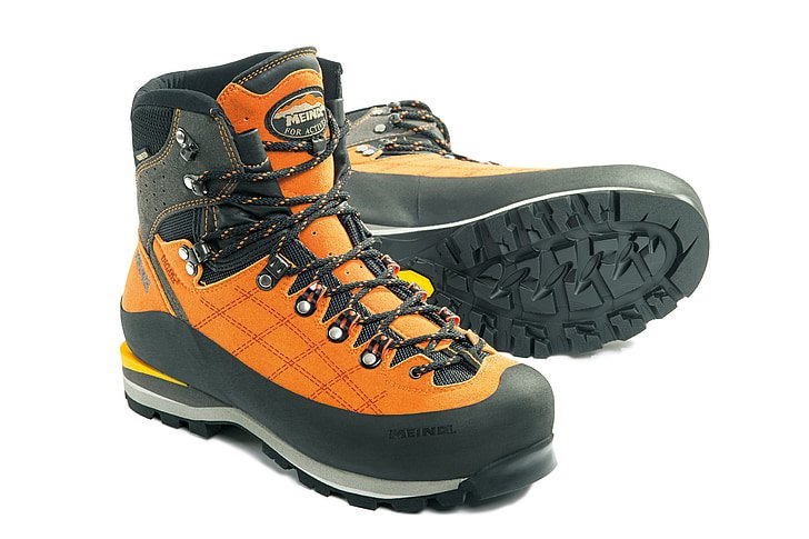
Footwear
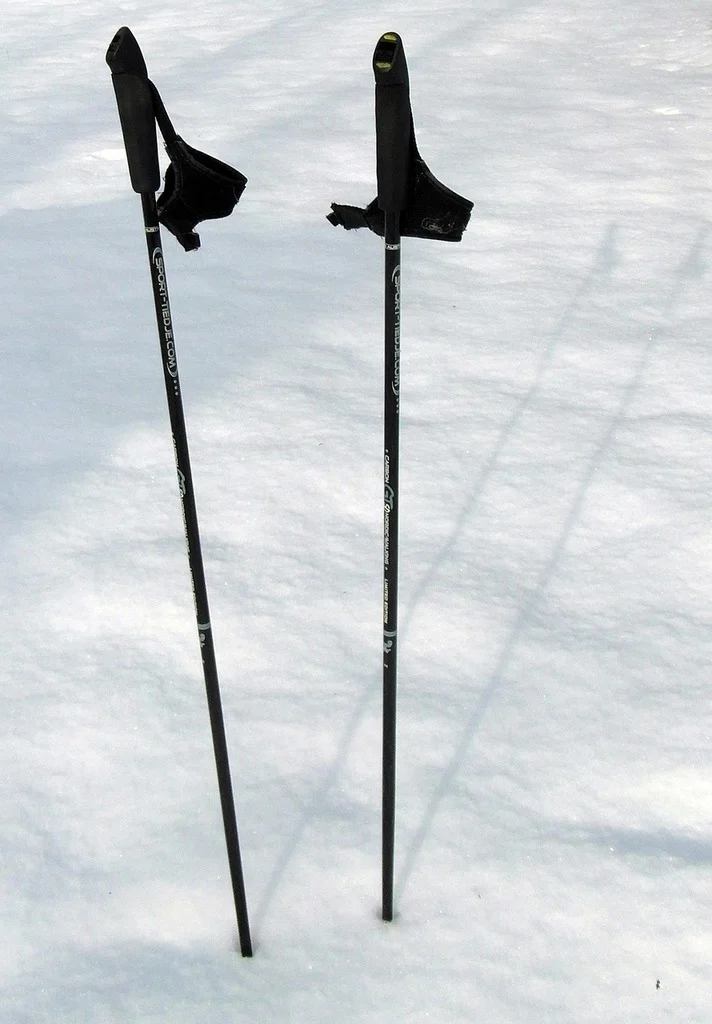
Equipment
Health & Hygiene
Documents & Finance
How to Reach Hampta Pass Trek Base Camp
The Hampta Pass Trek starts from Jobra, a small clearing 18 km from Manali. Manali is the main transit hub.
Reach Manali
- By Air: The nearest airport is Bhuntar Airport (Kullu-Manali Airport), 50 km from Manali. Direct flights connect Bhuntar to Delhi. From the airport, take a taxi or pre-paid cab to Manali (1.5 hours).
- By Road: Overnight Volvo buses connect Manali to Delhi (540 km, 12-14 hours) and Chandigarh (310 km, 8-10 hours). Private taxis are also available.
Manali to Jobra
- Jobra Distance: Jobra is approximately 18 km from Manali via a mountain road with 42 hairpin bends.
- Route: Manali – Prini – Sethan – Jobra
- Drive Time: 1.5 hours
- Vehicle: Shared taxi / private cab / operator-arranged vehicle
- Last ATM: Manali, withdraw enough cash for the full trek
- Last Reliable Network: Manali, assume no connectivity for 5 days beyond this point
Policy
| Policy Point | Details |
|---|---|
| Booking Confirmation | Your seat is considered confirmed only after the required advance payment is received. |
| Balance Payment | The remaining amount must be cleared before departure or as per the reporting instructions shared by the team. |
| Transport Selection | Pickup from Dehradun is applicable only if that option is selected at the time of booking. |
| ID Requirement | Every participant should carry a valid government photo ID for verification and trek administration. |
| Operational Changes | In case of weather, road, or safety concerns, the itinerary may be adjusted for the well-being of the group. |
| Cancellation Window | Charge / Refund |
|---|---|
| More than 30 days before departure | Minimal processing deduction may apply; remaining amount can be refunded or adjusted as per booking terms. |
| 15 to 30 days before departure | Partial cancellation charge applicable; remaining balance may be refunded or transferred to a future batch if approved. |
| 7 to 14 days before departure | Higher cancellation charge applies because transport, permits, and staffing arrangements are usually already blocked. |
| Less than 7 days before departure | Booking is generally non-refundable due to final operational commitments. |
| No show / Trek departure missed | No refund is usually applicable once reporting is missed without prior written coordination. |
Important: Trek departures and route decisions always remain subject to weather, road access, local administration, and safety conditions. Final operational decisions are taken in the interest of the group.
FAQ's
The Hampta Pass trek is graded moderate. The trails are well-defined and do not require technical climbing, but the pass-crossing day (Day 3) is long and physically demanding, with 9 hours of trekking and a 2,600-foot descent. Fit first-time trekkers complete it successfully with proper preparation.
The maximum altitude is 14,100 feet (4,300 meters) at Hampta Pass. Campsites range from 10,100 ft (Chika) to 12,000 ft (Balu Ka Ghera). Base camp at Jobra is at 9,000 ft.
June to early July for snow trekking and dramatic winter landscapes. July to August for green meadows, wildflowers, and lush Kullu Valley. September for clearest skies and best mountain views. Avoid October-May (trek closed).
5 days from Manali to Manali, including travel days and Chandratal visit. The actual trekking happens over 4 days (Days 1-4). Add 1 buffer day for potential weather delays.
Starts at Jobra (18 km from Manali by road). Ends at Chatru, from where you drive to Chandratal Lake and back to Manali. This is a crossover trek, not a loop.
Yes, for fit beginners with proper preparation. If you can jog 5 km in 30-35 minutes and have trained for 4-6 weeks before the trek, you will manage it. This is an ideal first high-altitude crossover trek.
The dramatic crossover from green Kullu Valley to barren Lahaul; Hampta Pass at 14,100 ft with views of Indrasan and Deo Tibba; Chandratal Lake visit; river crossings at Jwara and Shea Goru; camping at Balu Ka Ghera at 12,000 ft; and wildflower meadows in July-August.
Lower camps (Chika): 5°C to 15°C at night. Balu Ka Ghera: 0°C to 5°C at night (frost common). Hampta Pass during the day: 5°C to 10°C. Full layering including down jacket is essential.
Mild acclimatization happens naturally as you ascend from Jobra (9,000 ft) to Chika (10,100 ft) to Balu Ka Ghera (12,000 ft) over two days. Hampta Pass at 14,100 ft is where altitude becomes noticeable. Drink 3-4 litres of water daily. Report any AMS symptoms immediately.
Network works in Manali. Beyond Jobra, assume no network for 5 days. Occasional weak signal may be caught at high points, but do not rely on it. Download offline maps before leaving Manali.
Indian nationals: Forest permits and vehicle permits are included in trek packages. Foreign nationals: Check with local authorities for any special permits required.
Chandratal Lake, also called Moon Lake, is a crescent-shaped alpine lake at 14,100 ft in the Lahaul region. The water is turquoise and reflects the surrounding peaks perfectly. It is visited on Day 4 after descending from Hampta Pass to Chatru.
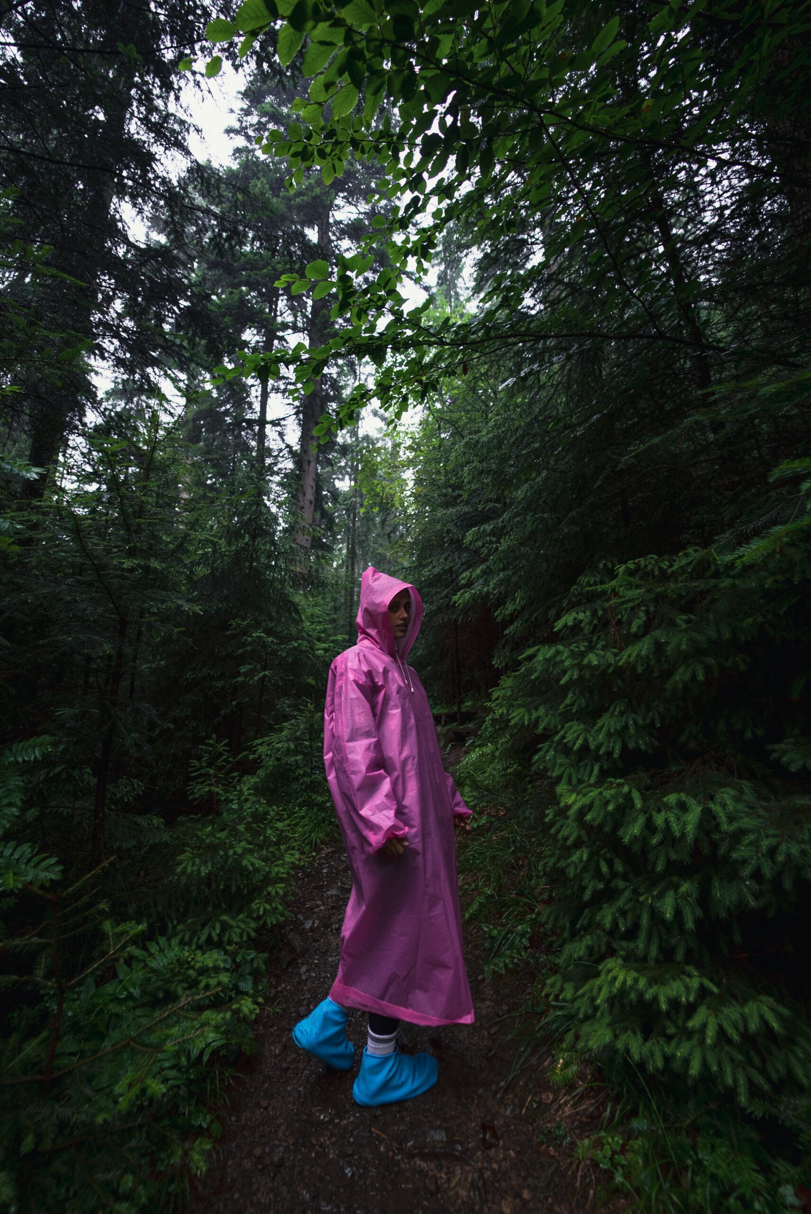
Yes. The trek involves crossing glacier-fed streams at Jwara (Day 2) and Shea Goru (Day 3). The water is icy, waist-deep in places, and ropes are used for support. Waterproof shoes or sandals are recommended for crossings.
Solo trekking is not recommended. The trek involves river crossings, high-altitude terrain, and no emergency services within reach. Organized group treks with experienced leaders and safety equipment are the only responsible way to do this trek.
Hampta Pass is unique because of the dramatic ecosystem shift. Most treks stay within one valley or region. Hampta Pass crosses from the lush, green Kullu Valley into the barren, desert landscape of Lahaul in a single day, offering two completely different worlds on the same trek.
Balu Ka Ghera is a glacial campsite at 12,000 ft in a U-shaped valley carved by ancient glaciers. It sits on a moraine beside the Rani Nalla stream, surrounded by peaks and hanging glaciers. The campsite is remote, cold, and stunningly beautiful, the last green camp before crossing into Lahaul.
Rental gear for this trek