Highlight
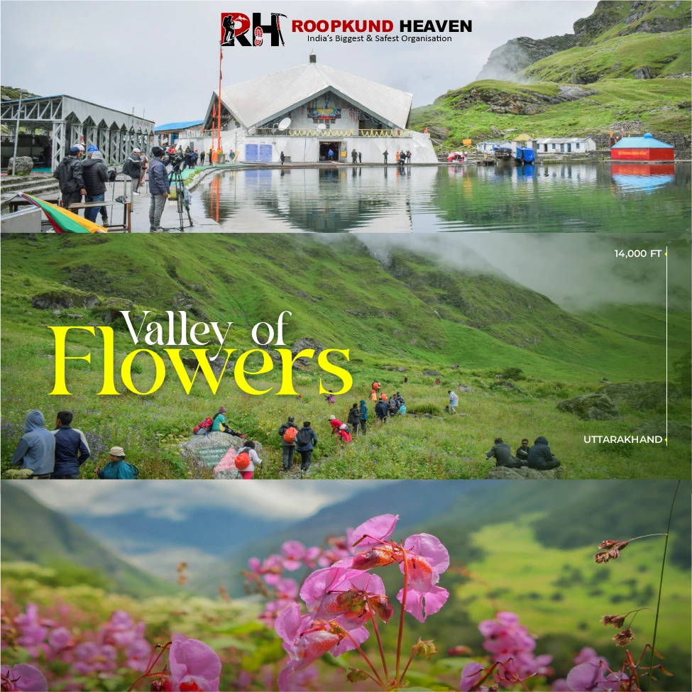
The Valley of Flowers National Park: A 10-km stretch of alpine meadow at 3,600 m with over 500 species of wildflowers blooming between July and August; a UNESCO World Heritage Site and one of the richest floral ecosystems in the Himalayas
Hemkund Sahib Gurudwara: The highest Sikh shrine in the world at 4,329 m, sitting beside a glacial lake surrounded by seven peaks; a place of pilgrimage, peace, and breathtaking altitude
Pushpawati River Trail: The 9-km climb from Pulna to Ghangaria follows the Pushpawati River through dense forest, waterfalls, and suspension bridges; one of the most scenic approach trails in Uttarakhand
Brahma Kamal and Blue Poppy: Two of the rarest and most iconic Himalayan flowers, found in abundance inside the valley and near Hemkund Lake during peak bloom season
Hemkund Lake (Lokpal Lake): A serene high-altitude glacial lake reflecting the peaks around it; a place pilgrims take ritual dips in water cold enough to stop your breath
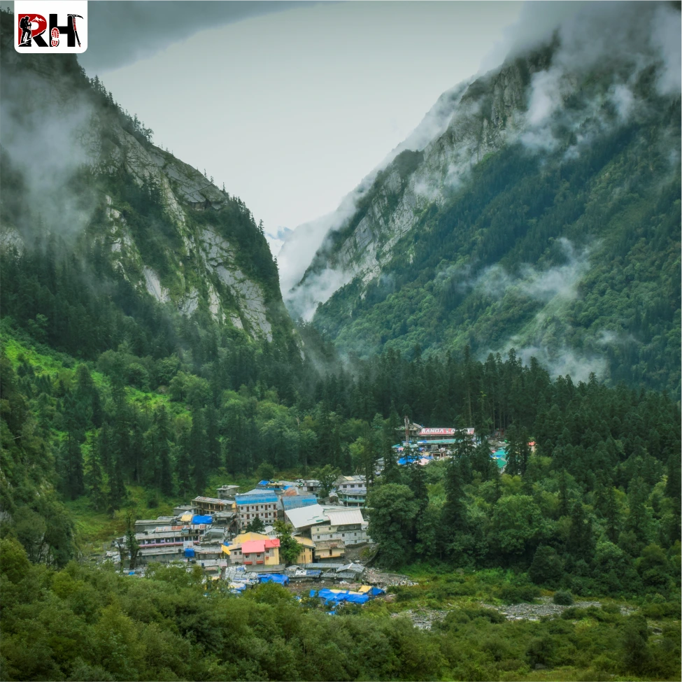
Ghangaria Village: The last inhabited settlement on the route and base camp for both Valley of Flowers and Hemkund Sahib; a quiet mountain village that becomes a bustling hub every monsoon season
Nanda Devi Biosphere Reserve: The valley lies within this protected reserve, home to endangered species like the Asiatic black bear, snow leopard, blue sheep, and Himalayan monal.
Valley of Flowers Trek
The Valley of Flowers Trek is one of the most beautiful monsoon experiences in the Indian Himalayas, where misty mountain trails, waterfalls, rare alpine flowers, and lush green valleys come together in a landscape that feels almost unreal. Hidden deep inside Uttarakhand’s Nanda Devi Biosphere Reserve, this UNESCO World Heritage Site transforms into a colourful Himalayan paradise during the monsoon months.
Most Himalayan treks exist because someone decided to go there. The Valley of Flowers exists because someone got lost trying to go somewhere else. A lost-and found game that opened the door to one of India’s oldest and most beautiful monsoon treks – the Valley of Flowers.
Why Trekkers Love It
Today, with Roopkund Heaven, we are walking through drizzled trails hand-in-hand to witness waterfalls, 300+ blooming flowers, misty mountains, and most importantly, the state flower of Uttarakhand (we will talk about that later; a little suspense is good, right?). So, let’s get started!
In 1931, British mountaineer Frank Smythe and his team were descending from an expedition to Mt. Kamet when they took a wrong turn into a valley they did not know existed.
What they found stopped them completely. An entire valley floor, 10 kilometres long, carpeted in wildflowers of colours they could not name. Blues, purples, yellows, reds, stretching in every direction under the shadow of snow peaks that had no idea this world existed beneath them.
Smythe called it the Valley of Flowers. The name stuck. And 95 years later, people still walk into that same valley during the monsoon months and stop exactly the way Smythe did, because some things refuse to change no matter how many decades pass.
The Valley of Flowers Trek is a 6-day, 42-km monsoon trek in Uttarakhand’s Chamoli district. It takes you through one of the most biodiverse alpine ecosystems in the Indian Himalayas. It starts at Rishikesh, moves through Joshimath and Govindghat, and bases itself out of Ghangaria village at 3,050 metres before opening into the valley itself at 3,600 metres.
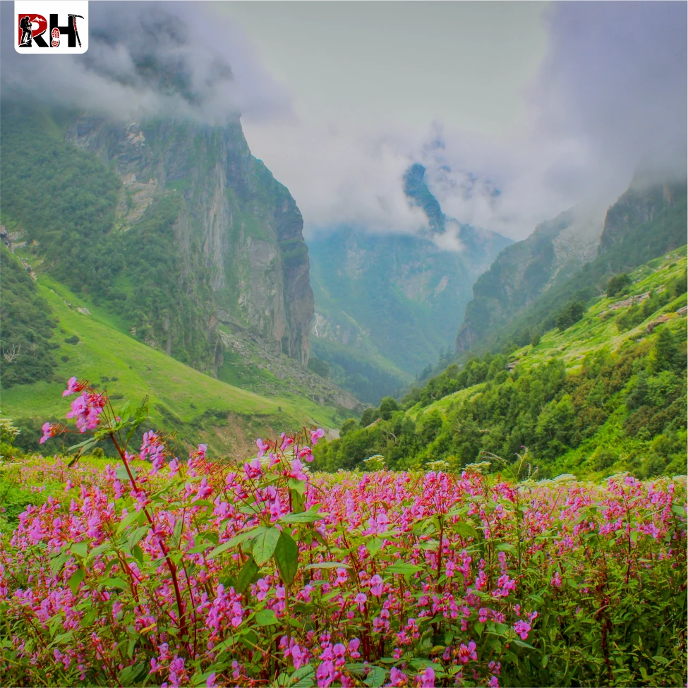
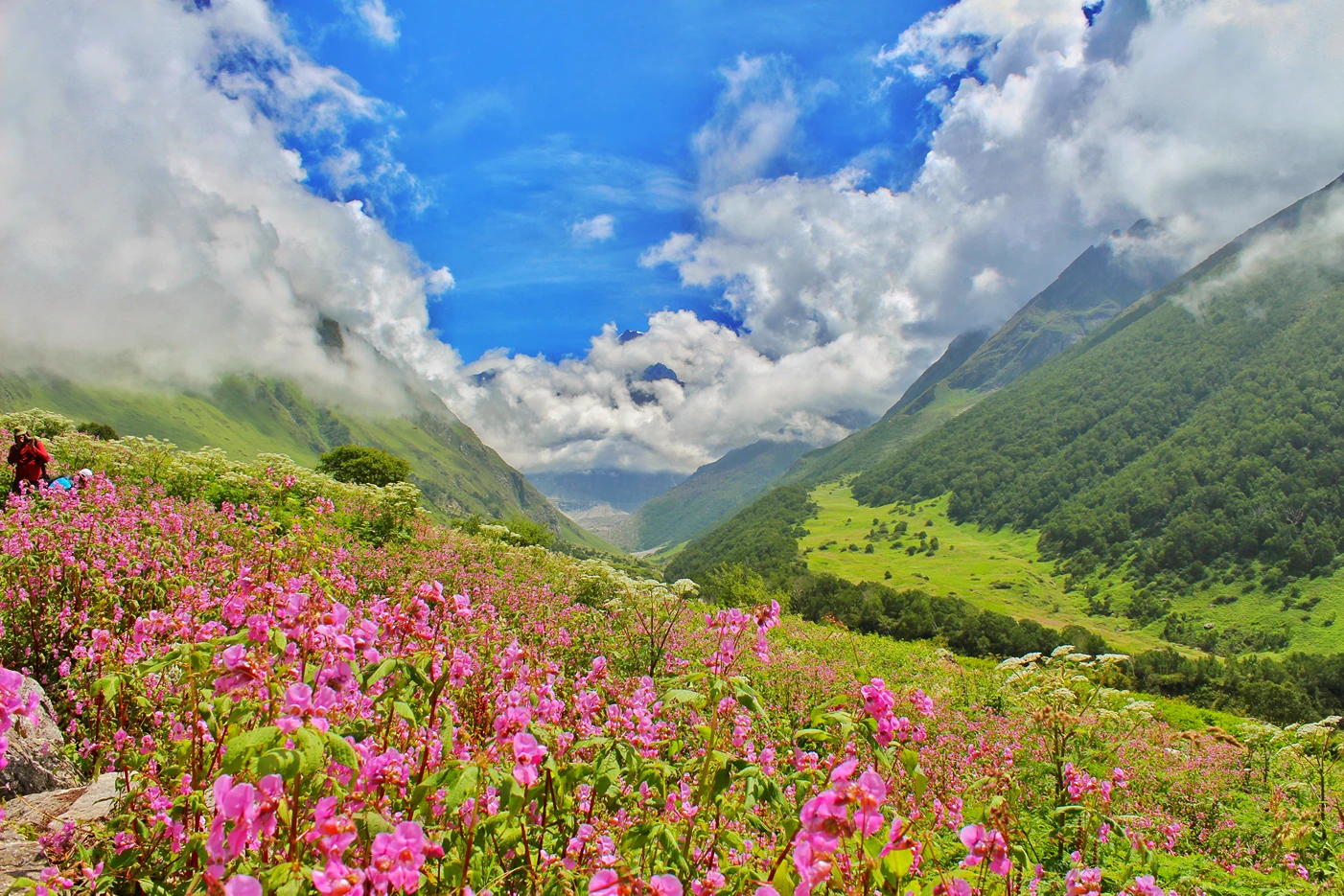
The route is unusual for a Himalayan trek because it does not climb toward a pass or a peak. It climbs toward a meadow. A 10-kilometre stretch of rolling grassland between 3,600 and 3,900 metres where over 500 species of alpine flowers bloom every year between late July and mid-August, turning the ground into something that does not look like it belongs on Earth.
This is not an exaggeration. The Valley of Flowers was declared a UNESCO World Heritage Site in 2005 specifically because of its floral density and the rarity of the species that grow here. Brahma Kamal, Blue Himalayan Poppy, Cobra Lily, Himalayan Bellflower, Potentilla, Anemone, Primula and a hundred more. Some of these flowers exist nowhere else in the world outside this valley and a handful of similar meadows scattered across the Greater Himalayas.
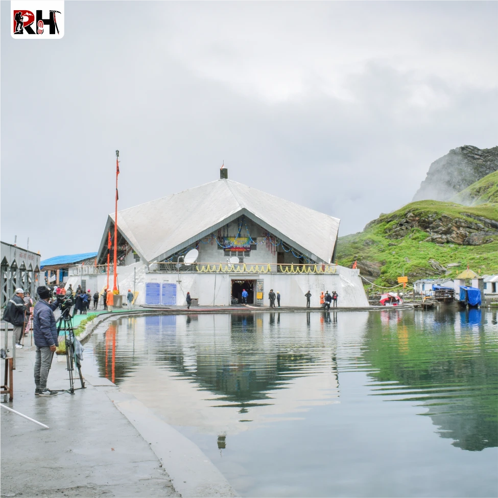
And because this is also India, the trek does not stop at flowers. Midway through, you climb to Hemkund Sahib, a Sikh pilgrimage site at 4,329 metres, sitting beside a glacial lake surrounded by seven snow peaks. The highest gurudwara in the world. A place so quiet that even in peak season, when hundreds of pilgrims arrive daily, the silence around the lake never really breaks.
Day 1 is the long drive from Rishikesh to Joshimath through the Alaknanda Valley. Nine hours through mountain towns, river confluences, terraced fields, and roadside dhabas that serve the best parathas you will eat on this trip.
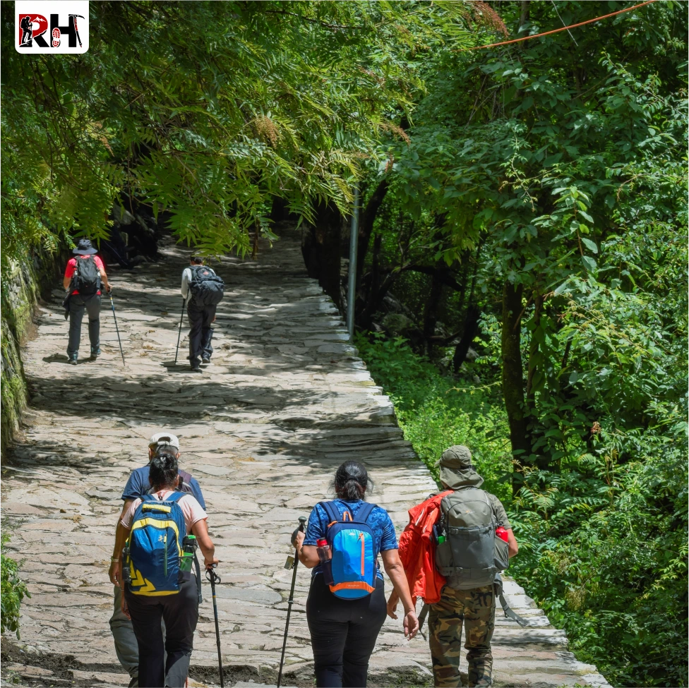
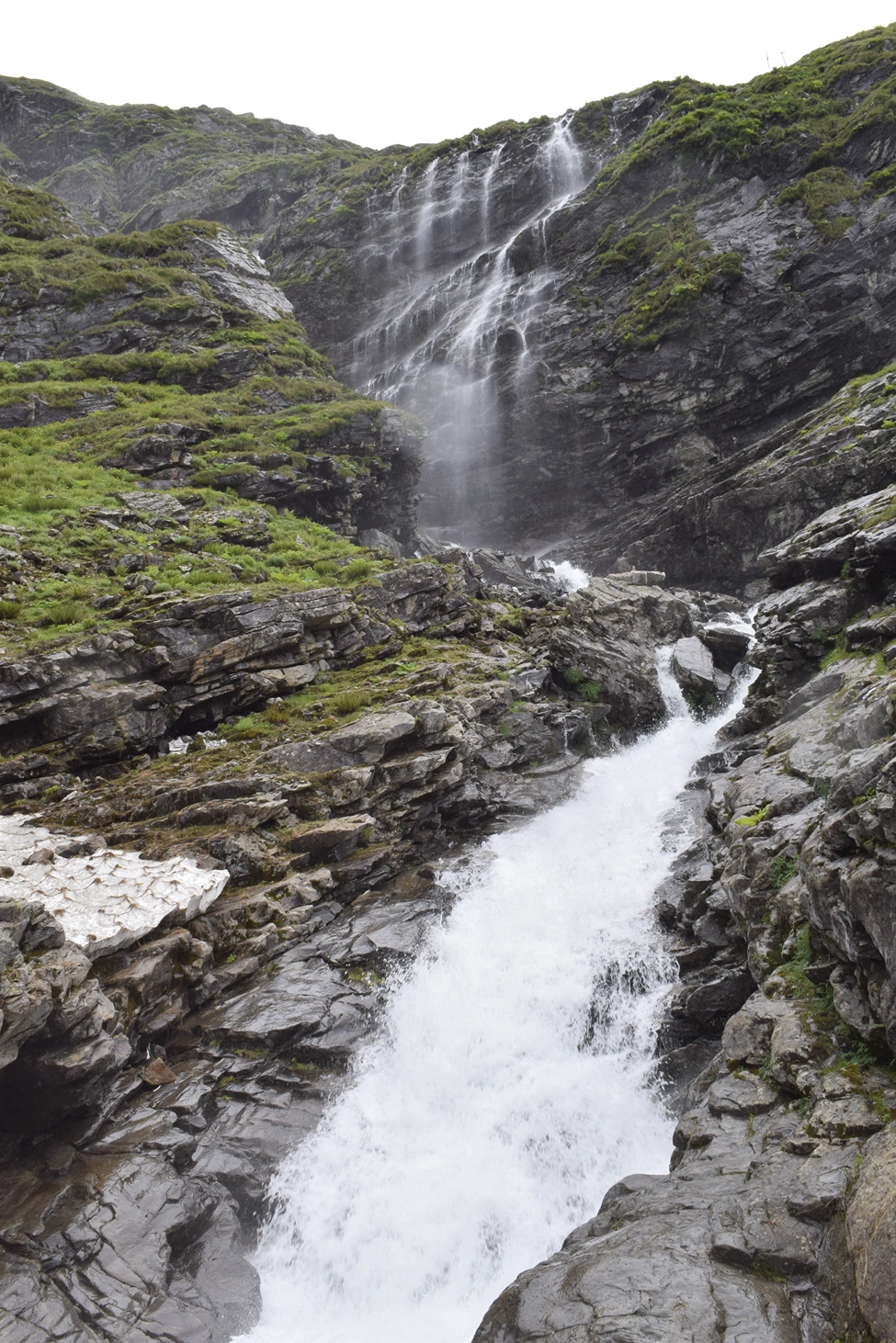
Day 2 brings you to Govindghat, then Pulna, and from there the trek begins, 9 kilometres uphill alongside the roaring Pushpawati River to Ghangaria village. Stone-paved paths, suspension bridges, waterfalls cutting across the trail, and forests so dense the sunlight arrives in shafts.
Day 3 is the Valley of Flowers itself. Four kilometres from Ghangaria to the forest checkpoint, then the valley opens. And when it does, you understand why Smythe wrote an entire book about getting lost.
Day 4 takes you to Hemkund Sahib, 6 kilometres of steep climbing to 4,329 metres, and then back down the same day. The hardest day of the trek, and for many, the most meaningful.
Day 5 is the descent back to Pulna and the drive to Joshimath. Day 6 is the return to Rishikesh.
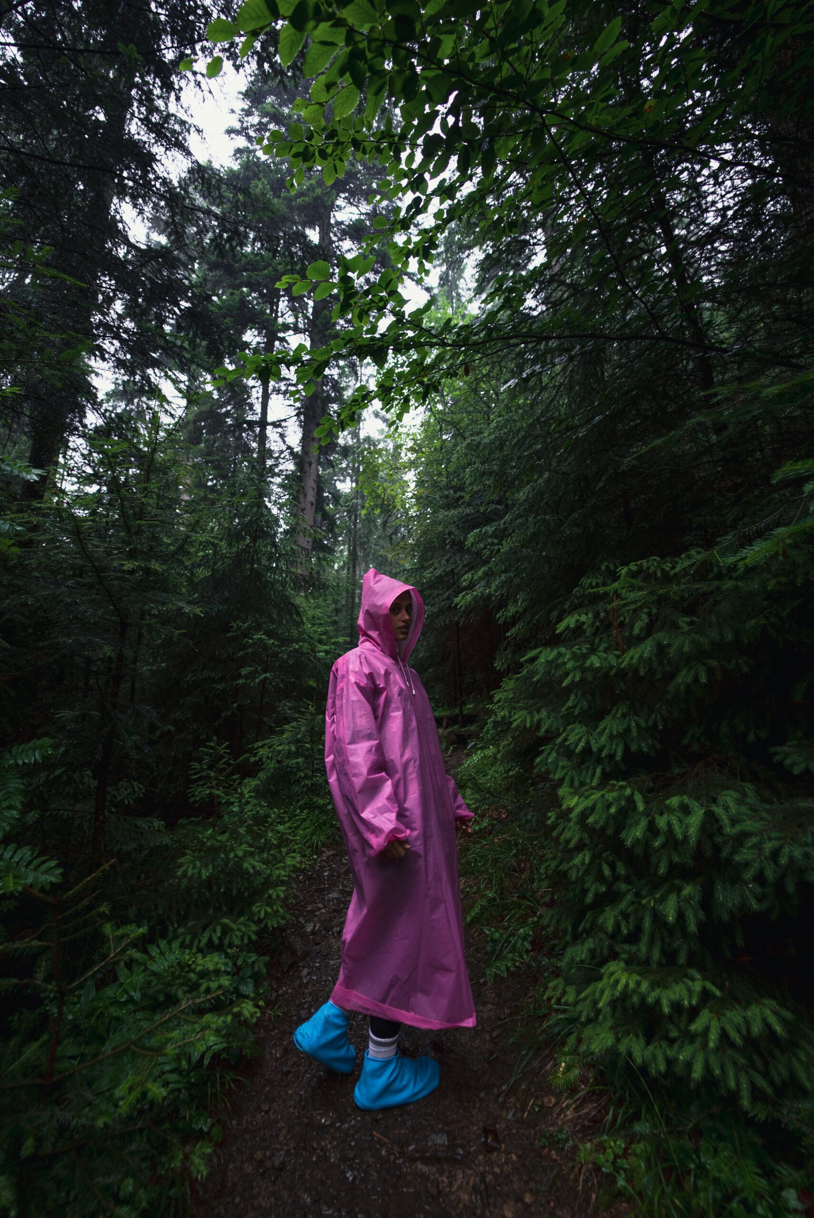
The trek is graded easy to moderate. You do not need any prior trekking experience. There are no technical sections, no scrambles, no glacier crossings. The trails are well-defined and have been walked by pilgrims for decades. But you do need to be comfortable walking 6 to 7 hours a day on uneven, sometimes slippery stone paths. You need to be okay with rain, because this is a monsoon trek and it will rain. And you need to understand that altitude at 4,300 metres is real whether the trail is easy or not.
The right person for this trek is someone who wants to see something genuinely rare without having to be a mountaineer to reach it. Someone who is fit enough to walk all day but does not need a Kedarkantha or a Hampta Pass under their belt first. This is a beginner-friendly Himalayan trek in the truest sense, which does not mean it is easy, it means it is
Accessible.
The total distance is 42 kilometres over 6 days. Daily trekking distances range from 4 km on shorter exploration days to 12 km on summit-and-return days. The cumulative altitude gain is significant but gradual, which is exactly why first-time trekkers manage it well with proper preparation.
If there is a single trek in India that delivers maximum visual reward for moderate physical effort, it is this one. And if you are ready to walk through a landscape that does not look like it should exist, there is no reason to wait.
Day wise plan
A complete day-wise itinerary of the Valley of Flowers Trek covering scenic drives, forest trails, blooming alpine valleys, Hemkund Sahib, trekking distances, altitude details, and the full monsoon Himalayan experience from Rishikesh to Ghangaria and beyond.
The Valley of Flowers Trek does not begin with a trail. It begins with a drive. A long, winding, nine-hour drive from Rishikesh to Govindghat through the Alaknanda Valley, and if you think that sounds exhausting, you are right. But you are also wrong, because this drive is one of the best parts of the entire trek.
Leave Rishikesh by 6 AM. The road follows the Alaknanda River upstream through a valley that grows narrower and steeper with every kilometre. Devprayag arrives first, where the Alaknanda and Bhagirathi rivers meet to form the Ganga. Then Rudraprayag, where the Alaknanda meets the Mandakini. Then Karnaprayag, where it meets the Pindar. And finally Nandprayag, where the Nandakini joins. Four of the five Panch Prayags in a single day.
Between the confluences, the valley opens and closes. Terraced fields cling to hillsides that should not be farmable. Small towns appear and disappear. Dhabas with names you will not remember serve chai and parathas you will not forget. The Alaknanda, green and cold and fast, never leaves your window.
Govindghat arrives by late afternoon. A hill town at 1,875 metres, perched on a ridge with views of the Nanda Devi massif on clear days. This is your base for the night. Settle into your hotel, eat a warm meal, hydrate properly, and sleep early. Tomorrow the trekking begins.
Tip: Withdraw cash in Joshimath. ATMs beyond this point are unreliable. Mobile network becomes patchy after Govindghat and disappears entirely after Ghangaria.
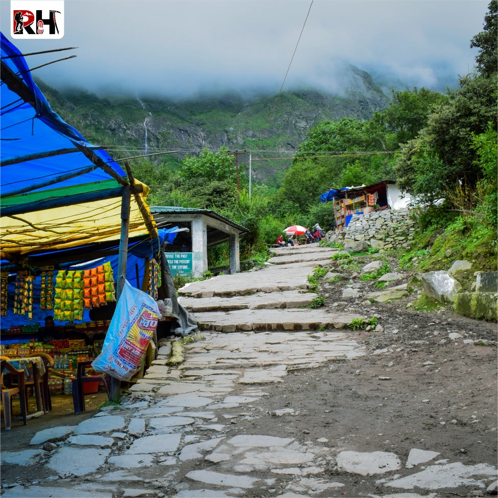
Govindghat sits at the base of the valley at 1,870 metres, a busy pilgrimage town that serves as the jumping-off point for both the Valley of Flowers and Hemkund Sahib. From here, a short 4-km jeep ride brings you to Pulna village, the official trek starting point.
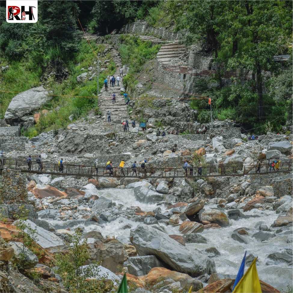
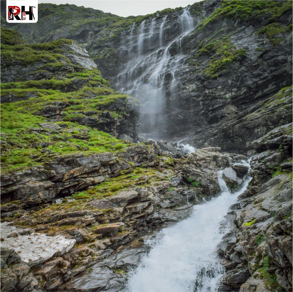
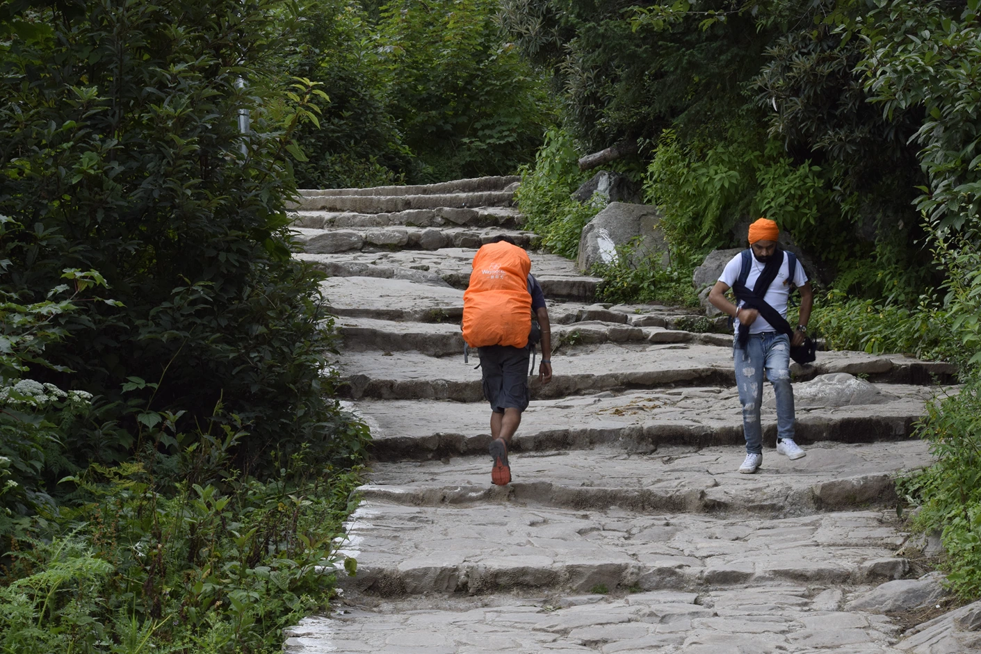
The trail out of Pulna climbs immediately. Stone-paved paths, steep in sections, winding upward through dense forest. The Pushpawati River roars somewhere below and to your right, loud enough that you hear it before you see it. The forest is thick, walnut and oak and rhododendron, with light coming through in broken patches.
Within the first hour, you cross the first suspension bridge. The river beneath it is glacial-fed, fast, and loud. The bridge sways slightly when groups cross together. Hold the railings. Keep moving.
The trail continues upward, sometimes steeply, sometimes gently, always upward. Small tea stalls appear every kilometre or so, selling chai, Maggi, biscuits, and bottled water. Use them. Refill your bottles. Eat something. These stalls are your only resupply points until Ghangaria.
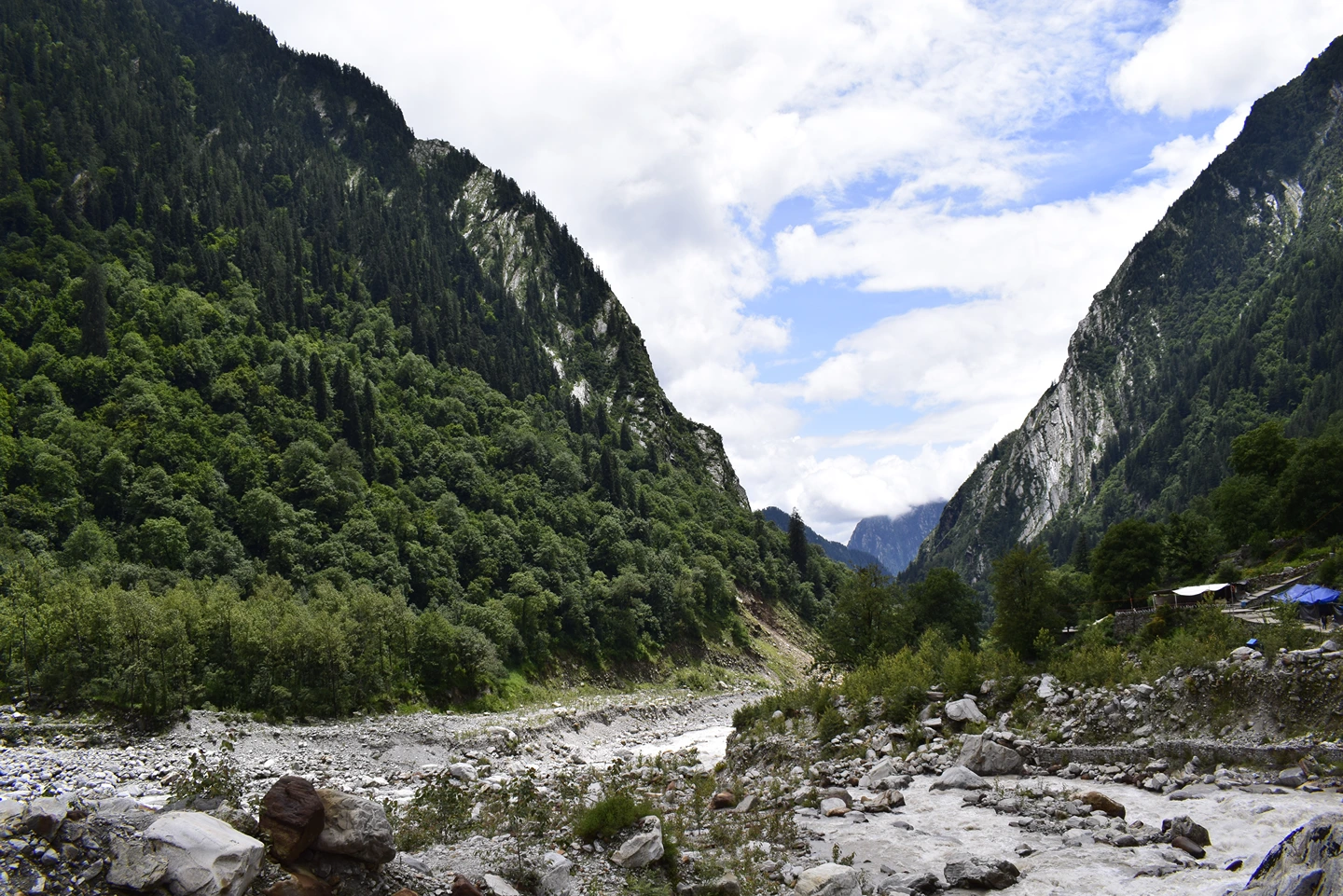
After about 5 kilometres, the forest begins to thin. Views of the valley open up on the left. Hathi Parvat (Elephant Mountain) appears ahead, a massive ridgeline that looks exactly like its name. The gradient eases slightly, but not much.
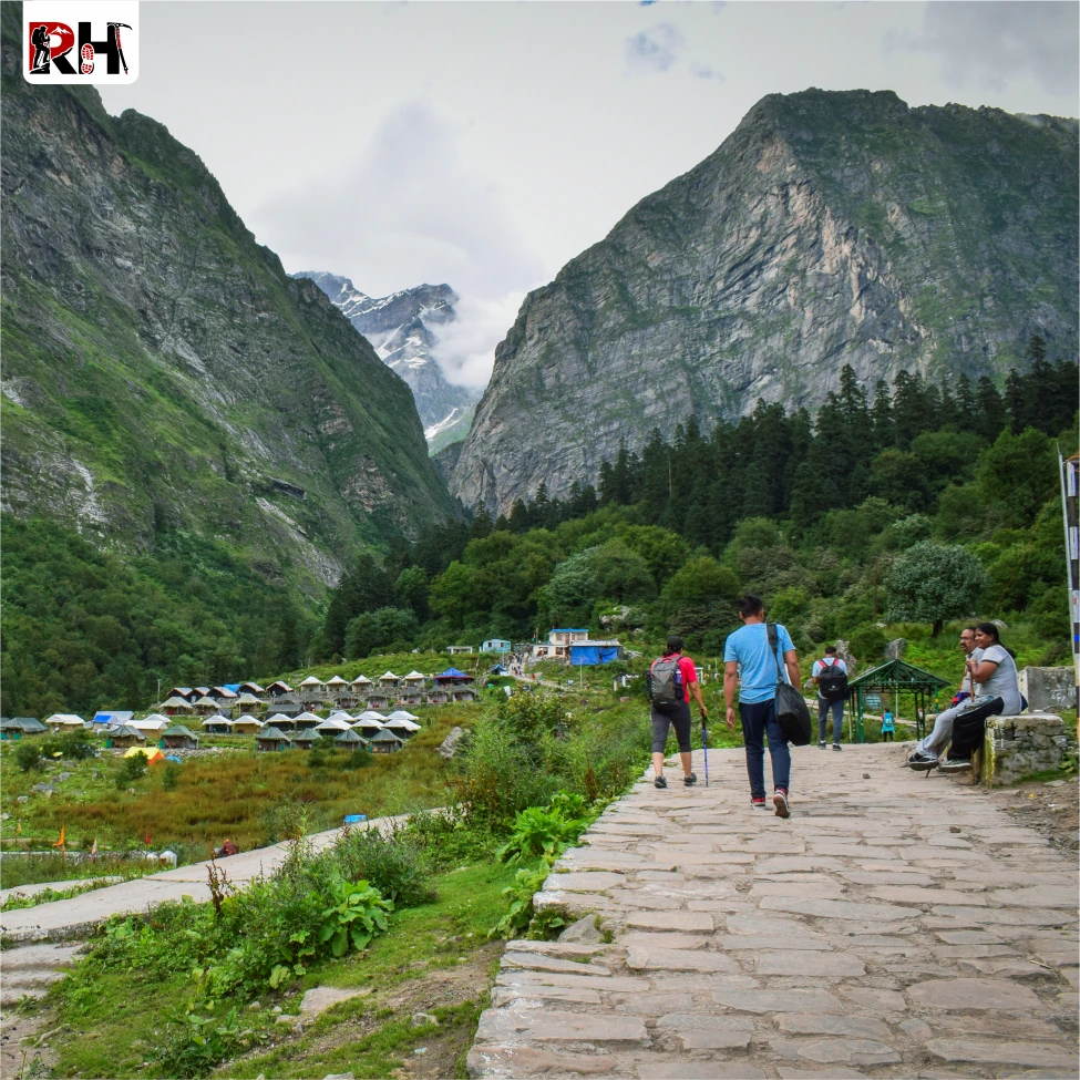
Ghangaria village arrives after 5 to 6 hours of trekking. A small mountain settlement at 3,050 metres, built on a sloping meadow with guesthouses, lodges, dhabas, and a Gurudwara. This is the last inhabited place on the route. Everything beyond this is national park. Ghangaria will be your home for the next three nights. Check into your lodge, eat, rest, and prepare for tomorrow. The valley is 4 kilometres away.
This is the day you came for. The Valley of Flowers National Park opens at 7 AM and closes at 5 PM. You need to be back before closing time, which means an early start gives you maximum time inside.
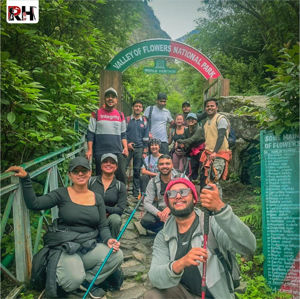
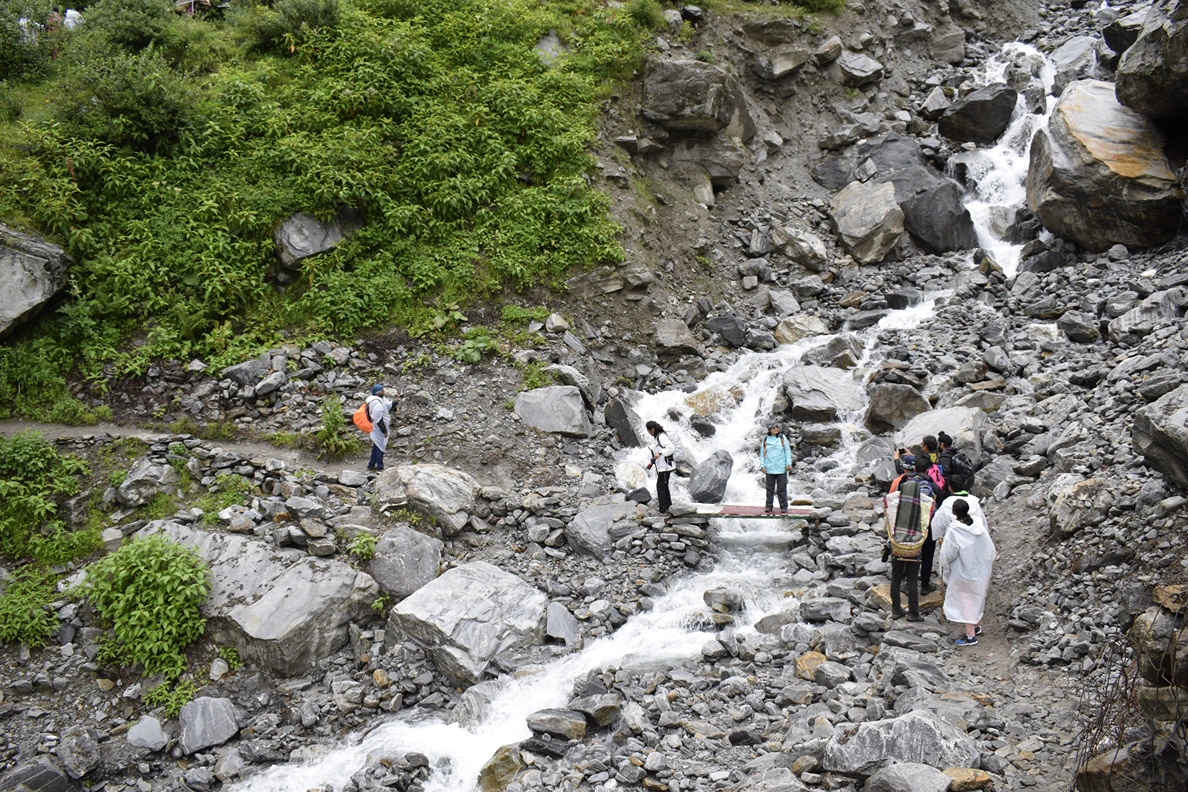
The trail out of Ghangaria is gentle for the first 10 minutes, following a stream through open meadow. Then it enters forest again, dense and quiet, with moss-covered rocks and waterfalls cutting across the path. After about 30 minutes, you reach the forest checkpoint. Entry permits are issued here. Carry your ID. Pay the fee. Continue.
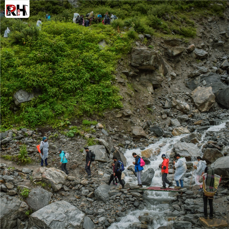
Just beyond the checkpoint, the trail crosses a wooden bridge over the Pushpawati River. The sound of water is everywhere now, not just the river but dozens of small streams feeding into it from the slopes above. The trail climbs steadily through boulder sections and forested stretches for another 3 kilometres.
And then it opens. The Valley of Flowers does not ease you in. One moment you are walking through forest. The next moment you step out onto a rolling meadow that stretches 10 kilometres ahead of you, with flowers covering every square metre of ground that is not rock or stream.
This is not a metaphor. This is what actually happens. In late July and early August, when the monsoon rains have been falling for three weeks and the snowmelt has fed every stream, the valley explodes into bloom. Geraniums, primulas, potentillas, Himalayan bellflowers, cobra lilies, blue poppies, brahma kamals, epilobium covering the riverbanks in pink. Colours you cannot name. Flowers you have never seen. All of it under a sky that shifts between blue and grey and mist every 20 minutes.
The trail inside the valley is marked but minimal. You are free to explore, but stay on the main path to avoid damaging the ecosystem. Walk slowly. Stop often. Look closely. Some of the rarest flowers in the world are growing within arm’s reach of where you are standing.
The valley stretches for 10 kilometres, ending at a glacial moraine with views of Rataban and Gauri Parvat. Most trekkers walk 5 to 6 kilometres in and turn back. The deeper you go, the fewer people you see, and the quieter it becomes.
You cannot camp inside the valley. You cannot cook. You cannot eat. These are strict forest department rules designed to protect the fragile ecosystem. Carry water and snacks, but carry all waste back out.
By mid-afternoon, start your return. The descent to Ghangaria takes 2 to 3 hours. Arrive before dark. Eat well. Tomorrow is harder.
If Day 3 was about flowers, Day 4 is about altitude. The trek to Hemkund Sahib is 6 kilometres one way and climbs nearly 1,300 metres from Ghangaria to the lake at 4,329 metres. It is steep. It is relentless. And for many first-time trekkers, it is the hardest single day they have ever walked.
Start early again, ideally by 6 AM. The trail begins on the same path you took to the Valley of Flowers, but after 10 minutes it splits right and climbs into forest. The gradient is punishing from the start. Stone steps, steep switchbacks, altitude gain that you feel in your lungs within the first kilometre.
The forest thins after 2 kilometres. Alpine meadows open up, and the views begin, Ghangaria and the Valley of Flowers spread out below, ridgelines stacked in every direction. But the climb does not ease. The trail continues upward, stone-paved in sections, rocky in others, with patches of snow appearing near the top even in mid-August.
After 3 hours of continuous climbing, the lake appears. Hemkund Lake, also called Lokpal Lake, sits in a glacial cirque surrounded by seven peaks. The Hemkund Sahib Gurudwara, with its distinctive star-shaped architecture, sits on the lakeshore at 4,329 metres. The highest Sikh shrine in the world.
The atmosphere here is different. Pilgrims arrive daily, hundreds of them, to take ritual dips in the freezing lake water and offer prayers inside the Gurudwara. Kirtan plays continuously from loudspeakers. Langar is served, hot chai and khichdi that tastes better at this altitude than anything else you will eat all week.
There is also a small temple dedicated to Lakshmana, Lord Rama’s brother, built beside the lake. Hindu pilgrims visit this alongside the Gurudwara, making Hemkund Sahib a rare confluence of faiths.
Spend time here. Walk around the lake. Sit by the water. Let the altitude settle. But do not stay too long, you need to descend the same day.The descent is brutal on tired knees. Six kilometres downhill on the same steep stone path you climbed in the morning. Use your trekking poles. Plant your heels. Take it slowly. Most injuries on this trek happen on this descent. Ghangaria arrives by late afternoon. Rest. Hydrate. Eat. Tomorrow you leave.
The morning descent from Ghangaria to Pulna retraces the trail from Day 2, but downhill now, which makes it faster but not easier. Tired legs and wet stone paths demand concentration. The monsoon does not stop just because you are leaving.
The trail drops through forest, across suspension bridges, past the tea stalls you stopped at two days ago. The Pushpawati River, which you climbed beside on the way up, now roars below you as you descend. After 4 to 5 hours, Pulna village appears.
From Pulna, a jeep brings you back to Govindghat. Check into your hotel, shower properly for the first time in three days, and eat a meal that does not come from a dhaba. Tomorrow is the long drive back to Rishikesh.
The final day is all road. The same route you took on Day 1, but in reverse now, winding back down the Alaknanda Valley through Karnaprayag, Rudraprayag, Devprayag, and into Rishikesh by late evening.
Arrive in Rishikesh between 6 PM and 8 PM, depending on traffic and road conditions. Book your onward travel from Rishikesh accordingly, with at least a 2-hour buffer for delays.
The Valley of Flowers Trek is over. But the memory of standing in a meadow full of flowers under snowpeaks in the monsoon rain stays longer than you expect.
Inclusion & exclusion
A detailed overview of all inclusions and exclusions for the Valley of Flowers Trek, covering stays, meals, permits, transportation, trek support, essential services, and important expenses trekkers should know before planning their journey.
Inclusions
Exclusions
- Bag offloading will be charged at ₹1,600 per bag.
- Maximum weight per bag should not exceed 10 kg.
Best Time to Visit Valley of Flowers Trek
The Valley of Flowers is not open year-round. It opens on June 1st every year and closes in early October when the first snowfall makes the trails impassable. But within that window, timing matters more on this trek than almost any other in India. The reason is simple: flowers bloom in phases. The valley contains over 500 species of alpine flora. Not all of them bloom at the same time. Some appear in early July. Some peak in August. Some fade by September. Visit at the wrong time and you will see a beautiful green meadow with a few scattered blooms. Visit at the right time and you will see what Frank Smythe saw in 1931.
July to Mid-August: Peak Bloom Season
This is the only time to visit if you want to see the Valley of Flowers at full bloom. The monsoon arrives in early July. Within two weeks, the valley transforms.
By mid-July, the first wave of flowers appears, blue poppies, geraniums, primulas, golden lilies. By late July and early August, the entire valley is in bloom. Balsams, potentillas, brahma kamals, Himalayan bellflowers, epilobium turning the riverbanks pink. Every colour you can name and several you cannot.
The best single window is July 20 to August 15. These are the 25 days when the highest number of species are blooming simultaneously. If you can only visit once, visit during this window.
- Daytime temperature: 10°C – 15°C
- Night temperature: 5°C – 8°C
- Rainfall: Frequent. Expect rain almost every day, sometimes heavy, sometimes a drizzle. Trails can be slippery. Leeches are common in forested sections.
- Crowds: High. This is peak season. Expect 200+ trekkers on busy weekends. Weekdays are quieter.
Early to Mid-July: Fewer Crowds, Good Bloom
If you want to avoid crowds and still see a good number of flowers, visit between July 1 and July 20.
The bloom is not at its absolute peak yet, but it is building. The valley is lush, green, and alive with early bloomers. Blue poppies and geraniums dominate the landscape. Rainfall is lighter in early July than in August, which makes trekking conditions slightly easier.
- Daytime temperature: 12°C – 18°C
- Night temperature: 6°C – 10°C
- Rainfall: Moderate. Less frequent than late July/August.
- Crowds: Low to moderate. Significantly fewer trekkers than peak season.
Late August to September: Autumn Colours, Fewer Flowers
By late August, the monsoon begins to retreat. Rainfall decreases, skies clear, and mountain views improve. But the flowers start to fade.
September brings autumn colours to the valley, yellows and browns replacing the greens. Some late-blooming species like brahma kamal and epilobium are still visible, but the diversity is much lower. The landscape is still beautiful, just different.
If you are not primarily interested in flowers and want clearer skies and better visibility of the surrounding peaks, September works. But this is not when the valley earns its name.
- Daytime temperature: 10°C – 15°C
- Night temperature: 3°C – 7°C
- Rainfall: Light and infrequent.
- Crowds: Low.
June: Early Season, Snow and Greenery
The valley opens on June 1st, but this is not flower season yet. June is transition time. Snow patches remain on higher trails. Streams are swollen with snowmelt. The valley is green but not blooming.
If you want to see the valley without crowds and do not mind missing the flowers, June works. But most people regret visiting in June once they see photos from July and August.
- Daytime temperature: 10°C – 18°C
- Night temperature: 5°C – 10°C
- Rainfall: Light. Monsoon has not arrived yet.
- Crowds: Very low.
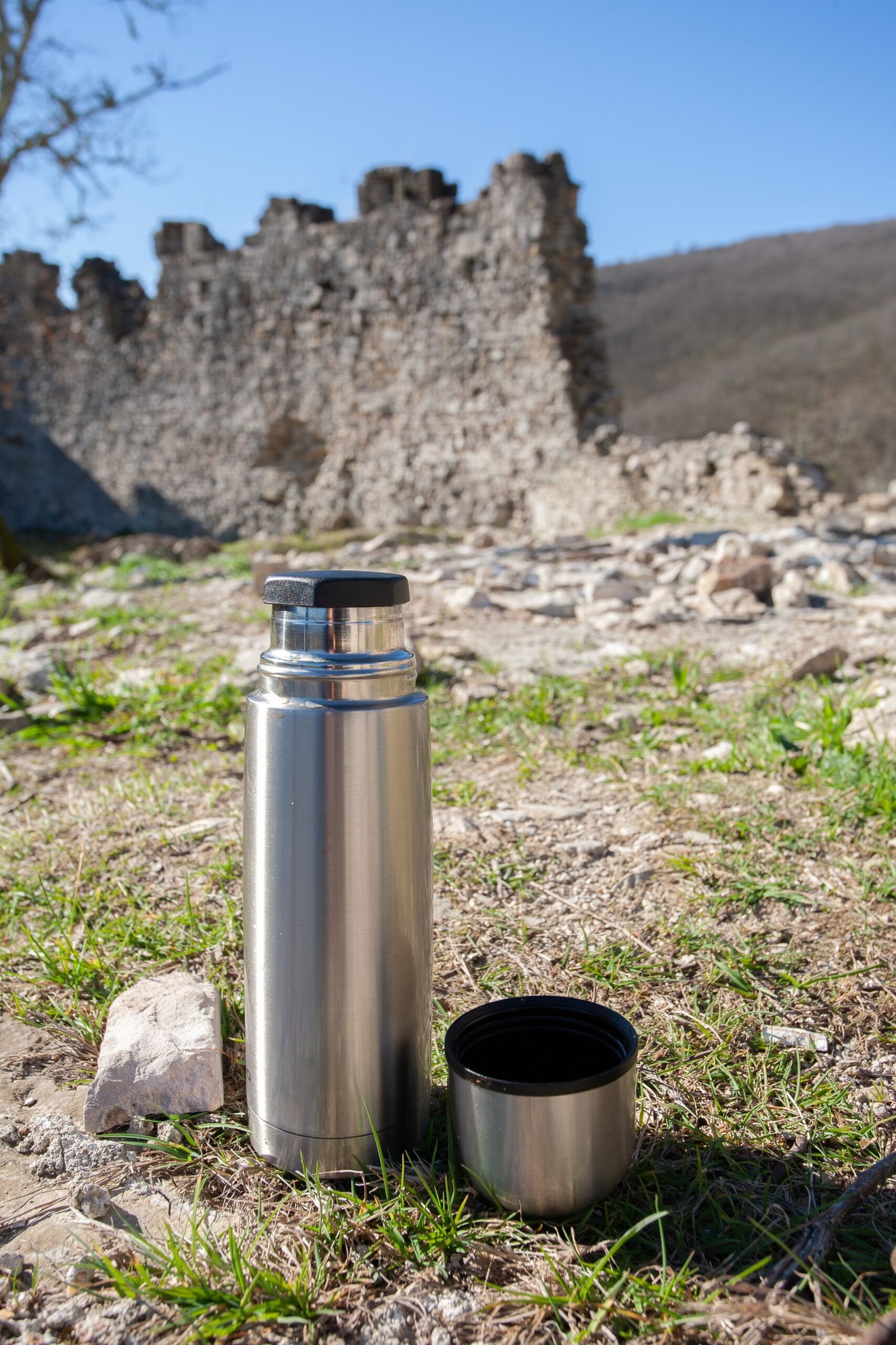
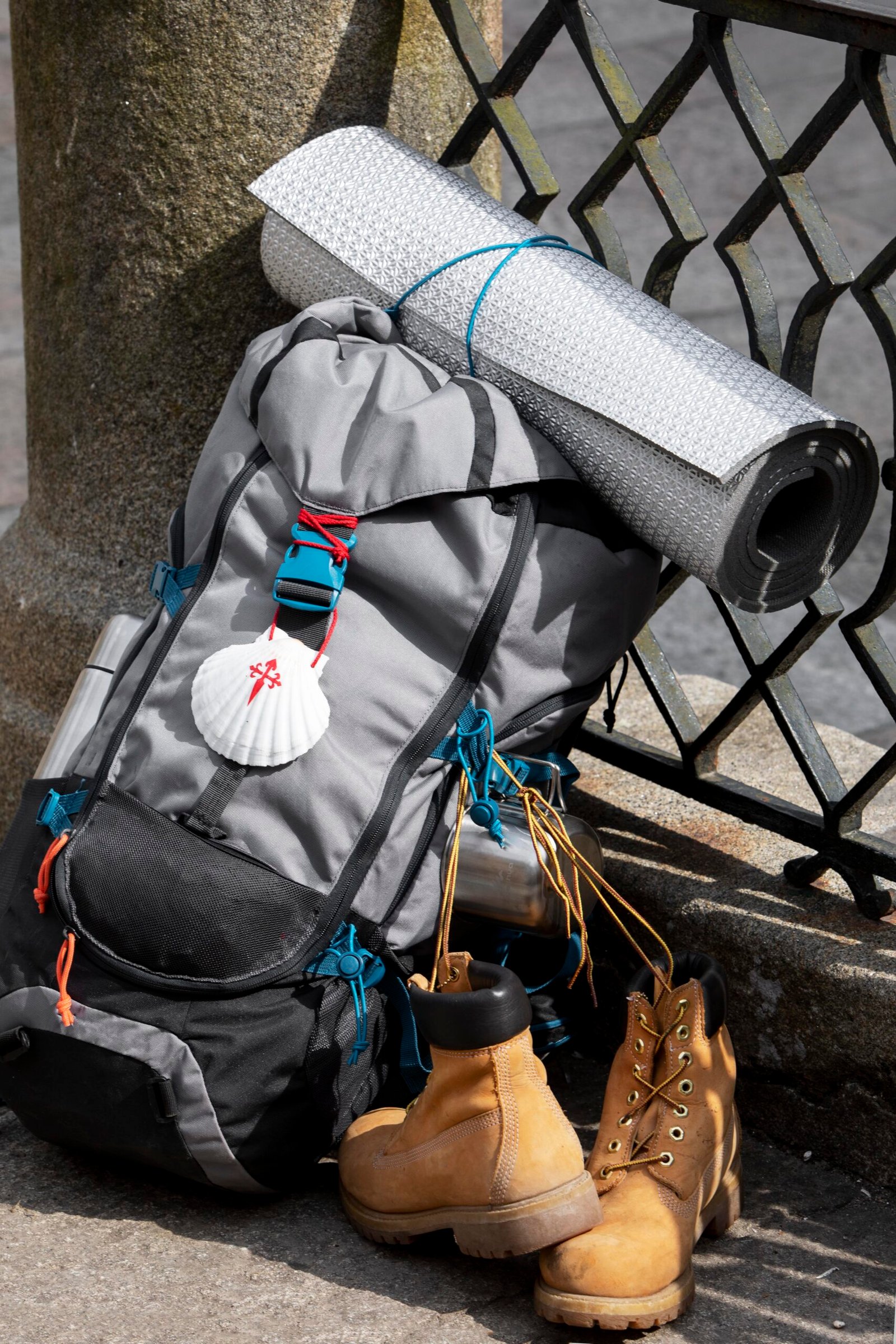
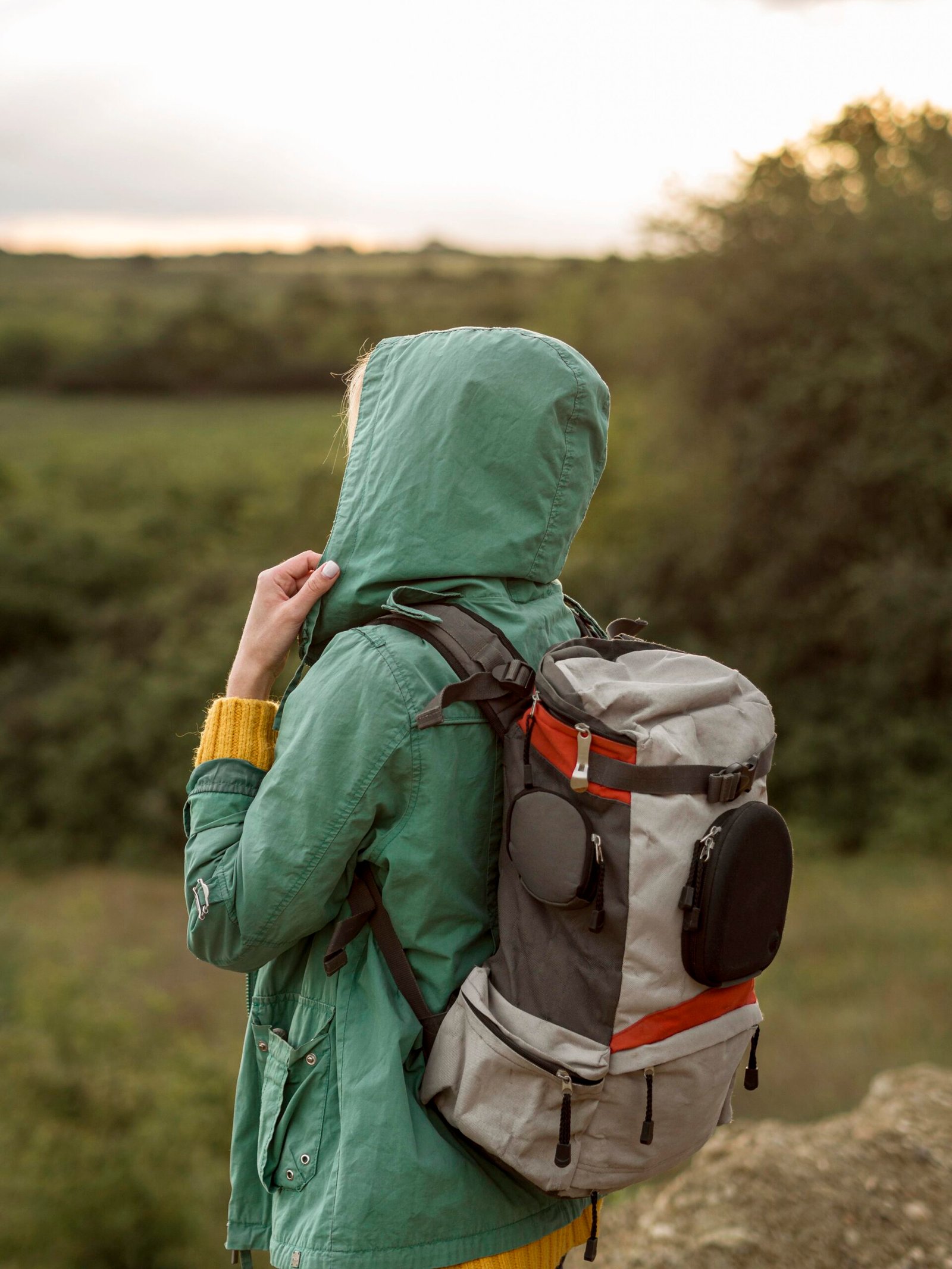
Things to Carry
Pack for two realities: 25°C sunshine in Rishikesh and 5°C rain-soaked trails at 4,300 metres. Both exist within the same week. Keep your pack under 10 kg. Anything heavier compounds fatigue on wet, slippery trails.
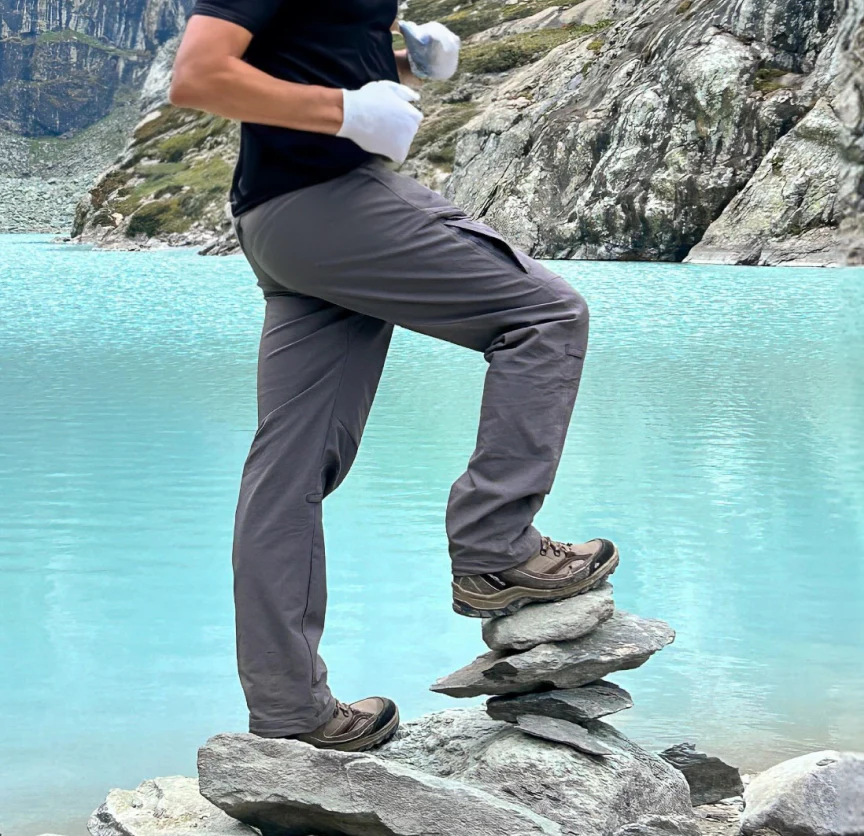
Clothing
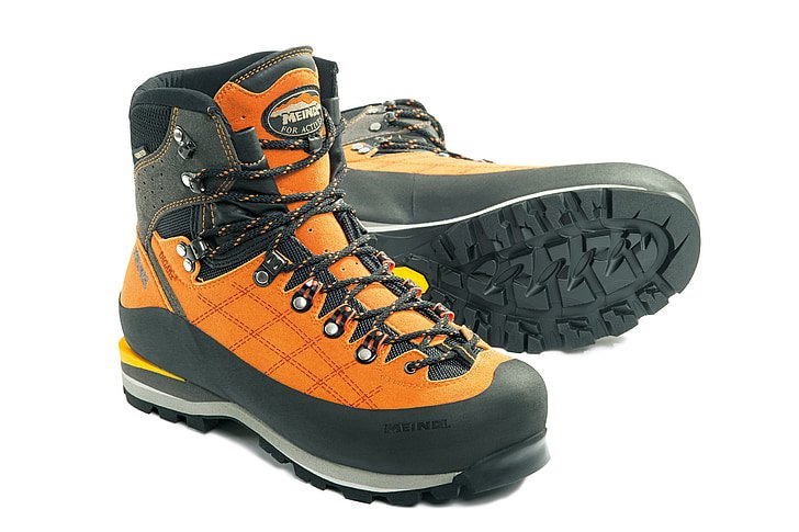
Footwear
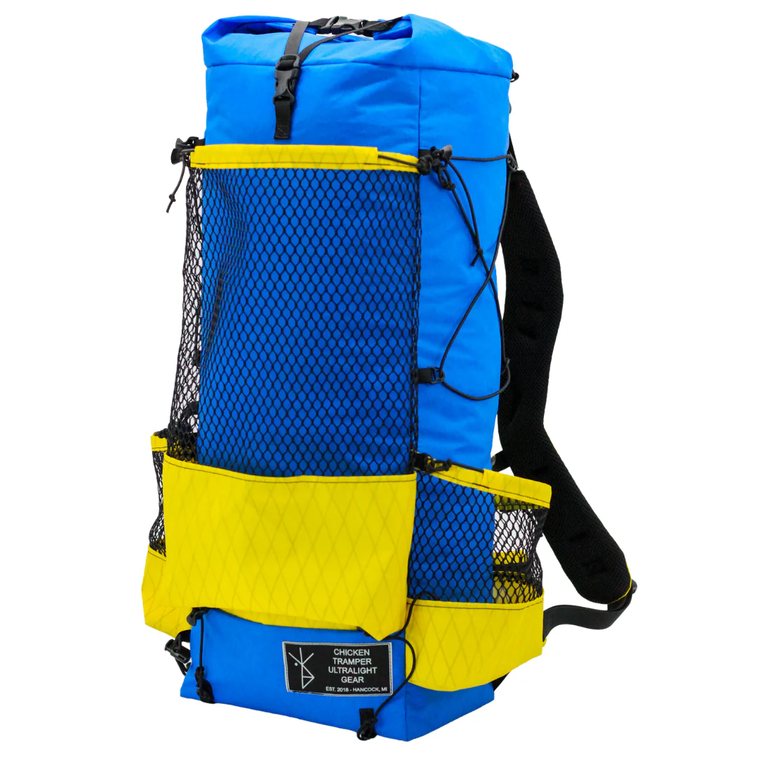
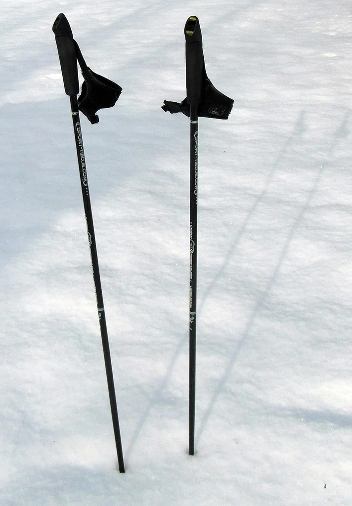
Equipment
Health & Hygiene
Documents & Finance
How to Reach Valley of Flowers Trek Base Camp
The Valley of Flowers Trek starts from Pulna village, but getting there requires a multi-stage journey through Rishikesh, Joshimath, and Govindghat. Rishikesh is the main transit hub.
Reach Rishikesh
- By Air: The nearest airport is Jolly Grant Airport in Dehradun, 21 km from Rishikesh. Direct flights connect Dehradun to Delhi. From the airport, take a taxi or pre-paid cab to Rishikesh (45 minutes).
- By Train: Rishikesh Railway Station and Haridwar Junction (24 km from Rishikesh) are well-connected to Delhi, Mumbai, Kolkata, and other major cities. From either station, take a taxi or local bus to Rishikesh.
- By Road: Direct UPSRTC and private Volvo buses connect Rishikesh to Delhi (240 km, 6-7 hours), Dehradun (45 km, 1.5 hours), and Haridwar (24 km, 1 hour).
Rishikesh to Govindghat
- Govindghat: Govindghat is approximately 275 km from Rishikesh via the Alaknanda Valley road.
- Route: Rishikesh – Devprayag – Srinagar – Rudraprayag – Karnaprayag – Nandprayag – Chamoli – Pipalkoti – Joshimath – Govindghat
- Drive Time: 10–11 hours
- Vehicle: Shared taxi / private cab / operator-arranged vehicle
- Last ATM: Joshimath (limited ATM facilities are available at Govindghat, but it is advisable to withdraw sufficient cash at Joshimath)
- Last Reliable Network: Joshimath. BSNL and Jio may work intermittently around Govindghat, but network connectivity can be unreliable beyond Joshimath.
- Road Conditions: The road is mostly well-maintained but consists of steep mountain sections, narrow stretches, and sharp bends. Traffic congestion near Joshimath and occasional landslides during monsoon can cause delays. It is recommended to start early from Rishikesh to reach Govindghat comfortably before evening.
Joshimath to Pulna (Trek Starting Point)
- Joshimath to Govindghat: 22 km by road (1 hour drive)
- Govindghat to Pulna: 4 km by jeep (15 minutes)
- Pulna: Pulna is the official trek starting point. From here, you trek 9 km uphill to Ghangaria.
Policy
Detailed booking, cancellation, refund, weather, transportation, and trek participation policies to help travelers understand all important operational terms and essential guidelines before joining the Valley of Flowers Trek.
| Policy Point | Details |
|---|---|
| Booking Confirmation | Your seat is considered confirmed only after the required advance payment is received. |
| Balance Payment | The remaining amount must be cleared before departure or as per the reporting instructions shared by the team. |
| Transport Selection | Pickup from Dehradun is applicable only if that option is selected at the time of booking. |
| ID Requirement | Every participant should carry a valid government photo ID for verification and trek administration. |
| Operational Changes | In case of weather, road, or safety concerns, the itinerary may be adjusted for the well-being of the group. |
| Cancellation Window | Charge / Refund |
|---|---|
| More than 30 days before departure | Minimal processing deduction may apply; remaining amount can be refunded or adjusted as per booking terms. |
| 15 to 30 days before departure | Partial cancellation charge applicable; remaining balance may be refunded or transferred to a future batch if approved. |
| 7 to 14 days before departure | Higher cancellation charge applies because transport, permits, and staffing arrangements are usually already blocked. |
| Less than 7 days before departure | Booking is generally non-refundable due to final operational commitments. |
| No show / Trek departure missed | No refund is usually applicable once reporting is missed without prior written coordination. |
FAQ's
A helpful collection of frequently asked questions about the Valley of Flowers Trek, including trek difficulty, flower bloom season, weather conditions, altitude, fitness preparation, permits, accommodation, safety, and important travel information for first-time trekkers.
Rental gear for this trek