Highlight
Kedarkantha Summit Sunrise: A 360-degree panorama from 12,500 ft at dawn, with Swargarohini, Bandarpoonch, Black Peak, Gangotri, Yamunotri, Kinner Kailash, and Har Ki Dun valley all visible simultaneously in the first light of morning
Juda Ka Taal: A high-altitude lake at 9,100 ft that freezes solid in winter; sacred in local mythology as the point where water drops from Lord Shiva’s hair turned into a lake
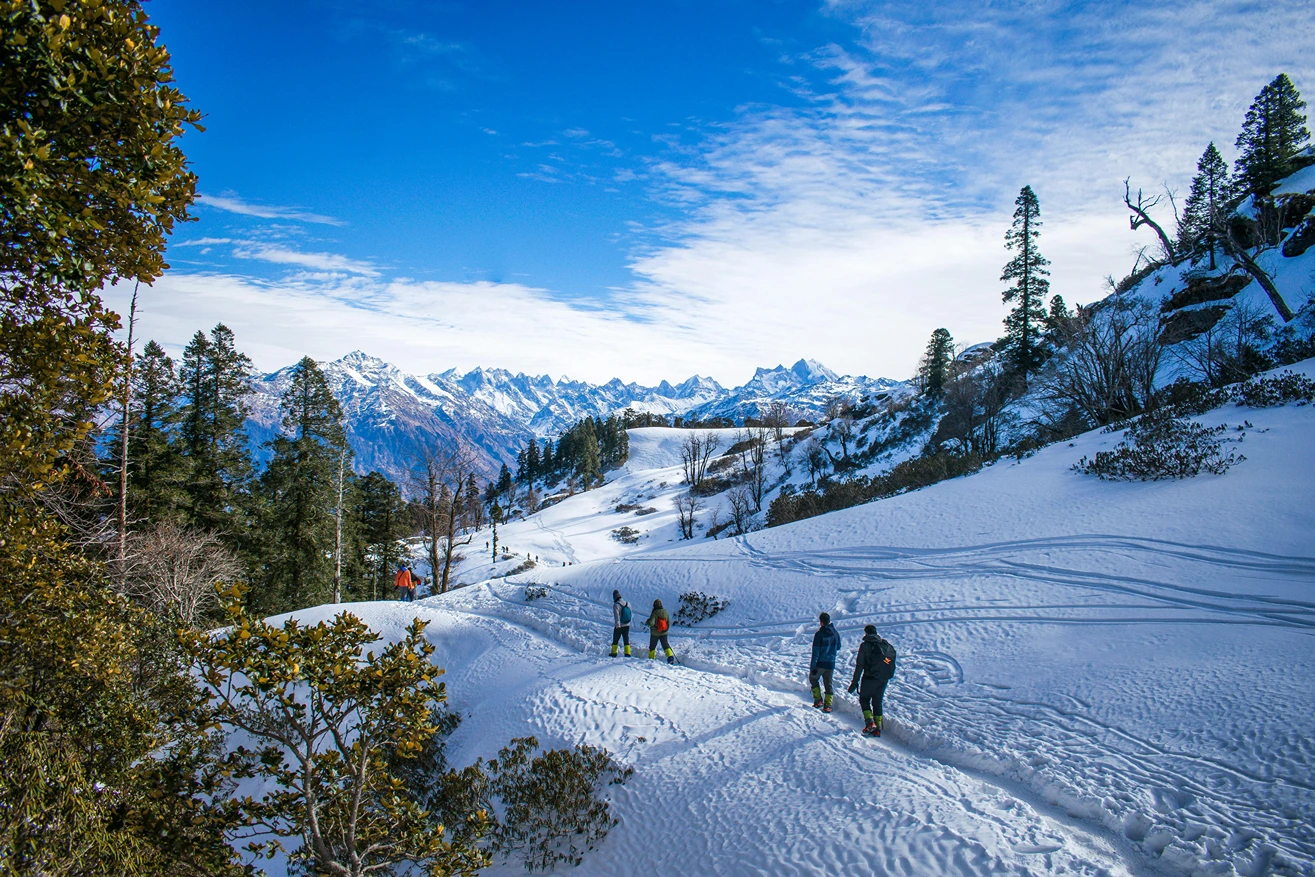
Snow-Covered Pine Forests: The entire trail from Sankri to Base Camp passes through Govind Wildlife Sanctuary’s protected oak and pine forests, draped in snow from December through March
Kedarkantha Base Camp: At 11,250 ft, surrounded by clearings with panoramic views of Swargarohini and Black Peak; on clear nights, one of the best stargazing locations in Uttarakhand
Sankri Village: A traditional Garhwali village at 6,400 ft, gateway to multiple Himalayan treks, with views of Ranglana, Kalanag, and Bandarpoonch from the village itself
Govind Wildlife Sanctuary: The protected forest surrounding the route, home to Himalayan black bear, snow leopard, monal pheasant, and Himalayan tahrs; the trails pass through one of Uttarakhand’s most intact high-altitude ecosystems
The Mythology of the Mountain: Lord Shiva’s meditation site before Kedarnath, the Pandavas’ passage through Swargarohini, a landscape where Hindu cosmology and Himalayan wilderness overlap
Kedarkantha Trek
Kedarkantha feels like a complete Himalayan story packed into one trek: forest silence, snowy camps, ridge views, glowing sunsets, and a summit morning that makes every step feel worth it.
There is a version of the Himalayas that most people never see. Not because it is hidden. Not because it is remote. But because it only exists for a few months every year, and you have to be standing at 12,500 feet before sunrise to witness it. That is Kedarkantha Trek.
It looks like this: complete darkness all around you. Your headtorch illuminating a narrow strip of snow-covered trail. Your breath visible in cold air, each exhale a small cloud. The stars above so thick and close they do not look like stars anymore, they look like scattered light. And then, slowly, almost imperceptibly, the horizon begins to shift. A thin line of orange appears above the ridgeline. It widens. It deepens. And as the sun clears the Swargarohini range, every peak for 300 kilometres in every direction turns gold simultaneously.
Why Trekkers Love It
Swargarohini. Bandarpoonch. Black Peak. Gangotri. Yamunotri. Kinner Kailash. The full sweep of the western Himalayas lit in the first light of morning, reflected in the snow beneath your feet.
That moment, that specific moment at the summit of Kedarkantha Peak, is why thousands of people drive nine hours from Dehradun every winter and walk four days through snow-covered forests to stand at 12,500 feet before the sun comes up.
The Kedarkantha Trek is a 5-day, 20-km winter summit trek in Uttarakhand’s Uttarkashi district, climbing from Sankri village at 6,400 feet through dense pine and oak forests to the summit of Kedarkantha Peak at 12,500 feet. It starts at Dehradun, winds through Mussoorie and alongside the Yamuna River to Sankri, climbs to Juda Ka Taal, a frozen lake with a mythology as old as the Garhwal mountains themselves, continues to base camp, summits before dawn on Day 4, and returns to Dehradun by evening of Day 5.
This trek holds a specific place in Indian trekking that no other route quite occupies. It is called the Queen of Winter Treks, not because it is the highest or the hardest or the most dramatic, but because it delivers the most complete, most beautiful, most accessible winter Himalayan experience available. Snow-covered forests. A frozen lake. A proper summit climb. A 360-degree panorama from the top. And a difficulty level that does not require you to have climbed anything before.
It is the first Himalayan summit for thousands of trekkers every year. And for many of those trekkers, it remains the most memorable one, not because it is the highest they have ever been, but because it is the first time they understood what it actually felt like to stand on a summit and see the world from above the clouds.
The mythology here runs as deep as the snow. Local legend says Lord Shiva chose Kedarkantha Peak for meditation before his journey to Kedarnath, drawn by the silence and the altitude and the complete absence of distraction. The frozen lake of Juda Ka Taal is said to have formed from drops of water that fell from Shiva’s hair as he meditated. Swargarohini Peak, visible from the summit, translates as the stairway to heaven, the path along which the Pandavas ascended after the Mahabharata war.
You are not just walking through snow. You are walking through a landscape that people have considered sacred for centuries, and when you spend a night beside Juda Ka Taal and look up at a sky so clear the Milky Way looks close enough to touch, you begin to understand why.
Day 1 is the long drive from Dehradun to Sankri, 198 kilometres through Mussoorie and the Yamuna Valley.
Day 2 climbs from Sankri to Juda Ka Taal, 4 kilometres through thick pine forest to a frozen high-altitude lake at 9,100 feet.
Day 3 continues to Kedarkantha Base Camp at 11,250 feet, 3 more kilometres through forest that thins and opens into clearings with views of Himalayan peaks in every direction.
Day 4 is summit day, leaving camp at 3 AM, climbing in darkness to reach Kedarkantha Peak at 12,500 feet for the sunrise, then descending all the way back to Juda Ka Taal.
Day 5 is the walk back to Sankri and the long drive back to Dehradun.
The trek is graded easy to moderate, which in real terms means: the daily distances are short, the total elevation gain is 6,100 feet spread over three days, and there are no technical sections, no glacier crossings, no river crossings requiring ropes. But the summit day is steep, starting from 11,250 feet and climbing at 40 to 60 degrees in snow before dawn. Your legs will feel every metre of it. And in winter, temperatures at the summit drop to -10°C or below with wind chill.
The right person for this trek is someone who wants their first Himalayan summit, or their hundredth, in winter snow, with a 360-degree panorama at the top and a frozen lake at the camp below. Someone who is willing to wake up at 3 AM, climb in the dark, and earn one of the best sunrises in India. Someone who understands that being cold is temporary but standing on a snowy peak above the clouds is something you carry for the rest of your life.
The total trekking distance is 20 kilometres over 4 days. Daily distances range from 3 km on the shorter days to 9 km on summit day. The trail stays within Govind Wildlife Sanctuary the entire time, which means the forests are protected, the wildlife is real, and the silence beyond camp is absolute.
If you are ready to stand above the Himalayas before sunrise, there is no reason to wait.
Watch the Trek Vibe
A quick visual feel for the route, camps, snow mood, and the overall experience of Kedarkantha.
Day wise plan
Follow a beautiful Himalayan journey from Sankri village to the snow-covered summit of Kedarkantha while trekking through dense pine forests, frozen lakes, scenic campsites, and breathtaking mountain landscapes across the Garhwal Himalayas.
The Kedarkantha Trek begins the way most great Himalayan journeys begin: with a long, winding road that does its best to prepare you for what lies ahead.
Leave Dehradun by 6 AM. The first hour takes you through Mussoorie, perched on its ridge above the plains, and then down into the Yamuna Valley. The road follows the Yamuna upstream, winding through mountain towns and terraced farms, past small temples and waterfalls, through forests that grow thicker and quieter with every kilometre. After Barkot, the valley narrows. The road gets smaller. Towns become villages. Villages become clusters of stone houses. By the time you reach Mori and begin the final climb to Sankri, the world outside the window has narrowed to pine forests, rocky ridgelines, and sky.
Sankri arrives by late afternoon. A Garhwali village at 6,400 feet, traditional stone houses, prayer flags, wood smoke drifting from cooking fires. From the upper part of the village on clear evenings, Bandarpoonch and Kalanag are visible to the north. This is the last town before the mountains. Everything beyond it is trail. Check into your guesthouse, eat a warm meal, hydrate, and sleep early. Tomorrow the trekking begins.
Tip: Withdraw cash in Dehradun or Barkot. There are no ATMs in Sankri or on the trek. Mobile network works in Sankri but disappears after the first hour on trail. Download offline maps before leaving Dehradun.
The trail out of Sankri climbs immediately through oak and pine forest. The gradient is steady but manageable. The forest is dense, the canopy overhead thick enough that sunlight arrives in narrow shafts between branches. In winter, snow covers the ground from the first kilometre onward, softening every sound except the crunch of your own footsteps.
This is one of the defining sensory experiences of the Kedarkantha Trek: the silence of a snow-covered pine forest. Not complete silence, there is wind, the sound of streams, the occasional birdsong, but an enveloping quiet that city life never quite produces. Most trekkers feel it within the first hour and do not want it to end. The trail climbs through forest for 3 kilometres before emerging at a small clearing. And there, below the clearing, is Juda Ka Taal.
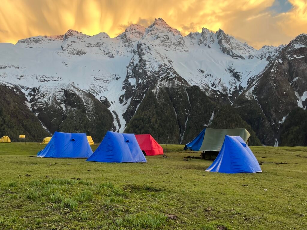
The lake sits at 9,100 feet in a shallow depression ringed by pine trees. In summer, it is a still, dark-green pool. In winter, it is frozen solid, a white disc surrounded by snow-covered pines, with the ridgelines above it dusted in ice. The campsite sits on the slope above the lake.
Local mythology says this lake formed from drops of water that fell from Lord Shiva’s hair during his meditation on Kedarkantha Peak. Whether you believe that or not, the first time you see it frozen in winter, with pine trees rising around it and peaks visible through the gaps above, the word sacred seems entirely appropriate.
Camp here for the night. The temperature after sunset drops quickly, 0°C to -5°C, sometimes lower. Eat well, hydrate, and sleep early. Tomorrow you move closer to the summit.
The shortest day by distance. Not a rest day. Three kilometres does not sound like much. But 2,150 feet of altitude gain over 3 kilometres, through snow-covered forest transitioning into open meadows at high altitude, is a full morning of real trekking.
The trail from Juda Ka Taal climbs steeply through pine and oak forest for the first kilometre. The trees are thinner now, more widely spaced, with snow between them and views beginning to appear through the gaps. After another kilometre, the forest begins to open into clearings. Grassy slopes under snow. Wide skies. And the first real views of the Himalayan peaks: Swargarohini to the north, Black Peak to the northeast, Bandarpoonch on the horizon.
The final kilometre to base camp is through open ground. No trees. Just snow, rock, and sky. And at 11,250 feet, the campsite opens onto a wide, flat clearing with an unobstructed view of the Kedarkantha ridge above. This is base camp. You will sleep here tonight and leave in darkness tomorrow.
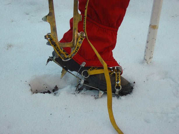
Arrive early. Rest for the afternoon. Eat well at dinner. Check your summit kit: down jacket, gloves, balaclava, headtorch with fresh batteries, trekking poles, microspikes. Drink 3-4 litres of water. Sleep by 8 PM. Tomorrow you wake up at 3 AM. On clear nights at base camp, the Milky Way is fully visible, a complete arc across the sky from horizon to horizon. No light pollution for 30 kilometres in any direction. Most trekkers who see it for the first time say it alone was worth the climb.
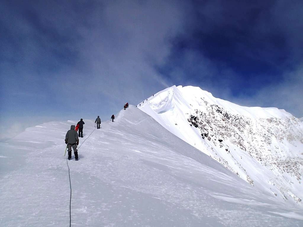
3 AM. Your alarm goes off in a dark, cold tent. Temperature outside: -10°C with wind chill. The summit is 1,250 feet above you. The sun will rise in three hours. This is the moment the entire trek has been building toward. Get dressed in full winter layers. Down jacket, balaclava, gloves, microspikes on boots. Head torch on. Walk out of camp into darkness.
The trail to the summit climbs steeply from the first step. Snow is knee-deep in places. The gradient ranges from 40 to 60 degrees near the top. Your headtorch illuminates a narrow circle of white ahead of you. Behind you, other torches bob in the darkness. Above you, stars and blackness.
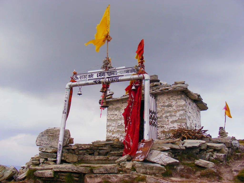
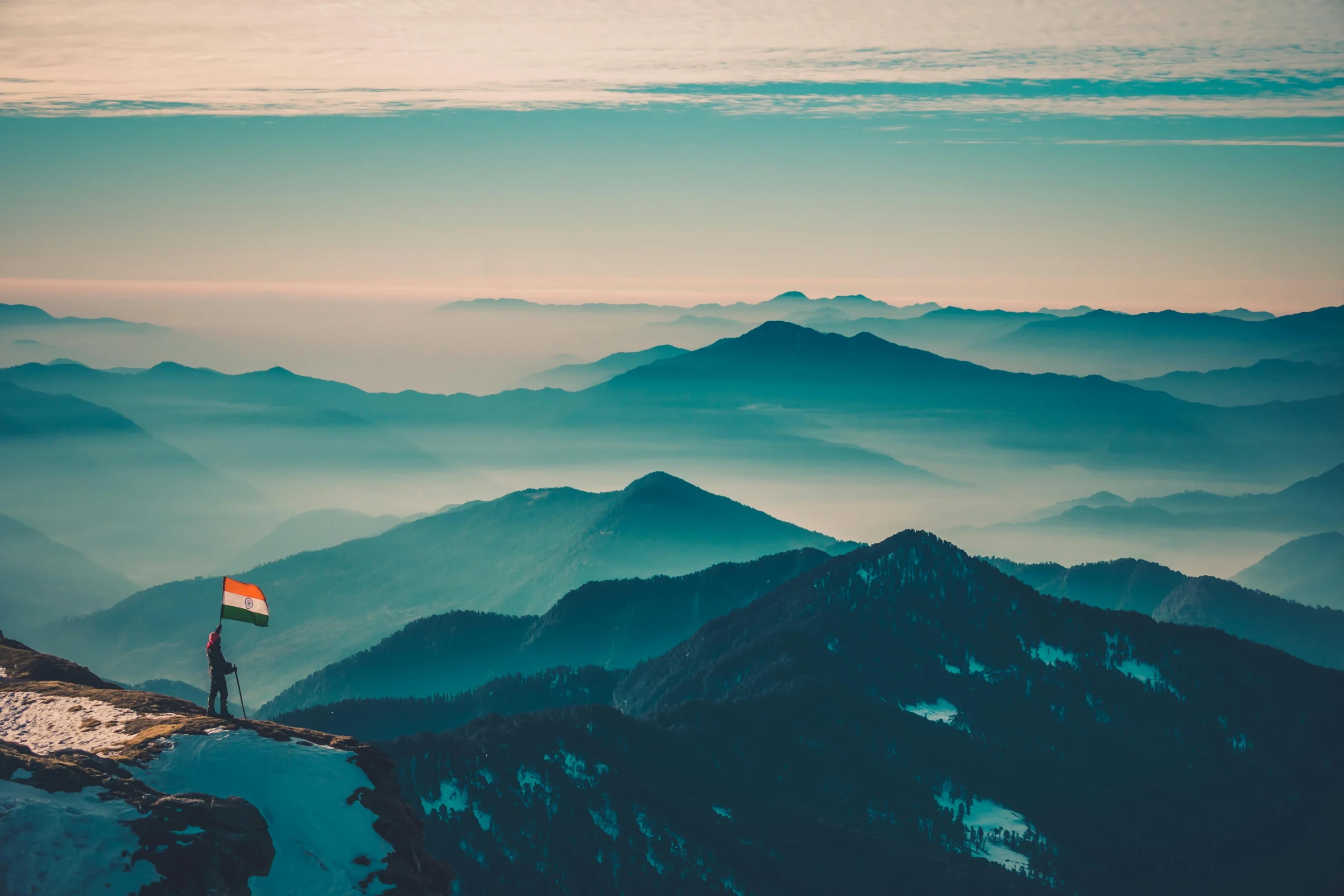
The climb takes 3 to 4 hours. One foot in front of the other. Steady pace. No rushing. At altitude, rushing only leads to breathlessness and stopping. The trekkers who move slowly and steadily reach the top; the ones who push hard in the first hour are the ones who sit down in the cold and regret it. About 45 minutes before sunrise, the horizon begins to shift. The stars fade. The darkness turns dark blue, then grey. And by the time you reach Kedarkantha Peak, the sky is already beginning to change. The summit is a broad, snow-covered ridge at 12,500 feet. Prayer flags on a pole. Mountains in every direction. And then the sunrise.
The sun clears the Swargarohini range and every peak for hundreds of kilometres turns gold simultaneously. Swargarohini. Bandarpoonch. Black Peak. Draupadi Ka Danda. Gangotri range. Yamunotri range. Kinner Kailash. Har Ki Dun valley far below. The Tons Valley stretching south. All of it lit at once in the first 10 minutes of morning.
This is what people drive nine hours and walk four days to see. And seeing it in person, in the cold, on a snowy summit above the clouds, does not disappoint. Stay as long as you can. The cold will eventually win. Then begin the descent.
The descent back to base camp takes about 2 hours on the same steep trail, harder on knees going down than lungs going up. From base camp, the trail continues all the way back down to Juda Ka Taal. Arrive by early afternoon. Rest. Eat. The hardest day of the trek is behind you.
The final trekking day retraces the trail from Day 2 in reverse, downhill now, which makes it faster and gentler. The snow-covered pine forest, which felt mysterious on the climb up, feels familiar and warm on the descent. The crunch of snow underfoot. The shafts of sunlight through the canopy. Sankri appearing below through the trees after 4 kilometres of gradual descent. Arrive in Sankri by midday. Freshen up. Eat a hot meal. And then the long drive back to Dehradun through the Yamuna Valley, arriving by late evening.
Book your onward travel from Dehradun accordingly, with at least a 2-hour buffer for road delays. The journey back feels different from the journey out, which it should, because you are different from the person who drove to Sankri five days ago.
Inclusion & exclusion
Inclusions
Exclusions
- Bag Offloading Charges: ₹1,400 per bag
- Maximum Weight per Bag: 10 kg
Best Time to Visit Kedarkantha Trek
Unlike most Himalayan treks which chase clear weather and avoid snow, Kedarkantha earns its reputation precisely because of snow. The best version of this trek is the winter version. But the route operates across multiple seasons and each one delivers something distinct.
December to February: Peak Winter - The Definitive Season
This is why Kedarkantha is called the Queen of Winter Treks. From December through February, the entire trail from Sankri to the summit is blanketed in snow. The pine forests are white and silent. Juda Ka Taal is frozen solid. Base camp sits under 2 to 3 feet of snow. And the summit is a winter wonderland at 12,500 feet with temperatures dropping to -10°C or below.
This is the season that has defined this trek’s identity. The frozen lake, the snow-covered forests, the pre-dawn summit push in headtorches, the sunrise over peaks covered in winter white, all of it exists in its most complete form in these three months.
Daytime temperature at Sankri: 5°C – 10°C
Daytime temperature at Base Camp: -2°C – 5°C
Night temperature at Base Camp: -8°C – -12°C
Summit morning temperature: -10°C to -15°C with wind chill
Snow depth on trail: 1–4 feet
Crowds: High. December-January is peak season. Weekends are extremely busy
March to April: Late Winter and Transition
The snow begins to melt in March but remains deep enough on the upper sections to maintain the winter feel. The forests start showing early signs of spring: patches of green appearing beneath the snow line, rhododendron buds forming on higher branches.
This is an excellent window for trekkers who want significant snow without the extreme cold of January or February.
Daytime temperature at Base Camp: 3°C – 10°C
Night temperature at Base Camp: -3°C – 0°C
Snow depth on trail: Moderate on upper sections, less on lower trail
Crowds: Moderate
April to June: Spring Season
Snow has largely melted from lower trails by April, though the summit and upper sections retain significant snowpack until mid-May. The forest erupts with rhododendron blooms in red, pink, and white. Wildflowers cover the meadows. The landscape transforms from white to vivid green and red.
The trek is beautiful in spring, just different. Less dramatic than winter but more colourful, and with longer daylight hours that make the summit push slightly less cold.
Daytime temperature at Base Camp: 8°C – 15°C
Night temperature at Base Camp: 0°C – 5°C
Crowds: Low to moderate
September to November: Autumn Season
Post-monsoon season brings clear skies, crisp air, and exceptional visibility. The forests turn gold and amber in October. Mountain views from the summit in November, when winter clouds have not yet arrived, are among the clearest of the entire year. Snow begins to return to the upper sections in November.
Daytime temperature at Base Camp: 5°C – 12°C
Night temperature at Base Camp: -2°C – 3°C
Crowds: Low
July to August: Monsoon (Not Recommended)
The trail is open during monsoon but slippery, muddy, and prone to landslides on the approach road from Dehradun. Leeches appear in the forest sections. Views are limited by clouds. Not recommended.
Things to Carry
Pack for two realities: 25°C sunshine in Rishikesh and 5°C rain-soaked trails at 4,300 metres. Both exist within the same week. Keep your pack under 10 kg. Anything heavier compounds fatigue on wet, slippery trails.
Clothing
Footwear
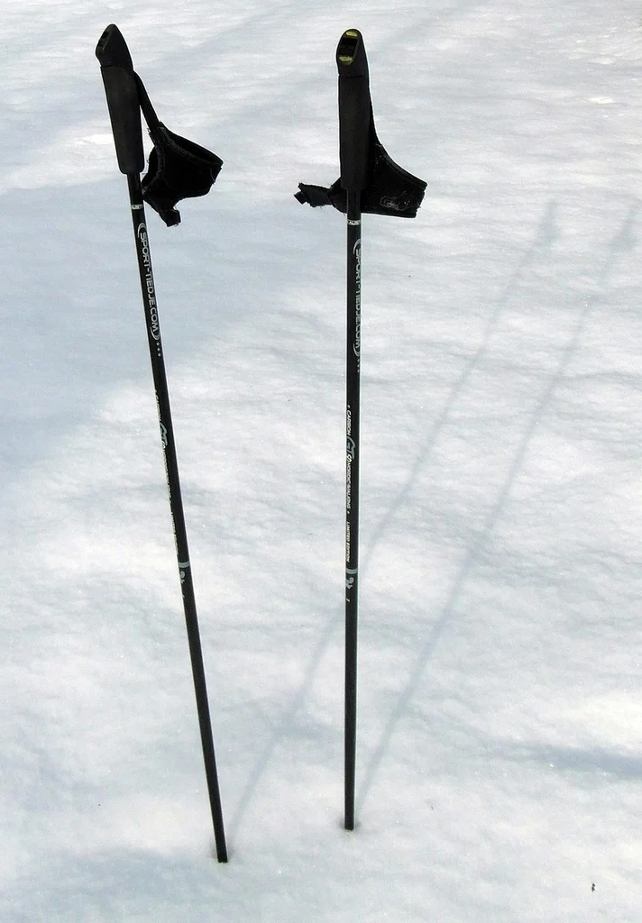
Equipment
Health & Hygiene
Documents & Finance
How to Reach For Kedarkantha Trek From Delhi?
The Kedarkantha Trek starts from Sankri village in Uttarakhand’s Uttarkashi district. Dehradun is the main transit hub.
Reach Dehradun
By Air: Dehradun’s Jolly Grant Airport has direct flights from Delhi, Mumbai, and Bengaluru. From the airport, take a taxi or pre-paid cab to the city centre (45 minutes).
By Train: Dehradun Railway Station is well-connected to Delhi, Mumbai, and other major cities. Overnight trains from Delhi (295 km) are a common choice.
By Road: Volvo buses connect Dehradun to Delhi (300 km, 6-7 hours) and Haridwar (54 km, 1.5 hours).
Policy
| Policy Point | Details |
|---|---|
| Booking Confirmation | Your seat is considered confirmed only after the required advance payment is received. |
| Balance Payment | The remaining amount must be cleared before departure or as per the reporting instructions shared by the team. |
| Transport Selection | Pickup from Dehradun is applicable only if that option is selected at the time of booking. |
| ID Requirement | Every participant should carry a valid government photo ID for verification and trek administration. |
| Operational Changes | In case of weather, road, or safety concerns, the itinerary may be adjusted for the well-being of the group. |
| Cancellation Window | Charge / Refund |
|---|---|
| More than 30 days before departure | Minimal processing deduction may apply; remaining amount can be refunded or adjusted as per booking terms. |
| 15 to 30 days before departure | Partial cancellation charge applicable; remaining balance may be refunded or transferred to a future batch if approved. |
| 7 to 14 days before departure | Higher cancellation charge applies because transport, permits, and staffing arrangements are usually already blocked. |
| Less than 7 days before departure | Booking is generally non-refundable due to final operational commitments. |
| No show / Trek departure missed | No refund is usually applicable once reporting is missed without prior written coordination. |
FAQ's
Rental gear for this trek