Highlight
- The Hanging Village of Jhaka: a traditional Kath-Kuni settlement perched on a narrow mountain spine, appearing suspended over the valley when seen from below
- Three-Stage Rupin Waterfall: one of the most dramatic natural features on any Himalayan trekking route; nearly 500 metres of cascading water into a glacial amphitheatre
- Dandreyash Thatch: vast open meadow at 3,556 m, surrounded by ridgelines, with views of the Kinner Kailash Range on clear evenings
- The Rupin Gully: steep, snow-filled corridor on summit day; the most technically demanding and most memorable section of the trek
- Summit Panorama at 4,650 m: the full sweep of the Kinner Kailash Range to the south, Uttarakhand’s high ridges ahead, and the valley you’ve spent six days walking through laid out below in complete silence
- Sangla Valley: one of Himachal Pradesh’s most beautiful valleys; your endpoint after the trek, framed by sheer cliff walls with the Baspa River running through it
- Kinnauri Culture: traditional villages, apple orchards, and a way of mountain life that hasn’t changed much despite the decades
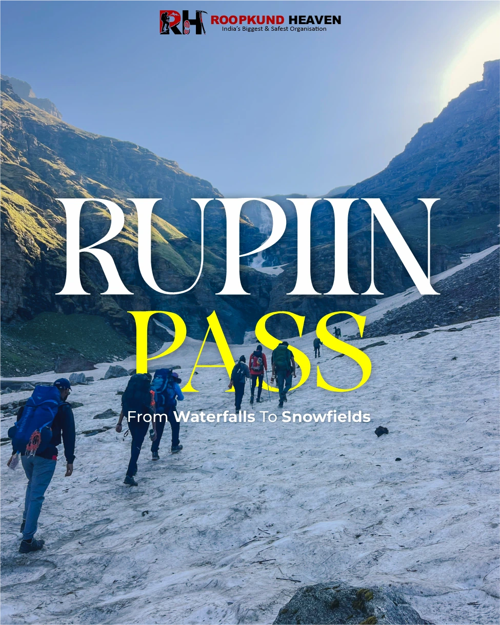
Rupin Pass Trek
Clear trek details, booking dates, inclusions, and rental options.
Most Himalayan treks ask you to reach something – a pass, a peak, a lake. The Rupin Pass Trek asks you to follow something: a river. From the moment you leave Jiskun village to the moment you stand at 4,650 metres on the pass, the Rupin River is your companion, your guide, and your trail.
It doesn’t just run beside the route – it is the route. The trail follows its mood, its pace, its direction. And that mood changes every single day.
Why Trekkers Love It
Rupin Pass Trek starts as a wide, calm valley river below the forests of Jiskun, moving slowly through apple orchards and pine slopes. As you climb higher through the forest above Bawta, the river narrows and picks up speed.
By the time you reach the open meadows of Dandreyash Thatch, it has become a small mountain stream – cold, clear, and quiet. Higher still, it drops – 3 stages of waterfalls. And then, close to the pass, it disappears completely into snow. It becomes the ground you are walking on. You don’t cross the river to reach the top. You walk on it.
That one idea following a river all the way from a valley floor to the snowfield where it is still being born is what makes the Rupin Pass Trek one of the most special journeys in the Indian Himalayas.
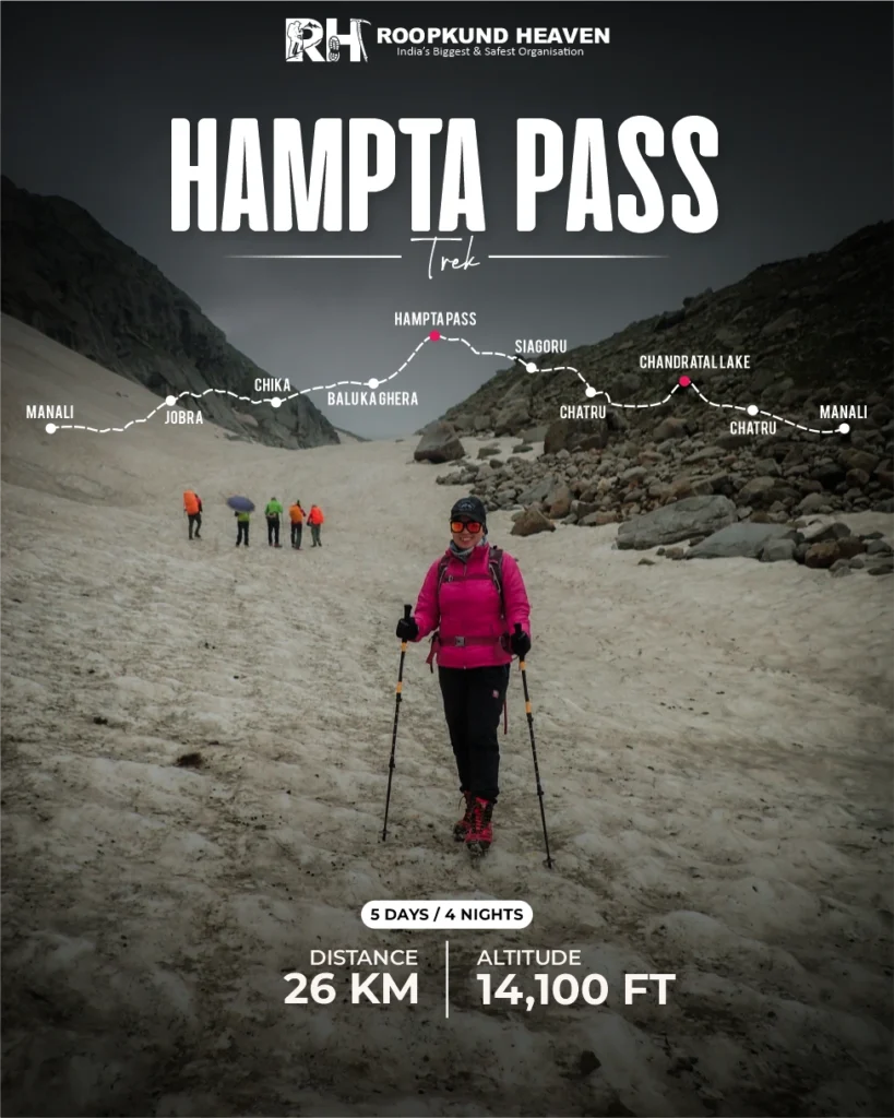
The Rupin Pass Trek is a 7 day, 42-km trek that crosses from Himachal Pradesh into Uttarakhand and back. It starts at Jiskun village in Himachal Pradesh, crosses the Rupin Pass at 4,650 metres (15,250 feet), briefly touches Uttarakhand on the way down, and ends at Sangla Valley in Himachal.
Along the way, the route passes through thick forests, old mountain villages, wide open grasslands, a massive three-stage waterfall, and steep snow slopes before giving you one of the best summit views in the western Himalayas.
Day 1 is a long mountain drive from Shimla through the Chainsheel Valley. Most people underestimate this drive. Most people also end up enjoying it more than they expected.
Day 2 puts you on a steep forest trail climbing to Jhaka, a traditional Kinnauri village sitting so dramatically on a narrow mountain ridge that it looks like it is floating in the air when you see it from the valley below.
Day 3 takes you above the treeline for the first time, out into the wide grasslands of Dandreyash Thatch at 3,556 metres. On a clear evening here, you can see the Kinner Kailash Range on the southern horizon
Day 4 is a rest and acclimatisation day. A genuinely necessary pause that your body needs before the altitude push ahead.
Day 5 brings you to the Rupin Waterfall and it is difficult to describe the scale of it without overstating things. Three stages of water falling nearly 500 metres down a sheer cliff face into a glacial bowl.
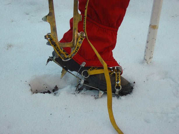
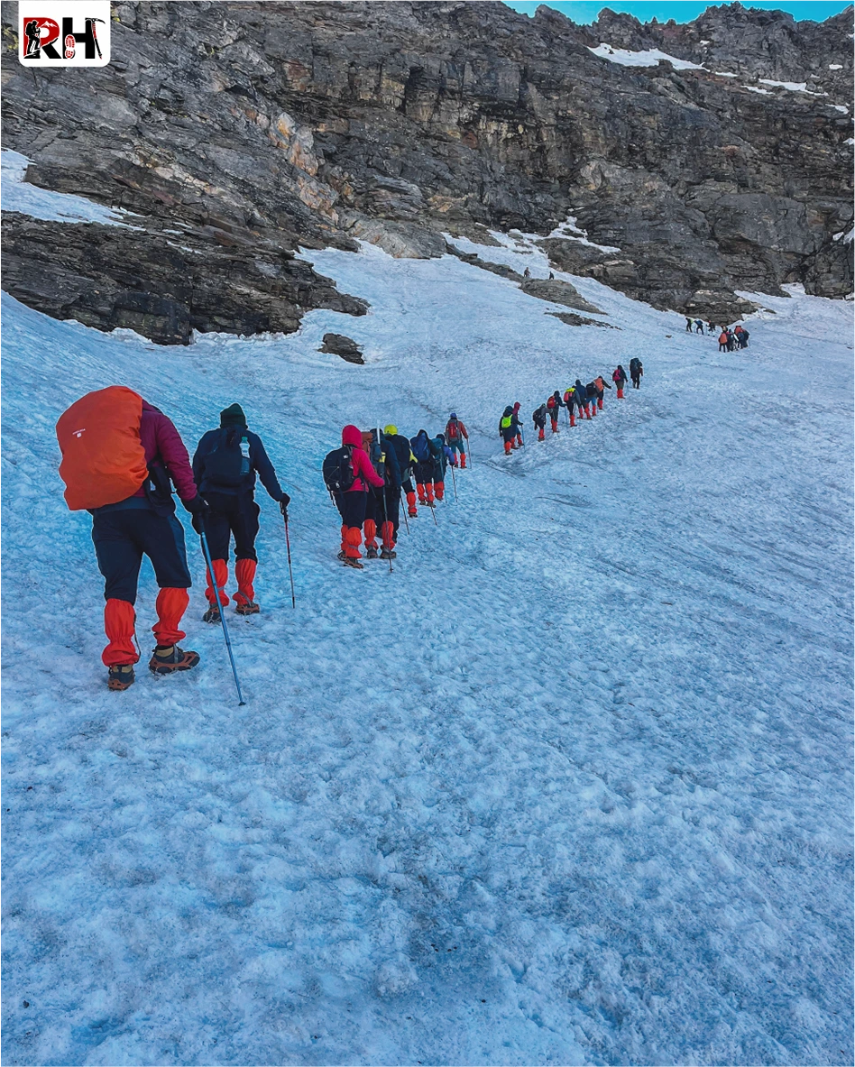
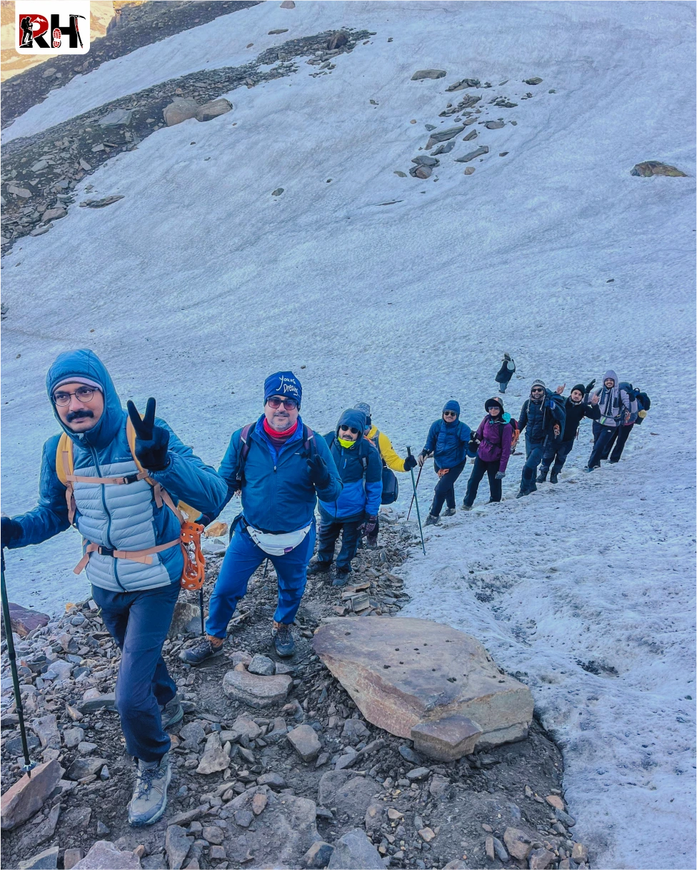
Day 6 is summit day. It starts before 4 AM, climbs through the Rupin Gully, a steep, snow-packed corridor that demands focused, careful movement and reaches the pass at 4,650 metres after 10 to 11 hours of trekking.
Day 7 is the walk down into Sangla Valley – green, warm, pine-scented and then the long overnight drive back to Shimla.
What surprises most people who do this route is that it never feels like one long climb to a summit and back. Most multi-day treks give you one big moment at the top and a long walk back down the same path. The Rupin Pass Trek gives you something new at every campsite, right until the last morning.
The villages along the lower route – Jiskun, Bawta, Jhaka are real, living Kinnauri communities. The architecture is Kath-Kuni: stone walls, timber frames, houses that have stood for generations.
In terms of difficulty, the Rupin Pass Trek is rated moderate to difficult. You do not need any technical climbing experience. There are no vertical rock faces, no glacier crossings, no ropes in the mountaineering sense. But you do need to be fit, because the summit day is 10 to 11 hours long. You need to be comfortable in cold conditions, because temperatures near the pass can drop to -5°C or lower.
The right person for this trek is someone who has done at least one moderate Himalayan trek before like Kedarkantha, Brahmatal, or Hampta Pass and is ready to take the next step.
The total distance is 42 km over 7 days. Daily walking distances range from 5 km on the shorter days to 12 km on summit day. And it is exactly why, when you step onto Rupin Pass and the mountains open up in every direction, the moment feels completely and entirely yours.
If you are physically ready for this, there is no reason to wait.
Day wise plan
Follow a dramatic Himalayan journey from Jiskun village to Sangla Valley while crossing hanging villages, alpine meadows, roaring waterfalls, snowfields, and the high-altitude Rupin Pass surrounded by breathtaking mountain landscapes.
Your trek doesn’t begin at the trailhead. It begins the moment you leave Shimla. The drive to Jiskun via Rohru and the Chainsheel Valley is its own quiet introduction to the mountains, apple orchards on terraced hillsides, the highway thinning into mountain roads, towns becoming smaller and further apart. After Rohru, the valley deepens and the world outside the window turns completely wild. Leave Shimla by 6 AM. Arriving at Jiskun by afternoon gives you daylight to settle into the guesthouse, eat a warm meal, and sleep at a sensible hour.
Jiskun is a quiet Himachali village at 2,340 metres. Surrounded by pine slopes and terraced farms, it is unhurried and self-contained. Spend the evening hydrating, resting, and preparing your pack. Tomorrow is a long day.
Before you leave Rohru: Withdraw cash, there are no ATMs beyond this point for the next 7 days. Download offline maps. Reliable mobile network ends here.
The trail out of Jiskun climbs immediately. Within the first hour, through dense deodar and walnut forest. The forest is shadowy in the early hours, filled with birdsong and, somewhere below, the sound of the Rupin River. Bawta, a small cluster of homes and tea stalls, arrives as a welcome mid-climb stop. Refill water here. The trail steepens from Bawta onward.
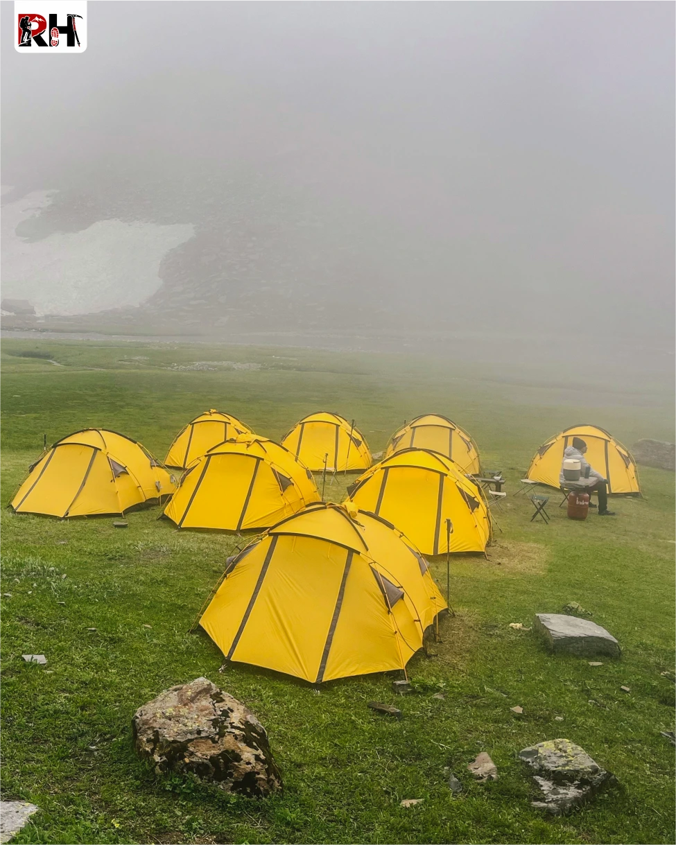
Jhaka is the landmark of the day. This is the famous Hanging Village of the Rupin Pass Trek, a settlement of traditional Kath-Kuni wooden houses built on a narrow mountain spur in a way that makes the entire village appear suspended when viewed from the valley below. Jhaka follows Satsang traditions and is meat-free. There’s a quietness about it that altitude alone doesn’t explain. This is the last inhabited village on the route. Hire a porter here if needed. Buy anything from a local shop you may have forgotten. Beyond Jhaka, there is nothing but trail. Campsites are set on open ground just above the village, with valley views in every direction.
This is the day the trek stops feeling like a forest walk and starts feeling like a Himalayan expedition. Above Jhaka, the treeline ends. Wide alpine meadows, sweeping, sun-drenched, disproportionately vast – open in front of you. The Rupin River is now far below in the valley. You’ll hear it all day. Saruwas Thatch is a broad plateau meadow that most groups use as a lunch point. In June, wildflowers cover every slope. In October, the grass has turned amber and the ridgelines are crystalline against a blue sky.
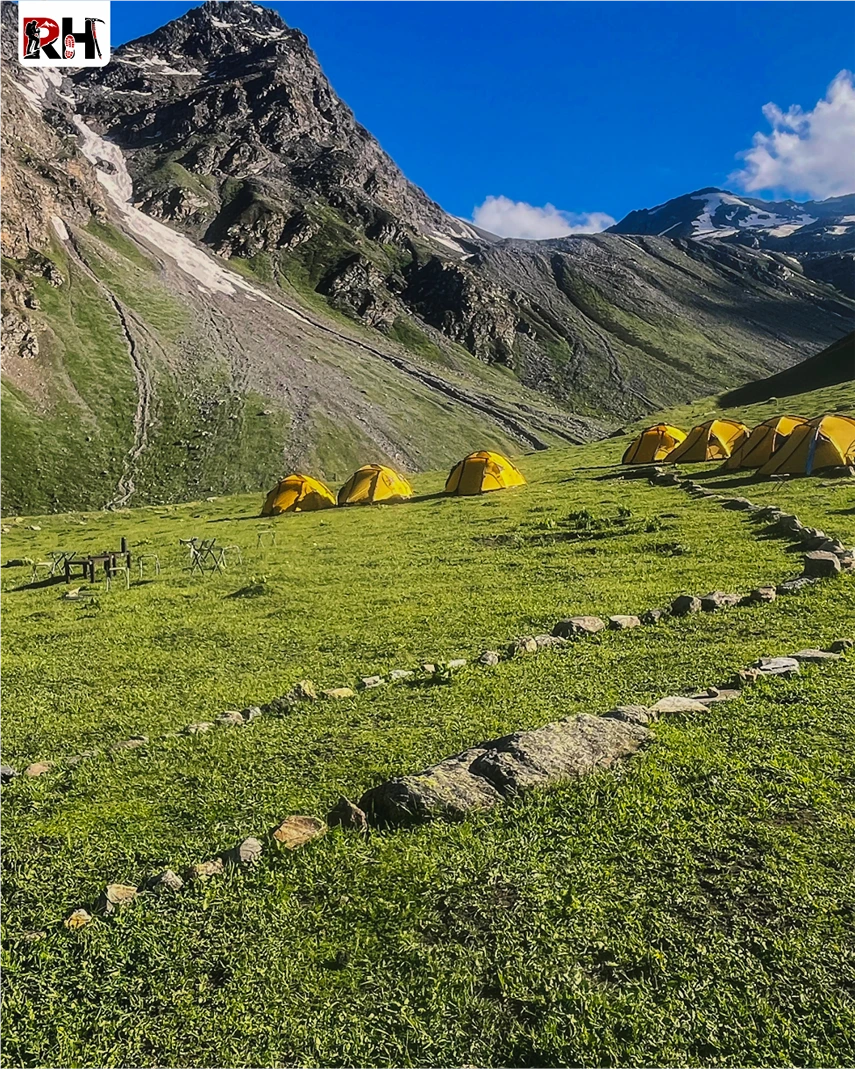
From Saruwas Thatch, the trail continues climbing to Dandreyash Thatch at 3,556 m, your home for the next two nights. The campsite sits inside a wide glacial bowl, ringed by ridgelines, with the Kinner Kailash Range visible on clear evenings. Your first proper view of distant snow happens somewhere along this stretch. Nights here are genuinely cold – 0°C to 5°C. Layer up early, drink plenty of fluids, eat well.
This day is not optional. It is the most important day on the itinerary. At 3,556 metres you are already at altitude. In two days you will be at 4,650 metres. Today exists to give your bloodstream, your lungs, and your red cell count the time they need to adapt before that push. The protocol is simple: wake up, eat, take a short 2–3 km uphill walk, return to camp, rest, hydrate (3–4 litres), eat, sleep early. The “climb high, sleep low” principle at its most basic.
Avoid alcohol entirely. Eat even if your appetite has decreased – appetite suppression is normal at altitude, but your body needs the calories. If a headache develops and doesn’t improve with rest and hydration after two hours, tell your trek leader immediately.
Use this day to check your summit kit: down jacket, gloves, balaclava, headtorch with fresh batteries, trekking poles, microspikes, 2 litres of water in an insulated sleeve (water freezes near the pass in cold months). Tomorrow is a short day. The day after starts before 4 AM.
AMS Symptoms to watch for: Persistent headache, nausea, loss of appetite, dizziness, breathlessness at rest.
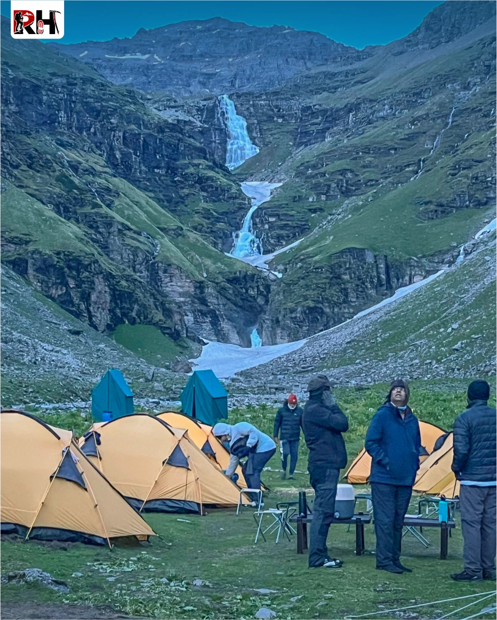
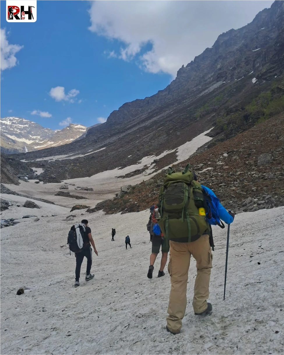
The shortest day by distance but not the easiest. The trail climbs toward the Rupin Waterfall- one of the most dramatic natural sights on any Himalayan trekking route. You hear it before you see it. Three cascading stages dropping nearly 500 metres down a sheer cliff face into a glacial U-shaped valley. No photograph captures the scale. In May and June, fed by snowmelt, the waterfall roars and its mist reaches the trail. In September the flow is gentler, but a 500-metre white streak against black rock needs no amplification. Beyond the lower falls, snow patches become frequent. By the time you reach Upper Waterfall Camp at 4,060 m, the terrain is different entirely – vast, exposed, white on three sides, the summit ridge visible for the first time from directly below.
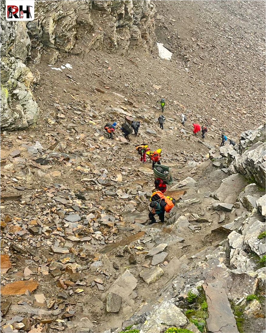
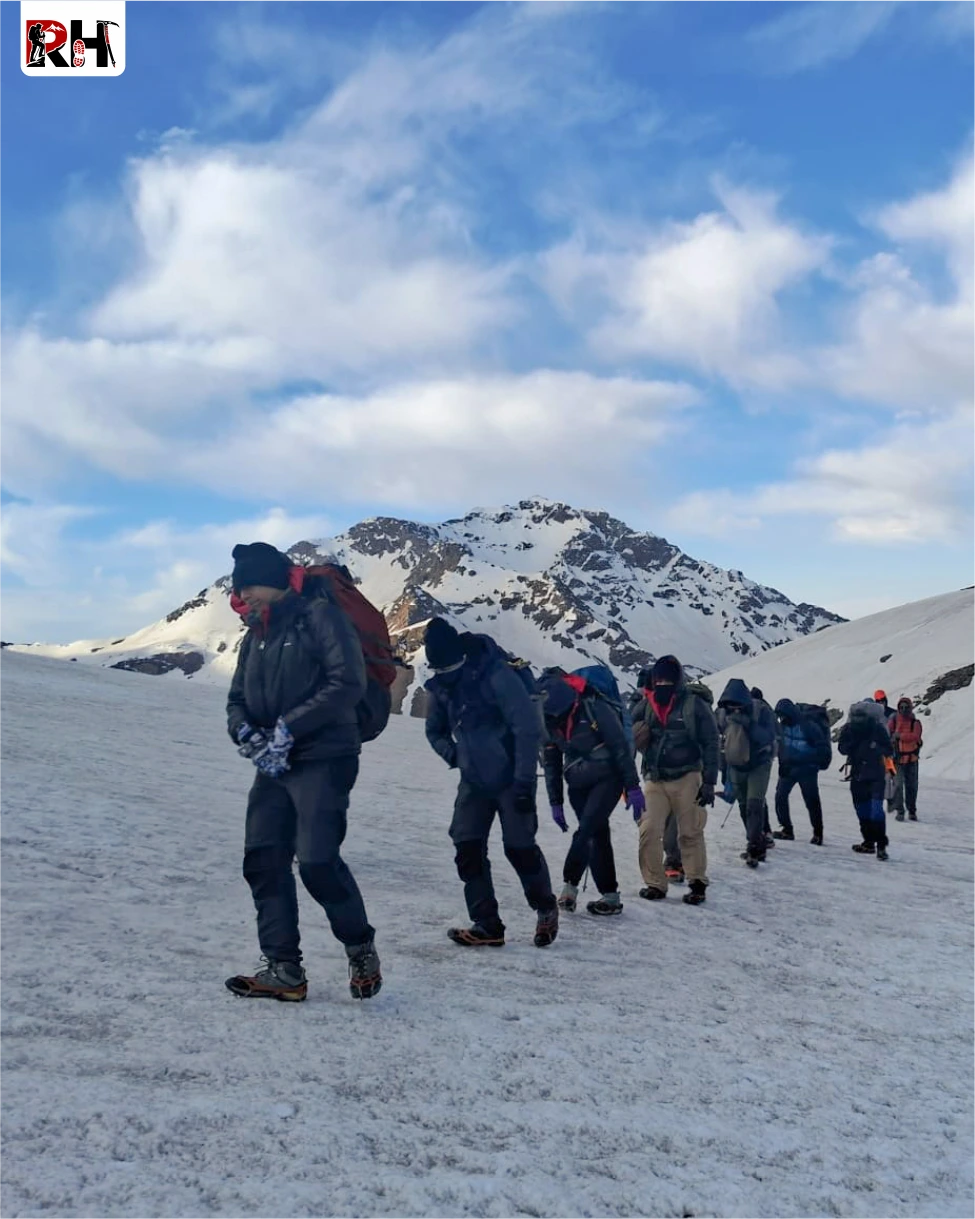
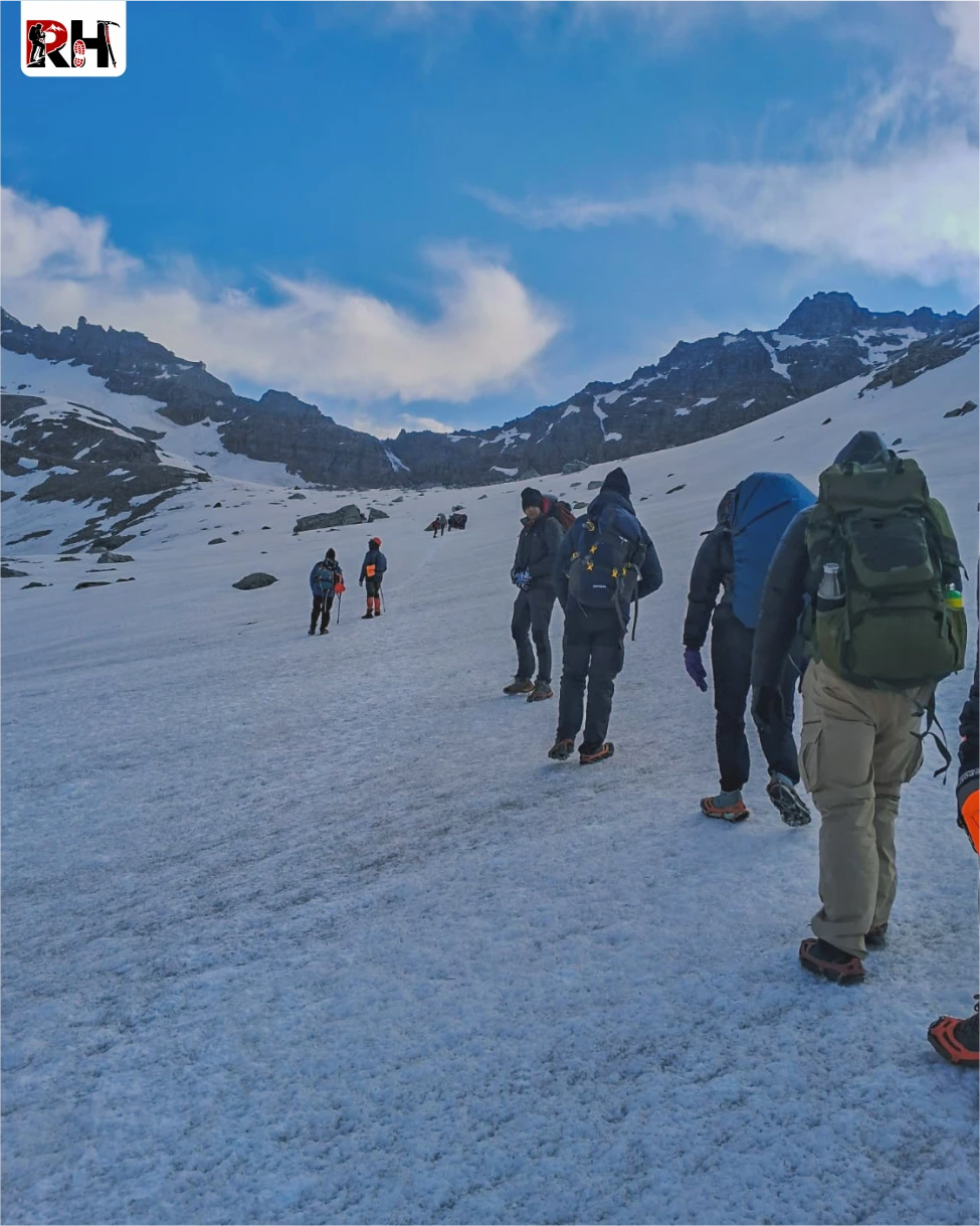
This is the day you trained for. You leave camp in darkness. Head torch on, breath visible in cold air, snowfield catching the light all around. The first section climbs steeply through the Rupin Gully, a narrow, snow-filled corridor that rises at a punishing gradient toward the pass. This is the most physically demanding section of the entire trek. Because it requires every step to be deliberate, every breath to be steady, and every trekker to trust their pace and their team. Above the gully, the gradient eases. You enter Rati Pheri – a wide snowfield that serves as the final rest point before the summit. The views are already extraordinary before you reach the top: ridgelines stacked in all directions, the sky turning from deep blue to pale gold as the sun rises.
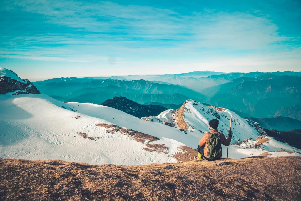
The final climb to Rupin Pass at 4,650 metres is steep but short. Prayer flags and cairns mark the summit. When you step up onto the pass, the full sweep of the Kinner Kailash Range opens to the south. Uttarakhand’s high wilderness stretches ahead. The valley you’ve spent six days walking through lies below in complete silence. Stay long enough to feel it. Then begin the descent. The descent into Ronti Gad drops nearly 1,500 metres over 6-7 km. Tired knees will feel every metre of it. Use your poles hard, plant your heels, and take it slowly. Ronti Gad campsite sits in a wide, quiet valley, peaceful after the intensity of the day.
The last day is long in hours but gentle in effort. The morning trail from Ronti Gad descends through terrain that softens with every kilometre – snowfield to alpine scrub, scrub to conifer forest, forest to the terraced orchards and stone villages that signal Sangla Valley. As altitude drops, the air thickens, the temperature rises, the colours return. Sangla is one of Himachal Pradesh’s most beautiful valley settlements. The Baspa River runs through it, green and cold. After a week of campsites, the sight of a proper village with a tea shop and a paved road feels like re-entering a world you’d nearly forgotten.
After lunch in Sangla, board your vehicle for the long drive back to Shimla. Arrive late at night – typically between 11 PM and 1 AM. Book your onward travel from Shimla accordingly.
Inclusion & exclusion
This section includes complete details about accommodation, meals, permits, transportation, camping equipment, trek leadership, and support services included in the Rupin Pass trek package, along with personal expenses and services that are not covered in the overall trek cost.
Inclusions
Exclusions
- Bag Offloading Charges: ₹3800 per bag
- Maximum Weight Limit: Each offloaded bag should not exceed 10 kg
Best Time to Visit Rupin Pass Trek
The Rupin Pass Trek is open for two seasons every year. Picking the right season makes a bigger difference on this trek than most.
May to June: Spring & Early Summer
This is the snow season on the Rupin Pass Trek. The lower sections of the trail – Jiskun, Bawta, Jhaka are green and alive with wildflowers. The upper sections from the waterfall camp onward carry significant snowpack. In May, the Rupin Gully can have 4 to 6 feet of snow. The three-stage Rupin Waterfall is at its loudest and most powerful, fed by snowmelt pouring off every ridge above it.
If you want to experience snow trekking without extreme cold, this is your season.
- Daytime temperature at lower camps: 10°C – 20°C
- Daytime temperature at upper camps: 3°C – 12°C
- Night temperature near the pass: -3°C to -5°C
- Snow bridges and heavy snowpack common near the upper waterfall and Rupin Gully
- Microspikes are essential, not optional
September to October: Post-Monsoon & Autumn
Post-monsoon is the clearest season on this route. The monsoon clears out, the skies open up, and the mountains come into full, unobstructed view. Snow is minimal only patches remain in the gully and near the pass. Trail surfaces are firm and dry. Visibility on summit day is often at its best of the entire year. The landscape shifts into autumn tones amber grass, golden slopes, deep blue skies.
If you want the best mountain views and the most stable trail conditions, this is your season.
- Daytime temperature at lower camps: 12°C – 18°C
- Daytime temperature at upper camps: 5°C – 10°C
- Night temperature near the pass: -5°C to -8°C
- Less snow on trail, easier footing on the Rupin Gully ascent and descent
- Best season for photography and summit panoramas
Things to Carry
Pack for two realities on the same trek: 25°C sunshine on the lower forest trails and -5°C at the pass on summit morning. Both conditions exist within a day of each other. Keep your pack to 8-10 kg maximum. Anything heavier compounds fatigue on the long summit day.
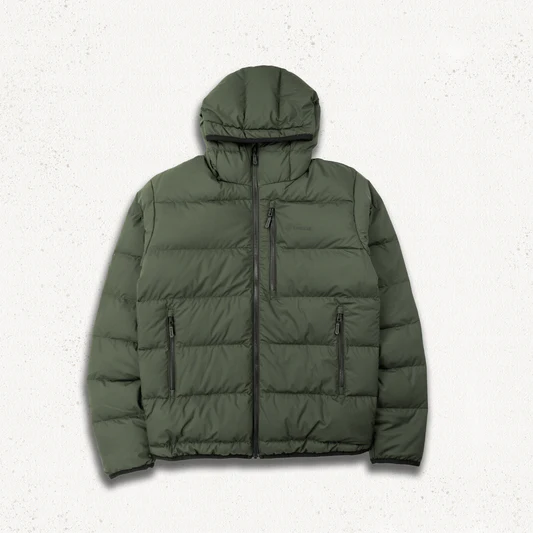
Clothing
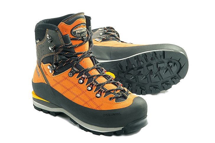
Footwear
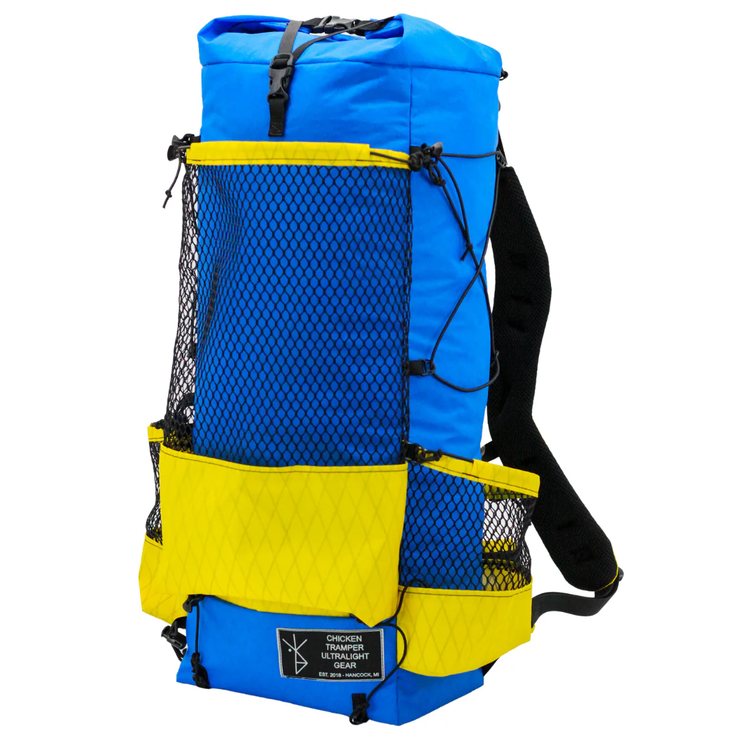
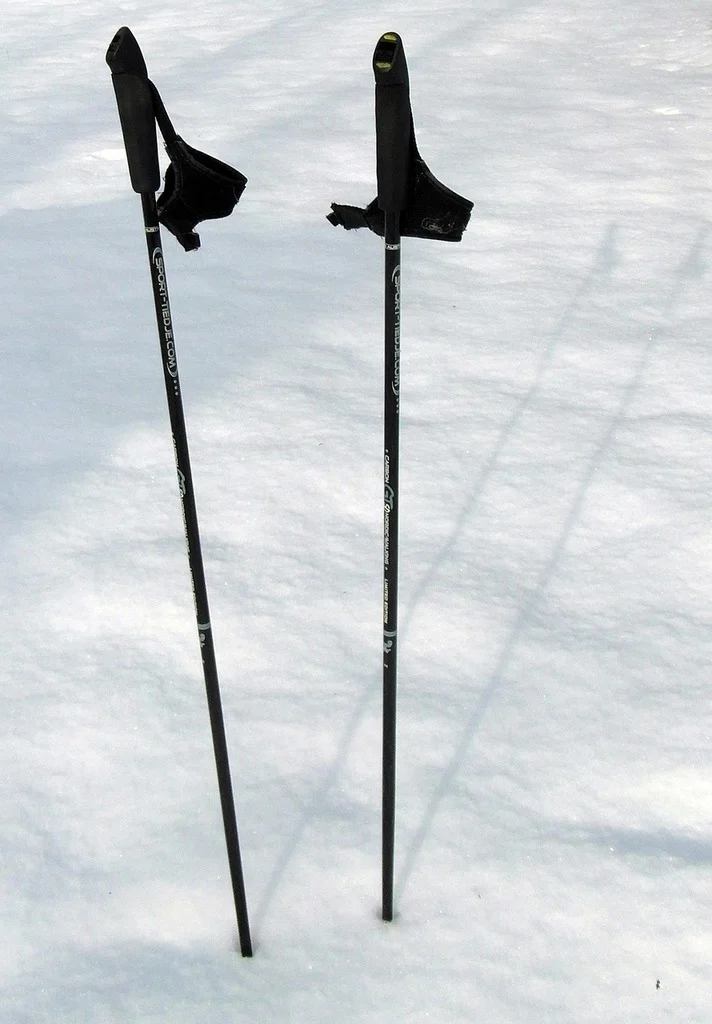
Equipment
Health & Hygiene
Documents & Finance
Leave Behind
How To Reach
The Rupin Pass Trek starts from Jiskun village in Himachal Pradesh. Shimla is the main transit hub. The journey to base camp happens in two stages.
Reach Shimla
By Air: The best-connected airport is Chandigarh International Airport (IXC), 113 km from Shimla. From Chandigarh, take a taxi or HRTC bus to Shimla (3–4 hours). Flying into Delhi (IGI) is also a common option – take an overnight Volvo bus directly to Shimla (350 km, 9–10 hours), or train to Kalka and then the Kalka–Shimla Toy Train.
By Train Kalka Railway Station (KLK) is the nearest mainline rail head, well-connected to Delhi via Kalka Mail and Himalayan Queen. From Kalka, taxi to Shimla (1.5 hours) or the UNESCO-listed Kalka–Shimla Toy Train (5 hours — scenic, worth doing once).
By Road: Direct HRTC and private Volvo buses connect Shimla to Delhi (350 km), Chandigarh (115 km), and Dehradun (230 km).
Shimla to Jiskun (Trek Base)
- Jiskun Distance: Jiskun is approximately 190 km from Shimla via Rohru and the Chainsheel Pass road.
- Route: Shimla → Rampur → Rohru → Chainsheel Pass Road → Jiskun
- Drive Time: 8–10 hours
- Vehicle: Private taxi / shared jeep / operator-arranged vehicle
- Last ATM: Rohru — withdraw sufficient cash for the full 7 days along with additional buffer amount.
- Last Reliable Network: Rohru — BSNL may work intermittently beyond this point, but connectivity should not be relied upon.
- Road Conditions: The road beyond Rohru becomes narrow and mountainous, making the drive slower but manageable. Carry sufficient snacks and drinking water during the journey. The scenery near and beyond Chainsheel Pass is exceptionally beautiful and highly scenic.
Policy
| Policy Point | Details |
|---|---|
| Booking Confirmation | Your seat is considered confirmed only after the required advance payment is received. |
| Balance Payment | The remaining amount must be cleared before departure or as per the reporting instructions shared by the team. |
| Transport Selection | Pickup from Dehradun is applicable only if that option is selected at the time of booking. |
| ID Requirement | Every participant should carry a valid government photo ID for verification and trek administration. |
| Operational Changes | In case of weather, road, or safety concerns, the itinerary may be adjusted for the well-being of the group. |
| Cancellation Window | Charge / Refund |
|---|---|
| More than 30 days before departure | Minimal processing deduction may apply; remaining amount can be refunded or adjusted as per booking terms. |
| 15 to 30 days before departure | Partial cancellation charge applicable; remaining balance may be refunded or transferred to a future batch if approved. |
| 7 to 14 days before departure | Higher cancellation charge applies because transport, permits, and staffing arrangements are usually already blocked. |
| Less than 7 days before departure | Booking is generally non-refundable due to final operational commitments. |
| No show / Trek departure missed | No refund is usually applicable once reporting is missed without prior written coordination. |
FAQ's
Rental gear for this trek