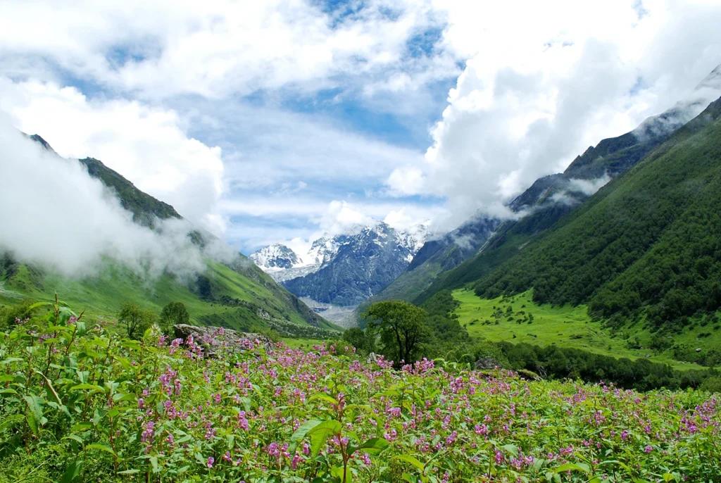
Valley of Flowers Trek in September: Is It Still Worth Visiting?
If you are planning the Valley of Flowers Trek in September, one question probably comes to mind: Will there still be enough flowers to make the trip worthwhile?
The short answer is yes—September can still be an excellent time to visit the Valley of Flowers, especially for trekkers who value greener landscapes, clearer mountain views, fewer crowds and a more peaceful Himalayan experience.
But September is different from July and August.
The peak monsoon months usually offer the most intense floral display, while September marks a transition. Some flowers begin to disappear, others continue blooming, the rains generally start easing, and the surrounding mountains can become much more visible.
Official Uttarakhand Tourism information says flowers are best viewed between May and October, with maximum abundance from July to September. Its Ghangaria information specifically notes that thousands of flowers bloom during August and September.
So, is the Valley of Flowers Trek in September worth doing?
Absolutely—but you should know what to expect.
Why Visit the Valley of Flowers Trek in September?
The Valley of Flowers National Park is located in Chamoli district, Uttarakhand, at an altitude of around 3,600 metres. Spread across approximately 87 sq km, it is part of the Nanda Devi Biosphere Reserve and a UNESCO World Heritage Site.
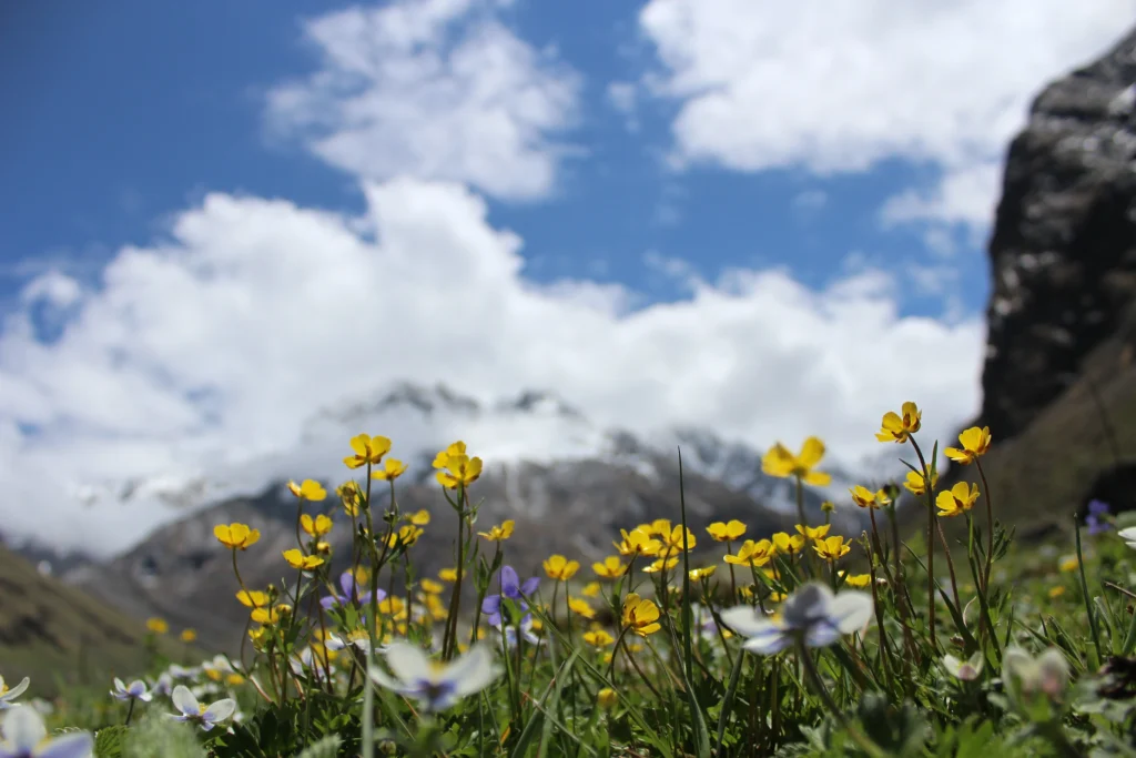
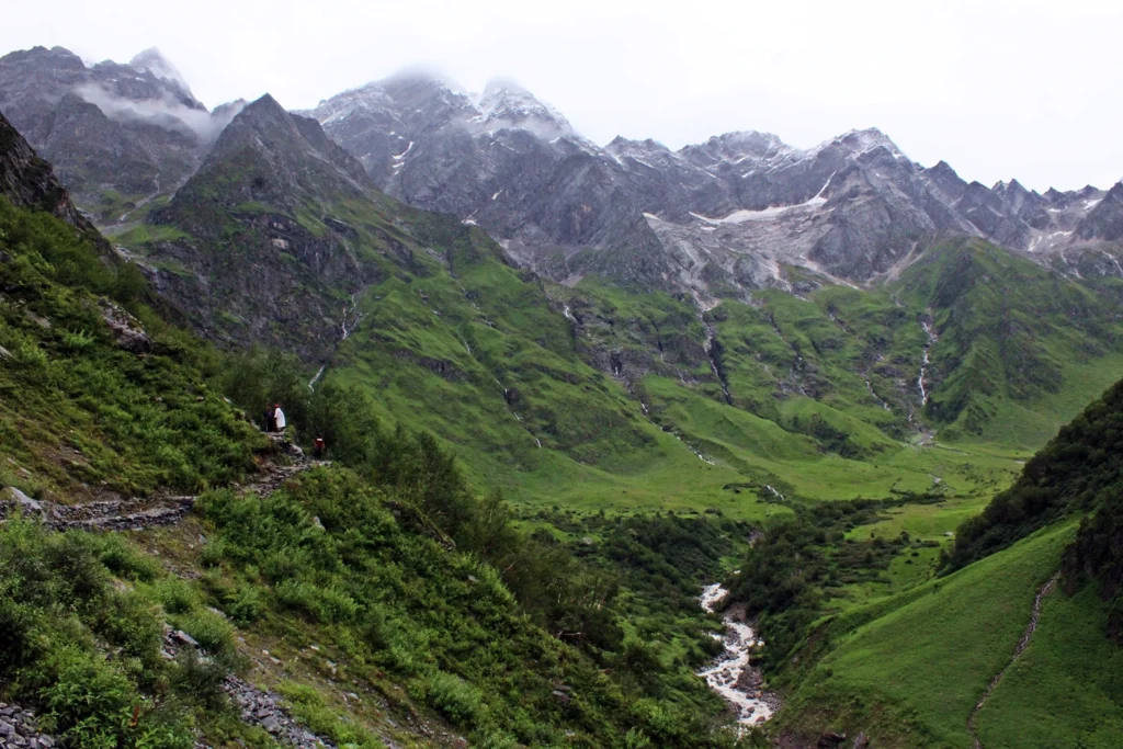
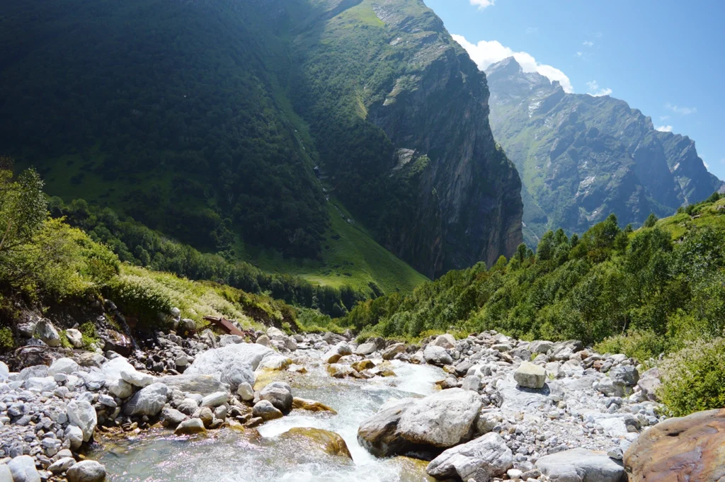
The landscape contains alpine meadows, waterfalls, streams and hundreds of species of flowering plants.
July and August are famous for peak monsoon greenery and blooms, but September offers something different.
You can experience:
Late-season Himalayan flowers
Lush green landscapes
Reduced monsoon intensity
Better chances of clear mountain views
Cooler trekking conditions
Fewer visitors compared with peak periods
Excellent landscape photography
In fact, Uttarakhand Tourism describes late August to early September as a “golden period” for the trek because rainfall is less intense while the landscape remains vibrant.
What Does the Valley of Flowers Look Like in September?
Do not expect September to look exactly like peak July or August.
By September, the valley gradually begins changing from its peak monsoon appearance toward autumn.
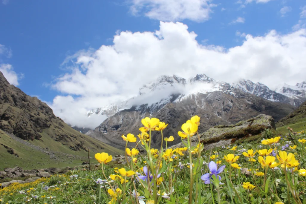
Early September can still be exceptionally green, with numerous flowering species visible across the valley. As the month progresses, some blooms begin to fade and the landscape starts developing more autumnal shades.
The advantage is visibility.
During heavy monsoon periods, clouds can hide the surrounding mountains. As rainfall gradually reduces, September can provide better opportunities to see the dramatic Himalayan landscape surrounding the valley.
For photographers, this combination can be particularly rewarding.
Instead of photographing only close-up flowers, you can capture:
flowers + green valley + waterfalls + streams + Himalayan mountains.
Early September vs Late September: Which Is Better?
If flowers are your main priority, early September is generally the safer choice.
Early September
You are more likely to find:
More surviving flowers
Rich greenery
Active streams and waterfalls
A stronger monsoon character
Greater floral variety
However, occasional rainfall and cloudy weather are still possible.
Mid-September
Mid-September offers a balance between flowers and improving weather.
You may encounter fewer blooms than in August, but clearer skies and cooler conditions can compensate.
Late September
By late September, the floral display can be significantly reduced.
However, the valley can still be spectacular for trekkers interested in landscapes, solitude and Himalayan scenery rather than maximum flower density.
Therefore, if your primary purpose is seeing flowers, target late August to early or mid-September rather than waiting until the end of the month.
The trekking season begins around early summer, with snowmelt and fresh greenery gradually transforming the landscape.
July
Monsoon moisture triggers extensive flowering. The valley becomes intensely green, although rain can affect trekking conditions and mountain visibility.
August
August is one of the classic periods for colourful flowers and dense vegetation.
September
September provides one of the most balanced experiences—flowers can still be present, especially earlier in the month, while rainfall generally begins decreasing.
October
The landscape becomes more autumnal and the flowering season largely winds down as temperatures fall.
Official Uttarakhand Tourism currently describes July to September as the prime flowering period and states that the reserve is generally accessible from May to October.
For travellers primarily interested in photography and a mixture of flowers and clearer mountain scenery, early September is one of the most attractive windows.
Valley of Flowers Trek Opening Date
The Valley of Flowers trek opening date normally falls around the beginning of June, while access continues into autumn, subject to official forest regulations and weather.
However, opening and closing dates can be formally announced for each season.
Therefore, travellers should verify the current year’s official forest and tourism notification before finalising transport or accommodation.
This is particularly important because heavy snowfall, landslides, trail conditions or administrative decisions can affect access.
Do not rely exclusively on an old blog when checking the Valley of Flowers trek opening date.
Valley of Flowers Trek KM: How Long Is the Trek?
There is considerable confusion online regarding the Valley of Flowers trek km because different websites calculate the distance differently.
The traditional journey can broadly be understood as:
Govindghat → Pulna → Ghangaria → Valley of Flowers → Ghangaria → Pulna/Govindghat
Road access toward Pulna has changed how some operators calculate the walking distance.
Official Uttarakhand Tourism’s published itinerary describes Govindghat to Ghangaria as approximately 15 km and Ghangaria to the Valley of Flowers as approximately 4 km one way.
The actual walking distance will therefore depend on your roadhead, how far you explore inside the valley and whether your itinerary also includes Hemkund Sahib.
When comparing packages, always ask whether the advertised Valley of Flowers trek km represents:
One-way trekking distance
Round-trip trekking distance
Only Ghangaria to the valley
The complete itinerary including Hemkund Sahib
This will give you a much more accurate comparison.
Valley of Flowers Trek Time
The Valley of Flowers trek time should be considered in two ways: the number of days required for the complete trip and the number of hours walked each day.
Most organised itineraries take approximately 5–7 days, depending on the starting city and whether Hemkund Sahib is included.
For the actual Valley of Flowers day, trekkers usually start early from Ghangaria, trek approximately 4 km to reach the valley, explore it and return to Ghangaria the same day. Uttarakhand Tourism also recommends an early start for this section.
Your walking time will vary according to:
Fitness
Trail conditions
Weather
Photography stops
How far you explore inside the valley
Group pace
Starting early is particularly important because overnight stays inside Valley of Flowers National Park are not part of the normal visitor experience; Ghangaria functions as the primary base.
Valley of Flowers Trek Map and Route
A simple Valley of Flowers trek map can be understood as:
Rishikesh/Dehradun → Joshimath → Govindghat → Pulna → Ghangaria → Valley of Flowers
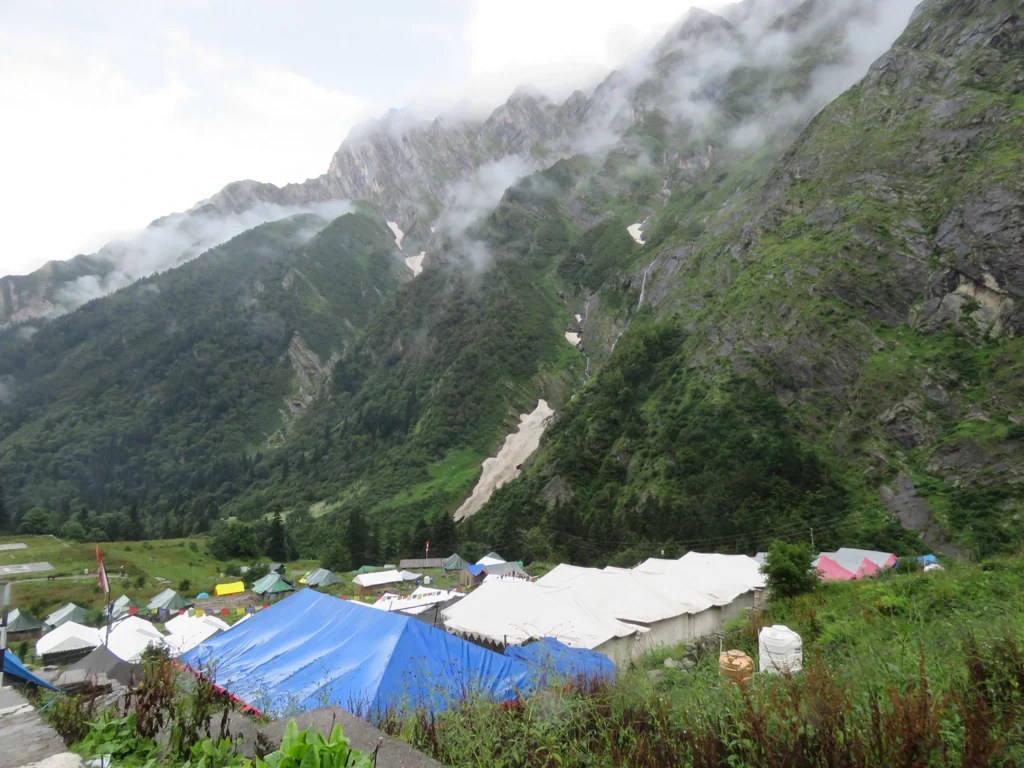
Ghangaria is the key base settlement.
From Ghangaria, two major trails separate:
Route 1: Ghangaria → Valley of Flowers
Route 2: Ghangaria → Hemkund Sahib
This makes Ghangaria strategically important for trekkers planning to experience both destinations.
The official Uttarakhand Tourism itinerary likewise uses Govindghat and Ghangaria as the principal approach to Valley of Flowers.
Begin the long mountain drive toward Joshimath and Govindghat.
The route follows the Alaknanda Valley and passes several important Himalayan towns and river confluences.
Overnight near Govindghat.
Day 2: Govindghat/Pulna to Ghangaria
Drive to the available roadhead and begin trekking toward Ghangaria.
The trail follows a beautiful mountain valley with rivers, waterfalls, forests and settlements along the way.
Ghangaria becomes your base for the next part of the journey.
Day 3: Ghangaria to Valley of Flowers and Back
This is the highlight of the Valley of Flowers Trek.
Start early and enter the national park.
The trail gradually reveals waterfalls, alpine vegetation, colourful flowers and the enormous glacial valley.
Spend adequate time exploring and photographing the landscape before returning to Ghangaria.
Day 4: Ghangaria to Hemkund Sahib and Back
Trekkers can optionally include Hemkund Sahib.
The climb is significantly steeper and reaches a much higher altitude than the Valley of Flowers trail.
After visiting Hemkund Sahib, descend to Ghangaria.
Day 5: Ghangaria to Pulna/Govindghat
Retrace the trail downhill and return toward Govindghat.
Depending on your schedule, continue toward Joshimath or stay nearby.
Day 6: Govindghat/Joshimath to Rishikesh
Drive back through the Alaknanda Valley and complete your Himalayan journey.
This itinerary can be modified according to transportation, accommodation, acclimatisation and current road conditions.
Valley of Flowers Trek Cost
The Valley of Flowers trek cost varies substantially between independent travel and organised packages.
Official Uttarakhand Tourism currently displays an example 6-night/7-day itinerary with an indicative budget of around ₹12,000 per person excluding airfare, but this should be treated as a reference itinerary rather than a universal market price.
Actual costs depend on:
Starting point
Transportation
Hotel category
Number of days
Meals
Guide services
Entry permits
Group size
Hemkund Sahib inclusion
Porter or mule services
Personal expenses
A cheaper package is not necessarily better.
Before booking, check exactly what the quoted Valley of Flowers trek cost includes.
What Flowers Can You See in September?
Valley of Flowers supports remarkable botanical diversity.
Uttarakhand Tourism notes that more than 600 species occur in the region and mentions orchids, poppies, primulas, marigolds, daisies and anemones among its notable flowers.
Exactly what you see in September varies because flowering depends on:
Seasonal rainfall
Temperature
Snowmelt
Elevation
Location within the valley
Timing within the month
This is an important point.
The Valley of Flowers is a natural ecosystem, not a maintained flower garden. No operator can guarantee that a specific flower will be blooming on a particular date.
That unpredictability is part of the experience.
Is September Good for Photography?
Yes. In some respects, September can be better than peak monsoon.
During July and August, intense clouds and rainfall can sometimes obscure the surrounding mountains.
Photographers may also benefit from fewer people on certain dates.
Carry weather protection for your camera because rain can still occur.
How Difficult Is the Valley of Flowers Trek?
The Valley of Flowers Trek is generally considered a moderate Himalayan trek.
It does not require technical mountaineering skills, but trekkers should still prepare physically.
Challenges include:
Long walking days
Continuous ascents and descents
Rain and slippery trails
High altitude
Changing weather
Steeper terrain if Hemkund Sahib is included
Uttarakhand Tourism describes its Valley of Flowers itinerary as moderate to challenging.
Beginners can undertake the trek with suitable fitness preparation and sensible acclimatisation.
September Weather in Valley of Flowers
September is a transition month.
Early September can retain monsoon conditions, while later September generally becomes cooler and drier.
You should still prepare for:
Sudden rain
Cloud cover
Cold mornings
Cool evenings
Wet trails
Rapid weather changes
A bright morning can become cloudy surprisingly quickly in the Himalayas.
Therefore, waterproof protection remains essential even if the weather forecast looks favourable.
What to Pack for Valley of Flowers in September
Your packing should focus on both rain protection and cold-weather layering.
Important items include:
Waterproof trekking shoes
Rain jacket or poncho
Backpack with rain cover
Quick-dry trekking trousers
Thermal or warm base layer
Fleece
Lightweight insulated jacket
Trekking pole
Sun cap
Sunglasses
Sunscreen
Water bottle
Personal medication
Small first-aid kit
Headlamp
Extra socks
Waterproof protection for electronics
Avoid carrying unnecessary weight.
September weather can change quickly, so a proper layering system is more useful than relying on one heavy jacket.
Is Valley of Flowers Trek in September Worth It?
Yes, particularly during early September.
If your only objective is seeing the maximum possible density of flowers, July and August may have an advantage.
But if you want a more balanced Himalayan trekking experience, September can be exceptional.
You can still experience flowers while potentially benefiting from decreasing rainfall, cooler temperatures, improving visibility and beautiful mountain landscapes.
Uttarakhand Tourism itself highlights late August to early September as an excellent period for the trek.
So don’t think of September as simply being “too late.”
Think of it as experiencing the Valley of Flowers in transition.
Important FAQs About Valley of Flowers Trek
1. Is September a good time for the Valley of Flowers Trek?
Yes. September remains a good time for the Valley of Flowers Trek, particularly during the first half of the month. Flowers are still visible while rainfall may gradually reduce and mountain visibility can improve.
2. Are there still flowers in Valley of Flowers in September?
Yes. Uttarakhand Tourism specifically notes flowering during August and September, although the density and variety naturally vary throughout the season.
3. What is the Valley of Flowers trek best time?
The Valley of Flowers trek best time for maximum flowering is generally July through August into early September. September is particularly attractive for trekkers seeking a combination of flowers and potentially improving weather.
4. What is the Valley of Flowers trek opening date?
The Valley of Flowers trek opening date generally falls around the beginning of June. Exact seasonal opening and closing dates should always be checked against current official notifications before travel.
5. How many km is the Valley of Flowers Trek?
The answer to Valley of Flowers trek km depends on where the distance is measured from. Official Uttarakhand Tourism describes Govindghat to Ghangaria as approximately 15 km and Ghangaria to Valley of Flowers as approximately 4 km.
6. What is the Valley of Flowers trek time?
Most complete itineraries require approximately 5–7 days depending on the starting point and whether Hemkund Sahib is included. The Valley itself is normally explored as a day trek from Ghangaria.
7. What is the standard Valley of Flowers trek itinerary?
A common Valley of Flowers trek itinerary follows:
Rishikesh/Dehradun → Joshimath/Govindghat → Pulna → Ghangaria → Valley of Flowers → Hemkund Sahib → Ghangaria → Govindghat → Rishikesh.
Hemkund Sahib can be omitted if required.
8. What is the Valley of Flowers trek cost?
The Valley of Flowers trek cost depends on transportation, accommodation, meals, guides, permits and trip duration. Uttarakhand Tourism currently lists an example 6-night/7-day itinerary at approximately ₹12,000 per person excluding airfare, but current commercial package prices can differ.
9. Is the Valley of Flowers Trek suitable for beginners?
Yes, reasonably fit beginners can undertake it. Regular walking, stair climbing and basic cardiovascular preparation before the trek are recommended.
10. Do I need a guide for the Valley of Flowers Trek?
The route is well established, but travelling with an experienced local guide can help with logistics, weather decisions, local information and understanding the flora.
11. Can we stay overnight inside the Valley of Flowers?
Visitors normally return to Ghangaria after exploring the Valley of Flowers. Ghangaria serves as the primary accommodation base for the trek.
12. What does the Valley of Flowers trek map look like?
The basic Valley of Flowers trek map follows:
Govindghat → Pulna → Ghangaria → Valley of Flowers
Ghangaria also connects to the separate trail leading to Hemkund Sahib.
13. Is Hemkund Sahib included in the Valley of Flowers Trek?
Many organised itineraries include Hemkund Sahib because both trails use Ghangaria as their base. However, Hemkund Sahib is a separate, higher and steeper trek and is not mandatory for visiting the Valley of Flowers.
14. Is September better than August for Valley of Flowers?
It depends on your priority. August usually offers denser flowering and greener monsoon landscapes, while September can offer a better balance of remaining flowers, cooler conditions and potentially clearer mountain views.
15. Is late September too late for Valley of Flowers?
Not necessarily, but visitors primarily interested in flowers should prefer early September. By late September, the number of blooms can decline considerably as autumn approaches.
Final Verdict: Should You Do the Valley of Flowers Trek in September?
The Valley of Flowers Trek in September is definitely still worth visiting, provided you arrive with the right expectations.
September is not simply an inferior version of July or August.
It offers a different Himalayan experience.
The valley is transitioning toward autumn. Flowers can still decorate its meadows, particularly earlier in the month, while the weakening monsoon can create better opportunities for mountain views.
For trekkers who want to experience flowers, waterfalls, alpine landscapes, photography and Himalayan scenery in one journey, early September can be one of the most rewarding periods of the entire season.
If your schedule allows, target the first half of September for the strongest balance between floral beauty and improving weather.
Before booking, verify the current Valley of Flowers trek opening date, understand the actual Valley of Flowers trek km, compare the complete Valley of Flowers trek cost, study the Valley of Flowers trek map, and choose a Valley of Flowers trek itinerary that allows enough time to enjoy the valley rather than rushing through it.
The flowers may be the reason you come—but in September, the entire Himalayan landscape may become the reason you remember the trek.
Why Is Roopkund Called Skeleton Lake? History, Science & Mysteries Explained
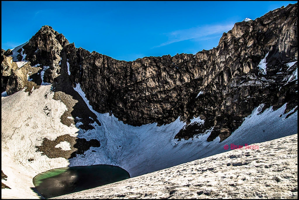
High in the Garhwal Himalayas of Uttarakhand lies a small glacial lake with a story unlike almost any other trekking destination in India. Roopkund is surrounded by towering mountains, alpine meadows and dramatic Himalayan landscapes, but its worldwide fame comes from something far more mysterious: hundreds of human skeletal remains found in and around the lake.
This is why Roopkund is popularly known as Skeleton Lake.
For decades, researchers, historians and local communities have tried to understand the Roopkund trek skeletons. Were they soldiers? Pilgrims? Victims of a violent Himalayan storm? And perhaps most intriguingly, why did people from apparently different parts of the world die at this remote Himalayan lake?
Modern DNA research has answered some questions—but it has also made the mystery considerably more interesting.
For trekkers researching the Roopkund trek 2026, understanding this history adds an entirely different dimension to a trail already famous for Ali Bugyal, Bedni Bugyal, Mt. Trishul and Nanda Ghunti.
Where Is Roopkund Skeleton Lake?
Roopkund is a high-altitude glacial lake located in the Chamoli district of Uttarakhand, within the Garhwal Himalayas. It lies at roughly 5,000 metres above sea level, depending on the exact elevation reference used.
The lake itself is relatively small. For much of the year, snow and ice dominate the landscape. Historically, when the snow melted, human bones and skulls could be seen around the lake and its surrounding slopes.
Scientific literature describes the site as containing the scattered remains of several hundred individuals.
That extraordinary concentration of human remains gave Roopkund its famous nickname—Skeleton Lake.
Why Is Roopkund Called Skeleton Lake?
The answer is straightforward, but the story behind it is not.
Roopkund is called Skeleton Lake because hundreds of ancient human skeletal remains have been discovered around the lake. The bones include skulls and other skeletal elements belonging to both men and women.
For many years, it was assumed that virtually everyone at Roopkund had died during one catastrophic event.
Modern research has challenged that assumption.
A major 2019 study published in Nature Communications analysed genome-wide ancient DNA from 38 individuals found at Roopkund. Researchers discovered that the individuals belonged to three genetically distinct groups and that their deaths occurred during different periods.
This means Skeleton Lake was probably not created by one single disaster.
And that is where the real Roopkund mystery begins.
When Were the Roopkund Skeletons Discovered?
The skeletal remains became widely known after they were reported in 1942 by a British forest guard.
The discovery immediately generated speculation.
This was during World War II, and one early concern was that the bodies might have belonged to soldiers. But it eventually became clear that many of the remains were far older.
The unusual preservation of bones in the cold, high-altitude environment helped turn Roopkund into one of India’s most fascinating archaeological mysteries.
Over subsequent decades, different explanations emerged concerning who these people were and why they died.
The Biggest Theories Behind the Roopkund Trek Skeletons
Before modern genetic research, several theories attempted to explain the human remains.
Theory 1: A Lost Army
One early hypothesis suggested that the skeletons belonged to soldiers who had attempted to cross the Himalayas.
However, later evidence weakened the military theory.
The 2019 genetic study examined individuals of both sexes—23 genetically male and 15 genetically female among the 38 people for whom genome-wide data were obtained. Researchers noted that this relatively balanced presence of men and women was difficult to reconcile with the theory of a military expedition.
Theory 2: Pilgrims Travelling Through the Himalayas
This remains an important possibility for at least some of the individuals.
Roopkund lies near the route associated with the traditional Nanda Devi Raj Jat, one of Uttarakhand’s most culturally important Himalayan pilgrimages.
Researchers have therefore considered whether some of the earlier individuals may have been pilgrims travelling through the region.
Scientific analysis does not conclusively prove this explanation, but the 2019 study described death during a pilgrimage as a plausible hypothesis for at least some of the South Asian individuals.
Theory 3: A Deadly Hailstorm
Perhaps the most famous explanation for the Roopkund skeletons is a catastrophic hailstorm.
Some skull injuries were historically interpreted as being consistent with heavy objects striking people from above. This led to the dramatic theory that a group travelling near Roopkund was trapped in an extreme Himalayan hailstorm and killed.
Osteological analysis discussed in the scientific research identified several individuals with unhealed compression fractures and considered a violent hailstorm as one possible explanation.
However, researchers also explicitly acknowledged that other scenarios are possible.
Therefore, it is misleading to claim that science has definitively proved that giant hailstones killed everyone at Roopkund.
What DNA Research Revealed About Roopkund Skeletons
This is where the story becomes extraordinary.
The 2019 Nature Communications study used ancient DNA, radiocarbon dating, isotope analysis and osteological evidence to investigate the remains.
Scientists successfully obtained genome-wide data from 38 individuals.
Instead of finding one homogeneous group, they identified three genetically distinct populations.
Group 1: South Asian-Related Individuals
Twenty-three individuals possessed ancestry within the range of present-day South Asian populations.
Their remains dated broadly to approximately the 7th–10th centuries CE.
Interestingly, even these individuals may not all have died simultaneously.
Group 2: Eastern Mediterranean-Related Individuals
Fourteen individuals possessed ancestry characteristic of the eastern Mediterranean.
These remains were dramatically younger, dating broadly to the 17th–20th centuries CE.
Genetic analysis found that this group showed particular affinity with present-day people from Crete, although the researchers specifically cautioned that this does not mean they necessarily came from Crete itself.
Group 3: Southeast Asian-Related Individual
Researchers also identified one individual with Southeast Asian-related ancestry.
This individual belonged to the later chronological period.
The 1,000-Year Mystery of Skeleton Lake
Perhaps the most important discovery was not simply where these people came from.
It was when they died.
Radiocarbon dating showed that the remains were deposited during events separated by roughly 1,000 years.
That completely changed the traditional interpretation of Skeleton Lake.
Instead of:
One group → One disaster → Hundreds of deaths
the evidence points toward:
Different groups → Different periods → Multiple events
This means there may never be one universal explanation for all the Roopkund skeletons.
A hailstorm, pilgrimage accident or other catastrophe might potentially explain one group without explaining another.
Why Were Mediterranean People at Roopkund?
This remains one of the greatest unanswered questions.
The later group contained unrelated men and women whose genetic ancestry pointed toward the eastern Mediterranean.
But why would such travellers have reached an isolated Himalayan location hundreds of years ago?
Researchers could not establish a definitive answer.
They considered that the individuals or their recent ancestors likely originated in the eastern Mediterranean region. Their isotope signatures also suggested dietary differences from the South Asian group.
But their purpose for travelling to Roopkund remains unknown.
Were they explorers?
Travellers?
Pilgrims?
Part of an undocumented expedition?
No conclusive historical record has yet provided the complete answer.
This unresolved question is one reason why Roopkund continues to deserve the title of one of India’s greatest Himalayan mysteries.
What Makes the Roopkund Trek Special Beyond Skeleton Lake?
Although Skeleton Lake made Roopkund internationally famous, the trek itself became legendary because of its extraordinary Himalayan terrain.
The classic route is associated with landscapes such as:
Lohajung
Didina
Ali Bugyal
Bedni Bugyal
Patar Nachauni
Bhagwabasa
Roopkund
Among these, Ali Bugyal and Bedni Bugyal are especially famous for their vast high-altitude grasslands.
Trekkers also encounter magnificent views of Himalayan giants such as Mt. Trishul and Nanda Ghunti.
The combination of alpine meadows, high-altitude terrain, local mythology, archaeology and the mysterious lake made the Roopkund Trek one of the most recognised trekking routes in India.
Roopkund Trek Distance
The exact Roopkund trek Distance varies according to the route, campsite configuration and starting/ending point used by an operator.
For the traditional trekking route, travellers should expect several days of hiking through progressively higher Himalayan terrain rather than treating Roopkund as a short lake excursion.
When comparing a Roopkund trek package, always check whether the stated distance represents:
trekking distance only,
road plus trekking distance,
one-way distance, or
the complete walking itinerary.
This prevents misleading comparisons between different packages.
Roopkund Trek Difficulty Level
The Roopkund trek difficulty level has traditionally been considered moderate-to-difficult or difficult, depending on itinerary and conditions.
The major challenges include:
High altitude: Roopkund lies at approximately 5,000 metres, where oxygen availability is considerably lower than at lower elevations.
Long trekking days: The route involves sustained walking through changing Himalayan terrain.
Steep sections: Higher sections can involve demanding ascents and descents.
Weather: Conditions in the Himalayas can change rapidly.
Cold: Temperatures at higher camps and around the lake can become severe.
Acclimatisation: Ascending too quickly significantly increases altitude-related risk.
The historical popularity of Roopkund should therefore never be confused with it being an easy beginner trek.
Roopkund Trek Best Time
Historically, the Roopkund Trek best time was generally associated with two trekking windows:
May to June for late-spring and early-summer conditions, and September to October for clearer post-monsoon mountain views.
However, current regulations and permitted access are more important than seasonal preference.
Anyone researching a Roopkund trek 2026 should verify the latest official forest, tourism and local administrative rules before planning the traditional route.
Why Roopkund Trek Is Banned – What Actually Happened?
The issue is closely connected to environmental protection of Uttarakhand’s fragile high-altitude meadows, locally called bugyals.
The traditional Roopkund trail depends heavily on areas such as Ali Bugyal and Bedni Bugyal. Restrictions affecting camping and tourism activity in sensitive alpine meadows therefore had a major impact on commercial operation of the classic trek.
As a result, the traditional Roopkund itinerary became inaccessible or operationally impractical for regular trekking groups.
It is better to describe this as a consequence of environmental restrictions and access regulations rather than simply assuming that Skeleton Lake itself was permanently “banned.”
For Roopkund trek, travellers should rely on the latest official notifications rather than old blogs or trekking itineraries because access rules can change.
Roopkund Trek 2026: What Trekkers Should Check
If you are considering Roopkund in 2026, do not book solely because an operator advertises the trek online.
Before paying for a Roopkund trek package, confirm:
Whether the proposed route is currently legally permitted
Forest permissions required
Current camping restrictions
Permitted campsites
Group-size regulations
Whether access to Roopkund Lake itself is allowed
Guide requirements
Waste-management regulations
Exact itinerary being offered
Cancellation terms if permits are refused
This is particularly important because older Roopkund itineraries available online may reflect regulations from before restrictions were introduced.
Roopkund Trek Package: What Should It Include?
A professionally organised Roopkund trek package, whenever the route is officially permitted, should clearly state what is and is not included.
Typical components may include accommodation, trekking meals, trained trek leaders, local guides, camping equipment where camping is legally permitted, forest permissions, safety equipment and logistical support.
The package should also clearly explain transportation arrangements and any additional charges.
More importantly, the operator should be transparent about the current legal status of the route.
Avoid packages that promise access to restricted areas without explaining permits or regulations.
Roopkund Trek Cost
The Roopkund trek cost cannot be treated as one permanent figure.
Pricing depends on factors such as:
Trek duration
Transportation
Group size
Accommodation
Guide-to-trekker ratio
Permits
Equipment
Meals
Safety arrangements
Route modifications
Current government regulations
Therefore, comparing packages only by the lowest advertised price can be misleading.
For the Roopkund trek 2026, legality, safety standards and the actual permitted itinerary should be checked before comparing prices.
History, Folklore and Science: Which Story Is Correct?
This is what makes Roopkund fascinating: there may not be one single story.
Local folklore connects the region with Nanda Devi and pilgrimage traditions.
Historical theories proposed armies, traders and travellers.
Physical anthropology raised the possibility of violent weather.
Modern genetics demonstrated that the people represented different ancestral groups and different periods.
Science has therefore solved part of the mystery while simultaneously making the overall story more complex.
What can now be stated with confidence is that the hundreds of Roopkund remains should not automatically be interpreted as victims of one single disaster.
The scientific evidence indicates multiple episodes of death separated by centuries.
Why Roopkund Skeleton Lake Still Fascinates the World
There are hundreds of beautiful glacial lakes in the Himalayas.
There is only one Roopkund.
Imagine reaching an isolated lake more than 5,000 metres above sea level and discovering hundreds of human remains.
Then imagine learning that some individuals died more than a millennium ago while others arrived many centuries later—and that one group apparently had ancestry associated with a region thousands of kilometres away.
That combination of geography, archaeology, genetics, folklore and unanswered questions makes Roopkund much more than a trekking destination.
It is a historical puzzle preserved in the Himalayas.
Conclusion
Why is Roopkund called Skeleton Lake? The immediate answer is simple: hundreds of human skeletal remains were discovered around its frozen waters.
But explaining how those remains arrived there is far more complicated.
Modern science has established that the Roopkund trek skeletons represent people from different genetic backgrounds and, crucially, different periods of history. Some possessed South Asian-related ancestry and died more than a thousand years ago. Others with eastern Mediterranean-related ancestry arrived centuries later.
The old idea of one group being wiped out in one mysterious Himalayan disaster can no longer explain the entire site.
That is what makes Roopkund extraordinary.
For trekkers researching the Roopkund trek 2026, Skeleton Lake represents far more than an adventurous Himalayan destination. It is where trekking, archaeology, local folklore and cutting-edge genetic science meet—and where some of the most interesting questions still remain unanswered.
FAQs
1. Why is Roopkund called Skeleton Lake?
Roopkund is called Skeleton Lake because the remains of several hundred humans have been found scattered around the high-altitude glacial lake.
2. How old are the Roopkund trek skeletons?
There is no single age for all the skeletons. Scientific dating indicates that some individuals date to approximately the 7th–10th centuries CE, while another group dates to roughly the 17th–20th centuries CE.
3. Who were the people found at Roopkund Lake?
DNA analysis of 38 individuals identified 23 with South Asian-related ancestry, 14 with eastern Mediterranean-related ancestry and one with Southeast Asian-related ancestry.
4. Did everyone at Roopkund die in one incident?
No. Modern radiocarbon dating shows that the remains were deposited during multiple events, with major groups separated by roughly 1,000 years.
5. Were the Roopkund skeletons killed by a hailstorm?
A violent hailstorm is one proposed explanation, and injuries observed on some remains have been discussed in relation to this possibility. However, scientific research does not establish a hailstorm as the definitive cause of death for all the people found at Roopkund.
6. Why Roopkund trek is banned?
The traditional route was heavily affected by environmental restrictions concerning camping and tourism activity in Uttarakhand’s fragile alpine meadows or bugyals. Because the classic trail depends on these areas, regular commercial trekking to Roopkund became severely restricted.
7. Is Roopkund Trek open in 2026?
The status of the Roopkund trek 2026 should be verified against current official government and forest-department permissions before booking. Trekkers should not assume that an online package automatically means the complete traditional route is legally accessible.
8. What is the Roopkund Trek difficulty level?
The Roopkund trek difficulty level is generally considered moderate-to-difficult to difficult because of its altitude, sustained trekking, cold conditions, steep sections and need for proper acclimatisation.
9. What is the Roopkund Trek best time?
Historically, May–June and September–October have been popular seasonal windows. However, the Roopkund Trek best time now also depends on whether the route is officially permitted during the intended travel period.
10. What is the Roopkund trek Distance?
The Roopkund trek Distance varies according to the route and itinerary followed. Travellers should check whether a package’s stated distance represents the entire trekking route or only a particular section.
11. How much does the Roopkund trek cost?
The Roopkund trek cost varies according to duration, transportation, permits, accommodation, meals, guides, group size and logistical arrangements. For 2026, travellers should prioritise legal access and safety over simply selecting the cheapest package.
12. What should a Roopkund trek package include?
A reliable Roopkund trek package should transparently mention the permitted itinerary, accommodation, meals, guides, transport arrangements, required permits, safety support, inclusions, exclusions and cancellation conditions.
13. Why are the Roopkund skeletons scientifically important?
The Roopkund trek skeletons are scientifically significant because DNA and radiocarbon research revealed individuals with different ancestries who died during different historical periods. The discovery challenges the older idea that everyone at Roopkund died during one catastrophic event.
14. Were foreigners really found among the Roopkund skeletons?
Genetic research identified 14 individuals with ancestry typical of the eastern Mediterranean. Researchers found genetic affinity with present-day people from Crete, but explicitly cautioned that this does not prove the individuals themselves came specifically from Crete.
15. Why did people from the Mediterranean travel to Roopkund?
Nobody knows for certain. The purpose of their journey to this remote part of the Himalayas remains one of the biggest unanswered questions surrounding Skeleton Lake.
Brahmatal Lake in Winter: What Does the Frozen Lake Really Look Like?
Imagine walking through a quiet Himalayan forest where snow covers the trail, branches carry a thin layer of frost, and every step takes you deeper into a white winter landscape. After hours of trekking, you finally reach one of the highlights of the Brahmatal Trek—Brahmatal Lake.
In winter, the surroundings of Brahmatal can transform dramatically. Snow-covered slopes, frozen ground, cold winds and the possibility of a frozen or partially frozen lake create an experience completely different from trekking here during warmer months.
But does Brahmatal Lake actually freeze completely? When can you see snow? What does the lake look like in December, January and February? And is the trek difficult when the trail is covered with snow?
This guide explains what you can realistically expect from Brahmatal Lake in winter, along with the Brahmatal Trek itinerary, distance, difficulty level, best time, duration and package price.
Brahmatal Trek at a Glance
Trek Detail
Information
Trek
Brahmatal Trek
Location
Chamoli, Uttarakhand
Base
Lohajung
Duration
6 Days
Main Attractions
Bekaltal, Brahmatal, snow trails, forests and Himalayan views
Season Covered
Winter
Difficulty Level
Moderate
Starting/Ending Point
Rishikesh
Offer Price
₹4,500 per person
The Brahmatal Trek has become particularly popular as a winter trek because trekkers can experience high-altitude landscapes without attempting a technical mountaineering expedition.
Its combination of forests, alpine lakes, snowy trails, open ridges and Himalayan panoramas makes it an attractive choice for people looking for a multi-day winter trek in Uttarakhand.
What Does Brahmatal Lake Look Like in Winter?
The appearance of Brahmatal Lake depends heavily on the weather.
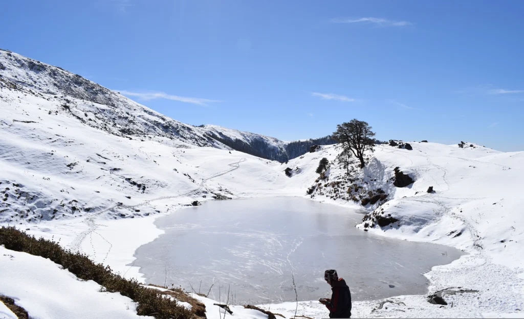
During sufficiently cold periods, the surface can freeze, while snow may accumulate around the lake and across the surrounding slopes.
Instead of expecting a bright blue alpine lake surrounded by greenery, winter trekkers should picture a much quieter landscape.
The lake may appear as a pale frozen surface surrounded by white snow and brown or snow-covered vegetation. During periods of fresh snowfall, the boundary between the lake and surrounding ground can become less obvious from a distance.
On clearer days, blue winter skies create a striking contrast with the white landscape.
But there is an important point every trekker should understand:
A completely frozen Brahmatal Lake cannot be guaranteed for a specific date.
Freezing depends on recent temperatures, snowfall, sunlight and changing mountain weather.
That uncertainty is part of experiencing the Himalayas in winter.
Does Brahmatal Lake Completely Freeze?
It can freeze significantly during periods of sustained sub-zero temperatures, particularly in peak winter.
However, the degree of freezing changes throughout the season.
One week may bring extensive ice and snow, while changing temperatures during another period can alter the surface.
Therefore, photographs and a Brahmatal Trek video from someone else’s trip should be treated as an example of conditions on those particular dates—not a guarantee of what you will encounter.
This is particularly important when choosing winter treks primarily to experience snow.
Mountain weather is dynamic.
Can You Walk on Frozen Brahmatal Lake?
You should not walk onto the frozen lake unless local authorities or qualified trek leaders explicitly determine that access is permitted and safe.
A frozen surface can look solid while sections underneath remain weak.
Ice thickness can vary considerably across the same lake because of sunlight, temperature, water movement and other environmental factors.
The safest way to experience Brahmatal is from the established trail and designated viewing areas.
A photograph is never worth taking an unnecessary risk on uncertain ice.
When Does Brahmatal Lake Freeze?
There is no fixed date on which Brahmatal Lake freezes every year.
Winter conditions usually strengthen as temperatures fall from December into January.
December
December marks the beginning of the main winter experience.
Early December conditions can vary considerably from year to year. As winter progresses, temperatures become colder and snowfall can transform the higher trail.
January
January is generally one of the coldest periods.
When sustained cold conditions occur, trekkers have a stronger possibility of experiencing extensive snow and frozen landscapes.
February
Winter conditions can continue through February, although the amount and condition of snow depend on that year’s weather.
Sunny sections may begin changing faster while shaded areas can retain snow and ice for longer.
March
March represents a transition towards spring.
Snow can remain at higher elevations, but conditions become increasingly variable as temperatures gradually rise.
For trekkers whose primary objective is winter scenery, late December through February is generally the period of greatest interest, although snowfall and lake freezing should never be promised for an exact departure.
Brahmatal Trek Best Time for a Frozen Lake Experience
When people search for the Brahmatal Trek best time, the correct answer depends on the experience they want.
For snow and winter landscapes, the core winter months are the obvious choice.
If your main priorities are:
Snow-covered trails: winter Cold weather: winter Frozen or partially frozen lake conditions: peak cold periods Winter photography: December to February Green landscapes: choose a non-winter season instead
January can be particularly attractive for people seeking deeper winter conditions, but it also means dealing with colder nights and potentially more demanding trail conditions.
There is a trade-off.
More snow can make the landscape spectacular, but it can also make trekking slower and more strenuous.
Brahmatal Trek in December
December is popular among winter trekkers because the landscape begins changing rapidly.
The forests around Lohajung and Bekaltal can provide a beautiful transition towards the higher snow-covered terrain.
Early winter may offer a mixture of dry trail, frost and snow depending on recent weather.
Later in the month, the probability of stronger winter conditions generally increases.
Christmas and New Year departures are consequently popular, but trekkers should book for the overall Brahmatal experience rather than expecting snowfall on a particular day.
Fresh snowfall is a weather event—not a scheduled attraction.
Brahmatal Trek in January
January brings more intense winter conditions.
Cold mornings, freezing nights, snow-covered sections and icy trails can all become part of the experience.
For many trekkers, this is exactly what makes the Brahmatal Trek special.
The forest becomes quieter under snow, the landscape changes almost completely, and clear weather can reveal dramatic Himalayan panoramas.
However, January also demands better preparation.
Proper winter clothing, waterproof trekking shoes, gloves, warm socks, thermals and multiple layers become essential rather than optional.
Brahmatal Trek in February
February can provide a balance between winter scenery and gradually changing seasonal conditions.
Snow may remain across significant parts of the higher trail, particularly after recent snowfall.
At the same time, stronger daytime sunshine can begin altering exposed sections.
The result can be a combination of snow, ice and occasionally muddy patches depending on temperature and altitude.
Trekkers should therefore prepare for mixed terrain rather than assuming every kilometre will be covered with soft snow.
What Is Special About the Brahmatal Trek Beyond the Lake?
It would be a mistake to think that the entire trek revolves around one frozen lake.
Brahmatal offers much more.
Bekaltal
Bekaltal is another important lake encountered during the trek and provides a very different setting surrounded by forest.
Winter Forests
The trail passes through beautiful Himalayan forest sections.
Fresh snow can completely change their appearance, creating some of the trek’s most atmospheric sections.
Open Ridge Walks
As the trail climbs higher, dense forest gives way to more open terrain.
This change provides wider views of the surrounding mountains.
The summit day is one of the biggest experiences of the entire itinerary.
It combines climbing, open mountain terrain and panoramic viewpoints, making Day 4 much more than simply another day of walking.
Brahmatal Trek Itinerary – 6 Days
Our Brahmatal Trek itinerary follows a six-day journey starting and ending in Rishikesh.
Day 1 – Rishikesh to Lohajung
The journey begins from Rishikesh and continues towards Lohajung, the base for the Brahmatal Trek.
It is a long mountain drive through Uttarakhand, so this day is primarily dedicated to reaching the trek base and preparing for the journey ahead.
After reaching Lohajung, rest and prepare your equipment for the next day’s trek.
Day 2 – Lohajung to Bekaltal
The trekking portion begins from Lohajung.
The route gradually enters forested mountain terrain while climbing towards Bekaltal.
During winter, snow and ice conditions depend on recent weather. Forest sections can be particularly beautiful after fresh snowfall.
Bekaltal becomes the major highlight of the day.
After reaching the campsite area, settle in and prepare for colder temperatures as evening approaches.
Day 3 – Bekaltal to Brahmatal
Today the trek continues towards Brahmatal.
As you gain altitude, the landscape gradually changes.
Depending on winter conditions, trekkers may encounter snow-covered sections, frozen ground and icy patches.
Reaching the Brahmatal area is one of the defining moments of the journey.
If temperatures have remained sufficiently low, the lake and surrounding landscape may provide the frozen winter scenery for which the trek is famous.
Day 4 – Brahmatal to Summit and Back – Summit Day
This is the most important and potentially demanding day of the itinerary.
Start early and climb towards the summit viewpoint.
As you move above the forest and onto more exposed terrain, the views become wider.
Snow conditions can make the climb more strenuous than walking the same route on dry ground.
The reward is the expansive Himalayan landscape from the higher viewpoints.
After spending appropriate time at the summit area, descend back towards Brahmatal.
Day 5 – Brahmatal to Lohajung
The descent begins towards Lohajung.
Descending through snow and ice still requires concentration. Slippery sections can sometimes make downhill walking more challenging than expected.
As altitude decreases, the trail gradually returns towards thicker forest and eventually Lohajung.
Spend the final night at Lohajung.
Day 6 – Lohajung to Rishikesh
After breakfast, begin the road journey back to Rishikesh.
The six-day Brahmatal Trek itinerary concludes after reaching Rishikesh.
Brahmatal Trek Distance
The Brahmatal Trek distance varies according to the exact trail, campsites and summit route followed.
Most itineraries involve several days of trekking between Lohajung, Bekaltal, Brahmatal and the higher viewpoint before returning to Lohajung.
When researching the distance, don’t confuse the walking distance with the complete Rishikesh-to-Rishikesh journey.
Road transportation from Rishikesh to Lohajung and back accounts for a substantial portion of the overall travel.
More importantly, distance alone does not determine difficulty.
Walking a relatively short distance through deep snow can require considerably more energy than covering the same distance on a dry trail.
Brahmatal Trek Time – How Many Days Are Required?
Our Brahmatal Trek time is 6 days from Rishikesh to Rishikesh.
The itinerary includes:
Day 1: Rishikesh → Lohajung Day 2: Lohajung → Bekaltal Day 3: Bekaltal → Brahmatal Day 4: Brahmatal → Summit → Brahmatal Day 5: Brahmatal → Lohajung Day 6: Lohajung → Rishikesh
This provides a structured schedule covering transportation as well as the primary trekking route.
Brahmatal Trek Difficulty Level
The Brahmatal Trek difficulty Level is generally considered moderate.
It does not normally require technical mountaineering skills, but winter conditions can substantially increase the physical challenge.
Trekkers should prepare for:
Several hours of walking
Continuous ascents and descents
Snow-covered trails
Slippery or icy sections
Cold nights
Sub-zero conditions at higher camps
Changing weather
Summit-day climbing
Consecutive trekking days
Someone who exercises regularly and prepares before departure can find Brahmatal manageable.
Someone with no physical preparation may find the same trail considerably more demanding.
Is Brahmatal Trek Suitable for Beginners?
Brahmatal is frequently chosen by people attempting their first Himalayan winter trek.
However, beginners should not interpret that as meaning the trek requires no preparation.
A first-time trekker should ideally begin preparing several weeks beforehand.
Useful exercises include:
Brisk walking
Jogging
Stair climbing
Squats
Lunges
Core exercises
Regular stretching
Your objective isn’t to become an athlete.
It is to develop enough cardiovascular endurance and leg strength to comfortably walk for several hours on consecutive days.
Is Trekking Through Snow Difficult?
Snow changes the way you walk.
Soft snow can cause your feet to sink, requiring additional energy with every step.
Hard-packed snow can become slippery.
Frozen sections can become icy.
This is why the same Brahmatal Trek distance can feel substantially more difficult during peak winter than during dry conditions.
Trekking poles can provide additional stability, while proper footwear becomes particularly important.
Always follow your trek leader’s instructions regarding traction equipment and safe movement over snow or ice.
What Should You Pack for Brahmatal Trek in Winter?
Winter packing requires more attention than a typical warm-weather trek.
Clothing
Carry thermal base layers, fleece or insulated mid-layers, a warm jacket, trekking pants and an appropriate weather-resistant outer layer.
Trekking Shoes
Use proper trekking shoes with strong grip.
Avoid attempting a winter Himalayan trek in casual sports shoes.
Gloves
Carry warm gloves, preferably with protection against moisture.
Socks
Pack multiple pairs of warm trekking socks.
Head Protection
A woollen cap or beanie and appropriate sun protection are important.
Sunglasses
Snow reflects intense sunlight, making UV-protective sunglasses essential.
Sunscreen
Cold temperatures don’t eliminate UV exposure.
Use sunscreen on exposed skin.
Trekking Poles
Poles provide additional stability on ascents, descents and slippery terrain.
Headlamp
Always carry a personal headlamp with spare batteries.
Brahmatal Trek Price
The Brahmatal Trek price varies between operators according to transportation, accommodation, meals, trek support, equipment, permits and other inclusions.
Our Brahmatal Trek Offer Price: ₹4,500 per person
The Brahmatal Trek package follows a six-day Rishikesh-to-Rishikesh itinerary covering Lohajung, Bekaltal, Brahmatal and the summit day.
When comparing packages, don’t select one based solely on the lowest advertised price.
Check what the quoted amount actually includes.
Transportation, meals, accommodation, trekking equipment, guide support, permits and other services can differ considerably between operators.
Brahmatal Trek Video: What Should You Watch Before Going?
Watching a recent Brahmatal Trek video can help you understand the actual terrain.
Look specifically for videos showing:
Lohajung in winter
Lohajung to Bekaltal trail
Bekaltal
Snow conditions between Bekaltal and Brahmatal
Brahmatal Lake
Summit trail
Campsites
Ridge sections
Winter clothing used by trekkers
Check when the video was recorded.
A Brahmatal video from January may show deep snow, while footage from another month—or even another January—may show very different conditions.
Never use one viral video as a reliable forecast for your departure.
What Does Fresh Snowfall at Brahmatal Feel Like?
Fresh snowfall can completely change the atmosphere of the trek.
The trail becomes quieter.
Forest branches begin collecting snow.
Footprints gradually disappear.
The landscape loses much of its colour and becomes dominated by white, grey and dark forest tones.
But snowfall also creates practical challenges.
Visibility can decrease, trails can become harder to identify and walking can become slower.
This is why trekkers should always stay with their group and follow the trek leader rather than wandering away for photographs.
Frozen Lake vs Snowfall: Understand the Difference
Many first-time winter trekkers assume a frozen lake automatically means fresh snowfall.
They are different phenomena.
A lake can remain frozen because of prolonged cold temperatures even when it hasn’t snowed recently.
Similarly, fresh snowfall can occur when the lake isn’t completely frozen.
Therefore, when booking a Brahmatal Trek package, avoid choosing an exact date based on promises of “100% snowfall.”
No responsible operator can control when snow falls.
Photography at Brahmatal Lake in Winter
Brahmatal can be extremely photogenic during winter.
Snow-covered surroundings and a frozen or partially frozen lake provide excellent opportunities for landscape photography.
Early mornings can produce particularly dramatic conditions.
However, protect your equipment from cold and moisture.
Phone and camera batteries can drain more quickly in low temperatures, so keep spare batteries or a power bank protected inside your backpack or jacket.
And never move onto uncertain ice merely to get a different photograph.
Why Brahmatal Is a Complete Winter Trek Experience
The attraction of Brahmatal isn’t simply “seeing snow.”
The trek combines several distinct Himalayan environments within one journey:
Mountain village → forest → Bekaltal → snow trail → Brahmatal → open ridge → summit viewpoint → Himalayan panorama.
That variety is one of its biggest strengths.
A frozen Brahmatal Lake can become one of the highlights, but it shouldn’t be the only reason you undertake the trek.
The forests, changing terrain, summit day and winter mountain environment collectively create the experience.
Responsible Winter Trekking at Brahmatal
Snow can hide litter temporarily, but it doesn’t make the waste disappear.
Every trekker has a responsibility to protect the trail.
Avoid leaving plastic wrappers, tissues, bottles or food waste behind.
Do not damage vegetation for photographs or campfires.
Stay on established trails whenever instructed.
Respect local communities around Lohajung and other settlements.
And around Brahmatal Lake, avoid disturbing the natural environment simply to create social-media photographs or videos.
The Himalayas should look just as beautiful for the next group arriving after you.
Conclusion
So, what does Brahmatal Lake really look like in winter?
Sometimes it can appear dramatically frozen, surrounded by snow and framed by an almost completely white landscape.
At other times, conditions may be more mixed—partially frozen surfaces, exposed vegetation and varying amounts of snow.
That variability is precisely why photographs from two Brahmatal trips can look completely different.
The Brahmatal Trek should therefore be experienced as a winter Himalayan journey rather than simply a trip to photograph a frozen lake.
Over six days, the route takes you from Rishikesh to Lohajung, through the forests towards Bekaltal, onwards to Brahmatal and up towards the summit before descending back to Lohajung and Rishikesh.
With an offer price of ₹4,500 per person, our Brahmatal Trek package follows this complete six-day itinerary.
Come prepared for snow, cold temperatures, long trekking days and unpredictable Himalayan weather.
If the lake is completely frozen when you arrive, enjoy the extraordinary sight.
If conditions are different, look around.
The forests, ridges, snow trails and Himalayan skyline are reminders that Brahmatal was never just about one lake.
Frequently Asked Questions About Brahmatal Trek
1. Does Brahmatal Lake freeze in winter?
Brahmatal Lake can freeze significantly during sustained cold winter conditions. However, whether it is completely or partially frozen depends on recent temperatures and weather, so a fully frozen lake cannot be guaranteed for a particular date.
2. Which month is best to see frozen Brahmatal Lake?
Late December, January and February are generally the main periods associated with peak winter conditions. January is particularly popular among trekkers seeking a strong winter experience, although actual conditions vary every year.
3. What is the Brahmatal Trek best time for snow?
December through February is generally preferred for a winter and snow-oriented Brahmatal experience. Snowfall timing and accumulation vary each season.
4. Is Brahmatal Trek difficult?
The Brahmatal Trek difficulty Level is generally considered moderate. Snow, ice, cold temperatures, ascents and summit-day walking can make winter departures more demanding.
5. Can beginners do Brahmatal Trek?
Yes, physically fit and properly prepared beginners can consider Brahmatal. Previous technical mountaineering experience is generally not necessary, but good cardiovascular fitness and appropriate winter preparation are important.
6. What is the Brahmatal Trek distance?
The exact Brahmatal Trek distance varies according to the campsites, summit route and itinerary followed. Always check the operator’s exact route rather than relying on a generic distance figure.
7. How much time is required for Brahmatal Trek?
Our Brahmatal Trek time is six days from Rishikesh to Rishikesh, including transportation to and from Lohajung.
8. What is the Brahmatal Trek price?
Our current Brahmatal Trek price is ₹4,500 per person for the six-day package. Check the exact package inclusions and exclusions before booking.
10. Is Brahmatal Lake safe to walk on when frozen?
Do not assume frozen ice is safe to walk on. Ice thickness and strength can vary significantly. Stay on the established route and follow instructions from local authorities and qualified trek leaders.
11. Can I experience fresh snowfall during Brahmatal Trek?
It is possible during winter, but fresh snowfall cannot be guaranteed for any specific trekking date. Snow already present on the trail and active snowfall during your trip are two different things.
12. Is December or January better for Brahmatal Trek?
December can provide early-to-peak winter landscapes, while January generally brings colder conditions. If experiencing stronger winter conditions is your priority, January can be attractive, but it also requires better cold-weather preparation.
13. Is watching a Brahmatal Trek video useful before booking?
Yes. A recent Brahmatal Trek video can show the trail, campsites, snow terrain and lake surroundings. Look for videos recorded during the same month you intend to travel, while remembering that conditions vary from year to year.
14. Is the Brahmatal Trek package suitable for a first winter trek?
It can be a good option for fit beginners seeking their first multi-day Himalayan winter trek. Preparation, appropriate clothing, good trekking shoes and following your trek leader’s instructions remain essential.
Ali Bedni Bugyal Trek in September & October: Weather, Views, Temperature & What to Expect
The monsoon has just withdrawn. The forests are freshly washed, the grasslands still carry shades of green, and the Himalayan peaks begin appearing against increasingly clear skies. This transition makes September and October two of the most rewarding months to experience the Ali Bedni Bugyal Trek in Uttarakhand.
Located in the Chamoli district, Ali and Bedni Bugyal are among Uttarakhand’s spectacular high-altitude meadows. The trail combines dense forests, traditional mountain villages, vast grasslands and close Himalayan views in one relatively compact trek.
According to Uttarakhand Tourism, the trek reaches approximately 3,810–3,825 metres (around 12,500–12,550 ft) and is classified as a moderate trek. The official tourism information highlights views of peaks including Trishul, Nanda Ghunti and Chaukhamba.
But what makes September and October special?
These months bring a combination that trekkers often look for: post-monsoon greenery, improving visibility, comparatively stable trekking conditions and crisp autumn mountain views.
If you are considering an Ali Bedni Bugyal Trek package during September or October, this guide explains the weather, temperature, scenery, difficulty, itinerary, distance, price and what you should realistically expect on the trail.
Quick Facts About Ali Bedni Bugyal Trek
Trek Detail
Information
Location
Chamoli, Uttarakhand
Starting Point
Lohajung
Maximum Altitude
Approx. 12,500–12,550 ft
Difficulty Level
Moderate
Trip Duration
6 Days
Main Attractions
Ali Bugyal, Bedni Bugyal, Bedni Top, forests and Himalayan views
Major Mountain Views
Trishul, Nanda Ghunti and surrounding Himalayan ranges
Best Autumn Period
September–October
Package Offer Price
₹8,500 per person
Starting/Ending City
Rishikesh
Uttarakhand Tourism describes the trekking section as approximately 27–31 km, depending on the route used. Different operators may follow slightly different trails, campsites and road-head combinations, so the advertised Ali Bedni Bugyal Trek distance should always be checked against the specific itinerary being booked.
Why September & October Are Special for Ali Bedni Bugyal Trek
September and October belong to the post-monsoon and autumn trekking season in Uttarakhand.
The landscape changes considerably between these two months.
In September, the monsoon has recently passed, which means the forests and meadows can retain their fresh green appearance. Clouds and occasional showers can still occur, particularly earlier in the month.
As September progresses into October, conditions generally become cooler and drier. The atmosphere tends to become clearer, making October particularly attractive to trekkers interested in mountain photography and long-distance Himalayan views.
This combination makes autumn one of the strongest contenders for the Ali Bedni Bugyal Trek best time.
Ali Bedni Bugyal Trek Weather in September
September is essentially a transition month.
The heavy monsoon period is ending, vegetation is refreshed and the landscape can look exceptionally vibrant.
A regional weather guide for Ali-Bedni reports approximate September temperatures of:
Maximum: around 15°C Minimum: around 6°C
It characterises September as increasingly pleasant and clear as conditions transition away from the monsoon.
However, mountain temperatures depend heavily on altitude, time of day, wind and current weather systems. Temperatures at exposed camps and higher sections can feel substantially colder than those at lower villages.
What can you expect in September?
You may experience:
Fresh post-monsoon greenery
Green alpine meadows
Moist forest sections
Cool mornings and evenings
Increasingly clear mountain views
Some lingering clouds
Occasional rainfall
Mist moving through the valleys
Cooler temperatures at Bedni Top
Early September can retain more monsoon influence than late September.
Therefore, trekkers travelling during this period should still carry reliable rain protection even if the weather forecast appears favourable.
How Does Ali Bedni Bugyal Look in September?
If greenery is your priority, September is difficult to ignore.
The monsoon replenishes the vegetation across the Garhwal Himalayas. By the time trekking conditions begin improving, the forests around Didina and the open landscapes towards Ali Bugyal can appear intensely green.
Walking out of the forest and seeing the enormous meadow open ahead is one of the defining experiences of this trek.
The contrast can be striking:
green meadows below + white Himalayan summits above + post-monsoon skies in the background.
September is therefore particularly appealing to landscape photographers and trekkers who prefer lush Himalayan scenery.
Ali Bedni Bugyal Trek Weather in October
October brings a different personality to the trail.
The moisture of the monsoon reduces considerably, the air becomes colder and the skies can become much clearer.
Indicative regional figures put October temperatures around:
Maximum: approximately 12°C Minimum: approximately 1°C
These are broad seasonal estimates rather than guaranteed temperatures for individual campsites.
At higher and exposed locations, particularly around Bedni Bugyal and Bedni Top, wind chill can make conditions feel considerably colder.
By late October, trekkers should be prepared for very cold mornings and nights.
What Makes October So Good for Mountain Views?
Visibility is one of October’s biggest advantages.
During the monsoon, moisture and clouds frequently obscure distant mountains. Once the rains withdraw, clearer atmospheric conditions can reveal the high Himalayan skyline much more dramatically.
Uttarakhand Tourism specifically identifies Trishul, Nanda Ghunti and Chaukhamba among the mountain views associated with the Ali Bedni Bugyal Trek.
Imagine starting early in the morning, walking across an open meadow and gradually watching the first sunlight illuminate the snow-covered peaks.
This is the kind of experience for which autumn trekking in Uttarakhand is famous.
October is therefore especially suitable for people whose priorities are:
clear Himalayan views, photography, cold mountain weather and autumn landscapes.
September vs October: Which Month Should You Choose?
Both months are excellent, but they provide slightly different experiences.
Factor
September
October
Meadows
Greener
Green gradually shifting towards autumn shades
Weather
Mild to cool
Cooler and crisper
Rain Possibility
Higher
Generally lower
Mountain Visibility
Good, especially later
Often excellent
Nights
Cool
Cold
Landscape
Fresh post-monsoon
Classic autumn
Photography
Excellent for greenery
Excellent for mountain views
Warm Clothing
Necessary
More important
Choose September if:
You want greener meadows, comparatively milder temperatures and fresh post-monsoon scenery.
Choose October if:
You prefer colder weather, crisp landscapes and clearer views of the Himalayan peaks.
For many trekkers, late September through October represents one of the most attractive windows for the Ali Bedni Bugyal Trek.
Ali Bedni Bugyal Trek Itinerary – 6 Days
Our Ali Bedni Bugyal Trek itinerary is designed as a six-day journey starting and ending in Rishikesh.
Day 1 – Rishikesh to Lohajung
The journey begins from Rishikesh and proceeds towards Lohajung, the gateway to the trek.
Lohajung is a mountain settlement in Chamoli district and serves as a base for several trekking routes in the region.
The long drive introduces you to Uttarakhand’s mountain roads, river valleys and progressively higher Himalayan terrain.
Spend the night at Lohajung and prepare for the trekking section beginning the following day.
Day 2 – Lohajung to Didina
The actual trek begins today.
The trail takes you from Lohajung towards Didina, a traditional Himalayan village surrounded by forests and mountains.
The day helps your body adjust to walking in the terrain before you move towards the higher meadows.
As the trail enters forested sections, the environment becomes quieter and more remote.
Overnight around Didina.
Day 3 – Didina to Ali Bugyal
This is one of the most anticipated days of the entire trek.
You gradually climb from the forest towards Ali Bugyal.
For a considerable portion of the trail, trees surround you. Then the forest suddenly begins opening.
And ahead lies the enormous expanse of Ali Bugyal.
At approximately 3,350 metres, Ali Bugyal is one of the major highlights identified on the official Uttarakhand Tourism route.
During September, the grasslands can remain beautifully green after the monsoon.
In October, the same landscape begins acquiring a more distinctly autumn appearance.
Either way, this transition from dense forest to open Himalayan meadow is one of the trek’s most memorable moments.
Day 4 – Ali Bugyal to Bedni Top to Gharoli Patal
Day 4 brings another major highlight: Bedni Bugyal and Bedni Top.
Bedni Bugyal sits at approximately 3,825 metres according to Uttarakhand Tourism. The area is also known for Bedni Kund and its surrounding mountain landscape.
The open terrain provides opportunities for expansive Himalayan views when the weather is clear.
After exploring the higher sections, the route proceeds towards Gharoli Patal for the night.
This is likely to be one of the most photographically rewarding days of the trek.
Day 5 – Gharoli Patal to Wan Village and Drive to Lohajung
After spending several days in the higher mountains, you begin descending towards Wan Village.
The environment gradually changes again as the trail moves from high-altitude landscapes into forest and village terrain.
From Wan Village, drive back to Lohajung.
The evening at Lohajung provides time to rest after completing the trekking section.
Day 6 – Lohajung to Rishikesh
After breakfast, begin the return journey from Lohajung to Rishikesh.
As the mountains gradually disappear behind you, the six-day Ali Bedni Bugyal journey comes to an end.
Ali Bedni Bugyal Trek Distance
One point that often creates confusion online is the Ali Bedni Bugyal Trek distance.
Uttarakhand Tourism currently gives figures of approximately 27 km in its trek summary, while its descriptive information also refers to roughly 31 km over four to five trekking days. This difference reflects route and itinerary variations.
The six-day itinerary described here includes:
Rishikesh → Lohajung → Didina → Ali Bugyal → Bedni Top → Gharoli Patal → Wan → Lohajung → Rishikesh.
Therefore, travellers should distinguish between the actual walking distance and the much greater overall journey distance that includes road travel between Rishikesh and Lohajung.
When comparing packages, always check the exact route rather than relying on a single distance figure.
Ali Bedni Bugyal Trek Time – How Many Days Do You Need?
The Ali Bedni Bugyal Trek time depends on where the itinerary begins.
The core trekking route can be completed in fewer days, but when transportation from Rishikesh, overnight stays and a practical trekking schedule are included, a 6-day itinerary provides a convenient format.
Our itinerary includes:
2 travel days + 4 days covering the trekking route and local transfers.
Trying to compress a Himalayan trek simply to save a day is not always beneficial. Adequate time allows trekkers to walk at a comfortable pace and experience the landscape rather than treating the route as a race.
Ali Bedni Bugyal Trek Difficulty Level
The Ali Bedni Bugyal Trek difficulty Level is generally classified as moderate.
Uttarakhand Tourism also officially lists the trek as moderate.
That does not mean no preparation is required.
Trekkers have to deal with:
Continuous ascents and descents
Several hours of walking
Forest trails
Uneven mountain terrain
High-altitude meadows
Cold weather
Changing mountain conditions
Altitude approaching 12,500 ft
A reasonably active beginner can consider this trek with appropriate preparation, but someone with a completely sedentary lifestyle should build basic cardiovascular fitness beforehand.
Regular brisk walking, stair climbing, jogging and basic leg-strength exercises in the weeks before departure can make the experience considerably more comfortable.
Is Ali Bedni Bugyal Trek Suitable for Beginners?
It can be suitable for fit beginners who prepare properly and understand that “beginner-friendly” does not mean effortless.
You don’t necessarily need previous technical mountaineering experience.
What matters more is your ability to walk for several hours on consecutive days while carrying a daypack and adapting to changing altitude and weather.
First-time trekkers should also learn basic mountain discipline:
walk at a sustainable pace, remain hydrated, follow the trek leader’s instructions and never ignore symptoms of altitude-related illness.
What Should You Pack for September?
September requires preparation for both cool weather and possible rain.
Important items include:
Waterproof trekking shoes with good grip
Rain jacket or poncho
Backpack rain cover
Quick-dry trekking pants
Full-sleeve base layers
Fleece jacket
Warm insulated jacket
Thermal layers
Woollen cap
Gloves
Trekking poles
Sunglasses
Sunscreen
Personal water bottle
Headlamp
Personal medicines
Avoid relying exclusively on cotton clothing because it dries slowly when wet.
What Should You Pack for October?
For October, insulation becomes more important.
Along with standard trekking equipment, carry proper thermal layers, a good fleece and an insulated outer jacket.
Cold mornings at altitude can feel dramatically different from afternoons in sunlight.
Layering is therefore more effective than carrying one extremely heavy garment.
A practical system is:
Base layer → fleece/mid-layer → insulated jacket → wind/water-resistant outer layer when required.
This allows you to add or remove layers as temperatures change throughout the day.
Ali Bedni Bugyal Trek Price
The Ali Bedni Bugyal Trek price varies according to transportation, accommodation, meals, trek support, group size and services included by the operator.
Our Offer Price: ₹8,500 per person
The Ali Bedni Bugyal Trek package follows the six-day route from Rishikesh to Lohajung and onwards through Didina, Ali Bugyal, Bedni Top, Gharoli Patal and Wan before returning to Rishikesh.
Before comparing packages solely on price, check exactly what is included and excluded.
Two packages with similar itineraries can differ significantly in transportation arrangements, accommodation, meals, equipment, permits, guide support and group size.
What Will You Actually See on This Trek?
The attraction of Ali Bedni isn’t limited to a single viewpoint.
The landscape evolves almost every day.
Himalayan Villages
Lohajung, Didina and Wan introduce trekkers to settlements surrounded by the Garhwal Himalayas.
Dense Forests
Before reaching the bugyals, the route travels through beautiful forested terrain.
Ali Bugyal
A vast high-altitude meadow where the landscape suddenly opens after the forest climb.
Bedni Bugyal
Higher and more dramatic, Bedni Bugyal combines grassland with impressive mountain surroundings.
Bedni Kund
Bedni Kund adds a cultural and spiritual dimension to a trek otherwise dominated by forests and meadows.
Himalayan Peaks
On clear days, the route provides expansive views of the surrounding Himalayan ranges, including prominent peaks such as Trishul and Nanda Ghunti.
Sunrise and Sunset in September & October
Autumn light can completely transform the appearance of the mountains.
Early morning is particularly important.
When skies are clear, the first sunlight can illuminate the higher snow-covered summits while the valleys below remain comparatively dark.
Sunsets can be equally dramatic.
For photographers, this means that reaching camp is not necessarily the end of the day’s experience.
Keep your camera or phone accessible during early morning and late afternoon rather than packing everything away immediately after reaching camp.
Ali Bedni Bugyal Trek Video – What Should You Look for Before Booking?
Watching an Ali Bedni Bugyal Trek video before travelling can help you understand the terrain better than photographs alone.
Look for recent videos that show:
The Didina forest trail
Climb towards Ali Bugyal
Actual size of Ali Bugyal
Bedni Bugyal landscape
Bedni Top
Gharoli Patal
Wan Village trail
Campsites
September or October trail conditions
However, don’t assume that a video filmed in one season represents conditions throughout the year.
A lush September meadow, a dry late-autumn landscape and a snow-covered winter bugyal can look like entirely different destinations.
Ali Bedni Bugyal Trek Best Time – Is September or October Better?
There isn’t one universal answer to the Ali Bedni Bugyal Trek best time.
It depends on what you want to see.
For greener post-monsoon landscapes, September has an advantage.
For crisper weather and clearer mountain views, October is particularly attractive.
Broadly, Uttarakhand Tourism describes Ali Bedni as a moderate high-altitude meadow trek, while seasonal weather information indicates that autumn brings cooler, drier conditions after the monsoon.
For trekkers specifically interested in autumn, September and October are both excellent choices, with the character of the landscape gradually changing as winter approaches.
Things to Know Before You Go
Mountain weather cannot be guaranteed, even during a favourable trekking season.
Keep a flexible mindset.
A perfectly clear morning can turn cloudy later in the day. Rainfall can occasionally occur after the main monsoon period, and temperatures at high altitude can drop quickly.
Most importantly, don’t choose a trekking date solely because an online forecast predicts clear skies several weeks in advance.
Himalayan weather forecasts become more useful closer to departure.
Respect the instructions of your trek leader if weather conditions require changes to the planned route or timings.
Responsible Trekking in Ali and Bedni Bugyal
Bugyals are not simply picturesque camping grounds. They are sensitive high-altitude ecosystems.
Trekkers should minimise their impact.
Carry your waste back, avoid single-use plastic wherever possible, don’t leave food wrappers on the trail, don’t damage plants, don’t play excessively loud music and follow local rules regarding camping and access.
The goal should be simple:
Leave the trail as clean as you found it—or cleaner.
A trek becomes more meaningful when experiencing the Himalayas does not come at the cost of damaging them.
Conclusion
The Ali Bedni Bugyal Trek in September and October offers two slightly different versions of the same Himalayan landscape.
September carries the freshness of the retreating monsoon—green meadows, rejuvenated forests and a landscape that still feels intensely alive.
October brings autumn—colder air, crisper mornings and clearer Himalayan panoramas.
With Ali Bugyal’s enormous grasslands, Bedni Bugyal’s high-altitude setting, forests, traditional villages and views towards peaks such as Trishul and Nanda Ghunti, the route packs considerable variety into a relatively short Himalayan trek.
For trekkers searching for an Ali Bedni Bugyal Trek package, our six-day itinerary starts from Rishikesh, travels to Lohajung and follows the route through Didina, Ali Bugyal, Bedni Top, Gharoli Patal and Wan before returning to Rishikesh.
Ali Bedni Bugyal Trek Package – ₹8,500 per person
Whether you choose September for greener landscapes or October for clearer autumn views, arrive prepared for cold temperatures, changing mountain weather and several days of trekking.
The reward is not simply reaching Bedni Top.
It is the entire transition—from roads to villages, villages to forests, forests to bugyals, and finally to a horizon dominated by the Himalayas.
Frequently Asked Questions About Ali Bedni Bugyal Trek
1. What is the Ali Bedni Bugyal Trek best time?
September and October are among the most attractive periods for post-monsoon and autumn trekking. September generally offers greener scenery, while October tends to bring colder and crisper conditions with excellent potential for clear mountain views.
2. What is the Ali Bedni Bugyal Trek difficulty Level?
The Ali Bedni Bugyal Trek difficulty Level is moderate. Uttarakhand Tourism also classifies the trek as moderate. Trekkers should have reasonable cardiovascular fitness and be comfortable walking for several hours on consecutive days.
3. What is the Ali Bedni Bugyal Trek distance?
Official Uttarakhand Tourism information lists approximately 27 km in its trek summary and also describes a roughly 31 km version of the trek. Actual walking distance varies according to the route, campsites and road head used.
4. How many days are required for Ali Bedni Bugyal Trek?
Our Ali Bedni Bugyal Trek itinerary is six days from Rishikesh to Rishikesh, including road travel and the trekking section.
5. What is the Ali Bedni Bugyal Trek price?
Our current Ali Bedni Bugyal Trek price is ₹8,500 per person for the package. Travellers should check the exact inclusions and exclusions before booking.
6. Is September a good time for Ali Bedni Bugyal Trek?
Yes. September is particularly attractive for trekkers interested in fresh post-monsoon greenery and relatively milder autumn temperatures. Some residual rain and cloud are still possible.
7. Is October a good time for Ali Bedni Bugyal Trek?
Yes. October is an excellent period for trekkers seeking cooler weather, crisp autumn scenery and potentially clearer Himalayan views.
8. How cold is Ali Bedni Bugyal in October?
Regional seasonal data indicates October temperatures of roughly 12°C maximum and 1°C minimum, but temperatures vary significantly with elevation, campsite, wind and weather. Higher locations can feel much colder.
9. Can beginners do the Ali Bedni Bugyal Trek?
Fit and properly prepared beginners can consider the trek. It does not require technical mountaineering, but trekkers should prepare for sustained walking, altitude, ascents and changing Himalayan weather.
10. Which is better for Ali Bedni Bugyal Trek: September or October?
Choose September for greener meadows and comparatively milder conditions. Choose October if your priorities are colder autumn weather and clear mountain panoramas.
11. Where does the Ali Bedni Bugyal Trek start?
Lohajung is the principal base for the trek. Our package begins from Rishikesh, from where participants travel to Lohajung before starting the trekking route.
12. What can I see during the Ali Bedni Bugyal Trek?
Major attractions include Ali Bugyal, Bedni Bugyal, Bedni Kund, Bedni Top, Himalayan forests, mountain villages and panoramic views of peaks including Trishul and Nanda Ghunti.
13. Is an Ali Bedni Bugyal Trek video useful before the trek?
Yes. A recent Ali Bedni Bugyal Trek video can help you understand trail conditions, terrain, campsites and the scale of the meadows. Try to watch footage recorded in the same season in which you plan to trek.
How Difficult Is the Ali Bedni Bugyal Trek?
The Ali Bedni Bugyal Trek is one of Uttarakhand’s most breathtaking Himalayan meadow treks, attracting trekkers with its endless alpine grasslands, dense oak and rhododendron forests, sacred mountain lakes, and uninterrupted views of towering Himalayan peaks like Mt. Trishul and Nanda Ghunti. Often considered one of the most scenic trekking experiences in India, this trail offers a perfect balance of adventure, nature, and cultural heritage.
However, before booking the trek, one question appears repeatedly among beginners and experienced trekkers alike:
How difficult is the Ali Bedni Bugyal Trek?
The answer isn’t simply “easy” or “difficult.” The experience depends on several factors, including your fitness level, altitude adaptation, weather conditions, daily trekking distance, and preparation. While the trek does not involve technical mountaineering or glacier crossings, it demands consistent walking over multiple days, gradual altitude gain, and the ability to trek through changing mountain terrain.
For many trekkers, the Ali Bedni Bugyal Trek serves as an excellent introduction to high-altitude Himalayan trekking. At the same time, its spectacular landscapes make it equally rewarding for experienced hikers looking for a peaceful alternative to crowded trekking routes.
In this comprehensive guide, we’ll explain the actual Ali Bedni Bugyal Trek Difficulty, discuss the trek route, altitude, weather, fitness requirements, altitude sickness, packing essentials, permits, and everything else you need to know before planning your journey.
Why Is the Ali Bedni Bugyal Trek So Popular?
Every Himalayan trek has its own identity. Some are known for snow-covered passes, others for challenging summits or glacial terrain. The Ali Bedni Bugyal Trek stands apart because of its extraordinary alpine meadows, which are among the largest and most beautiful in Asia.
Unlike many Himalayan treks where forests dominate most of the route, this trek opens into vast rolling grasslands stretching across the mountains. During sunrise and sunset, these meadows transform into shades of emerald green and golden yellow, creating a landscape unlike anywhere else in the Indian Himalayas.
The trail also passes through charming villages, ancient oak forests, vibrant rhododendron groves, and the sacred Bedni Kund, a high-altitude lake deeply connected to local traditions and the famous Nanda Devi Raj Jat Yatra.
Another reason behind the trek’s growing popularity is its panoramic Himalayan views. On clear days, trekkers witness an uninterrupted skyline featuring Mt. Trishul, Nanda Ghunti, Chaukhamba, Neelkanth, and several other majestic peaks.
Unlike highly crowded Himalayan routes, the Ali Bedni Bugyal Trek still retains a peaceful atmosphere, allowing trekkers to immerse themselves in nature without excessive footfall.
What Is the Difficulty Level of the Ali Bedni Bugyal Trek?
The Ali Bedni Bugyal Trek Difficulty is generally classified as Moderate.
This means the trek is suitable for healthy beginners with proper preparation while still offering enough physical challenge to satisfy experienced trekkers.
Unlike technical expeditions, you don’t need ropes, crampons, ice axes, or prior mountaineering skills. However, the trek should not be underestimated simply because it is non-technical.
Several factors contribute to its moderate difficulty.
1. Continuous Walking
Trekkers spend approximately 5–7 hours walking on most trekking days. While individual sections may not feel particularly difficult, the cumulative effort over multiple days can be physically demanding.
Maintaining a steady pace becomes far more important than walking fast.
2. Gradual Altitude Gain
The trek starts from the picturesque village of Lohajung and gradually climbs towards the high alpine meadows of Ali Bugyal and Bedni Bugyal.
The highest point reaches approximately 12,550 ft (3,825 m).
Although the altitude gain is gradual, oxygen levels naturally decrease as you ascend. Many first-time trekkers notice slower breathing during uphill sections, especially above 10,000 ft.
Fortunately, the itinerary is designed to help your body acclimatize naturally.
3. Changing Terrain
The trail constantly changes throughout the journey.
You’ll walk through:
Forest trails
Stone pathways
Village routes
Alpine grasslands
Steep ascents
Gradual ridgelines
Muddy paths after rainfall
Because the terrain changes almost every day, the trek remains engaging while requiring careful footing in certain sections.
4. Weather Variations
Mountain weather is famously unpredictable.
A bright sunny morning can quickly turn into cloudy skies, strong winds, or afternoon rain.
Depending on the season, trekkers may also experience:
Cold mornings
Warm afternoons
Freezing nights
Fog
Light snowfall (late autumn)
Occasional rain showers
Layering clothing properly becomes essential for staying comfortable throughout the trek.
Physical Difficulty of the Ali Bedni Bugyal Trek
From a physical perspective, the trek primarily tests endurance rather than strength.
You won’t need to climb vertical rock faces or navigate dangerous ridges. Instead, success depends on maintaining energy over several consecutive trekking days.
Typical daily walking distance ranges between 6–10 km, with gradual ascents interspersed by occasional steeper sections.
People who regularly participate in activities such as:
jogging,
cycling,
swimming,
hiking,
or brisk walking,
generally adapt well to the trek.
Those with sedentary lifestyles should begin preparing at least 6–8 weeks before departure.
A combination of cardio exercises, stair climbing, squats, lunges, and core strengthening significantly improves comfort during the trek.
Is the Ali Bedni Bugyal Trek Technically Difficult?
One of the biggest misconceptions is that every Himalayan trek involves dangerous climbing.
Fortunately, that isn’t the case here.
The Ali Bedni Bugyal Trek does not require:
Rock climbing
Ice climbing
Glacier travel
Rope techniques
Crampon usage
River crossings using ropes
The trail is well-established and follows traditional shepherd paths and trekking routes.
This makes it one of the safest Himalayan treks for beginners when undertaken with a reputed trekking organization.
However, trekkers should still remain cautious during slippery forest sections, loose stones, or wet trails after rainfall.
Proper trekking shoes with good grip are far more important than advanced climbing equipment.
Does Altitude Make the Trek Difficult?
Altitude is often the most underestimated challenge on Himalayan treks.
While the Ali Bedni Bugyal Trek Height of around 12,550 ft is lower than many summit expeditions, it is still high enough for some trekkers to experience mild symptoms of altitude adaptation.
These may include:
Mild headache
Reduced appetite
Slight breathlessness on steep climbs
Fatigue
Difficulty sleeping on the first high-altitude night
These symptoms are usually temporary and improve as the body acclimatizes.
The gradual ascent profile of the trek helps minimize the risk of severe Ali Bedni Bugyal Trek Altitude Sickness, but trekkers should never ignore symptoms or attempt to rush the ascent.
Simple precautions such as drinking sufficient water, eating regular meals, maintaining a steady pace, and avoiding alcohol greatly reduce the likelihood of altitude-related issues.
Is the Ali Bedni Bugyal Trek Suitable for Beginners?
Yes—provided you prepare properly.
The Ali Bedni Bugyal Trek is widely regarded as one of the best Himalayan treks for first-time trekkers because it offers an authentic high-altitude experience without requiring technical mountaineering skills.
If you can comfortably:
walk 8–10 km in a day,
climb several flights of stairs without excessive fatigue,
jog or brisk walk for 45–60 minutes,
and maintain good overall fitness,
you are well prepared for the trek.
Beginners who invest a few weeks in physical preparation often enjoy the experience far more than those who rely solely on enthusiasm.
The trek rewards patience, consistency, and respect for the mountains—not speed.
Ali Bedni Bugyal Trek Route Explained
One of the biggest reasons behind the popularity of the Ali Bedni Bugyal Trek is its beautifully diverse route. Unlike many Himalayan treks that remain inside dense forests or follow a single type of terrain, this trail constantly changes its scenery. From traditional Garhwali villages and ancient oak forests to vast alpine meadows and sacred high-altitude lakes, every day offers something different.
The Ali Bedni Bugyal Trek begins with a scenic drive from Rishikesh to Lohajung, the picturesque base village located in Chamoli district of Uttarakhand. From Lohajung, the trekking trail passes through traditional Himalayan villages, dense oak and rhododendron forests, the vast alpine meadows of Ali Bugyal and Bedni Bugyal, before descending to Wan Village. The journey concludes with a drive back to Rishikesh, completing a comfortable Rishikesh to Rishikesh itinerary
A standard Ali Bedni Bugyal Trek Route generally follows this itinerary:
Rishikesh → Lohajung
Lohajung → Didna Village
Didna → Ali Bugyal
Ali Bugyal → Bedni Bugyal
Bedni Bugyal → Lohajung
Lohajung → Rishikesh
Some operators may include Ghairoli Patal or nearby campsites depending on the itinerary, but the overall trekking experience remains largely the same.
As you ascend higher, the forests gradually give way to the iconic rolling meadows of Ali and Bedni Bugyal, where panoramic Himalayan views stretch as far as the eye can see.
If you’re looking at an Ali Bedni Bugyal Trek Map, you’ll notice that the route forms a gradual ascent rather than a steep climb. This is one of the key reasons why the trek is suitable for beginners while still offering a rewarding Himalayan experience.
Day-wise Difficulty Breakdown
Understanding the daily terrain helps trekkers prepare both mentally and physically. Here’s what you can realistically expect on each trekking day.
Day 1: Rishikesh to Lohajung
Difficulty: Easy
The adventure begins from Rishikesh, where trekkers meet the Roopkund Heaven team early in the morning before starting the scenic drive towards Lohajung. The journey takes around 10–11 hours, passing through Devprayag, Srinagar, Karnaprayag, and Gwaldam while offering spectacular views of river valleys, pine forests, and Himalayan villages. Although it is a long drive, the changing landscapes make it an enjoyable beginning to the trek. Upon reaching Lohajung, trekkers settle into their accommodation, attend a briefing by the trek leader, and prepare for the adventure ahead.
Day 2: Lohajung to Didna Village
Difficulty: Moderate
This is your first trekking day and a good introduction to Himalayan trails.
The route includes:
Descending towards a mountain stream
Crossing small bridges
Steady uphill forest climbs
Traditional village paths
Most beginners find this day physically demanding because the body is adjusting to carrying a backpack and walking continuously.
Fortunately, frequent breaks and a comfortable pace make the climb manageable.
Day 3: Didna Village to Ali Bugyal
Difficulty: Moderate
Many trekkers consider this the most rewarding day of the entire journey.
The trail initially passes through dense oak and rhododendron forests before suddenly opening into the spectacular Ali Bugyal.
The transition is unforgettable.
One moment you’re surrounded by towering trees, and the next you’re standing in one of Asia’s largest alpine meadows with uninterrupted Himalayan panoramas.
Although there are a few uphill stretches, the excitement of reaching Ali Bugyal often makes the effort worthwhile.
Day 4: Ali Bugyal to Bedni Bugyal
Difficulty: Easy to Moderate
This day is physically easier but visually extraordinary.
The route gently traverses rolling meadows with gradual ascents and descents.
Unlike previous days, there are fewer forest sections and more open landscapes.
Trekkers spend most of the day walking across lush grasslands while enjoying magnificent views of Mt. Trishul, Nanda Ghunti, Chaukhamba, and Neelkanth.
The visit to Bedni Kund, a sacred alpine lake, adds both cultural and spiritual significance to the experience.
Day 5: Ali Bugyal to Lohajung via Gharoli Patal
Difficulty: Moderate
The final trekking day follows a scenic descent from Ali Bugyal through the beautiful forests of Ghairoli Patal to Lohajung. Although mostly downhill, the long descent can be demanding on the knees, making trekking poles highly recommended. Upon reaching Lohajung, trekkers celebrate the successful completion of the Ali Bedni Bugyal Trek and relax after an unforgettable Himalayan adventure.
Day 6: Lohajung – Rishikesh
Difficulty: Easy
After an early breakfast, the team departs from Lohajung for the scenic drive back to Rishikesh. The route follows the Alaknanda River through picturesque mountain towns such as Gwaldam, Karnaprayag, Srinagar, and Devprayag before reaching Rishikesh by evening.
As the Himalayas fade into the distance, trekkers return with unforgettable memories of walking through the magnificent meadows of Ali and Bedni Bugyal, witnessing breathtaking Himalayan panoramas, and experiencing one of Uttarakhand’s most rewarding trekking adventures.
Which Part of the Trek Is the Most Challenging?
Unlike summit expeditions where one particular day is extremely demanding, the Ali Bedni Bugyal Trek Difficulty is spread evenly across the journey.
Trekkers usually find these sections most challenging:
However, none of these sections involve technical climbing or dangerous exposure.
The trek rewards patience far more than speed.
Best Time for Ali Bedni Bugyal Trek
Choosing the right season can dramatically change your trekking experience.
Every season presents the Bugyals in a different form.
May to June – Lush Green Meadows
This is one of the most popular seasons.
Trekkers enjoy:
Pleasant daytime temperatures
Blooming rhododendron forests
Vibrant green meadows
Comfortable camping weather
Crystal-clear mountain views
This period is ideal for first-time trekkers.
September to November – Golden Himalayan Landscapes
Post-monsoon is widely considered the best season for photography.
Expect:
Exceptionally clear skies
Fresh mountain air
Golden grasslands
Spectacular Himalayan visibility
Crisp mornings
If your priority is panoramic mountain views, autumn is hard to beat.
Winter
Some trekking operators conduct winter departures depending on snow conditions.
Snow transforms Ali and Bedni Bugyal into a white Himalayan wonderland, but trekking becomes more demanding due to freezing temperatures and snow-covered trails.
Ali Bedni Bugyal Trek Weather
Mountain weather changes rapidly, making preparation essential.
Summer
Day Temperature:
10°C to 18°C
Night Temperature:
2°C to 8°C
Pleasant trekking conditions with occasional afternoon clouds.
Autumn
Day Temperature:
8°C to 15°C
Night Temperature:
-2°C to 5°C
Cool mornings, clear skies, and excellent visibility.
Winter
Heavy snowfall is common.
Night temperatures may drop well below freezing, making proper winter gear essential.
Regardless of the season, carrying layered clothing is always recommended because weather can change within hours.
Fitness Preparation Before the Trek
Although beginners can complete the trek, physical preparation significantly improves the experience.
A good training routine should begin 6–8 weeks before departure.
Focus on:
Cardio
Jogging
Brisk walking
Cycling
Swimming
Aim for 45–60 minutes at least five days per week.
Strength Training
Include:
Squats
Lunges
Step-ups
Planks
Wall sits
Core exercises
Strong legs reduce fatigue during long ascents and descents.
Endurance
Weekend hikes carrying a light backpack closely simulate trekking conditions and build confidence.
Ali Bedni Bugyal Trek Packing List
Packing smart is just as important as fitness.
Essential items include:
Clothing
Moisture-wicking base layers
Fleece jacket
Insulated down jacket
Waterproof shell
Trekking pants
Thermal wear
Woollen cap
Sun cap
Waterproof gloves
Warm socks
Footwear
High-ankle trekking shoes with good grip
Lightweight camp shoes
Extra socks
Accessories
Trekking poles
Sunglasses (UV protection)
Sunscreen SPF 50+
Lip balm
Headlamp
Power bank
Water bottles (2 litres minimum)
Personal medicines
Rain cover for backpack
Avoid carrying unnecessary clothing, as excess weight makes trekking more tiring.
Ali Bedni Bugyal Trek Permit Guide
Since the trek passes through protected forest areas, necessary permissions are required before entering the trail.
These typically include:
Forest entry permits
Eco-development fees (where applicable)
Government-issued photo identification
Registration with local authorities, if required
If you book with a reputed trekking company like Roopkund Heaven, permit arrangements are generally handled on your behalf, allowing you to focus entirely on the trekking experience.
Ali Bedni Bugyal Trek Cost – What Does It Usually Include?
Roopkund Heaven’s Ali Bedni Bugyal Trek package includes transportation from Rishikesh to Rishikesh. The package generally covers transportation, accommodation, meals during the trek, camping equipment, experienced trek leaders, local guides, permits, and safety support, allowing trekkers to enjoy a hassle-free Himalayan adventure.
The Summit Story – Why Every Step Feels Worth It
Unlike summit-focused expeditions, the true reward of the Ali Bedni Bugyal Trek isn’t reaching a single peak—it’s immersing yourself in one of the Himalayas’ most breathtaking landscapes.
Imagine stepping out of your tent just before sunrise. The meadow is silent except for the gentle mountain breeze. As the first rays of sunlight touch Mt. Trishul and Nanda Ghunti, their snow-covered faces glow in brilliant shades of gold and orange. Thin wisps of mist drift across the grasslands, and Bedni Kund reflects the awakening sky like a mirror.
There are no crowds, no city noise, and no rush—only endless alpine meadows stretching toward the horizon.
It’s in these quiet moments that trekkers truly understand why Ali and Bedni Bugyal are considered among the finest high-altitude meadows in the Himalayas.
The journey isn’t about conquering a mountain; it’s about experiencing the rhythm of the mountains themselves.
Common Mistakes First-Time Trekkers Make
The Ali Bedni Bugyal Trek is often recommended as one of the best beginner-friendly Himalayan treks. However, many first-time trekkers underestimate the preparation required. While the trail is non-technical, poor planning can make the experience unnecessarily challenging.
Here are the most common mistakes and how to avoid them.
1. Underestimating the Trek
One of the biggest misconceptions is that a moderate trek requires little preparation. Although the trail doesn’t involve climbing or glaciers, you’ll still walk for several hours each day at high altitude. Regular cardio and strength training before the trek can make a significant difference.
2. Wearing New or Inappropriate Shoes
Footwear can determine whether your trek is enjoyable or painful. New trekking shoes that haven’t been broken in often cause blisters, while sports shoes usually lack the grip needed on rocky or muddy trails.
Invest in a good pair of high-ankle trekking shoes and wear them during practice walks before your trek begins.
3. Carrying Too Much Weight
Many beginners pack “just in case” items they never use. A heavy backpack increases fatigue, especially during long uphill climbs.
Pack only the essentials, following a well-planned Ali Bedni Bugyal Trek Packing List, and keep your backpack as light as possible.
4. Ignoring Hydration
The cool mountain climate often masks dehydration. At higher altitudes, your body loses fluids more quickly, increasing the risk of headaches and fatigue.
Drink water regularly throughout the trek, even if you don’t feel thirsty.
5. Walking Too Fast
Trying to lead the group or maintain a fast pace usually results in exhaustion.
The mountains reward consistency rather than speed. Maintain a comfortable rhythm and take short breaks whenever needed.
6. Neglecting Weather Preparation
Mountain weather can change rapidly. Even on sunny days, evenings and early mornings are often cold.
Always carry waterproof layers, warm clothing, gloves, and a rain cover for your backpack.
Is the Ali Bedni Bugyal Trek Worth It?
Absolutely.
The Ali Bedni Bugyal Trek is one of those rare Himalayan journeys where the destination is only part of the experience. Every day brings a new landscape—dense oak forests, traditional mountain villages, vibrant rhododendron trails, and finally, the breathtaking alpine meadows that make this trek famous.
Unlike high-altitude summit expeditions that focus on reaching a peak, this trek invites you to slow down and appreciate the journey itself. Walking across endless grasslands with panoramic views of Mt. Trishul and Nanda Ghunti creates memories that remain long after the trek ends.
Whether you’re an experienced trekker or planning your first Himalayan adventure, Ali and Bedni Bugyal offer a rewarding combination of natural beauty, moderate challenge, and cultural significance.
Why Choose Roopkund Heaven for the Ali Bedni Bugyal Trek?
Choosing the right trekking organization is just as important as choosing the trek itself. A well-organized expedition enhances safety, comfort, and the overall mountain experience.
At Roopkund Heaven, every trek is led by experienced local professionals who have extensive knowledge of the terrain, weather patterns, and Himalayan conditions.
When you trek with Roopkund Heaven, you benefit from:
Experienced and certified trek leaders
Local guides with in-depth regional knowledge
Well-planned itineraries for proper acclimatization
Fresh, hygienic, and nutritious meals during the trek
High-quality camping equipment
Comprehensive first-aid support
Small group sizes for better safety and personalized attention
Responsible trekking practices that respect local communities and fragile mountain ecosystems
Our focus is not simply on completing the trek but on ensuring that every participant enjoys a safe, memorable, and authentic Himalayan experience.
Final Verdict: How Difficult Is the Ali Bedni Bugyal Trek?
So, how difficult is the Ali Bedni Bugyal Trek?
The honest answer is that it is moderately difficult, but highly achievable for anyone who prepares properly.
It is not a technical trek. You won’t need ropes, mountaineering equipment, or prior climbing experience. However, it does require good physical fitness, mental endurance, and respect for the challenges of trekking at altitude.
The trek becomes significantly easier if you:
Build your fitness before departure
Wear proper trekking gear
Stay hydrated
Walk at a steady pace
Follow your trek leader’s guidance
Pack wisely
Allow your body to acclimatize naturally
For beginners seeking their first Himalayan trekking experience and seasoned trekkers looking to explore one of India’s most spectacular alpine meadows, the Ali Bedni Bugyal Trek is an excellent choice.
The reward is far greater than the effort—a journey through ancient forests, expansive bugyals, sacred mountain lakes, and some of the most breathtaking Himalayan views you’ll ever witness.
Frequently Asked Questions (Ali Bedni Bugyal Trek FAQ)
1. Is the Ali Bedni Bugyal Trek difficult?
The Ali Bedni Bugyal Trek Difficulty is graded as moderate. It involves gradual altitude gain, daily trekking of 5–7 hours, and some steep forest sections. With proper preparation, beginners can complete it comfortably.
2. What is the height of the Ali Bedni Bugyal Trek?
The highest point of the trek is approximately 12,550 ft (3,825 m) above sea level, offering magnificent views of Mt. Trishul, Nanda Ghunti, Chaukhamba, and surrounding Himalayan peaks.
3. Is the Ali Bedni Bugyal Trek suitable for beginners?
Yes. The trek is ideal for beginners who maintain good physical fitness and prepare with regular walking, jogging, stair climbing, or cycling for several weeks before the trek.
4. What is the best time for the Ali Bedni Bugyal Trek?
The best time is May to June for lush green meadows and blooming rhododendrons, and September to November for crystal-clear Himalayan views, pleasant weather, and golden alpine landscapes.
5. How many days does the Ali Bedni Bugyal Trek take?
The Ali Bedni Bugyal Trek is generally completed in 6 Days and 5 Nights, including transportation from Rishikesh to Rishikesh. The itinerary covers the scenic drive to Lohajung, trekking through Didna Village, Ali Bugyal, Bedni Bugyal, Wan Village, and the return journey to Rishikesh
6. What is the total trekking distance?
The total trekking distance is approximately 30–35 km, depending on the itinerary followed.
7. Can beginners experience altitude sickness?
Although the trek reaches around 12,550 ft, the gradual ascent helps reduce the risk of altitude sickness. Staying hydrated, eating properly, and maintaining a steady pace are important preventive measures.
8. What does the Ali Bedni Bugyal Trek Cost usually include?
Most trekking packages include accommodation, meals, camping equipment, certified trek leaders, local guides, forest permits, and first-aid support. Transportation may vary depending on the operator.
9. Is a permit required for the Ali Bedni Bugyal Trek?
Yes. Forest permits are mandatory for entering protected trekking areas. Most organized trekking companies arrange these permits as part of the package.
10. What kind of weather should I expect?
Weather varies by season. Summers are pleasant during the day, autumn offers clear skies and cool temperatures, while winters bring snowfall and sub-zero nights.
11. What should I pack for the Ali Bedni Bugyal Trek?
Essential items include waterproof trekking shoes, layered clothing, an insulated jacket, rain gear, trekking poles, headlamp, sunglasses, sunscreen, gloves, warm socks, reusable water bottles, and personal medications.
12. Is camping allowed at Bedni Bugyal?
Camping is permitted only in designated areas, subject to current forest regulations. Trekkers should always follow environmental guidelines to help preserve the fragile alpine ecosystem.
13. Is a guide mandatory for the trek?
While regulations may vary, trekking with an experienced guide or registered trekking company is highly recommended for safety, navigation, local support, and permit management.
14. How fit should I be before attempting the trek?
You should be able to comfortably walk 8–10 km in a day and perform moderate cardiovascular activities without excessive fatigue. Preparing for 6–8 weeks before the trek is recommended.
15. Why is the Ali Bedni Bugyal Trek famous?
The trek is renowned for its vast alpine meadows, sacred Bedni Kund, panoramic Himalayan views, vibrant rhododendron forests, traditional mountain villages, and its role as one of Uttarakhand’s most scenic meadow treks.
16. Where does the Ali Bedni Bugyal Trek start?
The Ali Bedni Bugyal Trek with Roopkund Heaven starts from Rishikesh. Trekkers assemble in Rishikesh before driving to Lohajung, the trek’s base village. After completing the trek via Ali Bugyal, Bedni Bugyal, and Wan Village, the group returns to Rishikesh, making it a complete Rishikesh-to-Rishikesh itinerary.
Conclusion
The Ali Bedni Bugyal Trek perfectly demonstrates that a memorable Himalayan adventure doesn’t have to involve extreme difficulty. While the trek demands preparation, endurance, and respect for the mountains, it remains accessible to anyone willing to train and embrace the journey with the right mindset.
From the quiet trails winding through ancient oak forests to the breathtaking expanse of Ali and Bedni Bugyal, every step reveals why this trek is regarded as one of Uttarakhand’s finest. The gradual ascent, rich cultural heritage, sacred Bedni Kund, and uninterrupted views of Mt. Trishul and Nanda Ghunti create an experience that is both rewarding and unforgettable.
If you’re looking for a Himalayan trek that combines natural beauty, moderate adventure, and a sense of peace away from crowded trails, the Ali Bedni Bugyal Trek deserves a place at the top of your bucket list. With proper preparation and an experienced team by your side, it’s a journey that offers not only stunning landscapes but also lasting memories of the Himalayas.
How to Plan a Brahmatal Trek from Dehradun (Complete 2026 Guide)
The Brahmatal Trek is one of the few Himalayan treks that offers an unforgettable winter experience without demanding technical mountaineering skills. Nestled in the Chamoli district of Uttarakhand, this trek brings together dense oak and rhododendron forests, snow-covered meadows, frozen alpine lakes, and sweeping views of some of the tallest Himalayan peaks. Whether you’re taking your first step into high-altitude trekking or looking for another memorable Himalayan adventure, Brahmatal offers a perfect balance of beauty, challenge, and accessibility.
What makes the experience even more convenient is its excellent connectivity from Dehradun, the gateway to many of Uttarakhand’s most famous trekking destinations. From Dehradun, the journey gradually leaves behind city life and climbs into the Garhwal Himalayas, passing through river valleys, traditional mountain villages, and scenic roads before finally reaching Lohajung, the starting point of the trek.
Planning the journey properly is just as important as preparing for the trek itself. Knowing how to reach the base village, understanding the daily trekking distances, choosing the right season, and carrying the right gear can make your overall trekking experience much more comfortable.
This comprehensive guide covers everything you need to know about planning the Brahmatal Trek from Dehradun, including the route, day-by-day trekking details, weather, permits, packing list, and practical tips shared by experienced trek leaders.
Why Plan the Brahmatal Trek from Dehradun?
Most organized trekking expeditions begin from Dehradun, and for good reason. The city is well connected by flights, trains, and overnight buses from major Indian cities, making it one of the most convenient Himalayan gateways to reach.
Starting from Dehradun also simplifies logistics. Instead of arranging multiple local transfers, trekkers can join a scheduled pickup and travel directly to Lohajung with their trekking group. This not only saves time but also helps everyone reach the base village together for the pre-trek briefing and equipment check.
The drive itself is a memorable part of the adventure. As you leave Dehradun behind, the landscape gradually changes—from bustling towns to winding mountain roads, deep river valleys, and picturesque villages surrounded by pine forests. By the time you reach Lohajung, you’ll already feel close to the Himalayan environment.
Another advantage of beginning from Dehradun is the availability of accommodation, outdoor gear stores, ATMs, pharmacies, and transport services. If you’ve forgotten any essential trekking equipment or need to make a last-minute purchase, Dehradun is the best place to do so before heading into the mountains.
How to Reach Dehradun
By Air
The nearest airport is Jolly Grant Airport (Dehradun), which receives regular flights from Delhi, Mumbai, Bengaluru, Hyderabad, and other major cities. From the airport, taxis and local transport are easily available to reach the city centre.
By Train
Dehradun Railway Station is connected to Delhi, Kolkata, Varanasi, Lucknow, Chandigarh, Mumbai, and many other cities through direct and overnight trains. For many trekkers, travelling by train is an economical and comfortable option.
By Bus
Regular Volvo, AC, and state transport buses operate between Delhi and Dehradun throughout the day and night. Overnight buses are quite popular, allowing trekkers to arrive early in the morning and continue towards Lohajung on the same day.
Dehradun to Lohajung Travel Guide
The road journey from Dehradun to Lohajung covers approximately 220–230 kilometres and usually takes around 10–11 hours, depending on road and weather conditions.
The route passes through several scenic Himalayan towns:
Along the way, you’ll see the changing colours of the Alaknanda River, dramatic mountain landscapes, terraced farms, and traditional Garhwali villages. Stops for breakfast, lunch, and refreshments are usually made at roadside restaurants and local dhabas.
As the road climbs higher, temperatures begin to drop, especially during the winter months. Carrying a warm jacket within easy reach is a good idea, as Lohajung is much colder than Dehradun, particularly after sunset.
Most trekking operators, including Roopkund Heaven, organize group transportation from Dehradun to Lohajung, making the journey more convenient and hassle-free.
Brahmatal Trek Route Map
The classic Brahmatal Trek follows a circular route that showcases diverse Himalayan landscapes while gradually gaining altitude, helping trekkers acclimatize more comfortably.
Route Overview:
Dehradun → Lohajung → Bekaltal → Brahmatal → Brahmatal Top → Jhandi Top → Lohajung → Dehradun
Beginning from Lohajung, the trail enters dense oak forests before reaching the serene Bekaltal Lake. The next day’s climb leads to the Brahmatal campsite, surrounded by snow-covered ridges during winter. Summit day takes trekkers to Brahmatal Top, where spectacular views of Mt. Trishul, Mt. Nanda Ghunti, Chaukhamba, and other Himalayan peaks unfold in every direction. The descent via Jhandi Top offers a different perspective, making the route even more scenic and rewarding.
Understanding the daily walking distances helps trekkers prepare physically and mentally before arriving in the mountains.
Day
Route
Distance
Time
Day 1
Dehradun to Lohajung
Drive (220–230 km)
10–11 hrs
Day 2
Lohajung to Bekaltal
6 km
5–6 hrs
Day 3
Bekaltal to Brahmatal
7 km
5–6 hrs
Day 4
Brahmatal Camp to Brahmatal Top to Jhandi
11–12 km
8–9 hrs
Day 5
Jhandi to Lohajung
4 km
2–3 hrs
Day 6
Lohajung to Dehradun
Drive
10–11 hrs
Day 2: Lohajung to Bekaltal
The trek begins with a gradual climb through forests of oak and rhododendron. During winter, these trails are often covered with fresh snow, creating one of the most picturesque sections of the journey. Bekaltal, a peaceful high-altitude lake surrounded by dense woodland, is the first campsite.
Day 3: Bekaltal to Brahmatal
The trail climbs steadily above the tree line, revealing wider mountain views. Depending on the season, trekkers may walk across snowfields before reaching the Brahmatal campsite, which lies beneath the towering Himalayan skyline.
Day 4: Brahmatal Top and Jhandi
Summit day starts before sunrise. The ascent to Brahmatal Top (approximately 12,250 ft) is the highlight of the trek, rewarding every step with panoramic views of Mt. Trishul, Mt. Nanda Ghunti, Chaukhamba, Neelkanth, Kamet, and several other snow-clad peaks. After spending some time at the summit, the trail descends via Jhandi Top, offering a different landscape and making this the longest and one of the most rewarding days of the trek.
Day 5: Jhandi to Lohajung
The final trekking day is relatively short and mostly downhill. The trail winds through forests and traditional mountain paths before reaching Lohajung, where trekkers celebrate the successful completion of the trek.
Why is the Brahmatal Trek Famous?
The Brahmatal Trek has earned its reputation as one of India’s finest winter treks because it combines snow-covered landscapes, moderate difficulty, and breathtaking Himalayan views in a relatively short itinerary.
One of its biggest highlights is the stunning summit view. Few treks at this altitude offer such an uninterrupted view of iconic peaks, including Mt. Trishul, Mt. Nanda Ghunti, Chaukhamba, Neelkanth, Kamet, Hathi-Ghoda, and many other Garhwal Himalayan giants.
The trek is equally admired for its frozen alpine lakes. During winter, Bekaltal and Brahmatal Lake turn into beautiful sheets of ice, creating a magical setting rarely seen on moderate Himalayan trails.
Another reason behind its popularity is the diversity of landscapes. Within just a few days, trekkers pass through ancient oak forests, vibrant rhododendron groves, open alpine meadows, snow-covered ridges, and panoramic mountain viewpoints. Each day feels different, making the journey visually rewarding from start to finish.
Brahmatal also carries mythological significance. According to local belief, Lord Brahma is believed to have meditated near the lake, giving the trek its name. This spiritual connection adds another dimension to an already remarkable Himalayan experience.
Finally, the trek’s accessibility makes it ideal for those looking to experience a true Himalayan winter without attempting a technically demanding expedition. With proper preparation and guidance, it offers an unforgettable introduction to snow trekking while still providing enough challenge to give trekkers a strong sense of achievement.
Best Time for Brahmatal Trek
One of the biggest reasons behind the popularity of the Brahmatal Trek is that it offers a different experience in every season. From snow-covered forests during winter to blooming rhododendrons in spring, every season reveals a unique side of the Garhwal Himalayas.
If your dream is to walk through fresh snow while enjoying uninterrupted views of Himalayan giants like Mt. Trishul and Mt. Nanda Ghunti, winter is undoubtedly the best season. However, if you prefer pleasant temperatures and colourful mountain landscapes, the spring months can be an equally rewarding time to visit.
Here’s a month-by-month guide to help you choose the Best Time for Brahmatal Trek.
Month
Weather
Snow Conditions
Recommended
December
Cold and clear
Light to moderate snowfall
★★★★★
January
Very cold
Heavy snow
★★★★★
February
Cold
Thick snow cover
★★★★★
March
Pleasant days, cold nights
Snow at higher sections
★★★★★
April
Mild temperatures
Mostly snow-free with blooming rhododendrons
★★★★☆
May–June
Warm
No snow
Limited departures
July–September
Monsoon
Slippery trails
Not Recommended
October–November
Cool and dry
Little or no snow
Good for clear mountain views
December to February – The Classic Winter Experience
Winter is considered the most rewarding time to complete the Brahmatal Trek. Fresh snowfall transforms the forests, ridgelines, and campsites into a stunning white landscape. Frozen lakes, snow-covered trails, and the crisp mountain air make every day of the trek memorable.
This is also when the panoramic Himalayan views are often at their clearest. As temperatures remain low, trekkers should carry proper winter clothing and insulated footwear to stay comfortable throughout the trek.
March – Snow with Comfortable Weather
March is an excellent choice for those who want to experience snow without facing the extreme cold of peak winter. Snow usually remains on the higher sections of the trail and around Brahmatal Top, while daytime temperatures are more comfortable for trekking.
The combination of snow patches, blue skies, and longer daylight hours makes March one of the most popular months for families and first-time trekkers. These pleasant conditions also make the overall trekking experience more enjoyable.
April – Rhododendron Season
As winter gradually retreats, the forests surrounding Lohajung and Bekaltal begin to bloom with vibrant rhododendron flowers. Snow is mostly limited to the higher elevations, while the trail becomes greener with every passing week.
Trekkers looking for colourful Himalayan landscapes instead of deep snow often choose April, as it offers pleasant weather and vibrant mountain scenery.
Monsoon (July to September)
Although the mountains become lush and green, heavy rainfall increases the risk of slippery trails, landslides, and poor visibility. For this reason, most experienced trekking operators avoid organizing the Brahmatal Trek during the monsoon season.
Autumn (October and November)
Autumn offers stable weather, cool temperatures, and exceptionally clear mountain views. While snowfall is generally absent, the dry conditions make the trek enjoyable for those who prefer comfortable walking over snow adventures.
Brahmatal Trek Weather
Understanding the Brahmatal Trek Weather is essential before planning your journey. Weather conditions in the Himalayas can change quickly, especially during winter, when sunny mornings can turn into snowy afternoons.
During the trek, daytime temperatures usually remain comfortable while walking. However, after sunset, temperatures drop significantly, especially at the higher camps.
Approximate Seasonal Temperatures
Location
Day
Night
Lohajung
8°C to 18°C
0°C to 5°C
Bekaltal Camp
5°C to 12°C
-3°C to 2°C
Brahmatal Camp
2°C to 8°C
-6°C to -2°C
Summit Day
-2°C to 6°C
Depends on weather
Winter mornings are usually clear, offering spectacular sunrise views over the Himalayan peaks. Snowfall can occur unexpectedly, particularly between late December and February, so trekkers should always carry waterproof outer layers and an extra pair of gloves.
Despite the cold, Brahmatal’s weather is generally more stable than many higher Himalayan treks, making it one of the safest winter trekking destinations in India.
Brahmatal Trek Difficulty
The Brahmatal Trek Difficulty is generally graded as Moderate, making it suitable for beginners with good fitness as well as experienced trekkers seeking a rewarding winter adventure.
Unlike technical mountaineering expeditions, the trail does not require climbing equipment such as ropes or crampons under normal conditions. However, trekking through snow, walking for several hours, and adjusting to the increasing altitude require both physical preparation and mental endurance.
What Makes the Trek Moderate?
Daily trekking duration of 5–8 hours
Continuous ascent on some sections
Snow-covered trails during winter
Cold temperatures at campsites
Long summit day
High-altitude environment above 12,000 ft
Although the trail itself is well-defined, fresh snowfall can make some sections more challenging. Trek leaders may provide microspikes or gaiters whenever extra traction is needed.
Is the Brahmatal Trek Suitable for Beginners?
Yes. The Brahmatal Trek is often recommended as one of India’s best winter treks for beginners. However, first-time trekkers should prepare well before heading into the mountains.
A minimum of 6–8 weeks of physical training is advisable. Regular walking, stair climbing, jogging, cycling, and strength exercises can improve endurance and make the trek feel more enjoyable.
Trekkers who maintain a steady pace and stay well hydrated usually find the altitude easier to manage. Proper rest and a gradual approach also help in adapting to the changing conditions.
Brahmatal Trek Height
The Brahmatal Trek Height gradually increases over several days, allowing the body enough time to adjust to higher elevations.
Location
Approximate Altitude
Dehradun
640 m / 2,100 ft
Lohajung
2,330 m / 7,650 ft
Bekaltal
2,900 m / 9,515 ft
Brahmatal Camp
3,250 m / 10,660 ft
Brahmatal Top
3,735 m / 12,250 ft
The highest point reached during the trek is approximately 12,250 ft, where trekkers are rewarded with uninterrupted views of the stunning Garhwal Himalayas.
Since the altitude gain is gradual, the risk of severe altitude-related issues remains relatively low compared to treks above 14,000 feet. Nevertheless, trekkers should not underestimate the importance of hydration, slow walking, and proper rest.
Brahmatal Trek Cost – What Does It Usually Include?
The Brahmatal Trek Cost varies depending on the trekking company, group size, inclusions, and transport arrangements. While prices can differ, understanding what is usually included helps you compare different packages more effectively.
A standard trek package usually includes:
Transportation between Dehradun and Lohajung (if selected)
Accommodation in guesthouses and alpine camps
Nutritious vegetarian meals during the trek
Experienced trek leader and local guides
Qualified support staff and cooks
Camping equipment, including tents and sleeping arrangements
Forest entry permits and camping fees
Group medical kit and basic safety equipment
What Is Usually Not Included?
Most operators exclude:
Travel to and from Dehradun
Personal trekking gear
Travel insurance
Porter or mule charges for personal luggage
Personal expenses and snacks
Emergency evacuation costs
Any services not specifically mentioned in the package
Before booking, always check the inclusions carefully instead of comparing prices alone. A slightly higher package often provides better safety standards, experienced guides, and quality camping equipment, which contribute significantly to a better trekking experience.
Brahmatal Trek Permit Guide
Since the trek passes through protected forest areas in Uttarakhand, obtaining the required permissions is mandatory before starting the journey.
Fortunately, trekkers joining organized groups usually do not need to arrange permits themselves, as most trekking companies complete the required formalities before the trek begins.
Documents Commonly Required
Government-issued photo ID
Passport (for foreign nationals)
Passport-sized photographs (if requested)
Medical declaration form
Emergency contact details
Forest permits generally cover entry into designated trekking zones and approved camping locations, ensuring that the trek is conducted according to local regulations.
Trekkers should also follow local environmental guidelines, such as avoiding littering, respecting wildlife, and camping only at approved sites to help protect the Himalayan ecosystem.
Drone photography may require separate permission from local authorities and should never be assumed to be permitted without proper approval.
Brahmatal Trek Packing List
Packing wisely can make a significant difference to your comfort and safety in the mountains. Since weather conditions can change quickly, layering your clothes is always more effective than carrying a single heavy jacket.
Clothing
Down jacket
Waterproof shell jacket
Thermal innerwear (2 sets)
Fleece jacket
Trekking trousers (2 pairs)
Full-sleeve quick-dry T-shirts
Woollen cap
Sun cap
Waterproof gloves
Woollen gloves
Extra socks
Footwear
Waterproof trekking shoes with good grip
Comfortable camp shoes or sandals
Gaiters (during snow season)
Essential Accessories
UV-protection sunglasses
Trekking pole
Headlamp with spare batteries
30–50 litre backpack
Rain cover
Personal water bottles or hydration bladder
Sunscreen (SPF 50+)
Lip balm
Quick-dry towel
Personal Medicines
Prescribed medications
Basic first-aid kit
Pain relievers
Bandages
ORS packets
Motion sickness medicine
Blister care supplies
Packing light while carrying all essentials allows you to walk comfortably without unnecessary fatigue.
Brahmatal Trek Altitude Sickness
Although the Brahmatal Trek does not reach extreme Himalayan elevations, trekkers should still understand the basics of altitude sickness and how to stay prepared for changing mountain conditions.
Acute Mountain Sickness (AMS) can affect anyone above approximately 8,000 ft, regardless of age, fitness level, or previous trekking experience.
Common Symptoms
Mild headache
Fatigue
Loss of appetite
Difficulty sleeping
Nausea
Dizziness
Fortunately, the gradual ascent followed on the Brahmatal Trek significantly reduces the likelihood of serious altitude-related problems.
How to Reduce the Risk
Stay hydrated throughout the trek.
Walk at a steady, comfortable pace.
Avoid alcohol and smoking before and during the trek.
Eat regular meals even if your appetite decreases.
Inform your trek leader immediately if symptoms worsen.
Never ignore persistent headaches or breathing difficulties.
Your trek leader’s advice should always take priority over your desire to continue climbing. The mountains will always be there, but your safety must come first.
Brahmatal Trek Summit Story – The Moment You’ll Never Forget
Every Himalayan trek has a defining moment, and on the Brahmatal Trek, it arrives long before sunrise.
The day begins in complete darkness. Headlamps illuminate the snow-covered trail as the team quietly leaves camp, the only sounds being the crunch of boots on snow and the occasional whisper of the mountain wind. As you gain altitude, the first hints of dawn begin to paint the eastern horizon in shades of orange and pink.
Step by step, the landscape transforms. The forests disappear behind you, replaced by open ridgelines where the vast Garhwal Himalayas slowly emerge from the darkness. Then comes the final push to Brahmatal Top.
Standing at approximately 12,250 feet, you’re rewarded with one of the most spectacular panoramic views in Uttarakhand. Towering peaks such as Mt. Trishul, Mt. Nanda Ghunti, Chaukhamba, Neelkanth, and Kamet shine under the first rays of sunlight, while the frozen Brahmatal Lake rests silently below. The feeling is hard to describe—it is a perfect blend of relief, achievement, and awe that makes every uphill step truly worthwhile.
For many trekkers, this is the moment that defines the entire journey. It is not just about reaching a summit; it is about witnessing the Himalayas in their most peaceful form and experiencing a sunrise that stays with you long after the trek has ended.
Fitness Preparation for the Brahmatal Trek
Although the Brahmatal Trek is considered a moderate Himalayan trek, your overall experience largely depends on your physical preparation. Many first-time trekkers assume that because the trail is beginner-friendly, less training is required. In reality, arriving with good fitness levels allows you to enjoy the beautiful surroundings instead of struggling with every climb.
Ideally, begin preparing 6–8 weeks before your trek. Focus on improving cardiovascular endurance, leg strength, and overall stamina.
A Simple Weekly Fitness Plan
Running or Brisk Walking: 4–5 km, four to five days a week
Stair Climbing: 20–30 minutes with a light backpack
Strength Training: Squats, lunges, step-ups, planks, and core exercises
Flexibility: Stretch after every workout to reduce muscle fatigue
Weekend Hikes: If possible, practice on uneven terrain while carrying a backpack.
A good benchmark is being able to comfortably complete a 5 km run in under 35–40 minutes or climb several flights of stairs without feeling exhausted.
Remember, mountain trekking is not about speed. Consistent fitness helps you maintain a steady pace throughout the journey and recover faster after each day’s walk.
Responsible Trekking Practices
The Himalayas are incredibly fragile ecosystems, and every trekker has a responsibility to help preserve them for future generations. Following responsible trekking practices not only protects the environment but also creates a cleaner and better experience for everyone on the trail.
Follow the Leave No Trace Principles
Always carry your waste back to designated disposal points. Avoid leaving plastic bottles, food wrappers, tissues, or any other litter on the trail to keep the Himalayan environment clean.
Respect Local Communities
The villages around Lohajung have welcomed trekkers for many years. Support local businesses whenever possible, interact respectfully with residents, and always seek permission before photographing people or private property.
Avoid Loud Music
One of the greatest attractions of the Himalayas is its peaceful atmosphere. Playing loud music on speakers can disturb wildlife and reduce the natural experience for other trekkers.
Stay on Designated Trails
Creating shortcuts damages fragile alpine vegetation and increases soil erosion. Always follow your trek leader and stay on the marked routes to help protect the natural surroundings.
Minimize Plastic Use
Carry a reusable water bottle instead of purchasing disposable plastic bottles whenever possible.
Respect Wildlife
You may encounter Himalayan birds, mountain foxes, or other wildlife during the trek. Observe them from a distance and never attempt to feed or disturb them.
Responsible trekking ensures that destinations like Brahmatal remain beautiful for generations to come.
Common Mistakes First-Time Trekkers Make
Even a well-planned trek can become unnecessarily difficult if you overlook a few basic things. Here are some of the most common mistakes trekkers make—and how to avoid them.
1. Ignoring Fitness Preparation
Many beginners rely only on enthusiasm. While motivation helps, it cannot replace proper physical preparation. Good fitness makes every day of the trek smoother and more enjoyable.
2. Carrying Too Much Weight
A heavy backpack can quickly become exhausting, especially during long ascents. Carry only essential clothing and equipment while avoiding unnecessary items that add extra weight.
3. Wearing New Trekking Shoes
Never bring brand-new trekking shoes directly to the mountains. Use them during training hikes beforehand to prevent blisters, discomfort, and foot-related issues during the trek.
4. Walking Too Fast
A common mistake at high altitude is trying to maintain the same pace as on city roads. Walk at a comfortable speed, breathe deeply, and conserve your energy throughout the trek.
5. Drinking Too Little Water
Cold weather often reduces the feeling of thirst, but dehydration can increase the risk of fatigue and altitude-related symptoms. Drink water regularly throughout the day to maintain energy levels and support your body at high altitude.
6. Underestimating Mountain Weather
Sunny mornings can quickly change into snowfall or cold winds in the mountains. Always keep an extra warm layer and a waterproof jacket easily accessible for sudden weather changes.
7. Ignoring Your Trek Leader’s Advice
Experienced trek leaders understand mountain conditions better than anyone else on the trail. Following their instructions regarding pace, weather, and safety is essential for a safe and enjoyable trekking experience.
Is the Brahmatal Trek Worth It?
Absolutely.
Among all the winter treks in Uttarakhand, the Brahmatal Trek offers one of the most complete Himalayan experiences without requiring technical climbing skills.
Within a relatively short itinerary, trekkers experience:
Snow-covered forests
Frozen alpine lakes
Beautiful campsites
Panoramic Himalayan viewpoints
Spectacular sunrises
Rich local culture
Peaceful mountain villages
Unlike some popular Himalayan trails that become crowded during peak seasons, Brahmatal still retains a sense of wilderness and tranquility. Every day introduces a new landscape, ensuring the journey never feels repetitive.
Whether your goal is to witness snowfall for the first time, improve your trekking experience, or simply disconnect from busy city life, Brahmatal offers memories that stay with you long after you return home.
Before You Begin Your Trek
Planning the Brahmatal Trek from Dehradun is relatively straightforward, but proper preparation can make a big difference. Understanding the route, choosing the right season, training in advance, carrying suitable gear, and selecting an experienced trekking organization all help create a safer and more memorable adventure.
Beyond the practical aspects, the trek offers something that is difficult to capture in photographs—the peaceful feeling of walking through snow-covered forests, watching the first rays of sunlight illuminate Mt. Trishul, and sharing unforgettable moments with fellow trekkers in the heart of the Himalayas.
If you’re looking for a trek that combines accessibility, natural beauty, and a true high-altitude experience, the Brahmatal Trek deserves a place on your adventure list.
At Roopkund Heaven, our experienced trek leaders, well-planned itineraries, quality camping arrangements, and strong focus on safety ensure that every trekker enjoys the journey with confidence. If you’re ready to explore one of Uttarakhand’s most spectacular winter trails, we would be delighted to welcome you on your next Himalayan adventure.
Frequently Asked Questions (Brahmatal Trek FAQ)
1. Is the Brahmatal Trek suitable for beginners?
Yes. The Brahmatal Trek is considered one of the best winter treks in India for beginners who have a good level of fitness. The trail is well-defined, the altitude gain is gradual, and no technical climbing skills are required, making it a great choice for first-time Himalayan trekkers.
2. What is the height of the Brahmatal Trek?
The highest point of the trek is Brahmatal Top, situated at approximately 12,250 ft (3,735 m) above sea level, offering breathtaking panoramic views of the surrounding Himalayan peaks.
3. How difficult is the Brahmatal Trek?
The trek is graded as moderate. Trekkers usually walk between 5 and 8 hours daily, with the summit day being the most challenging due to the longer distance, steep sections, and higher altitude.
4. What is the total distance of the Brahmatal Trek?
The total trekking distance is approximately 28–30 km, depending on the campsite locations and the specific itinerary planned by the trekking organization.
5. What is the best time for the Brahmatal Trek?
The best time for the Brahmatal Trek is from December to March for a classic snow trekking experience. Trekkers who prefer blooming rhododendrons, greener landscapes, and milder temperatures can choose April.
6. How cold does it get during the Brahmatal Trek?
During winter, daytime temperatures usually range between 2°C and 10°C, while nighttime temperatures at higher camps can drop to -6°C or even lower, depending on snowfall and changing weather conditions.
7. Is snowfall guaranteed on the Brahmatal Trek?
Snowfall cannot be guaranteed as it completely depends on weather conditions. However, January and February usually offer the highest chances of experiencing fresh snowfall during the Brahmatal Trek.
8. Is altitude sickness common on the Brahmatal Trek?
Most trekkers acclimatize well because the ascent is gradual. However, mild symptoms of Acute Mountain Sickness (AMS) can still occur above 10,000 ft, making hydration and steady pacing essential.
9. Are permits required for the Brahmatal Trek?
Yes. Forest entry permits are mandatory. If you’re joining an organized trek, these permits are usually arranged by the trekking company.
10. What should I pack for the Brahmatal Trek?
Essential items include layered winter clothing, waterproof trekking shoes, gloves, thermal wear, a down jacket, sunglasses, sunscreen, a headlamp, a reusable water bottle, and personal medications.
11. Can I do the Brahmatal Trek solo?
While experienced trekkers may choose to travel independently, joining an organized trek is recommended. Trek operators manage permits, logistics, accommodation, meals, and provide experienced guides, making the overall journey safer and more enjoyable.
12. Which mountain peaks are visible from Brahmatal Top?
On a clear day, trekkers can enjoy panoramic views of Mt. Trishul, Mt. Nanda Ghunti, Chaukhamba, Neelkanth, Kamet, Hathi-Ghoda, and several other peaks of the Garhwal Himalayas.
13. How many days are required for the Brahmatal Trek?
Most itineraries span 6 days, including transportation from Dehradun to Lohajung and back.
14. Is mobile network available during the Brahmatal Trek?
Mobile connectivity is generally available in Lohajung, but network coverage becomes weak or unavailable once the trek begins. It’s best to inform your family before starting the trek.
15. Why is the Brahmatal Trek famous?
The Brahmatal Trek is famous for its snow-covered trails, frozen alpine lakes, breathtaking views of Mt. Trishul and Mt. Nanda Ghunti, peaceful oak forests, unforgettable winter camping experiences, and its fascinating mythological connection with Lord Brahma.
Roopkund Trek Reopens After 8 Years – Everything That Has Changed in 2026
For nearly eight years, one question echoed across trekking communities in India: “When will the Roopkund Trek reopen?” From experienced mountaineers to first-time Himalayan trekkers, thousands waited for the return of one of India’s most iconic high-altitude adventures. In 2026, that wait finally came to an end.
The Roopkund Trek, famous for its mysterious Skeleton Lake, panoramic Himalayan ridges, and the breathtaking Bugyals of Uttarakhand, has officially reopened with revised regulations and a renewed focus on responsible trekking. While the excitement surrounding the reopening is immense, the trek is not exactly the same as it was before. Several important changes have been introduced to protect the fragile Himalayan ecosystem while allowing trekkers to experience this legendary route once again.
If you’re planning the Roopkund Trek 2026, understanding these updates is just as important as preparing physically for the journey. The reopening is more than just a return of a popular trekking destination—it represents a new approach where adventure and environmental conservation go hand in hand.
In this guide, we’ll explain why the trek remained closed for almost eight years, what led to its reopening, the latest regulations, route updates, and everything you should know before planning your next Himalayan adventure.
Why Was the Roopkund Trek Closed?
The closure of the Roopkund Trek surprised the trekking community because the trail had long been considered one of Uttarakhand’s flagship high-altitude treks. However, the decision wasn’t made overnight.
Over the years, the growing popularity of Roopkund brought thousands of trekkers to the alpine meadows of Ali Bugyal and Bedni Bugyal every trekking season. While tourism generated employment for local communities, it also placed significant pressure on one of the most fragile ecosystems in the Indian Himalayas.
Large trekking groups, increasing camping activity, improper waste disposal, and continuous human movement began affecting the biodiversity of these protected alpine grasslands. The Bugyals are not ordinary meadows—they are delicate high-altitude ecosystems that take years to recover from even minor disturbances.
To safeguard these landscapes, authorities introduced restrictions on camping and movement through sensitive zones. Legal proceedings and environmental recommendations further extended these restrictions, resulting in the closure of the traditional Roopkund route for several years.
Although many trekkers viewed the closure as disappointing, it ultimately highlighted a growing reality in Himalayan tourism: iconic destinations must be protected if future generations are to experience them.
Rather than reopening immediately, forest authorities, local administrations, and trekking stakeholders spent years evaluating how tourism could return without repeating past mistakes.
Roopkund Trek Reopened After 8 Years
The reopening of the Roopkund Trek marks one of the most significant developments in Indian trekking in recent years.
Unlike earlier seasons, the 2026 reopening has been planned with sustainability at its core. The objective is not simply to bring trekkers back but to ensure that tourism benefits local communities while preserving the ecological balance of the Himalayas.
For trekkers, this means experiencing Roopkund in a more regulated and better-managed environment.
Instead of unrestricted access, trekking operations now follow stricter environmental guidelines. Trek operators are expected to comply with updated forest regulations, waste management protocols, and responsible camping practices. These measures are designed to reduce human impact while maintaining the quality of the trekking experience.
For local villages such as Lohajung and surrounding communities, the reopening also represents an important economic revival. Guides, porters, homestay owners, transport operators, mule owners, and small businesses that depend on trekking tourism once again have opportunities to earn their livelihoods.
The reopening is therefore not just about reaching Skeleton Lake again—it’s about rebuilding Himalayan tourism in a way that is sustainable for both people and nature.
Roopkund Trek Latest Update (2026)
If you’ve followed the news about Roopkund over the past several years, you’ll know that many rumours circulated regarding its status. The Roopkund Trek Latest Update finally brings much-needed clarity.
The trek has reopened with revised operational guidelines aimed at balancing adventure tourism and environmental conservation.
Some of the most noticeable updates include:
Greater emphasis on eco-friendly trekking practices.
Better monitoring of trekking activities.
Responsible waste management throughout the route.
Controlled camping practices in environmentally sensitive regions.
Increased awareness about protecting alpine meadows.
Stronger coordination between forest authorities and registered trekking operators.
These updates are intended to reduce environmental damage while ensuring trekkers continue to enjoy one of India’s most spectacular Himalayan journeys.
Trekkers should also understand that flexibility has become an important part of expedition planning. Mountain weather, conservation requirements, and forest advisories may occasionally require itinerary adjustments. Responsible trekking companies now place greater emphasis on following official guidelines rather than rushing itineraries.
This shift ultimately improves safety while protecting the landscape that makes Roopkund so unique.
Everything That Has Changed in Roopkund Trek 2026
The reopening isn’t simply a return to the old trekking experience. Several aspects of the journey have evolved over the past eight years.
1. Conservation Comes First
Perhaps the biggest change is the overall philosophy behind the trek.
Earlier, many trekkers focused solely on reaching Roopkund Lake. Today, the emphasis has shifted toward experiencing the Himalayas responsibly.
Trekkers are encouraged to minimise waste, respect local biodiversity, avoid disturbing wildlife, and follow Leave No Trace principles throughout the expedition.
2. Better Environmental Awareness
Modern trekking groups receive more detailed briefings regarding:
Waste disposal
Plastic reduction
Responsible camping
Water source protection
Respecting local culture
Wildlife conservation
Many operators now include environmental orientation before the trek begins.
3. Improved Trek Management
Professional trekking companies have significantly upgraded their operational standards compared to several years ago.
Today, trekkers can expect:
Better-trained trek leaders
Improved medical preparedness
Better communication systems
More organised camps
Stronger safety protocols
Better emergency planning
These improvements enhance both safety and overall trekking experience.
4. Smaller, Better Managed Groups
Instead of focusing on large group sizes, many experienced operators now prefer smaller batches.
Smaller groups offer several advantages:
Less environmental impact
Better interaction with trek leaders
Easier movement on narrow trails
Improved emergency response
More enjoyable trekking experience
For trekkers, this often translates into a quieter and more immersive Himalayan journey.
5. Greater Respect for Local Communities
One of the most positive developments after the reopening is the growing recognition of local communities.
Responsible tourism helps ensure that the economic benefits of trekking remain within the Himalayan villages that make these adventures possible.
6. Safety Has Become a Bigger Priority
Over the last decade, Himalayan trekking standards have improved significantly.
Many operators now place greater emphasis on:
Acclimatisation
Hydration
Health monitoring
Emergency evacuation planning
Weather tracking
Team communication
Rather than pushing aggressively toward the summit, trek leaders now prioritise safe decision-making based on weather and team conditions.
Before vs After Reopening
Earlier Roopkund Trek
Roopkund Trek 2026
Focus on reaching the lake
Focus on responsible trekking
Less emphasis on conservation
Environmental protection is a priority
Larger trekking groups
Smaller, better-managed groups
Limited environmental awareness
Strong Leave No Trace practices
Basic operational standards
Improved safety and trek management
Growing tourism pressure
Better regulated trekking activities
Why These Changes Are Actually Good for Trekkers
At first glance, additional regulations may appear restrictive. However, most experienced trekkers agree that these changes improve the overall Himalayan experience.
Cleaner campsites, reduced crowding, better-trained trek leaders, improved medical preparedness, and greater environmental awareness all contribute to a safer and more rewarding journey.
Most importantly, protecting fragile alpine landscapes today ensures that future generations can continue experiencing the beauty of Roopkund without causing irreversible damage.
The Roopkund Trek has always been more than a destination—it is an experience that combines adventure, history, mystery, and the raw beauty of the Himalayas. Its reopening in 2026 represents a fresh chapter, where responsible tourism takes centre stage without diminishing the magic that has drawn trekkers here for decades.
Planning Your Roopkund Trek 2026
The reopening of the Roopkund Trek has reignited interest among trekkers across India, but planning the trek now requires more preparation than ever before. High-altitude trekking is never just about reaching the destination—it’s about respecting the mountains, understanding the terrain, and preparing your body for changing weather and reduced oxygen levels.
If you’re considering the Roopkund Trek 2026, take time to prepare well in advance. A well-planned trek not only increases your chances of completing the journey comfortably but also allows you to fully appreciate the stunning Himalayan landscapes along the way.
Is Roopkund Trek Difficult?
Yes, the Roopkund Trek is generally classified as a moderate to difficult Himalayan trek.
While the daily walking distances are manageable for experienced trekkers, the combination of high altitude, long trekking hours, steep ascents, rocky trails, and unpredictable mountain weather makes it physically demanding.
Several factors contribute to its difficulty:
Maximum altitude of approximately 15,700 ft (4,785 m)
Continuous altitude gain over multiple days
Long summit day requiring sustained endurance
Rocky and uneven mountain terrain
Cold temperatures, especially before sunrise
Reduced oxygen levels at higher elevations
Rapid weather changes
Unlike lower-altitude Himalayan treks, Roopkund demands both physical fitness and mental resilience. Trekkers should be prepared for early morning starts, long walking hours, and changing weather conditions throughout the expedition.
Who Should Do the Roopkund Trek?
The Roopkund Trek 2026 is best suited for people who already have a basic trekking background or maintain an active lifestyle.
It is ideal for:
Experienced Himalayan trekkers
Adventure enthusiasts
Nature photographers
Outdoor lovers
Trekkers looking for their first challenging high-altitude experience
Those interested in Himalayan history and the mystery of Skeleton Lake
While motivated beginners can attempt the trek with proper preparation, they should dedicate sufficient time to improving their fitness before the expedition.
Fitness Required for Roopkund Trek 2026
Fitness plays a crucial role in enjoying the trek safely. Even though the trail is non-technical, your body needs to adapt to continuous walking at high altitude.
A good preparation plan should begin at least 6–8 weeks before departure.
Cardiovascular Fitness
Aim for activities such as:
Running
Brisk walking
Cycling
Swimming
Stair climbing
You should comfortably be able to:
Run 5 km without excessive fatigue
Walk for 6–7 hours in a day
Climb stairs continuously for 20–30 minutes
Strength Training
Focus on building leg and core strength through:
Squats
Lunges
Step-ups
Planks
Wall sits
Deadlifts with light weights
Flexibility and Mobility
Include stretching sessions several times a week to improve recovery and reduce the risk of injury.
Best Time to Do Roopkund Trek
One of the most common questions after the Roopkund Reopened announcement is about the ideal trekking season.
The trek is generally best enjoyed during two primary windows:
Summer (May–June)
This period offers pleasant daytime temperatures, snow patches at higher elevations, and clear Himalayan views. The Bugyals gradually turn green as the snow melts, creating spectacular landscapes.
Ideal for:
Snow lovers
First-time Roopkund trekkers
Clear mountain views
Post-Monsoon (September–October)
Many experienced trekkers consider this the best season.
Why?
Crystal-clear skies
Stable weather
Beautiful golden Bugyals
Excellent visibility of Himalayan peaks
Pleasant trekking temperatures
The post-monsoon season is also ideal for photography due to exceptional mountain clarity.
What Makes Roopkund Trek So Special?
Even after nearly eight years of closure, Roopkund continues to hold a special place among Himalayan trekking destinations.
Unlike many alpine treks, Roopkund offers an extraordinary combination of experiences:
Vast alpine meadows
Dense oak and rhododendron forests
High mountain ridges
Snow-covered peaks
Ancient mystery surrounding Skeleton Lake
Rich local folklore
Traditional Himalayan villages
Spectacular sunrise and sunset viewpoints
Every day of the journey presents a completely different landscape, making the trek visually rewarding from start to finish.
Responsible Trekking Matters More Than Ever
The reopening of Roopkund comes with an important responsibility.
Every trekker visiting this fragile ecosystem should actively contribute to its preservation.
Simple practices can make a significant difference:
Carry reusable water bottles.
Avoid single-use plastics.
Never leave litter on the trail.
Respect wildlife.
Stay on designated trekking paths.
Avoid disturbing alpine vegetation.
Follow instructions from trek leaders.
Respect local customs and traditions.
Responsible trekking ensures that Roopkund remains accessible for future generations while protecting one of Uttarakhand’s most valuable natural landscapes.
Frequently Asked Questions (FAQs)
Is the Roopkund Trek open in 2026?
Yes. The Roopkund Trek has reopened after nearly eight years with updated trekking guidelines and an increased focus on environmental conservation and responsible tourism.
Why was the Roopkund Trek closed?
The trek was closed to protect the fragile alpine meadows (Bugyals), reduce environmental degradation, and regulate tourism in ecologically sensitive areas.
What is the latest update on Roopkund Trek?
The Roopkund Trek Latest Update confirms that the trek has reopened with revised operational guidelines, improved environmental practices, and stricter trekking regulations aimed at preserving the Himalayan ecosystem.
Can beginners do the Roopkund Trek?
Yes, but only if they are physically fit and prepare adequately before the trek. Previous trekking experience is beneficial but not mandatory.
How difficult is the Roopkund Trek?
The trek is considered moderate to difficult due to its high altitude, long trekking days, and demanding summit section.
What is the highest altitude of the Roopkund Trek?
The trek reaches approximately 15,700 feet (4,785 metres) above sea level.
What is the best time for the Roopkund Trek?
The best seasons are May–June and September–October, when weather conditions are generally favourable and mountain views are at their best.
Can I still visit Skeleton Lake?
Yes. Roopkund Lake, often called Skeleton Lake, remains the highlight of the trek. Trekkers should treat the site with respect as it is both historically and archaeologically significant.
How many days does the Roopkund Trek take?
Most itineraries range between 7 and 9 days, depending on the trekking operator and route plan.
Do I need special permits?
Trekkers may require permissions based on current forest department regulations. Registered trekking operators usually arrange the necessary permits as part of the trek package.
Is altitude sickness a concern?
Yes. Since the trek crosses 15,000 ft, proper acclimatisation, hydration, and a gradual pace are essential to reduce the risk of Acute Mountain Sickness (AMS).
Is mobile network available during the trek?
Mobile connectivity is generally available only in lower villages. Once the trek begins, network coverage becomes unreliable or unavailable.
Should I hire a registered trekking company?
Absolutely. Choosing an experienced trekking company ensures better safety, professional trek leaders, medical preparedness, and compliance with forest regulations.
The Journey Begins Again
The reopening of the Roopkund Trek after eight years is more than just the return of a famous Himalayan trail—it represents a new era of responsible adventure tourism in Uttarakhand.
For years, trekkers dreamed of walking once again through the rolling Bugyals, climbing toward the legendary Skeleton Lake, and witnessing the breathtaking panorama of Trishul and Nanda Ghunti. In 2026, that dream has become a reality, but with a renewed understanding that these mountains deserve protection as much as admiration.
The updated regulations, improved trekking practices, and stronger emphasis on conservation are positive steps toward ensuring that Roopkund remains accessible without compromising its fragile ecosystem. While the experience may be more regulated than before, it is ultimately more sustainable, safer, and rewarding for both trekkers and the local communities who call these mountains home.
If you’re planning the Roopkund Trek 2026, prepare well, choose a responsible trekking operator, respect the environment, and embrace the journey with patience. The true beauty of Roopkund has never been just the destination—it lies in every forest trail, alpine meadow, mountain ridge, and unforgettable sunrise that unfolds along the way.
Whether you’re visiting for the mystery of Skeleton Lake, the stunning Himalayan landscapes, or the challenge of trekking above 15,000 feet, one thing is certain: Roopkund has returned, and its comeback is one of the most exciting chapters in Indian trekking in recent years.
Roopkund Trek is Open Again: Supreme Court Order of 20 July 2026, New Rules & Everything You Need to Know
After years of waiting, the Roopkund Trek is finally open again. The Supreme Court’s order dated 20 July 2026 has brought major changes to the restrictions introduced in 2018.
Here’s everything you need to know about the latest rules and how to book your Roopkund Trek Package.
Breaking News: Roopkund Trek Officially Reopens After 8 Years
The Roopkund Trek has been closed for organised camping-based batches since 2018. Following the Supreme Court order and the 27 July 2026 forest department circular, the restrictions that made the trek difficult to operate have now been removed.
The biggest challenge was the ban on overnight camping at Bedni Bugyal, the most important acclimatisation stop before climbing to Patar Nachauni, Bhagwabasa, and Roopkund Lake. Without camping at Bedni Bugyal, completing the trek safely became extremely challenging, as trekkers could not acclimatise properly before gaining higher altitude.
With the latest update, the Roopkund Trek is officially open again. However, trekkers must still obtain the required permits, book through registered operators, and follow all forest department guidelines.
Why Was the Roopkund Trek Closed? The 2018 High Court Order Explained
The Roopkund Trek was closed after the Nainital High Court’s 2018 order, In August 2018, the Nainital High Court passed an order in response to a Public Interest Litigation (PIL) seeking to protect Uttarakhand’s fragile high-altitude bugyals (alpine meadows), including Ali Bugyal, Bedni Bugyal, and Bajji Bugyal, which are part of the Roopkund trekking route.
The court issued several directions (A to L) to reduce environmental damage caused by increasing tourism. However, three directions had the biggest impact on the Roopkund Trek:
A limit of 200 trekkers allowed in the bugyals at one time
A ban on overnight camping inside the bugyals
A proposal to declare the bugyals as national parks or protected sanctuaries
These measures were introduced to protect the fragile Himalayan ecosystem from littering, damage to meadow vegetation, and the effects of unregulated tourism.
However, the overnight camping ban made the Roopkund Trek extremely difficult to operate. Bedni Bugyal is the main acclimatisation stop before climbing towards Patar Nachauni, Bhagwabasa, and Roopkund Lake. Without an overnight stay at Bedni Bugyal, completing the trek safely became challenging because trekkers could not acclimatise properly, increasing the risk of Acute Mountain Sickness (AMS) on a trek that reaches nearly 16,000 feet.
The Uttarakhand Government later challenged the High Court order by filing a Special Leave Petition (SLP) in the Supreme Court. That appeal resulted in the landmark 20 July 2026 Supreme Court judgment, which removed the key restrictions and paved the way for the Roopkund Trek to reopen.
The Latest: What the Supreme Court Said on July 20, 2026
On 20 July 2026, the Supreme Court delivered its judgment on the Uttarakhand Government’s appeal against the 2018 High Court order on the conservation of the state’s high-altitude bugyals. The court reviewed the three key restrictions that had affected trekking activities, including the Roopkund Trek, and set them aside, removing the main legal barriers that had impacted the trek for the past eight years.
Direction C: 200-Trekker Limit Removed
The earlier order limited the number of trekkers allowed in the bugyals to 200 at a time. Since this limit applied across the shared bugyal ecosystem used by multiple trekking routes, it often filled up during peak season, making it difficult for operators to plan regular trek batches.
With this direction now set aside, the fixed 200-trekker limit is no longer applicable. This gives operators more flexibility to organise batches. However, this does not mean unlimited or unregulated tourism. Trekkers must still obtain forest permits, follow environmental guidelines, and operators are expected to maintain safe group sizes.
Direction E: Overnight Camping Ban Removed
This is the biggest change for the Roopkund Trek. The ban on overnight camping inside the bugyals, including Bedni Bugyal, has been removed.
Since Bedni Bugyal is the main acclimatisation stop before reaching Patar Nachauni, Bhagwabasa, and Roopkund Lake, operators can once again run the original Roopkund itinerary with proper camping, better acclimatisation, and a safer climb.
Direction L: National Park Proposal Set Aside
Direction L proposed declaring the bugyals as national parks or protected sanctuaries. If implemented, it could have introduced stricter regulations, additional permissions, and more restrictions on trekking activities.
By setting this direction aside, the Supreme Court removed that additional uncertainty. However, this does not mean environmental protection has been removed. Forest conservation rules, permits, and existing regulations, including those related to the Nanda Devi Biosphere Reserve, will continue to apply.
Overall, the Roopkund Trek will continue under the existing forest guidelines without the additional restrictions that could have come with a new protected area classification.
What the Supreme Court Order Means for Trekkers
The Supreme Court’s decision brings major relief for trekkers planning the Roopkund Trek in 2026.
The Roopkund Trek is officially open again with the original itinerary.
Overnight camping at Bedni Bugyal is allowed again, making proper acclimatisation and safer trekking possible.
The 200-trekker limit has been removed, giving operators more flexibility to organise batches.
Forest permits and environmental guidelines still apply, so trekkers must book through registered operators and follow all forest department rules.
The original route through Lohajung – Didna – Ali Bugyal – Bedni Bugyal – Patar Nachauni – Bhagwabasa – Roopkund Lake can now be operated again.
If you were holding off on booking because of years of “is it open, is it not” confusion, this Supreme Court’s order finally gives you a clear answer: yes, Roopkund trek is officially open again.
Roopkund Heaven Opens Bookings for Roopkund Trek
Bookings for the Roopkund Trek – September & October 2026 batches are now open at Roopkund Heaven!
After years of waiting, this is your chance to experience one of India’s most iconic Himalayan treks. September and October are the best months to enjoy crystal-clear mountain views and witness the mysterious skeletons of Roopkund Lake, the reason this trek is famous around the world.
Following the Supreme Court order and the latest forest department update, Roopkund Heaven has officially started accepting bookings for the September and October 2026 batches.
Don’t miss the opportunity to be among the first trekkers to return after the reopening. Book your Roopkund Trek today
Roopkund Trek 2026 FAQs
1. Is the Roopkund Trek open now?
Yes. Following the Supreme Court’s order dated 20 July 2026, the Roopkund Trek is officially open again. Trekking is now allowed through registered operators under the latest forest department guidelines.
2. Why was the Roopkund Trek closed?
The trek was affected by the 2018 Nainital High Court order, which banned overnight camping in high-altitude bugyals such as Bedni Bugyal and introduced a 200-trekker limit. These restrictions made the original Roopkund itinerary difficult to operate.
3. What did the Supreme Court decide on 20 July 2026?
The Supreme Court set aside three key directions from the 2018 order: the 200-trekker limit, the overnight camping ban, and the national park proposal, allowing the Roopkund Trek to operate again under existing forest regulations.
4. Is overnight camping at Bedni Bugyal allowed again?
Yes. Overnight camping at Bedni Bugyal is permitted again under the latest order, allowing operators to follow the original Roopkund Trek itinerary with proper acclimatisation.
5. Do I still need permits for the Roopkund Trek?
Yes. Trekkers must obtain the required forest permits, book through a registered trekking operator, and follow all forest department and environmental guidelines.
6. What is the best time to do the Roopkund Trek?
The best seasons are May–June and September–October. September and October are especially popular for clear mountain views and the best chance to see the mysterious skeletons at Roopkund Lake.
7. How difficult is the Roopkund Trek?
The Roopkund Trek is considered moderate to difficult. It reaches nearly 16,000 feet, so good fitness, proper acclimatisation, and suitable trekking gear are essential.
8. What is the Roopkund Trek route?
The standard route is Lohajung → Didna → Ali Bugyal → Bedni Bugyal → Patar Nachauni → Bhagwabasa → Roopkund Lake, following the original trekking itinerary.
9. Why is Roopkund Lake called Skeleton Lake?
Roopkund Lake is famous for the hundreds of ancient human skeletons found around its shores. Their mysterious origin has made it one of India’s most fascinating Himalayan destinations.
10. How can I book the Roopkund Trek 2026?
Bookings for September and October 2026 batches are now open. Book your trek through a registered operator such as Roopkund Heaven, which follows the latest forest department guidelines and provides permits, camping, meals, and experienced trek leaders.
Everything You Need to Know Before Planning the Valley of Flowers Trek 2026
Your Complete Travel Guide to India’s Most Beautiful Monsoon Trek
Valley of Flowers Trek 2026 is one of India’s most beautiful Himalayan adventures and the perfect choice for nature lovers, photographers, and first-time trekkers. This complete guide covers everything you need to know, including the best time to visit, Valley of Flowers Cost, trek distance, weather, itinerary, permits, packing list, and travel tips before planning your journey.
Nestled in the Chamoli district of Uttarakhand, this UNESCO World Heritage Site transforms into a colourful paradise every monsoon, attracting thousands of trekkers, photographers, botanists, and nature lovers from around the world. Unlike many Himalayan treks that focus solely on reaching a summit, the Valley of Flowers rewards visitors with breathtaking alpine meadows, rare Himalayan flora, crystal-clear streams, waterfalls, glaciers, and snow-clad mountains throughout the journey.
If you’re planning your Valley of Flowers 2026 adventure, proper preparation can make all the difference. From understanding the trekking route and weather conditions to estimating your budget and selecting the right travel dates, every small decision contributes to a smoother and more enjoyable experience.
This comprehensive guide covers everything you need to know before planning your Valley of Flowers Trek in 2026.
Why Plan Your Valley of Flowers Trek in 2026?
Every year, thousands of travellers visit the Valley of Flowers during its short blooming season. However, each season offers a unique experience because the flowering patterns, weather conditions, and landscapes change naturally.
Planning your Valley of Flowers 2026 trip in advance provides several advantages.
Better hotel availability in Govindghat and Ghangaria.
Easier booking of transport from Rishikesh or Haridwar.
More options when selecting a reliable trekking company.
Lower travel costs through early reservations.
Better flexibility in choosing the peak flowering period.
The Valley of Flowers remains open only for a limited period each year, usually from June until late September or early October, depending on weather conditions. Since accommodation and transportation become limited during July and August, early planning is highly recommended.
Whether you’re travelling independently or booking a Valley of Flowers Trek Package, preparing well in advance helps you enjoy the journey without unnecessary stress.
About Valley of Flowers National Park
The Valley of Flowers National Park is one of India’s most ecologically important protected areas. Located within the Nanda Devi Biosphere Reserve, it was declared a National Park in 1982 and later recognised as a UNESCO World Heritage Site due to its exceptional biodiversity.
Spread across approximately 88 square kilometres, the valley lies at an altitude ranging from 3,250 metres to 3,650 metres above sea level. During winter, heavy snowfall completely covers the landscape. As temperatures rise in early summer, the snow melts, allowing hundreds of alpine flower species to bloom across the valley.
The park is home to more than 600 species of flowering plants, including:
Himalayan Blue Poppy
Cobra Lily
Himalayan Bellflower
Primula
Marsh Marigold
Geranium
Anemone
Pedicularis
Potentilla
Himalayan Balsam
Besides flowers, the national park also supports remarkable wildlife.
Some species found here include:
Himalayan Black Bear
Musk Deer
Bharal (Blue Sheep)
Red Fox
Himalayan Tahr
Snow Leopard (rare)
Himalayan Monal
Griffon Vulture
Strict conservation rules help preserve this fragile ecosystem. Visitors are not allowed to camp inside the park, pick flowers, litter, or disturb wildlife.
These regulations ensure that future generations can continue to enjoy this extraordinary natural treasure.
Phoolon Ki Ghati Uttarakhand – The Valley of Legends
Long before the Valley of Flowers gained international recognition, local communities knew it as Phoolon Ki Ghati Uttarakhand.
The name translates to “Valley of Flowers,” and the region has long been associated with local folklore and spiritual beliefs.
According to popular legends, the valley was believed to be the garden of celestial fairies. Local villagers considered it sacred and often avoided wandering deep into the valley after sunset.
The region also lies close to the famous Sikh pilgrimage site of Hemkund Sahib, making it an important destination for both nature lovers and pilgrims.
In 1931, British mountaineer Frank S. Smythe accidentally discovered the valley while returning from a successful expedition to Mount Kamet. Captivated by its incredible beauty, he introduced the destination to the world through his book The Valley of Flowers.
Today, the valley is internationally recognised as one of the most beautiful alpine landscapes on Earth.
Valley of Flowers Trek Overview
The Valley of Flowerstrek is considered one of the most rewarding monsoon treks in India.
Unlike summit-focused expeditions, this trek combines beautiful mountain landscapes, lush forests, waterfalls, rivers, suspension bridges, alpine meadows, and colourful flower fields throughout the journey.
Quick Trek Facts
Trek Information
Details
Location
Chamoli District, Uttarakhand
State
Uttarakhand
Trek Type
Easy to Moderate
Maximum Altitude
Approximately 3,650 metres
Trek Duration
5–6 Days
Trek Season
June to September
UNESCO Site
Yes
Famous For
Alpine flowers, biodiversity, photography
One of the best features of this trek is that every day offers different scenery.
The journey begins with dense forests and mountain rivers before gradually opening into vast alpine meadows filled with colourful flowers.
Every few hundred metres, the landscape changes dramatically.
Valley of Flowers Trek Distance Explained
One of the most common questions asked by first-time visitors is:
“What is the Valley of Flowers Trek Distance?”
Although many people think it is simply a one-day hike, the complete journey includes both road travel and trekking.
Here’s the complete breakdown.
Delhi to Rishikesh
Approximate Distance:
240 km
Travel Time: 5–6 Hours
Rishikesh to Govindghat
Approximate Distance:
270 km
Travel Time: 9–10 Hours
This scenic drive passes through several famous Himalayan towns, including:
Devprayag
Srinagar
Rudraprayag
Karnaprayag
Joshimath
Govindghat to Pulna
Distance:
4 km
Mode: Shared Jeep
Since the construction of the motor road to Pulna Village, trekkers no longer need to walk this section.
Pulna to Ghangaria
Distance: 9 km
Walking Time: 5–7 Hours
This is the main trekking day.
The trail passes through:
Mountain streams
Forests
Tea stalls
Wooden bridges
Beautiful waterfalls
Ghangaria to Valley of Flowers
Distance: 4 km (One Way)
Round Trip: 8 km
Visitors generally spend several hours exploring the valley before returning to Ghangaria for the night.
Total Valley of Flowers Trek Distance
Pulna → Ghangaria 9 km
Ghangaria → Valley of Flowers → Ghangaria 8 km
Ghangaria → Pulna 9 km
Approximately 26 kilometres of trekking
If you also visit Hemkund Sahib, add approximately another 12 km (one way) round-trip trekking distance over a steeper trail.
How Difficult Is the Valley of Flowers Trek?
The Valley of Flowers is generally classified as an Easy to Moderate Himalayan trek.
It doesn’t involve:
Technical climbing
Ropes
Glacier crossings
Ice climbing
Rock climbing
However, it still requires reasonable fitness because you’ll walk several kilometres every day on mountain trails.
The altitude and gradual ascents can feel tiring, particularly for people who are not physically active.
Difficulty Factors
Daily walking of 8–10 km
Gradual uphill sections
High altitude
Monsoon weather
Slippery trails after rainfall
Fortunately, the well-maintained path makes the trek achievable for most healthy individuals.
Who Can Do the Valley of Flowers Trek?
One reason behind the popularity of the Valley of Flowers is that it is suitable for a wide range of travellers.
This trek is ideal for:
First-Time Trekkers
If you’ve never trekked in the Himalayas before, this is one of the best places to begin.
Families
Families travelling with teenagers or active senior citizens often choose this trek because of its manageable difficulty level.
Solo Travellers
The trail remains busy throughout the season, making it one of the safer Himalayan treks for solo travellers.
Nature Lovers
If your primary goal is to experience Himalayan biodiversity rather than conquer difficult peaks, few destinations can match the Valley of Flowers
Photographers
The changing colours, misty landscapes, waterfalls, rivers, and flower-filled meadows provide endless photography opportunities.
Bird Watchers
The national park is home to numerous Himalayan bird species, making it a rewarding destination for wildlife enthusiasts.
Do You Need Previous Trekking Experience?
No.
Previous trekking experience is not mandatory.
However, preparing your body before the trek will make your experience much more enjoyable.
Aim to practise for at least 3–4 weeks before departure.
Simple preparation includes:
Walking 5–6 km daily.
Climbing stairs regularly.
Light jogging or cycling.
Basic strength exercises.
Stretching to improve flexibility.
Even moderate preparation significantly reduces fatigue during the trek.
Why This Trek Is Different from Other Himalayan Treks
Many Himalayan treks focus on reaching a summit, a high-altitude lake, or a mountain pass.
The Valley of Flowers offers something completely different.
Instead of one final viewpoint, the entire trail is filled with breathtaking scenery.
You’ll experience:
Colourful alpine meadows.
Hundreds of flower species.
Glacier-fed rivers.
Wooden bridges.
Dense forests.
Snow-covered peaks.
Waterfalls.
Peaceful mountain villages.
Rich biodiversity.
Every step reveals another spectacular landscape, making the journey just as memorable as the destination itself.
Valley of Flowers Uttarakhand Best Time to Visit
One of the most important decisions while planning your Valley of Flowers 2026 trip is choosing the right time to visit.
Unlike many Himalayan treks that remain open for several months, the Valley of Flowers National Park welcomes visitors for only a short period each year. The valley undergoes a dramatic transformation throughout the season, meaning your experience can vary significantly depending on when you arrive.
Some travellers visit to witness endless carpets of blooming flowers, while others prefer fewer crowds, pleasant weather, or clearer mountain views.
So, what is the Valley of Flowers Uttarakhand best time to visit?
The answer depends on what you’re looking for.
Valley of Flowers Trek Best Time (Month-Wise Guide)
June – Fresh Beginnings
The trekking season usually begins in early June after the winter snow starts melting.
During this time, the valley is waking up after several months under snow.
You’ll notice:
Fresh green grass covering the meadows.
Snow lingering on nearby peaks.
Crystal-clear rivers flowing with glacial melt.
Small patches of early alpine flowers.
Cool and pleasant weather.
June is ideal for trekkers who prefer quieter trails and don’t mind seeing fewer flowers.
Advantages
Less crowded trails.
Easier accommodation availability.
Pleasant daytime temperatures.
Excellent mountain views.
Snow-covered Himalayan peaks.
Things to Consider
Flower bloom is still developing.
Some sections may remain muddy due to melting snow.
July – The Valley Starts Blooming
By July, the landscape changes dramatically.
The arrival of the monsoon awakens hundreds of flower species, turning green meadows into colourful alpine gardens.
Visitors can expect:
Large flowering patches.
Lush green forests.
Powerful waterfalls.
Misty mountain landscapes.
Comfortable trekking temperatures.
July marks the beginning of the peak flowering season.
It is one of the best months for photographers looking to capture vibrant colours without encountering the largest crowds of the year.
August – Peak Blooming Season
If your goal is to witness the Valley of Flowers at its absolute best, August is widely considered the Valley of Flowers Trek Best Time.
This is when nature reaches its peak.
The valley becomes covered with countless species of alpine flowers blooming simultaneously.
Popular flowers visible during this period include:
Himalayan Blue Poppy
Balsam
Cobra Lily
Primula
Marsh Marigold
Geranium
Anemone
Bellflowers
Himalayan Daisy
The landscape appears almost surreal.
Every section of the trail reveals different colours and flower species.
However, because August attracts the highest number of visitors, hotels in Govindghat and Ghangaria often sell out weeks in advance.
If you’re planning your Valley of Flowers 2026 trip during August, book accommodation and transportation well ahead of time.
September – Peaceful and Scenic
By September, the flowering season gradually comes to an end.
Although fewer flowers remain, the valley takes on a different kind of beauty.
Advantages include:
Fewer tourists.
Peaceful trekking experience.
Clear mountain views after the monsoon.
Comfortable weather.
Better photography conditions for landscapes.
Nature lovers who prefer solitude often choose September over the busier July and August period.
Which Month Should You Choose?
Month
Flower Bloom
Crowd
Photography
Overall Experience
June
Early Bloom
Low
Excellent Mountain Views
Quiet Trek
July
Good Bloom
Moderate
Excellent
Highly Recommended
August
Peak Bloom
High
Outstanding
Best Overall
September
Late Bloom
Low
Clear Landscapes
Peaceful Experience
For most travellers, late July to mid-August remains the Valley of Flowers Uttarakhand Best Time to Visit, offering the greatest variety of blooming flowers.
Valley of Flowers Weather
Mountain weather changes quickly, and understanding the Valley of Flowers Weather is essential before packing your bags.
Even on sunny mornings, rain showers can arrive unexpectedly during the afternoon.
Because the trek takes place during the monsoon season, trekkers should always prepare for changing conditions.
Average Weather
Month
Day Temperature
Night Temperature
Rainfall
June
15–20°C
7–10°C
Low to Moderate
July
12–18°C
8–10°C
Moderate
August
10–18°C
7–9°C
High
September
10–17°C
5–8°C
Low to Moderate
Weather During the Day
During daytime trekking, temperatures usually remain pleasant.
Expect:
Comfortable walking conditions.
Cool mountain breeze.
Frequent cloud movement.
Occasional sunshine.
Sudden rain showers.
A lightweight waterproof jacket becomes one of your most valuable pieces of equipment.
Weather at Night
Even during summer, nights can become surprisingly cold.
Temperatures often fall below 10°C.
Warm clothing is essential, particularly in Ghangaria.
Carry:
Fleece jacket.
Thermal layers.
Woollen cap.
Gloves.
Rainfall During the Trek
Rain is responsible for the valley’s incredible flower bloom.
While showers can occasionally interrupt trekking, they also create:
Lush green landscapes.
Powerful waterfalls.
Fresh mountain air.
Spectacular photography conditions.
Always pack:
Waterproof backpack cover.
Poncho or rain jacket.
Waterproof trekking shoes.
Dry bags for electronics.
Flowers You Can Expect During Different Months
One reason the Valley of Flowers attracts botanists from around the world is the constantly changing bloom cycle.
June
Buttercups
Primulas
Early Anemones
July
Himalayan Balsam
Bellflowers
Geraniums
Orchids
August
Blue Poppies
Cobra Lilies
Daisies
Himalayan Bellflowers
Marsh Marigolds
September
Late-season alpine flowers.
Golden grasslands.
Autumn vegetation.
Every visit offers something unique.
No two flowering seasons are exactly the same.
Sample Valley of Flowers Trek Itinerary (6 Days)
Planning your schedule in advance makes the journey much smoother.
Here’s a commonly followed itinerary for Valley of Flowers 2026.
Day 1 – Rishikesh to Govindghat
Drive approximately 270 km.
Scenic journey along the Alaknanda River.
Pass Devprayag, Rudraprayag, Karnaprayag, and Joshimath.
Overnight stay in Govindghat.
Day 2 – Govindghat to Ghangaria
Shared jeep to Pulna.
Trek approximately 9 km.
Walk alongside the Pushpawati River.
Overnight stay in Ghangaria.
Day 3 – Explore Valley of Flowers National Park
Early morning entry into the park.
Spend several hours exploring flower meadows.
Photography.
Wildlife observation.
Return to Ghangaria.
Day 4 – Optional Trek to Hemkund Sahib
Many visitors combine the Valley of Flowers with a visit to Hemkund Sahib.
Highlights include:
High-altitude glacial lake.
Historic Sikh shrine.
Panoramic Himalayan views.
Return to Ghangaria.
Day 5 – Trek Back to Pulna
Descend to Pulna.
Drive back to Govindghat.
Continue towards Joshimath or Pipalkoti depending on your travel plan.
Day 6 – Return to Rishikesh
Enjoy one final scenic drive through Uttarakhand before returning home with unforgettable memories.
How to Reach Valley of Flowers from Delhi
Another frequently searched query is “How to Reach Valley of Flowers from Delhi?”
Fortunately, reaching the Valley of Flowers is straightforward, though it involves multiple stages of travel.
By Air
The nearest airport is Jolly Grant Airport, Dehradun.
After landing:
Travel to Rishikesh.
Continue by road to Govindghat.
Take a shared jeep to Pulna.
Trek to Ghangaria.
Visit the Valley of Flowers.
Flying is the fastest option for travellers coming from distant cities.
By Train
The nearest railway stations are:
Haridwar Junction
Rishikesh
Dehradun
Popular trains from Delhi include:
Dehradun Shatabdi
Mussoorie Express
Nanda Devi Express
From the railway station, taxis and buses regularly operate towards Govindghat.
By Road
Many trekkers choose to travel by road because of the breathtaking Himalayan scenery.
Route
Delhi
↓
Haridwar
↓
Rishikesh
↓
Devprayag
↓
Rudraprayag
↓
Karnaprayag
↓
Joshimath
↓
Govindghat
↓
Pulna
↓
Ghangaria
↓
Valley of Flowers
The road journey takes approximately 12–14 hours from Delhi to Govindghat, depending on traffic and weather conditions.
Many travellers break the journey with an overnight stay in Joshimath or Pipalkoti for a more comfortable experience.
Travel Tips for Valley of Flowers 2026
To make your trip smoother, keep these tips in mind:
Book hotels and transport at least 1–2 months in advance for July and August.
Start trekking early each morning to avoid afternoon rain.
Carry waterproof clothing and backpack covers.
Keep cash, as digital payments may not work everywhere.
Respect park rules and avoid littering.
Stay hydrated throughout the trek.
Wear proper trekking shoes with good grip.
Check the latest weather forecast before departure.
Proper planning will help you enjoy every moment of your Valley of Flowers 2026 adventure.
Valley of Flowers Cost (2026 Complete Budget Guide)
One of the first questions travellers ask while planning their trip is:
“What is the Valley of Flowers Cost?”
The answer depends on your travel style. Whether you’re a backpacker, travelling with family, or booking a professionally organised Valley of Flowers Trek Package, there are options to suit almost every budget.
The good news is that compared to many Himalayan destinations, the Valley of Flowers offers excellent value for money. Since the trek is non-technical and the route is well-developed, you don’t need expensive mountaineering equipment or specialised guides.
Below is a realistic cost estimate for Valley of Flowers 2026.
Transportation Cost
Your travel expenses will depend on how you reach Uttarakhand.
Delhi to Haridwar / Rishikesh
By Train
Approximate Cost: ₹300–₹2,000
Depending on the class of travel.
By Bus
Approximate Cost: ₹600–₹1,500
Volvo buses are generally more comfortable for overnight journeys.
By Flight
Delhi → Dehradun
Approximate Cost: ₹2,500–₹8,000
Flight fares vary based on the booking date and travel season.
Rishikesh to Govindghat
This scenic mountain drive covers approximately 270 km.
Government Bus
₹700–₹900
Shared Taxi
₹800–₹1,500
Private Taxi
₹6,000–₹10,000
Private vehicles are ideal for families or groups looking for flexibility.
Govindghat to Pulna
A shared jeep service connects Govindghat to Pulna Village.
Approximate Fare:
₹50–₹100 per person
This short drive saves around 4 km of trekking compared to the older route.
Accommodation Cost
Accommodation is available mainly at Govindghat and Ghangaria.
Govindghat
Budget Hotel ₹800–₹1,500
Comfort Hotel ₹2,000–₹4,000
Premium Stay ₹4,000+
Ghangaria
Budget Guest House ₹1,200–₹2,000
Comfort Hotel ₹2,500–₹4,500
Premium Hotel ₹5,000+
During July and August, prices usually increase due to high demand.
Booking early is strongly recommended for Valley of Flowers 2026.
Food Expenses
Food is available throughout the trekking route.
Most restaurants serve:
Dal
Rice
Chapati
Vegetables
Noodles
Tea
Coffee
Maggi
Paratha
Daily Food Budget: ₹700–₹1,200
Since the trek passes through eco-sensitive areas, expect simple but fresh meals rather than elaborate menus.
Entry Permit Charges
Every visitor entering the Valley of Flowers National Park must purchase an official entry permit.
Permit charges differ for:
Indian Nationals
Foreign Nationals
The permit generally remains valid for a limited period.
Since government fees can change, always verify the latest charges before your trip.
Porter Charges
Hiring a porter is optional but extremely helpful if you prefer trekking without carrying a heavy backpack.
Approximate Cost: ₹1,000–₹1,500 per day
Mule Charges
Mules are available for carrying luggage.
Approximate Cost: ₹2,000–₹3,500 per day
Rates vary depending on weight and distance.
Trekking Equipment Rental
If you don’t own trekking gear, basic equipment can be rented from Rishikesh or Joshimath.
Common rental items include:
Trekking poles
Rain ponchos
Jackets
Backpack
Sleeping bags (if required)
Rental charges are generally affordable and ideal for first-time trekkers.
Miscellaneous Expenses
Always keep a small emergency budget.
Include expenses for:
Snacks
Water bottles
Tea
Souvenirs
Charging electronic devices
Personal medicines
Emergency transport
Suggested Budget: ₹2,000–₹3,000
Estimated Valley of Flowers Cost
Travel Style
Estimated Budget
Backpacker
₹8,000–₹12,000
Budget Traveller
₹12,000–₹16,000
Comfortable Traveller
₹16,000–₹22,000
Premium Traveller
₹22,000–₹35,000+
Overall, the Valley of Flowers Cost remains reasonable considering the breathtaking landscapes, UNESCO status, and unforgettable trekking experience.
Should You Book a Valley of Flowers Trek Package?
Many travellers face one important question:
Should I travel independently or book a Valley of Flowers Trek Package?
The answer depends on your trekking experience, available time, and comfort level.
Let’s compare both options.
Independent Travel
Advantages
Flexible schedule
Complete freedom
Budget-friendly
Explore at your own pace
Disadvantages
Multiple transport bookings
Hotel reservations
Route planning
Managing permits
Weather-related challenges
Limited local support during emergencies
Valley of Flowers Trek Package
A professionally organised Valley of Flowers Trek Package takes care of almost every logistical aspect.
Most packages include:
Accommodation
Transportation
Meals
Trek Leader
Local Guide
Forest Permits
Medical Support
Group Coordination
This allows you to focus entirely on enjoying the journey.
Why Many Travellers Prefer Trek Packages
1. Professional Trek Leaders
Experienced trek leaders monitor:
Group safety
Weather conditions
Trekking pace
Emergency situations
Their experience becomes particularly valuable in mountain environments.
2. Local Expertise
Local guides know:
Flower species
Wildlife
Safe trekking routes
Local history
Cultural significance
Their insights greatly enrich the overall experience.
3. Medical Assistance
Most reputed trekking companies carry:
First Aid Kit
Oxygen Cylinder
Oximeter
Basic emergency medicines
This is reassuring for first-time trekkers and families.
4. Pre-Arranged Accommodation
Hotels in Ghangaria become fully booked during peak bloom.
Package bookings eliminate the stress of searching for rooms after arriving.
5. Better Time Management
Since transportation, permits, and accommodation are organised in advance, you spend less time managing logistics and more time enjoying nature.
Accommodation During the Trek
Accommodation remains fairly simple throughout the route.
Govindghat
Available Options:
Hotels
Lodges
Guest Houses
Facilities generally include:
Attached bathrooms
Hot water (subject to availability)
Restaurants
Parking
Ghangaria
Since Ghangaria serves as the base village for both Valley of Flowers and Hemkund Sahib, it offers:
Hotels
Guest Houses
Budget Lodges
Luxury accommodation is limited because of the remote mountain location.
What to Pack for Valley of Flowers
Packing correctly can significantly improve your trekking experience.
Clothing
Carry:
Waterproof Jacket
Rain Poncho
Thermal Innerwear
Fleece Jacket
Down Jacket (late season)
Quick Dry T-Shirts
Trek Pants
Woollen Cap
Sun Cap
Gloves
Avoid cotton clothing as it takes longer to dry.
Footwear
Good trekking shoes are essential.
Choose shoes with:
Excellent grip
Waterproof protection
Proper ankle support
Also carry:
Extra socks
Lightweight slippers
Trekking Essentials
Backpack (30–40 L)
Rain Cover
Trekking Pole
Water Bottle
Dry Bags
Head Torch
Personal Essentials
Sunscreen SPF 50+
Sunglasses
Lip Balm
Moisturiser
Personal Medicines
Power Bank
Identity Card
Cash
Energy Snacks
Carry lightweight snacks such as:
Dry Fruits
Protein Bars
Chocolates
Energy Gels
Trail Mix
Biscuits
These provide quick energy during long trekking days.
Fitness Preparation
Although the Valley of Flowers is beginner-friendly, preparation makes the trek much more enjoyable.
Begin training 4–6 weeks before your trip.
Walking
Walk at least: 5–6 km daily
Increase your pace gradually.
Stair Climbing
Climb stairs for 20–30 minutes several times a week.
This improves endurance for uphill sections.
Cardio Exercises
Choose activities like:
Jogging
Cycling
Swimming
Brisk Walking
Aim for 30–45 minutes, four or five days each week.
Strength Training
Focus on:
Squats
Lunges
Step-ups
Core exercises
Strong leg muscles make long trekking days much easier.
Stretching
Regular stretching improves flexibility and reduces muscle soreness.
Include:
Hamstring stretches
Hip mobility
Calf stretches
Shoulder mobility
Essential Planning Checklist
Before leaving for your Valley of Flowers 2026 adventure, confirm the following:
✔ Book accommodation in advance.
✔ Reserve transportation.
✔ Check the latest Valley of Flowers Weather forecast.
✔ Purchase travel insurance (recommended).
✔ Keep enough cash.
✔ Carry valid identity proof.
✔ Pack waterproof clothing.
✔ Wear proper trekking shoes.
✔ Charge your power bank.
✔ Inform family members about limited mobile connectivity.
✔ Download offline maps.
✔ Carry a reusable water bottle.
✔ Keep emergency contact numbers handy.
✔ Avoid carrying unnecessary luggage.
A well-planned trip ensures you can focus on the stunning landscapes instead of worrying about logistics.
Common Mistakes First-Time Trekkers Should Avoid
The Valley of Flowers is considered one of the easiest Himalayan treks, but that doesn’t mean you should underestimate it. Every year, many trekkers face avoidable difficulties simply because they overlook basic planning.
Avoiding these common mistakes will make your Valley of Flowers 2026 experience safer, more comfortable, and far more enjoyable.
1. Booking at the Last Minute
The Valley of Flowers trekking season is short, and July and August are the busiest months. Hotels in Govindghat and Ghangaria, along with transport services, often sell out well in advance.
Book your:
Accommodation
Transportation
Trek package
Train or flight tickets
at least 4–8 weeks before your departure.
2. Wearing Regular Sports Shoes
Many first-time trekkers assume running shoes are enough.
They’re not.
The trail becomes slippery during the monsoon due to mud, rocks, and flowing water.
Invest in proper trekking shoes with:
Good grip
Waterproof protection
Ankle support
Your feet will thank you after walking nearly 26 km during the trek.
3. Ignoring Weather Forecasts
The Valley of Flowers Weather can change within minutes.
A bright sunny morning can quickly turn into heavy rainfall.
Always carry:
Rain jacket
Poncho
Backpack rain cover
Waterproof pouch for electronics
Mountain weather should never be underestimated.
4. Carrying Too Much Luggage
Heavy backpacks are one of the biggest reasons trekkers become exhausted.
Carry only essentials.
A 30–40 litre backpack is usually sufficient for this trek.
Avoid unnecessary items that increase your load.
5. Starting the Trek Late
Afternoon rainfall is common during the monsoon.
Starting early allows you to:
Trek comfortably.
Enjoy clearer views.
Avoid walking in heavy rain.
Return safely before evening.
An early start also provides the best opportunities for photography.
6. Not Drinking Enough Water
Cool weather often makes trekkers forget to stay hydrated.
Even at moderate altitude, dehydration can cause fatigue and headaches.
Drink water regularly throughout the trek.
Carry reusable water bottles to minimise plastic waste.
7. Ignoring Fitness Preparation
The Valley of Flowers trek doesn’t require mountaineering skills, but it still involves several hours of walking each day.
Preparing your body before the trek significantly improves your experience.
Even a month of regular walking and stair climbing can make a noticeable difference.
8. Littering the Mountains
The Valley of Flowers National Park is one of India’s most fragile ecosystems.
Leave nothing behind except footprints.
Carry your waste back whenever possible.
Respect nature so future generations can enjoy the same beauty.
Responsible Tourism at Valley of Flowers National Park
The Valley of Flowers isn’t just another tourist destination.
It is a globally recognised biodiversity hotspot.
Every visitor plays an important role in protecting this delicate ecosystem.
Follow Park Rules
Stay on marked trails.
Do not enter restricted areas.
Respect park timings.
Never Pick Flowers
Many flower species found inside the valley are rare and protected.
Picking flowers damages the ecosystem and is strictly prohibited.
Enjoy them through photographs instead.
Avoid Plastic Waste
Carry reusable:
Water bottles
Food containers
Cloth bags
Take all waste back with you.
Respect Wildlife
If you encounter wildlife:
Observe quietly.
Maintain distance.
Never feed animals.
Avoid loud noises.
Remember, you’re visiting their home.
Support Local Communities
Choose local:
Homestays
Hotels
Guides
Shops
Restaurants
Responsible tourism directly benefits mountain communities and encourages conservation.
Is Valley of Flowers Worth Visiting in 2026?
Absolutely.
If you’ve been dreaming of experiencing the Himalayas without attempting a difficult expedition, Valley of Flowers 2026 is one of the best opportunities.
Here’s why.
Spectacular Flower Bloom
The valley comes alive with hundreds of species of alpine flowers, creating one of the most colourful natural landscapes in the world.
Beginner-Friendly Trek
Unlike technical mountain expeditions, this trek is suitable for most healthy travellers with basic fitness.
UNESCO World Heritage Site
Very few trekking destinations combine such extraordinary biodiversity with international recognition.
Incredible Photography
Every section of the trail offers stunning scenery:
Colourful meadows
Waterfalls
Snow-capped mountains
Rivers
Forests
Clouds rolling through valleys
Perfect Escape from City Life
The Valley of Flowers provides something increasingly rare—silence.
Away from traffic, crowds, and constant digital distractions, you’ll experience the peaceful rhythm of the Himalayas.
A Journey You’ll Never Forget
Many trekkers return home saying the Valley of Flowers wasn’t just another holiday—it changed the way they look at nature.
The fresh mountain air, colourful landscapes, and peaceful atmosphere create memories that stay with you long after the trek ends.
Final Thoughts
The Valley of Flowers is much more than a trekking destination.
It is a celebration of nature at its finest.
Whether you’re drawn by the colourful alpine flowers, the peaceful Himalayan landscapes, or the opportunity to experience one of India’s most remarkable UNESCO World Heritage Sites, this trek offers something truly unforgettable.
From understanding the Valley of Flowers Cost and choosing the Valley of Flowers Trek Best Time to planning your itinerary, estimating your budget, and learning How to Reach Valley of Flowers from Delhi, careful preparation ensures a smooth and memorable adventure.
If you’re planning your Valley of Flowers 2026 journey, start preparing early, book your accommodation or Valley of Flowers Trek Package in advance, and pack wisely.
Most importantly, travel responsibly.
Protect the mountains, respect local communities, and help preserve the natural beauty of Phoolon Ki Ghati Uttarakhand for future generations.
One visit is often enough to make you fall in love with the Himalayas forever.
Frequently Asked Questions (FAQs)
1. What is the best time to visit Valley of Flowers?
The Valley of Flowers Uttarakhand best time to visit is from late July to mid-August, when the valley is covered with the highest variety of blooming alpine flowers. June offers fresh greenery, while September provides fewer crowds and clearer mountain views.
2. What is the Valley of Flowers Cost for a complete trip?
The Valley of Flowers Cost generally ranges from ₹8,000 to ₹35,000+, depending on your mode of travel, accommodation, and whether you choose an organised trek package or travel independently.
3. How difficult is the Valley of Flowers trek?
The trek is considered easy to moderate. It is suitable for beginners with reasonable fitness and does not require technical climbing or previous trekking experience.
4. What is the Valley of Flowers Trek Distance?
The total Valley of Flowers Trek Distance is approximately 26 km, including the trek from Pulna to Ghangaria and the return visit to the Valley of Flowers. An optional trek to Hemkund Sahib adds extra distance.
5. How many days are required for the Valley of Flowers trek?
A 5 to 6-day itinerary is ideal for completing the trek comfortably. If you plan to visit Hemkund Sahib, consider adding an extra day.
6. Is Valley of Flowers suitable for beginners?
Yes. It is one of India’s best Himalayan treks for beginners due to its well-marked trail, moderate altitude, and manageable difficulty level.
7. What is the Valley of Flowers Weather like?
The Valley of Flowers Weather during the trekking season is cool and pleasant, with daytime temperatures between 10°C and 20°C. Rainfall is common during July and August, so waterproof clothing is essential.
8. How do I reach Valley of Flowers from Delhi?
If you’re wondering How to Reach Valley of Flowers from Delhi, you can travel by train, bus, or flight to Haridwar, Rishikesh, or Dehradun. From there, continue by road to Govindghat, take a shared jeep to Pulna, and then trek to Ghangaria before entering the national park.
9. Is a permit required for Valley of Flowers National Park?
Yes. Every visitor must purchase an entry permit before entering the Valley of Flowers National Park. Entry fees vary for Indian and foreign nationals.
10. Can I visit Hemkund Sahib during the same trip?
Yes. Most trekkers combine the Valley of Flowers with a visit to Hemkund Sahib, which is around 6 km uphill from Ghangaria.
11. Are mobile networks available during the trek?
Mobile connectivity is limited. Some networks may work intermittently in Govindghat and Ghangaria, but coverage inside the valley is generally unavailable.
12. What kind of accommodation is available?
Accommodation mainly includes hotels, guest houses, and lodges in Govindghat and Ghangaria. Luxury options are limited due to the remote mountain location.
13. Should I book a Valley of Flowers Trek Package?
If it’s your first Himalayan trek, booking a Valley of Flowers Trek Package is recommended. Packages usually include accommodation, meals, transportation, permits, trek leaders, and basic medical support, making the journey more convenient.
14. Can children and senior citizens do this trek?
Yes, provided they are medically fit and comfortable walking several kilometres each day. Many families complete the trek successfully with proper preparation.
15. What should I pack for the Valley of Flowers trek?
Essential items include waterproof trekking shoes, a rain jacket, warm clothing, a backpack with a rain cover, trekking pole, reusable water bottle, sunscreen, sunglasses, personal medicines, and energy snacks.
16. Is camping allowed inside Valley of Flowers National Park?
No. Camping is strictly prohibited inside the national park to protect its fragile ecosystem. Trekkers stay overnight in Ghangaria.
17. Which flowers can I see during the trek?
Depending on the month, you may see Himalayan Blue Poppies, Cobra Lilies, Primulas, Bellflowers, Marsh Marigolds, Geraniums, Himalayan Balsam, Daisies, and many other alpine species.
18. Is Valley of Flowers worth visiting in 2026?
Without a doubt. Valley of Flowers 2026 promises an unforgettable experience with breathtaking Himalayan landscapes, vibrant flower meadows, rich biodiversity, and one of India’s most scenic beginner-friendly treks. Planning early will help you secure the best travel dates and accommodation.
Brahmatal Trek: The Best Alternative to the Roopkund Trek?
In this guide, we’ll compare Brahmatal Trek vs Roopkund Trek based on difficulty, altitude, distance, scenery, best season, fitness requirements, and overall trekking experience, helping you decide whether Brahmatal is the perfect alternative or if it’s worth waiting for the Roopkund Trek to reopen.
Why Compare Brahmatal to Roopkund in the First Place
At first glance, Brahmatal Trek and Roopkund Trek may seem completely different. Roopkund is famous for its mysterious Skeleton Lake, while Brahmatal is known for its frozen lake, snow-covered forests, and spectacular winter landscapes. So why are they so often compared?
The biggest reason is that both treks begin from Lohajung, a small village in Chamoli, Uttarakhand. They share similar forests, alpine meadows, and breathtaking Himalayan scenery during the initial stages of the journey, making them two of the most popular trekking routes in the region.
Another reason is that Brahmatal has become one of the best alternatives to the Roopkund Trek. Roopkund is operated only during its recommended trekking seasons—May to June and September to November. It is not operated during the monsoon (July–August) or winter (December–March) due to weather and safety concerns. In addition, overnight camping is no longer permitted in the protected alpine meadows (bugyals) under current environmental regulations, which has changed how the Roopkund Trek is conducted.
On the other hand, Brahmatal Trek remains one of India’s best winter treks, offering snow-covered trails, a frozen alpine lake, and magnificent views of Mount Trishul and Nanda Ghunti. It is also less physically demanding than Roopkund, making it an excellent choice for beginners, winter trekking enthusiasts, and anyone looking to experience the Himalayas without the challenges of a high-altitude expedition.
Brahmatal Trek Overview
The Brahmatal Trek is a moderate-grade Himalayan trek located in the Chamoli district of Uttarakhand. Starting from Lohajung, the same base village as the Roopkund Trek, this trail passes through dense oak and rhododendron forests, scenic alpine meadows, and snow-covered ridgelines before reaching the beautiful Brahmatal Lake at an altitude of approximately 12,250 ft (3,735 m).
According to local legends, Lord Brahma is believed to have meditated at Brahmatal Lake, giving the lake both spiritual and natural significance. During the winter months, the lake freezes completely, creating a spectacular sight surrounded by snow-covered mountains.
The total trekking distance is around 24–26 km, usually completed over 5–6 days, including the drive from and back to Rishikesh. Compared to many high-altitude Himalayan treks, Brahmatal is shorter and involves gradual ascents, making it an excellent choice for beginners as well as experienced trekkers looking for a winter Himalayan adventure.
What makes Brahmatal truly special is its winter season. While many Himalayan treks close because of heavy snowfall, Brahmatal is at its best between December and March. The trail is covered with fresh snow, the forests transform into a winter landscape, and trekkers enjoy stunning views of Mount Trishul, Nanda Ghunti, Mrigthuni, and several other Himalayan peaks.
The trek also passes Bekaltal Lake, a peaceful forest lake surrounded by oak trees, before reaching the frozen Brahmatal Lake. Together, these two lakes make the journey even more scenic and memorable.
Roopkund Trek Overview
The Roopkund Trek is one of India’s most iconic high-altitude Himalayan treks, famous for the mysterious Skeleton Lake, where hundreds of ancient human skeletons were discovered around a glacial lake at an altitude of approximately 15,750 ft (4,800 m).
Starting from Lohajung in Chamoli, Uttarakhand, the trek passes through dense oak and rhododendron forests, the spectacular Ali Bugyal and Bedni Bugyal, and rugged Himalayan terrain before reaching Roopkund Lake. The total trekking distance is around 45–53 km, usually completed over 7–9 days, including travel from and back to Rishikesh.
Roopkund is a moderate to difficult trek that requires good physical fitness and proper acclimatisation due to its high altitude and long trekking days. Along the route, trekkers enjoy magnificent views of Mount Trishul, Nanda Ghunti, and the surrounding Himalayan peaks.
Brahmatal vs Roopkund Trek: Key Differences at a Glance
Sometimes, a quick comparison makes the choice much easier.
Factor
Brahmatal Trek
Roopkund Trek
Maximum Altitude
~12,250 ft
~15,750 ft
Total Trek Distance
24–26 km
45–53 km
Duration
5–6 Days
7–8 Days
Difficulty
Moderate
Moderate to Difficult
Best Time to Visit
December–March
May–June & September–November
Ideal For
Beginners, snow lovers, winter trekkers
Experienced trekkers and high-altitude enthusiasts
Main Attraction
Frozen Brahmatal Lake, snow trails, Trishul views
Roopkund Lake, Ali & Bedni Bugyal, high-altitude adventure
Fitness Requirement
Basic to moderate fitness
Good physical fitness and acclimatisation
Snow Experience
Excellent (Winter)
Limited (Spring & Autumn)
The Famous Lakes on Trek
Brahmatal Trek – Bekaltal & Brahmatal Lake
On the Brahmatal Trek, you’ll visit two scenic lakes during the journey.
Bekaltal Lake is usually reached on Day 2. Nestled within dense oak and rhododendron forests, it is a peaceful alpine lake that offers beautiful reflections of the surrounding landscape. During winter, the lake is often partially frozen and covered in snow.
Brahmatal Lake is visited on Day 3 or Day 4, depending on the itinerary. Located at around 12,250 ft, the lake is believed to be the meditation site of Lord Brahma. During December to February, it freezes completely, creating one of the most beautiful winter landscapes in Uttarakhand.
Roopkund Trek – The Famous Skeleton Lake
On the Roopkund Trek, the main attraction is Roopkund Lake, commonly known as the Skeleton Lake. Trekkers usually reach the lake on Day 5.
The Roopkund Lake situated at an altitude of approximately 15,750 ft, It is one of the highest glacial lakes in India. It became famous after hundreds of ancient human skeletons were discovered around its shores and beneath its icy waters. During the post-monsoon season (September–October), when the snow melts, trekkers have the best chance of seeing these mysterious remains.
If you’re curious about the history, scientific discoveries, and legends behind the lake, read our detailed guide: “Why Is Roopkund Called Skeleton Lake? The Full Story”, where we explain everything you need to know about one of the Himalayas’ greatest mysteries.
Summit View Offers: Brahmatal vs Roopkund
Brahmatal Trek – Jhandi Top
The best viewpoint on the Brahmatal Trek is Jhandi Top, usually visited on Day 4. After a short but steep climb from the campsite, you’ll be greeted with one of the finest panoramic views in the Garhwal Himalayas.
On a clear day, you can see Mount Trishul, Nanda Ghunti, Mrigthuni, Maiktoli, Chaukhamba, Neelkanth, Hathi Parvat, Ghoda Parvat, Kamet, and several other snow-covered Himalayan peaks. What makes Jhandi Top special is how close these mountains appear despite the trek’s relatively moderate altitude. During winter, the snow-covered landscape and sunrise views make this one of the most memorable highlights of the trek.
Roopkund Trek – Kalu Vinayak & Roopkund Lake
The most spectacular mountain views on the Roopkund Trek are experienced from Kalu Vinayak and the final approach to Roopkund Lake, usually on Day 5. At over 14,000 ft, the higher altitude offers an even more dramatic Himalayan panorama.
From this section of the trek, you can enjoy breathtaking views of Mount Trishul, Nanda Ghunti, Mrigthuni, Chaukhamba, Neelkanth, Nanda Devi, Nanda Kot, Hathi Parvat, Ghoda Parvat, Kamet, and many other peaks of the Garhwal and Kumaon Himalayas. The combination of vast alpine meadows, rugged ridgelines, glaciers, and towering snow-covered mountains makes this one of the most spectacular viewpoints in Uttarakhand.
Difficulty Level & Fitness Requirements
The biggest difference between these two treks is the fitness and endurance they demand.
Brahmatal Trek – Moderate Difficulty
The Brahmatal Trek is graded moderate, making it suitable for beginners with a reasonable fitness level. The daily altitude gain is gradual, there are no extremely steep summit pushes, and the maximum altitude of 12,250 ft is generally comfortable for most healthy trekkers.
To prepare for Brahmatal, 2–3 weeks of regular walking, light jogging, stair climbing, and basic leg exercises is usually enough. If you can comfortably walk 4–5 km without getting exhausted, you’re likely ready for the trek.
Roopkund Trek – Moderate to Difficult
The Roopkund Trek is graded moderate to difficult and requires much better physical preparation. At 15,750 ft, oxygen levels are significantly lower, making every climb more demanding and increasing the risk of Acute Mountain Sickness (AMS) if you don’t acclimatise properly.
The summit day is the toughest part of the trek, often involving 7–9 hours of continuous trekking over rocky, steep, and sometimes snow-covered terrain, starting before sunrise.
For Roopkund, it’s recommended to train for 6–8 weeks before the trek. Your preparation should include:
Running 5 km comfortably in about 30 minutes.
Regular stair climbing with a 5 kg backpack.
Leg and core strengthening exercises.
Cardio workouts and breathing exercises such as pranayama to improve endurance at high altitude.
Best Time to Visit: Brahmatal vs Roopkund
Brahmatal Trek – Best in Winter
The Brahmatal Trek is best experienced from December to March. Unlike many Himalayan treks that close during winter, Brahmatal becomes even more beautiful as fresh snowfall transforms the forests, trails, and lakes into a winter wonderland.
December–February: Peak snow season with frozen Brahmatal Lake and snow-covered trails.
March: Snow starts melting, but many sections still remain covered, offering a mix of snow and pleasant weather.
Roopkund Trek – Best in Summer & Autumn
The Roopkund Trek is typically operated during May–June and September–November, when weather and trail conditions are most suitable.
May–June: Pleasant weather, green alpine meadows, and clear mountain views.
September–November: Post-monsoon season with crisp skies, golden bugyals, and the best chance to see the famous Skeleton Lake after the snow has melted.
Roopkund is not operated during July–August (monsoon) because of landslides and slippery trails, or during December–March (winter) due to heavy snowfall and unsafe conditions.
Month-by-Month Comparison
Month
Brahmatal Trek
Roopkund Trek
December – February
✅ Best time (Peak snow season)
❌ Closed
March
✅ Good (Snow & pleasant weather)
❌ Closed
April
❌ Not recommended
❌ Usually Closed
May – June
⚠️ Limited snow
✅ Best time
July – August
❌ Not recommended (Monsoon)
❌ Closed (Monsoon)
September – November
❌ Off season
✅ Best time
Which Trek Should You Choose?
Choose Brahmatal Trek if you want a snow trek, frozen lakes, and a beginner-friendly winter adventure.
Choose Roopkund Trek if you want a challenging high-altitude trek, stunning bugyals, and the unique experience of visiting the famous Skeleton Lake during its operating season.
Safety, Permits & Environmental Restrictions (Why Roopkund Access Has Tightened)
This section deserves honesty rather than vague reassurance, because it directly affects your booking decision.
In recent years, the Uttarakhand High Court issued directives restricting commercial camping activity on certain high-altitude bugyals (alpine meadows) across the state, citing ecological damage from overtourism — litter accumulation, soil erosion, and disturbance to fragile grassland ecosystems that take years to recover once damaged. Since Roopkund’s route passes directly through some of these protected bugyal zones (notably sections of Ali Bugyal and Bedni Bugyal), several trekking operators have had to pause, restructure, or seek fresh clearances for their Roopkund batches.
Practically, this means:
Availability isn’t guaranteed even during the traditional May–June or September–October windows
Permits may require additional documentation or route adjustments depending on current forest department guidelines
Some operators have shifted campsite locations away from restricted meadow zones to comply with the order
Brahmatal, by contrast, has not faced these restrictions, since its camping zones fall largely outside the specifically regulated bugyal areas. This is a major reason it has become the reliable “go-to” trek for operators and trekkers alike whenever Roopkund’s status is uncertain.
Before booking Roopkund specifically, always confirm current operational status directly with your operator rather than relying on older blog content — regulations and clearances can change season to season.
Cultural & Mythological Significance: Brahmatal vs Roopkund
Brahmatal Trek – Associated with Lord Brahma
According to local tradition, Brahmatal Lake is believed to be the place where Lord Brahma meditated, which is how the lake got its name. While this belief is part of local folklore rather than historical evidence, it gives the lake cultural and spiritual importance for the people of the region.
Roopkund Trek – Skeleton Lake & Nanda Devi Raj Jat
Roopkund Trek is famous for Skeleton Lake, where hundreds of ancient human skeletons were discovered around the glacial lake. Scientific research has shown that many of these remains are around 1,000 years old, although their exact origins are still being studied.
The Roopkund route also lies along the traditional Nanda Devi Raj Jat Yatra, one of Uttarakhand’s most important pilgrimages, held approximately every 12 years. For centuries, this route has held deep cultural and religious significance for local communities, making Roopkund an important destination for both trekkers and pilgrims.
Why You Should Book Your Trek With Roopkund Heaven
Roopkund Heaven is one of India’s trusted trekking and adventure travel companies, offering professionally organised treks across the Himalayas. While our roots are in Uttarakhand, we operate trekking expeditions all over India, including Uttarakhand, Himachal Pradesh, Kashmir, Ladakh, Sikkim, and other popular trekking destinations.
Here’s why trekkers choose us:
Treks Across India – From Himalayan winter treks to high-altitude expeditions, we organise adventures across multiple states.
Experienced Trek Leaders – Certified and knowledgeable leaders who prioritise safety and deliver a well-managed trekking experience.
Complete Trek Management – We take care of permits, transportation, accommodation, camping, meals, and all trek logistics.
Safety First – First-aid-trained staff, high-altitude safety protocols, and emergency support throughout the trek.
Quality Camping & Equipment – Comfortable camps, nutritious meals, and reliable trekking gear for a better outdoor experience.
Transparent Pricing – No hidden charges, with clear package inclusions and dedicated customer support.
Customised Group Departures – Planning a trip with 5 or more people? We can organise a private trek on your preferred dates.
Local Expertise – Our experienced team provides accurate advice on weather, trail conditions, fitness preparation, and the best time to visit.
Visit our website to explore upcoming batch dates, choose the perfect trek package, and book your dream Himalayan adventure today.
Frequently Asked Questions (FAQs)
1. Is Brahmatal Trek easier than Roopkund Trek?
Yes. Brahmatal is a moderate trek suitable for beginners, while Roopkund is a moderate to difficult high-altitude trek that requires better fitness and endurance.
2. Which trek is better for beginners?
Brahmatal Trek is the better choice for beginners because of its moderate difficulty, shorter distance, and lower altitude.
3. What is the best time to visit Brahmatal Trek?
The best time is December to March, when the trail is covered in snow and Brahmatal Lake is usually frozen.
4. What is the best time to visit Roopkund Trek?
The best time is May to June and September to November, when weather and trail conditions are most favourable.
5. Which trek offers better mountain views?
Both treks offer spectacular Himalayan views. Brahmatal is known for Jhandi Top, while Roopkund offers breathtaking views from Kalu Vinayak and the route to Skeleton Lake.
6. Which trek has snow?
For a reliable snow experience, Brahmatal Trek is the better choice during December to March. Roopkund may have snow in some sections during early summer, but it is not a dedicated winter trek.
7. Why is Roopkund called Skeleton Lake?
Roopkund Lake became famous after hundreds of ancient human skeletons were discovered around its shores. To learn the complete history and mystery behind them, read our guide: “Why Is Roopkund Called Skeleton Lake? The Full Story.”
8. How many days do these treks take?
Brahmatal Trek usually takes 5–6 days, while Roopkund Trek generally takes 7–9 days, including travel.
9. Should I do Brahmatal before Roopkund?
Yes. Many trekkers choose Brahmatal as their first Himalayan trek before attempting the more challenging Roopkund Trek.
10. Which trek should I choose?
Choose Brahmatal if you want a beginner-friendly winter trek with snow and frozen lakes. Choose Roopkund if you’re looking for a challenging high-altitude adventure, alpine meadows, and the famous Skeleton Lake.
Limited-time Trek Assistance
Plan Your Next Himalayan Escape
Share your details and our trek team will call you with routes, dates, and best offers.