Highlight
Roopkund Lake (Skeleton Lake): A glacial lake at 15,696 ft where hundreds of human skeletons from three different groups across a thousand years remain scattered, making it one of the most mysterious archaeological sites in India.
The 2019 DNA Mystery: Skeletons revealed to be from South Asians (800 CE), Mediterranean Greeks/Cretans (1800 CE), and one Southeast Asian, deepening rather than solving the century-old mystery.
Bhagwabasa High Camp: The final campsite at 14,500 ft before Roopkund, a barren, windswept plateau beneath the Trishul massif where altitude becomes viscerally real.
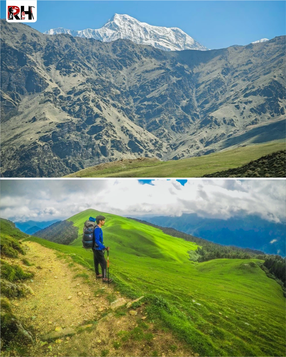
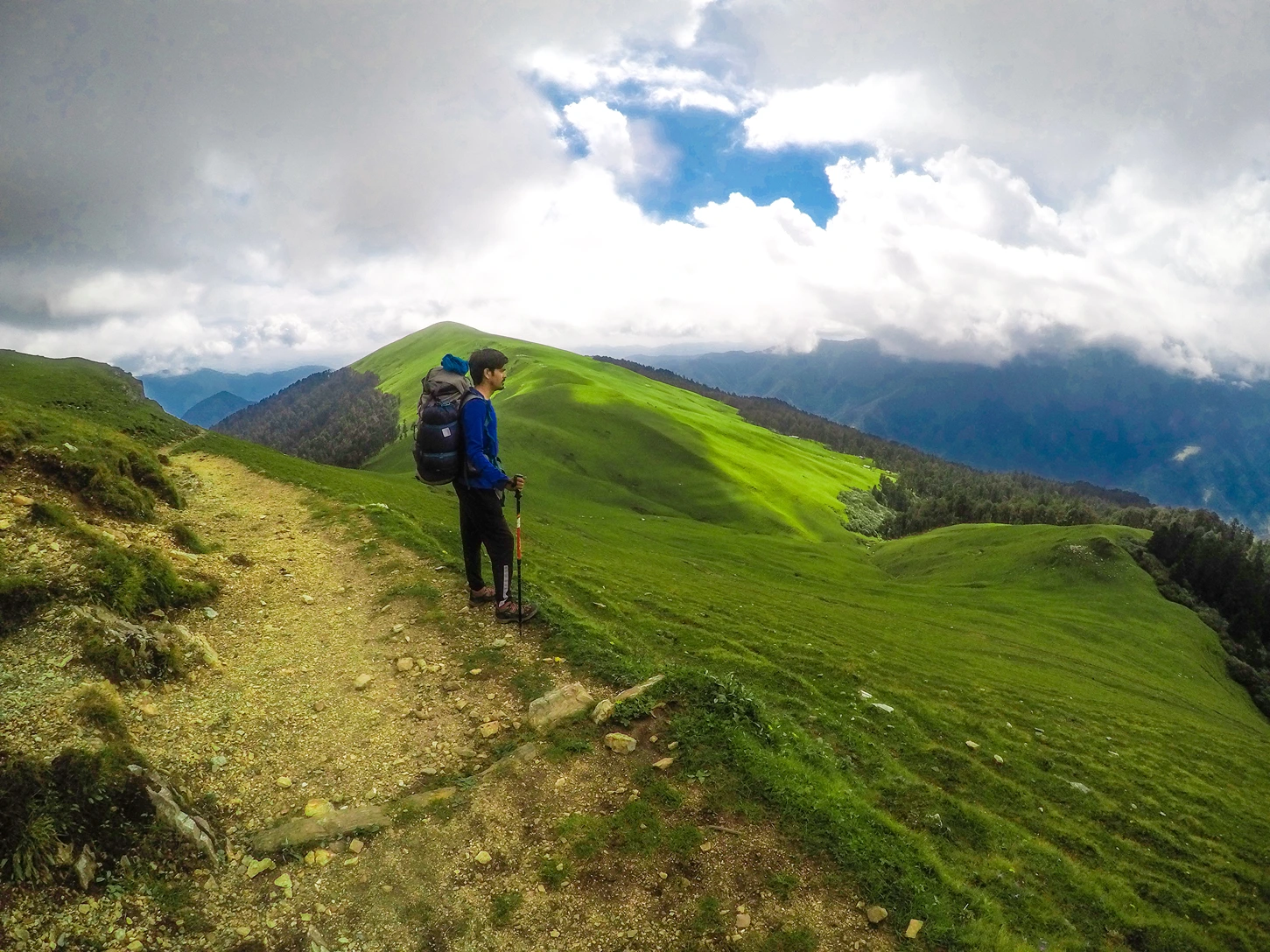
Ali Bedni Bugyal Meadows: Two of the largest alpine meadows in Asia, crossed on Days 3–4, with 360-degree views of rolling grassland and distant peaks.
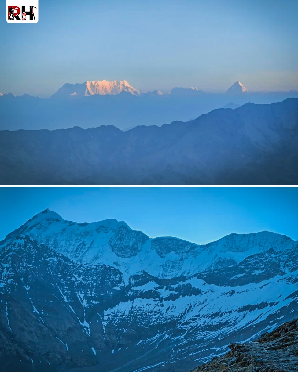
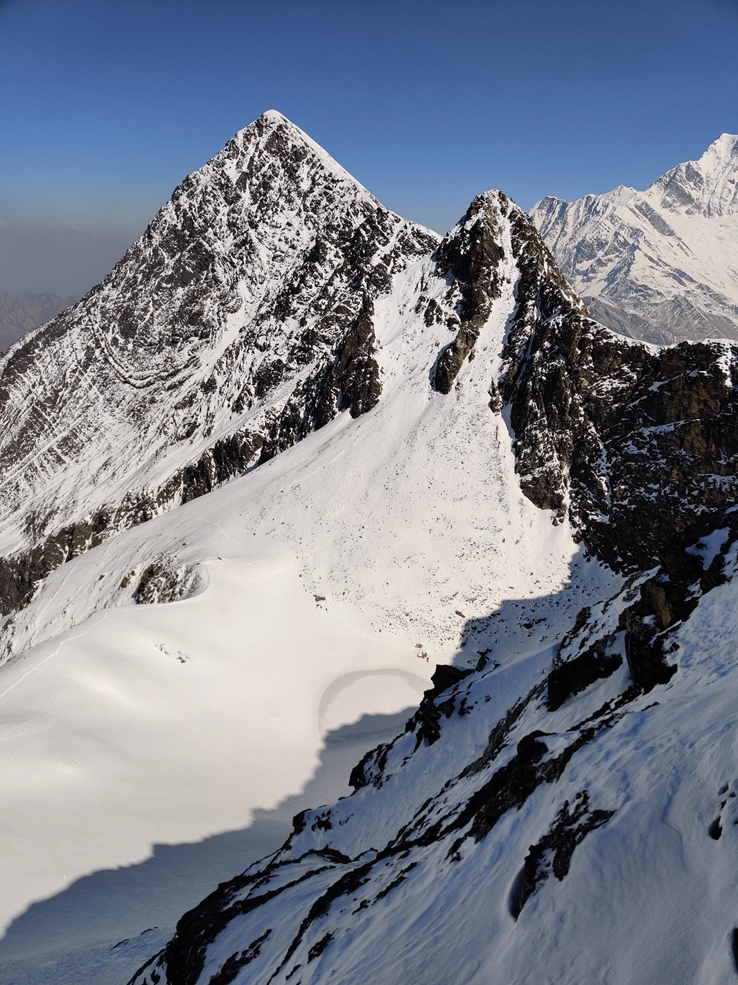
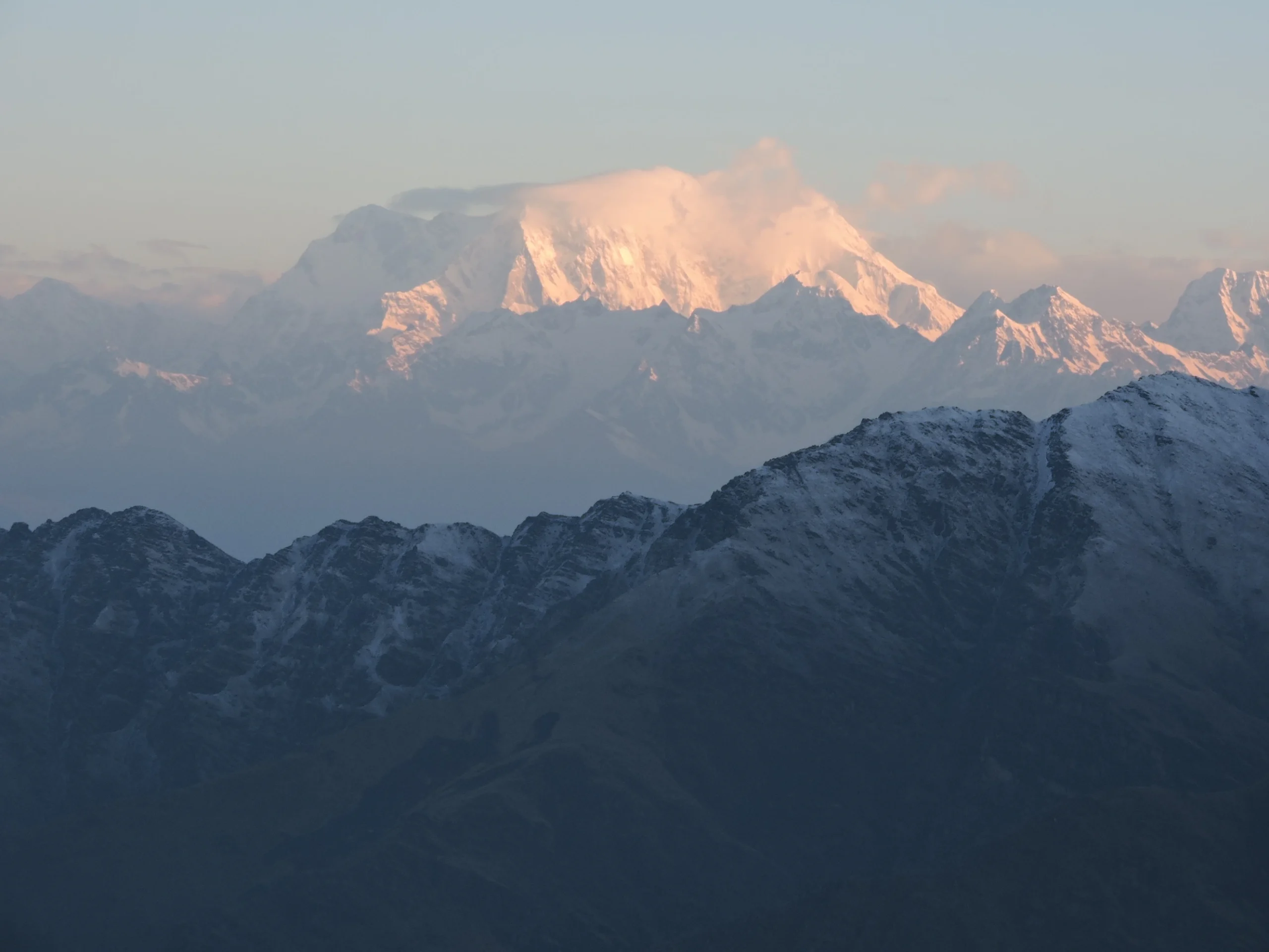
Trishul and Nanda Ghunti Views: The twin peaks of Trishul (7,120 m) and Nanda Ghunti (6,310 m) dominate the skyline from Bedni Bugyal onward, their full 6,000–7,000 vertical foot faces visible from the meadows.
Patarnauchani Campsite: A high-altitude camp at 13,500 ft surrounded by rocky ridgelines, the transition point between meadows and the barren high-altitude zone.
Summit Day Experience: A 10–12 hour push from Bhagwabasa to Roopkund and back, climbing through boulder fields and snow patches to one of the most haunting landscapes in the Indian Himalayas.
Roopkund Trek
Clear trek details, booking dates, inclusions, and rental options.
Most mysteries get solved eventually. Someone finds the missing piece. Someone runs the right test. Someone figures out what happened and why and the mystery stops being mysterious. The Roopkund Trek is not most mysteries.
Why Trekkers Love It
In 1942, a British forest ranger named H.K. Madhwal was walking through the Nanda Devi National Park in Uttarakhand when he found a lake. Not unusual, there are hundreds of glacial lakes in the Himalayas. But this one was different. This one had bones. Human bones. Hundreds of them. Scattered across the lakeshore, half-buried in the sediment, visible through the ice when it melted in summer. Skulls. Femurs. Ribcages. An entire population of dead people at 16,000 feet above sea level in one of the most remote corners of India.
The discovery made headlines. Theories multiplied. Were these soldiers? Pilgrims? Traders caught in a storm? An epidemic? A battle? For decades, the answer seemed clear: they were victims of a catastrophic hailstorm during the Nanda Devi Raj Jat pilgrimage in the 9th century. A single tragic event. One storm. One group. One story. Then, in 2019, scientists published a DNA study that changed everything.
The skeletons were not from one group. They were from three. And they did not die in one event. They died across a thousand years. Twenty-three individuals had South Asian ancestry and died around 800 CE. Fourteen had Mediterranean ancestry, from Greece and Crete specifically, and died around 1800 CE. One had Southeast Asian ancestry and also died in the 1800s. None of them were related to each other. They ate different diets. They lived in different centuries. And somehow, all of them ended up dead at the same frozen lake at 16,000 feet.
The mystery did not get solved. It got deeper. And that lake, that impossible, haunted, beautiful lake, is exactly where the Roopkund Trek takes you.
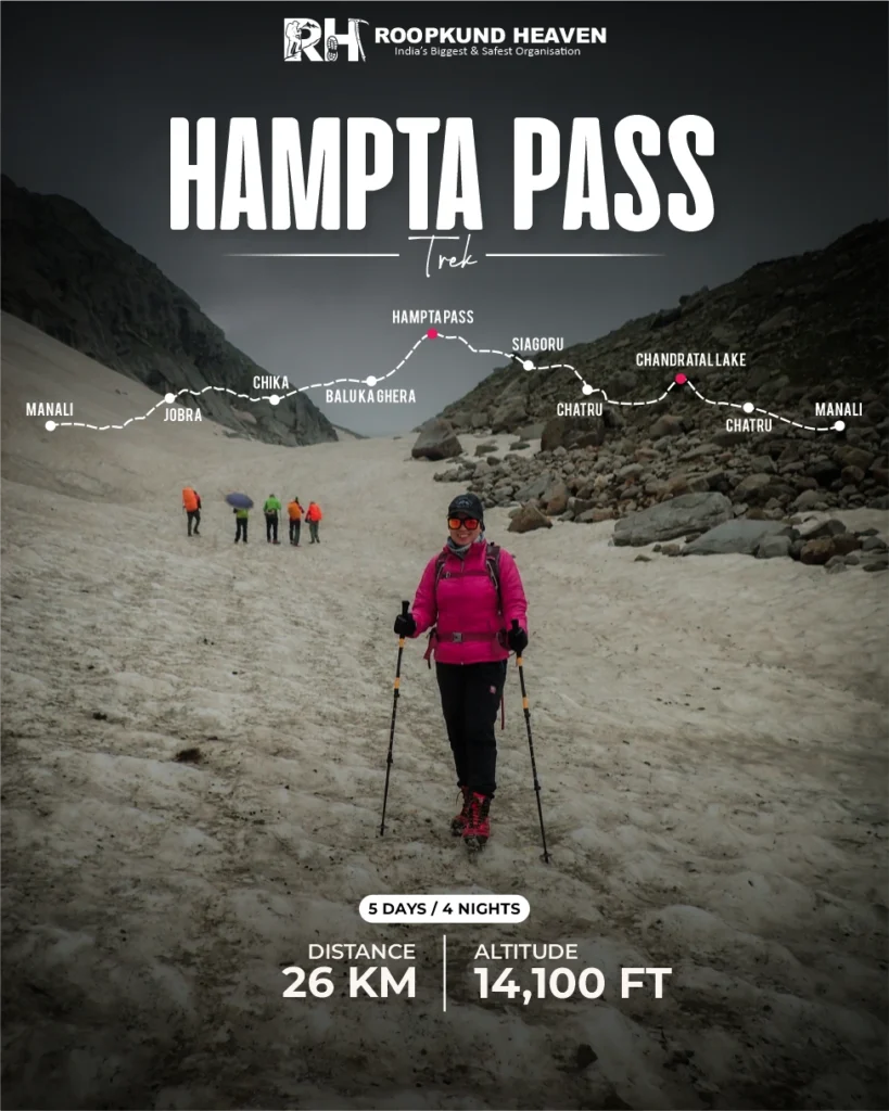
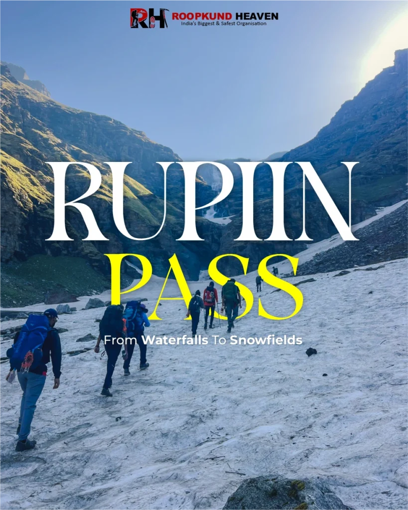
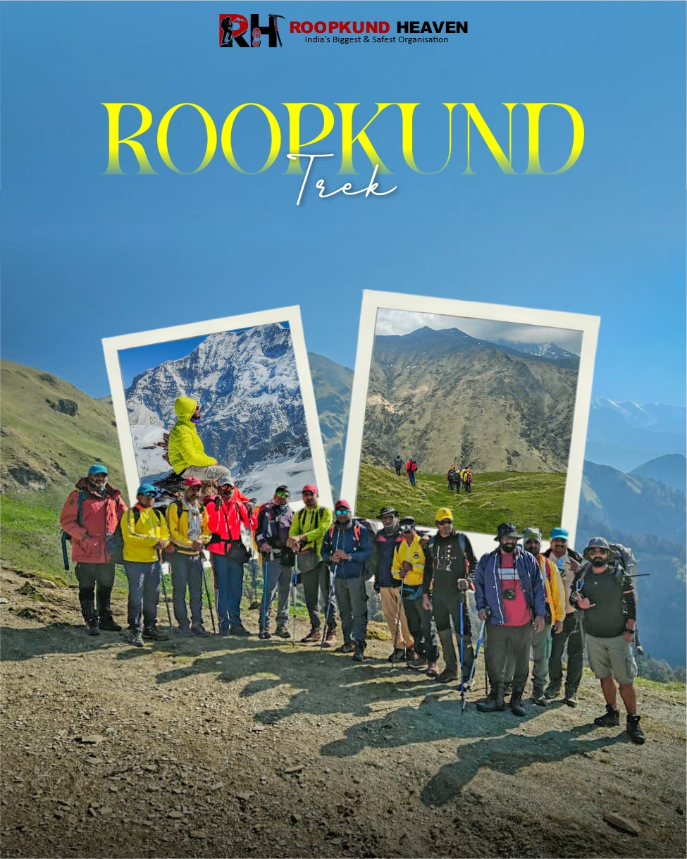
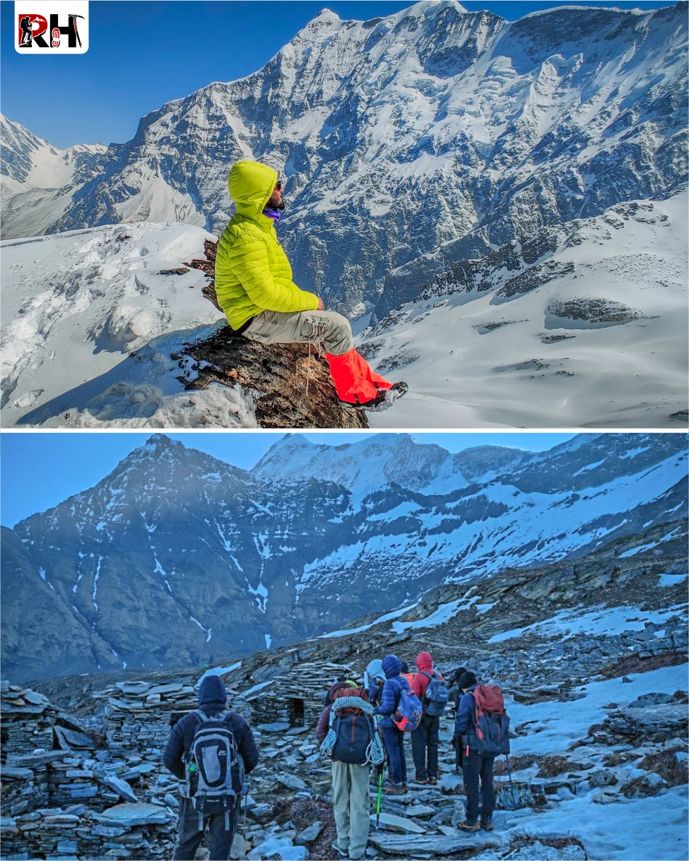
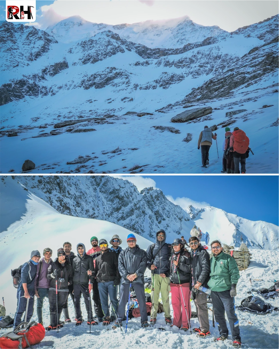
The Roopkund Trek is an 8-day, 53-km high-altitude route through Uttarakhand’s Chamoli district that climbs from Lohajung village at 7,650 feet to Roopkund Lake at 15,696 feet. It passes through the same landscapes as the Ali Bedni Bugyal Trek for the first three days – oak and rhododendron forests, the vast meadows of Ali and Bedni Bugyal, views of Trishul and Nanda Ghunti rising 20,000 feet above you. But where Ali Bedni turns back at Bedni Top, Roopkund keeps climbing.
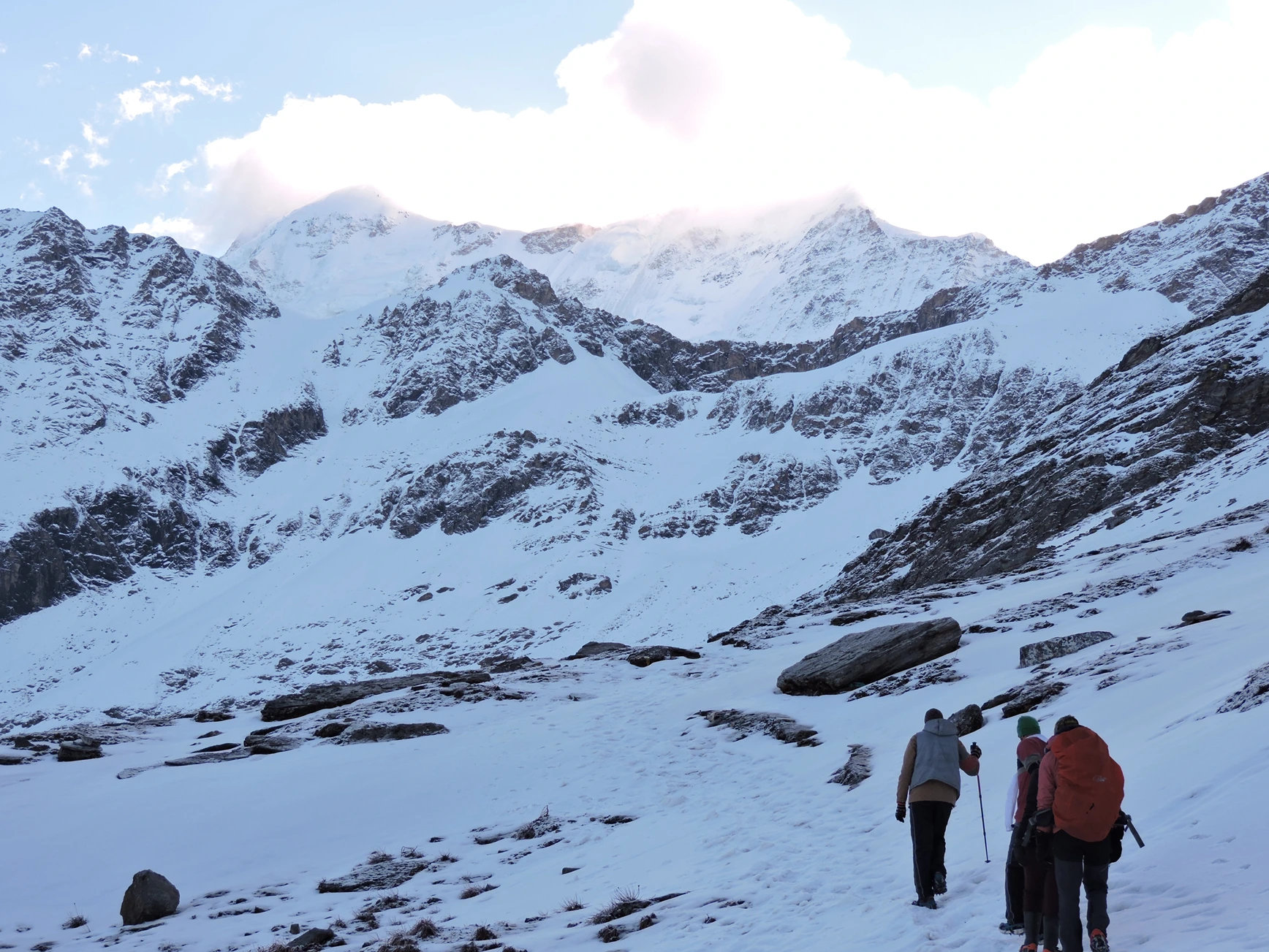
Past Bedni Bugyal, the trail continues to Patarnauchani, a high campsite at 13,500 feet surrounded by rocky ridgelines. From there, it climbs to Bhagwabasa, the final camp before the lake at 14,500 feet, a windswept, barren place where nothing grows and the air holds half the oxygen it does at sea level. And from Bhagwabasa, before sunrise on Day 6, you climb the final 3 kilometres to Roopkund Lake.
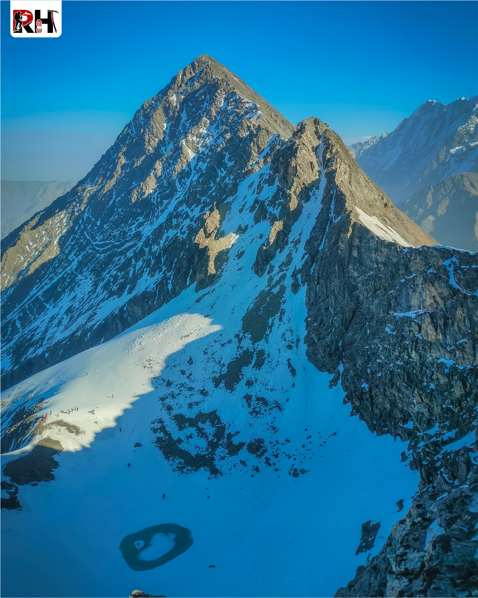
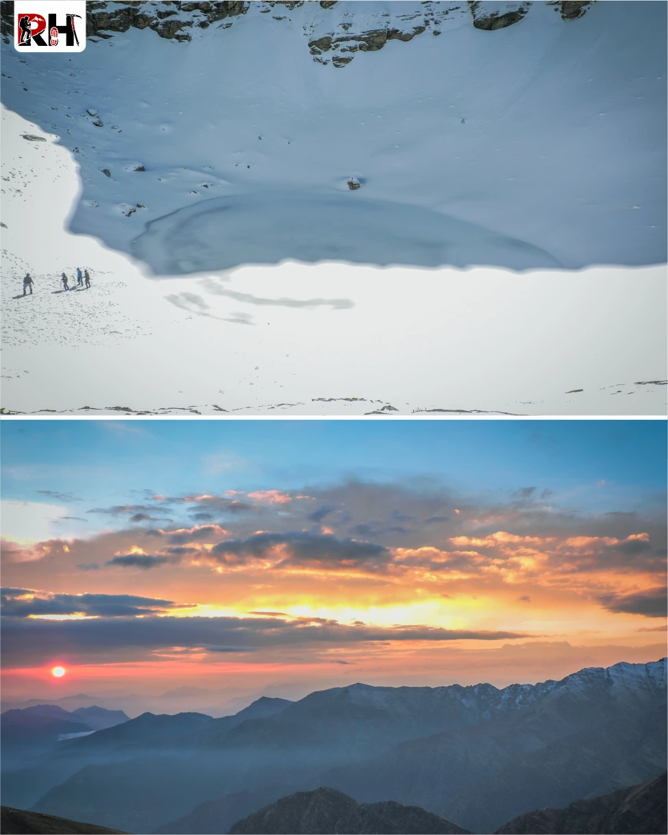
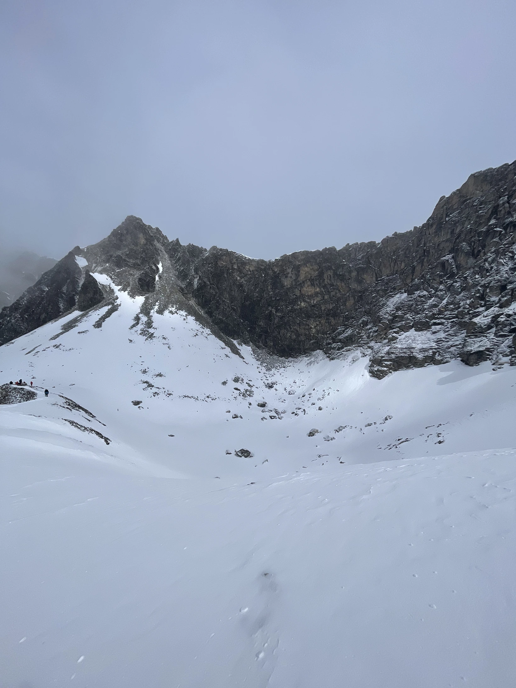
The lake itself sits in a glacial bowl beneath the Trishul massif. It is small, maybe 130 feet across, frozen solid for nine months of the year. And when the ice melts in late summer, the skeletons appear. Not all of them, most have been moved or buried or taken by trekkers over the decades, but enough. Enough that when you stand on the shore and look down, you understand why this place has haunted people for 80 years.
The trek does not involve technical climbing. There are no fixed ropes, no ice axes required, no scrambles over vertical rock. But it is a serious high-altitude trek. You gain nearly 8,000 vertical feet from Lohajung to Roopkund over five days. You camp at 14,500 feet. You walk for 10 to 12 hours on summit day. And you do it in terrain that is remote, exposed, and unforgiving if the weather turns.
Day 1 is the drive from Rishikesh to Lohajung, 258 kilometres through the Alaknanda Valley.
Day 2 is the trek to Didina village through oak forests alongside the Neel Ganga River.
Day 3 climbs to Ali Bugyal, the vast alpine meadow at 11,000 feet.
Day 4 crosses to Bedni Bugyal and continues to Patarnauchani at 13,500 feet, the highest camp before the final push.
Day 5 climbs to Bhagwabasa at 14,500 feet.
Day 6 is summit day to Roopkund Lake at 15,696 feet and back down to Patarnauchani.
Day 7 descends all the way to Lohajung via Wan Village. Day 8 is the drive back to Rishikesh.
The trek is graded moderate to difficult, which in practical terms means: if you have done multiple Himalayan treks and are comfortable at 12,000-14,000 feet, you will manage this. If this is your first or second trek, you will struggle, because the altitude is real and the summit day is long and there is no shortcut around either.
The right person for this trek is someone who wants to walk into a mystery that cannot be solved. Someone who understands that some places do not owe you an explanation, they just exist, strange and beautiful and impossible, and the only thing you can do is stand there and try to absorb what you are seeing. Someone who is fit enough, prepared enough, and mentally ready for a trek that is not about conquering anything. It is about witnessing.
The total distance is 53 kilometres over 8 days. Daily trekking distances range from 4 km on the Bhagwabasa-to-Roopkund summit day to 15 km on the final descent. The cumulative altitude gain from Lohajung to Roopkund Lake is nearly 8,000 feet, with the steepest section happening in the final 3 kilometres on Day 6.
If you are ready to walk to the edge of one of the strangest places in the Himalayas, there is no reason to wait.
Day wise plan
Follow an unforgettable Himalayan expedition from Lohajung to the mysterious Roopkund Lake while crossing dense forests, Ali and Bedni Bugyal meadows, high-altitude camps, rugged mountain terrain, and breathtaking Himalayan landscapes beneath the towering Trishul massif.
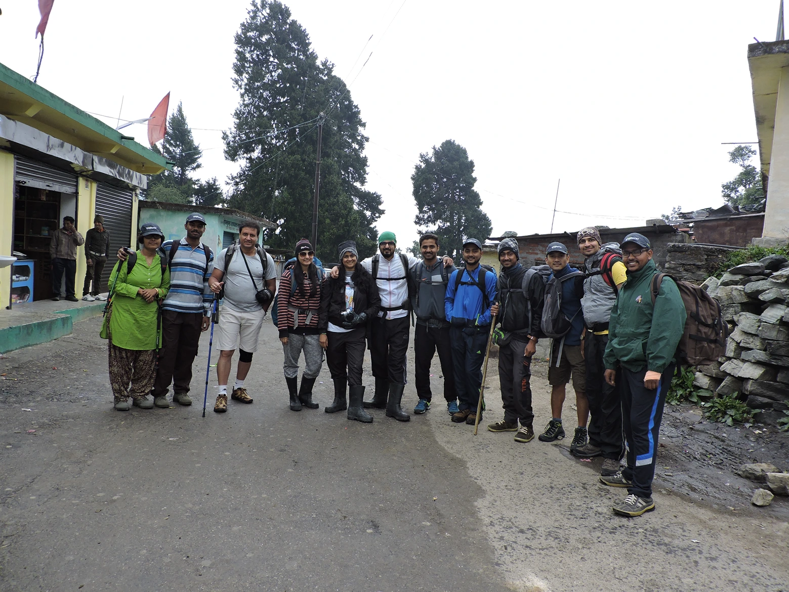
The Roopkund Trek begins exactly the same way the Ali Bedni Bugyal Trek begins: with a long drive through the Alaknanda Valley.
Leave Rishikesh by 6 AM. The road follows the Alaknanda River upstream through a valley that narrows and steepens with every kilometre. Devprayag, Rudraprayag, Karnaprayag, the three great confluences where rivers meet and form the Ganga. Between them, terraced fields, small towns, dhabas serving chai and parathas. The Alaknanda, loud and green and fast, never leaves your window.
After Karnaprayag, the road climbs through pine forests and smaller valleys until it reaches Lohajung by late afternoon. A quiet Garhwali village at 7,650 feet, perched on a ridge with views of Nanda Ghunti when the skies are clear. Settle into your guesthouse, eat, hydrate, and sleep early. Tomorrow the trekking begins, and it does not stop for seven days.
Tip: Withdraw cash in Rishikesh or Karnaprayag. There are no ATMs in Lohajung or anywhere on the trek. Mobile network disappears entirely after Didina.
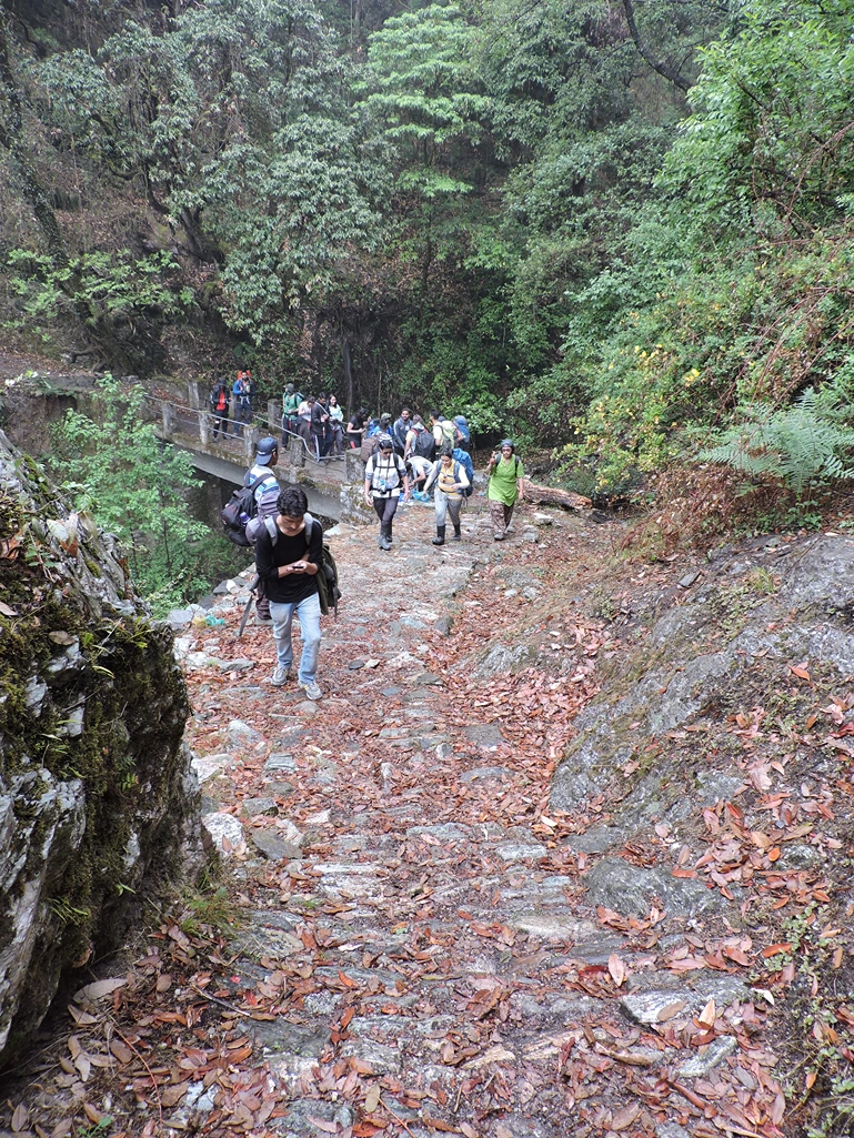
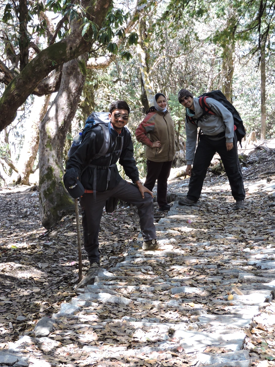
The trail out of Lohajung drops steeply through forest for the first 2 kilometres. Oak, rhododendron, pine. The Neel Ganga River roars somewhere below. After an hour, the trail reaches the riverbank and a narrow metal bridge suspended above the water.
Cross the bridge. On the far side, the trail turns uphill. Steeply uphill. The next 2 kilometres climb nearly 1,300 feet through dense forest, stone-paved in sections, rocky and root-tangled in others. This is the hardest section of the day. Take it slowly. Refill water from streams whenever you can. After 2 hours of climbing, the forest thins. Didina village appears ahead, a small cluster of stone houses scattered across a sloping meadow. The campsite sits just above the village at 8,100 feet. Rest. Eat well. The next five days climb another 7,500 vertical feet.
The trail climbs steadily through oak and rhododendron forest for the first 3 kilometres. In May and June, the rhododendrons bloom bright red. In September and October, the leaves turn gold.
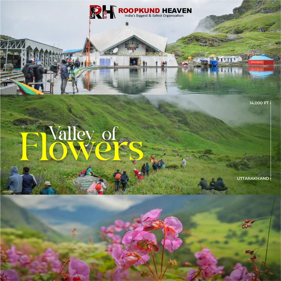
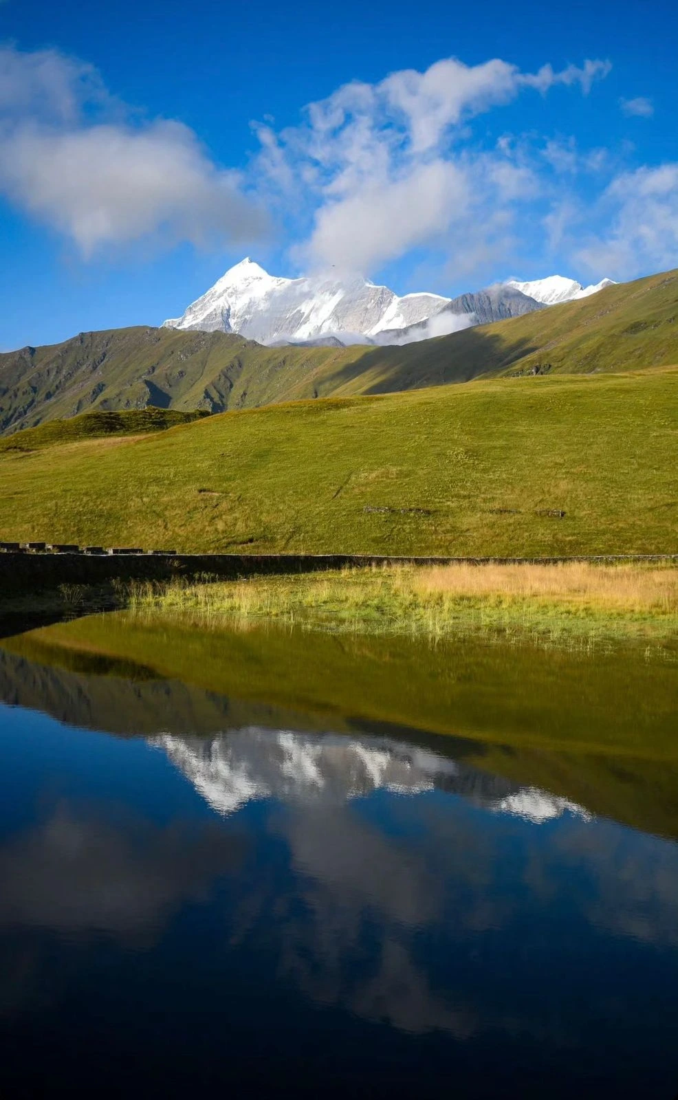
After Tolpani, the last water source before Ali Bugyal, the treeline ends. And the meadows begin. The moment you step out of the forest onto the ridge, the entire expanse of Ali Bugyal opens in front of you. Green grass rolling in every direction. Trishul and Nanda Ghunti rising so high above the meadows that you cannot see their summits without tilting your head back. The trail crosses the meadow for 2 kilometres to the campsite at 11,000 feet. You camp here for the night.
When you wake up tomorrow and see Trishul turning gold in the sunrise, you will understand why people call this one of the most beautiful landscapes in India.
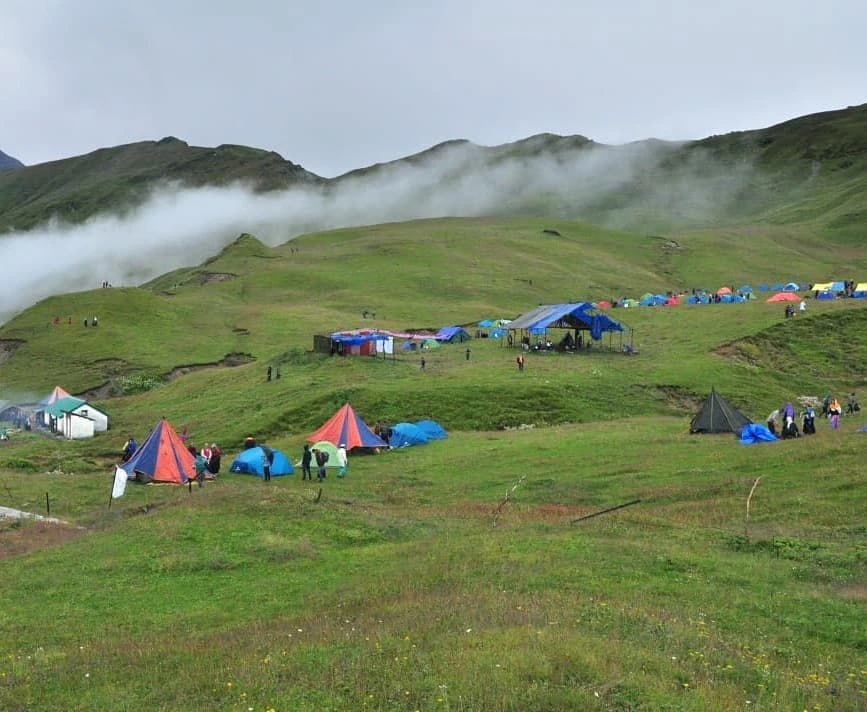
This is the day the trek stops being a meadow walk and starts being a high-altitude expedition. The trail from Ali Bugyal to Bedni Bugyal is 3 kilometres of the most visually stunning trekking in India. You walk across rolling meadows with no obstructions, nothing between you and the mountains except grass and sky. Bedni Bugyal opens ahead, broader and more open than Ali. The trail continues past Bedni Kund, the sacred glacial lake at 11,200 feet, and begins climbing toward Patarnauchani.
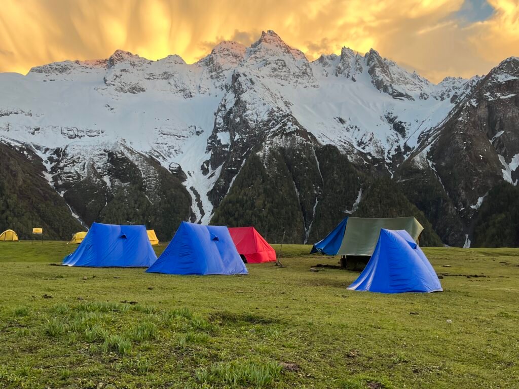
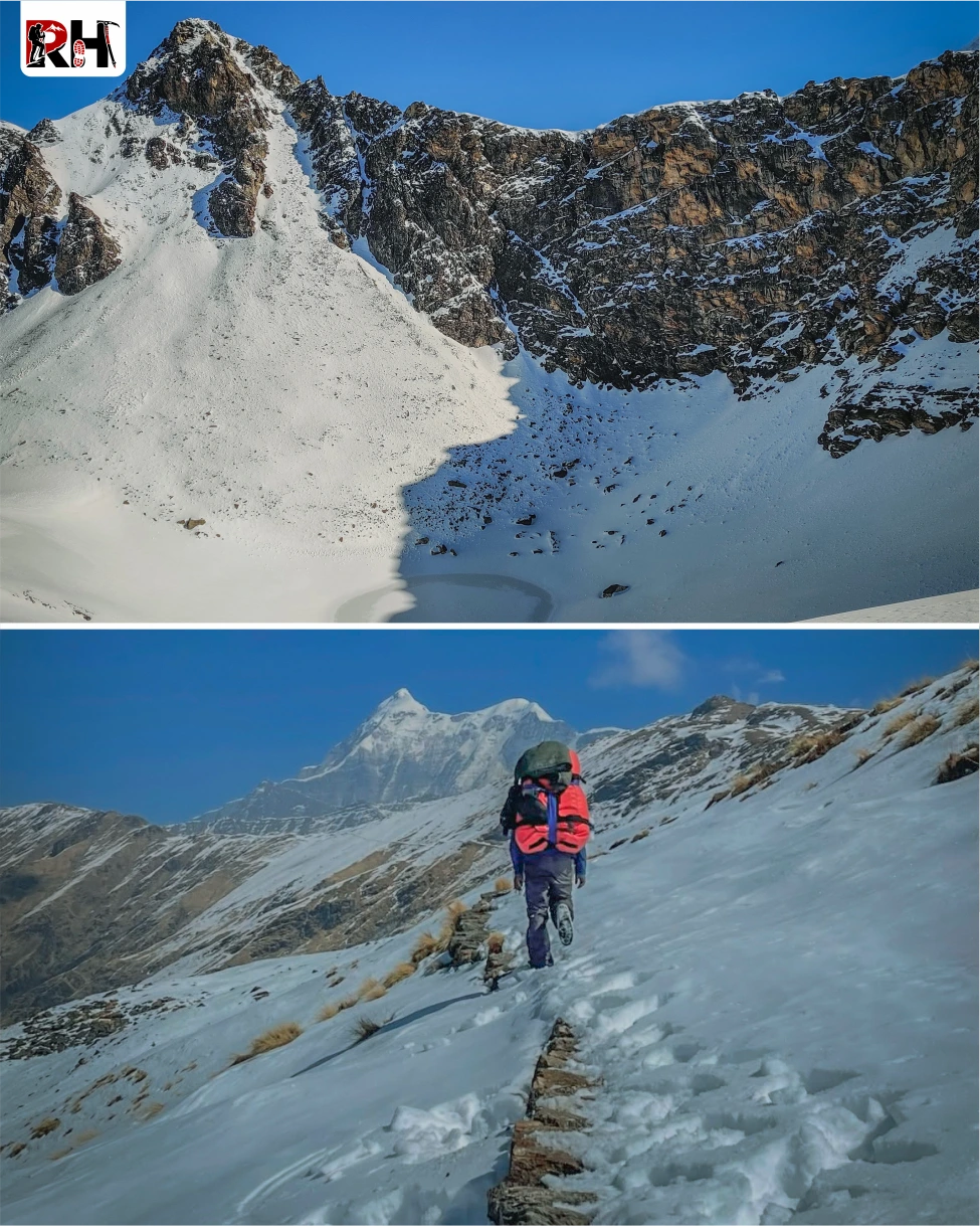
The landscape changes quickly. Grass gives way to rocks. The air gets thinner. The trail steepens. After 2 hours of climbing, you reach Patarnauchani at 13,500 feet, a barren plateau surrounded by rocky ridgelines.
This is the highest camp before Bhagwabasa. Nights here are cold, 0°C or below. Altitude becomes noticeable. Headaches are common. Drink 3-4 litres of water. Eat even if your appetite has decreased. Sleep early. Tomorrow you climb another 1,000 feet.
The shortest day by distance. Not the easiest. The trail from Patarnauchani to Bhagwabasa climbs 1,000 vertical feet over 4 kilometres. Rocky, exposed, no trees, no shelter. Just boulders, scree, and sky.
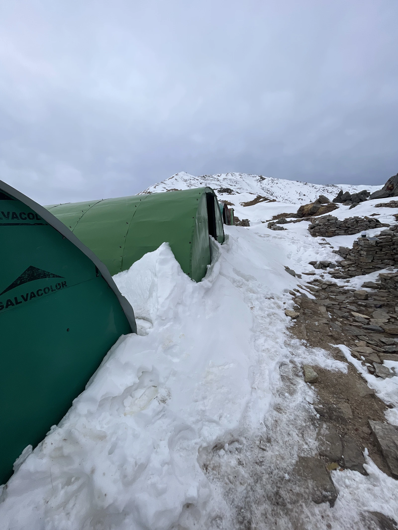
Bhagwabasa sits at 14,500 feet in a barren glacial valley beneath the Trishul massif. Nothing grows here. The wind never stops. The air holds half the oxygen it does at sea level. This is the final camp before Roopkund Lake.
Arrive by early afternoon. Set up camp. Rest. Hydrate. Check your summit kit: down jacket, gloves, balaclava, headtorch with fresh batteries, trekking poles, 2 litres of water. Pack everything you need for tomorrow before you sleep. Tomorrow starts at 3 AM.
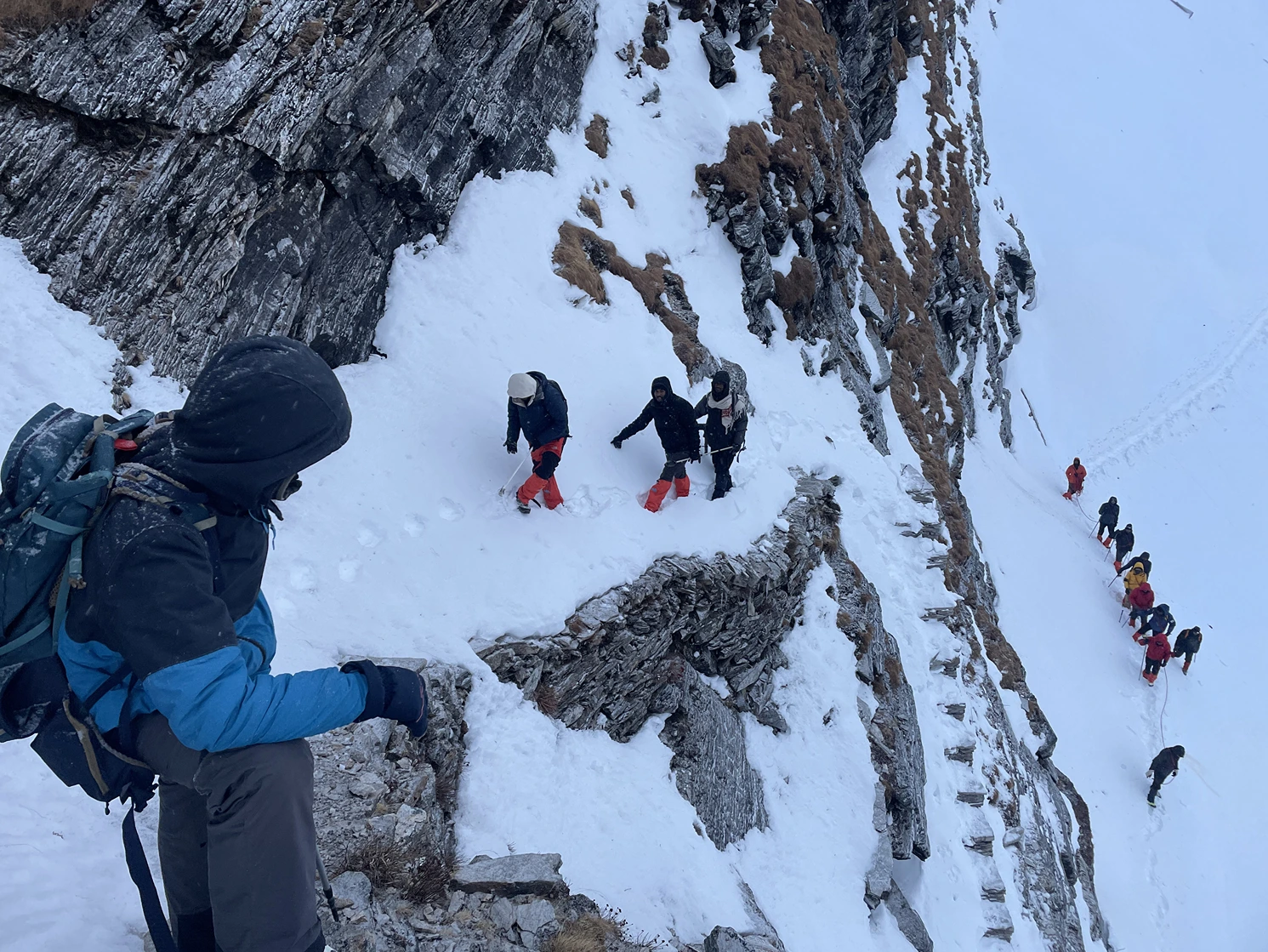
This is the day you trained for. Leave Bhagwabasa at 3 AM in complete darkness. Head torch on, breath visible in cold air. The trail climbs steeply through boulder fields and snow patches toward Roopkund Lake.
The final 3 kilometres gain 1,200 vertical feet. At this altitude, every step requires effort. Your lungs are working harder than they ever have. Your legs are tired from five days of climbing. And the gradient does not ease. After 3 to 4 hours of climbing, the lake appears. Roopkund Lake. A small glacial pool, maybe 130 feet across, sitting in a frozen bowl beneath the Trishul massif at 15,696 feet. And scattered around it, if you arrive in September or October when the snow has melted, the skeletons.
Not all of them. Most have been moved or buried or taken over the decades. But enough. Skulls half-buried in sediment. Femurs visible through the ice. Ribcages lying on the shore. The remains of people who died here across a thousand years, for reasons no one fully understands. Stand there as long as you can. Let the altitude and the cold and the silence and the strangeness of this place settle into you. Then begin the descent.
The descent is long. From Roopkund back to Bhagwabasa (3 km), then from Bhagwabasa all the way down to Patarnauchani (4 km). Nearly 2,000 vertical feet of downhill trekking on tired knees. Use your poles. Plant your heels. Take it slowly. Arrive at Patarnauchani by late afternoon. Rest. Tomorrow is the final descent
The final trekking day is long but the altitude drops quickly, and with it, the effort required to breathe.
The trail from Patarnauchani descends through Bedni Bugyal, past Bedni Kund, and down through Gharoli Patal forest toward Wan Village. The landscape softens with every kilometre. Rocks give way to grass. Grass gives way to trees. Trees give way to terraced fields and stone villages.
After 7 to 8 hours of trekking, you reach Wan Village at 7,500 feet, a small Garhwali settlement with a roadhead. From here, a jeep brings you back to Lohajung (14 km, 45 minutes).
Arrive in Lohajung by evening. Check into your guesthouse, shower, eat, and rest. Tomorrow is the long drive back to Rishikesh.
The final day is all road. The same route from Day 1, but in reverse. Lohajung to Karnaprayag, Rudraprayag, Devprayag, and into Rishikesh by evening. Arrive in Rishikesh between 5 PM and 7 PM. Book your onward travel accordingly, with at least a 2-hour buffer for delays.
The Roopkund Trek is over. But the memory of standing at 16,000 feet beside a frozen lake full of skeletons from a thousand years ago stays longer than you expect.
Inclusion & exclusion
Inclusions
Exclusions
- Bag Offloading Charges: ₹1,400 per bag
- Maximum Weight Limit: Each offloaded bag should not exceed 10 kg
Best Time to Visit Roopkund Trek
The Roopkund Trek is accessible from May through October, but the experience changes dramatically depending on when you go. This matters more on Roopkund than on most other treks because of one critical variable: whether or not you can see the skeletons.
May to June: Snow Season
This is the snow trekking season. The lower sections, Lohajung to Ali Bugyal, are green and alive with wildflowers and blooming rhododendrons. But from Bedni Bugyal onward, snow covers everything. Patarnauchani has 2 to 4 feet of snow. Bhagwabasa is buried. And Roopkund Lake is frozen solid.
The skeletons are not visible. They are buried beneath ice and snow. You stand at the lake and see a white expanse, beautiful and silent, but devoid of the eerie presence that makes this trek famous.
If you want to experience high-altitude snow trekking and do not mind missing the skeletons, this is your season.
Daytime temperature at lower camps: 12°C – 18°C
Daytime temperature at Bhagwabasa: 0°C – 5°C
Night temperature at Bhagwabasa: -5°C to -10°C
Snow coverage: Heavy from Patarnauchani onward
Microspikes essential: Yes
Skeletons visible: No
September to October: Post-Monsoon Clear Season
This is the best time to visit if you want to see the skeletons. The monsoon clears by mid-September. Skies open up. Visibility is exceptional. And most importantly, the snow has melted. Roopkund Lake is partially or fully thawed, and the skeletons are visible. Not all of them, many have been moved or buried over the decades, but enough. Skulls, bones, ribcages lying on the shore and visible through the clear water.
The mountain views from Bedni Top and the approach to Roopkund are at their sharpest of the entire year. Trishul, Nanda Ghunti, Chaukhamba, all of them stand in perfect clarity against blue skies.
Daytime temperature at lower camps: 10°C – 15°C
Daytime temperature at Bhagwabasa: 3°C – 8°C
Night temperature at Bhagwabasa: -8°C to -12°C (frost always present)
Snow coverage: Minimal, patches only near the lake
Skeletons visible: Yes
Crowds: Moderate in September, low in October
July to August: Monsoon (Not Recommended)
The monsoon arrives in early July and continues through August. Rainfall is frequent, trails become slippery, leeches appear in forested sections, and visibility is often poor due to clouds and mist. Landslides can block the approach road to Lohajung.
Not recommended unless you specifically want a monsoon trekking experience.
November to April: Winter (Trek Closed)
The trek closes in November when the first heavy snowfall makes the trails impassable. Lohajung receives heavy snowfall from December through March. Roopkund Lake and the upper camps remain buried under snow until late April.
The trek does not operate during winter.
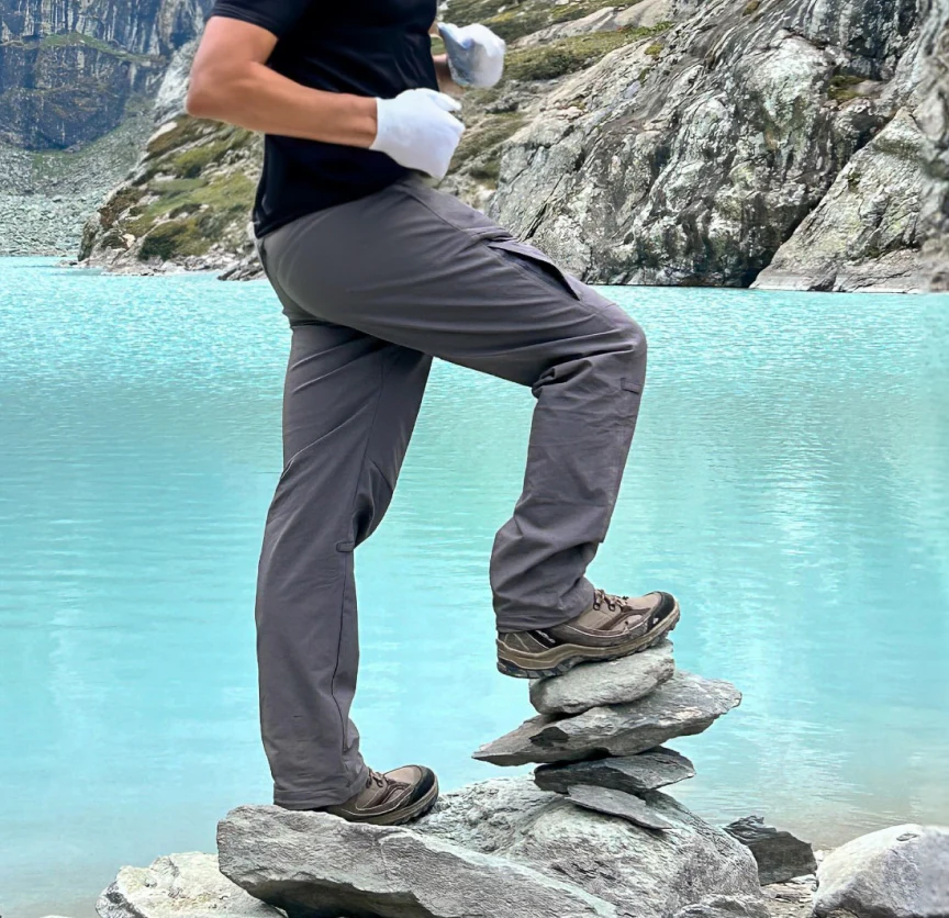
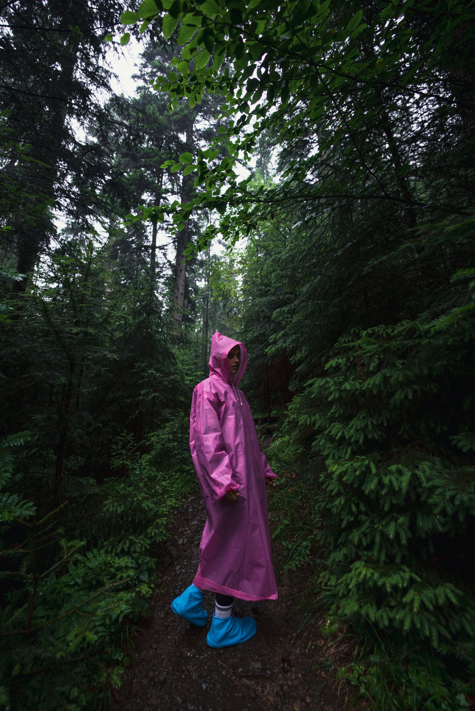
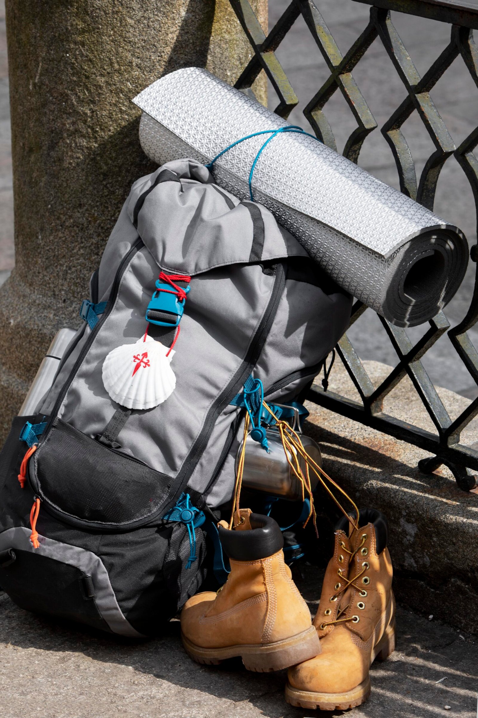
Things to Carry
Pack for two realities: 18°C sunshine in the meadows and -12°C at Bhagwabasa. Both exist within the same week at different altitudes. Keep your pack under 10 kg. Anything heavier compounds fatigue on uphill climbs and becomes dangerous on steep descents.
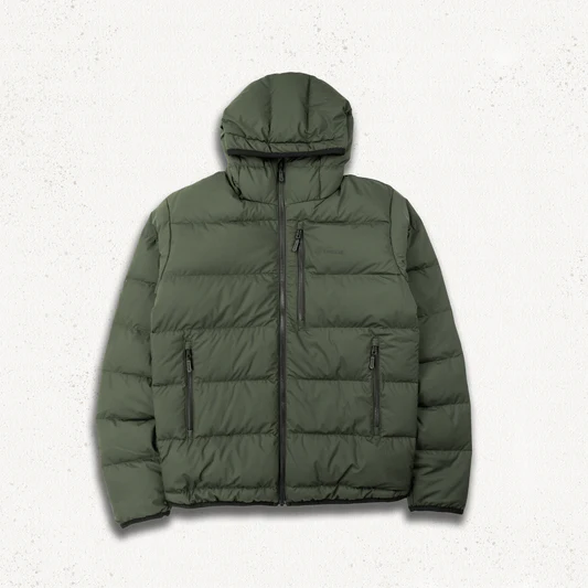
Clothing
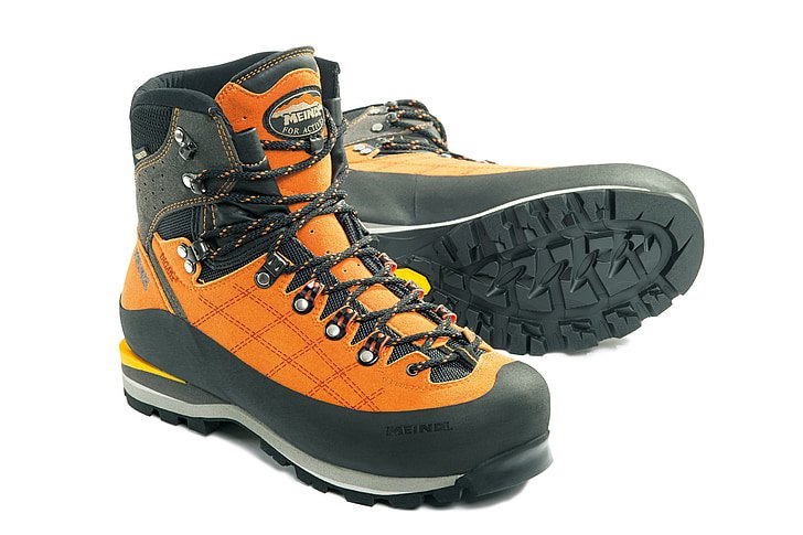
Footwear
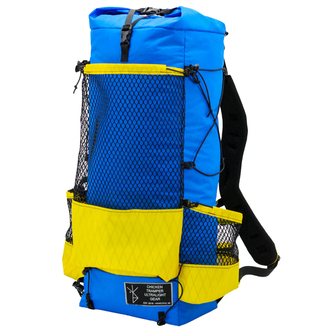
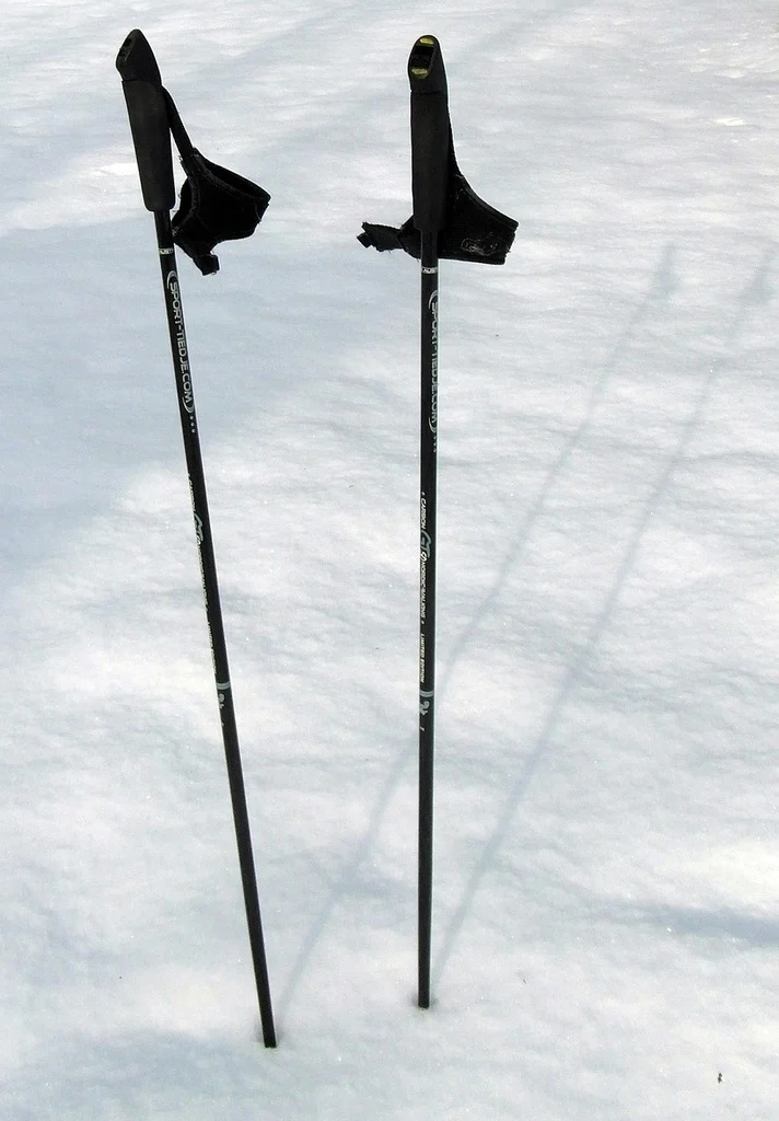
Equipment
Health & Hygiene
Documents & Finance
How to Reach Roopkund Trek Base Camp
The Roopkund Trek starts from Lohajung village in Uttarakhand’s Chamoli district. Rishikesh is the main transit hub
Reach Rishikesh
By Air: The nearest airport is Jolly Grant Airport in Dehradun, 21 km from Rishikesh. Direct flights connect Dehradun to Delhi. From the airport, take a taxi or pre-paid cab to Rishikesh (45 minutes).
By Train: Rishikesh Railway Station and Haridwar Junction (24 km from Rishikesh) are well-connected to Delhi, Mumbai, Kolkata, and other major cities. From either station, take a taxi or local bus to Rishikesh.
By Road: Direct UPSRTC and private Volvo buses connect Rishikesh to Delhi (240 km, 6-7 hours), Dehradun (45 km, 1.5 hours), and Haridwar (24 km, 1 hour).
Rishikesh to Lohajung
Lohajung is approximately 258 km from Rishikesh via the Alaknanda Valley road.
Route: Rishikesh – Devprayag – Rudraprayag – Karnaprayag – Dewal – Lohajung
Drive Time: 8-9 hours
Vehicle: Shared taxi / private cab / operator-arranged vehicle
Last ATM: Karnaprayag, withdraw enough cash for the full trek
Last Reliable Network: Lohajung, assume no connectivity for 7 days beyond this point
The road is well-maintained but narrow and winding. Landslides during monsoon can cause delays. Start early.
Policy
| Policy Point | Details |
|---|---|
| Booking Confirmation | Your seat is considered confirmed only after the required advance payment is received. |
| Balance Payment | The remaining amount must be cleared before departure or as per the reporting instructions shared by the team. |
| Transport Selection | Pickup from Dehradun is applicable only if that option is selected at the time of booking. |
| ID Requirement | Every participant should carry a valid government photo ID for verification and trek administration. |
| Operational Changes | In case of weather, road, or safety concerns, the itinerary may be adjusted for the well-being of the group. |
| Cancellation Window | Charge / Refund |
|---|---|
| More than 30 days before departure | Minimal processing deduction may apply; remaining amount can be refunded or adjusted as per booking terms. |
| 15 to 30 days before departure | Partial cancellation charge applicable; remaining balance may be refunded or transferred to a future batch if approved. |
| 7 to 14 days before departure | Higher cancellation charge applies because transport, permits, and staffing arrangements are usually already blocked. |
| Less than 7 days before departure | Booking is generally non-refundable due to final operational commitments. |
| No show / Trek departure missed | No refund is usually applicable once reporting is missed without prior written coordination. |
FAQ's
Rental gear for this trek