Highlight
Pangarchulla Summit at 15,069 ft: A genuine peak summit, not a pass, with a 360-degree panorama including Nanda Devi, Dronagiri, Kamet, Chaukhamba, Hathi Ghoda, Neelkanth, and Trishul all visible simultaneously
Six Snow Ridges on Summit Day: The defining challenge of the trek; six separate ridge crossings on packed snow and scree between Khullara and the summit, each one higher and more exposed than the last
The Transition from Trek to Summit: Where Kuari Pass ends at 12,516 ft, Pangarchulla continues 2,553 feet higher to a genuine mountaineering summit
Khullara Alpine Meadows: High-altitude bugyal at 11,014 ft where Nanda Devi and Dronagiri come into full view; the last camp before the summit push
Oak and Rhododendron Forests: The lower trail from Tugasi to Guling passes through Garhwal’s protected forests, spectacular in spring bloom
Pre-Dawn Summit Push: Leaving Khullara camp in complete darkness at 3-4 AM, climbing by headtorch through snow ridges to reach the summit at sunrise
Crampons and Technical Terrain: The final approach to the summit requires crampons, introducing trekkers to equipment and movement skills that belong to mountaineering rather than standard trekking
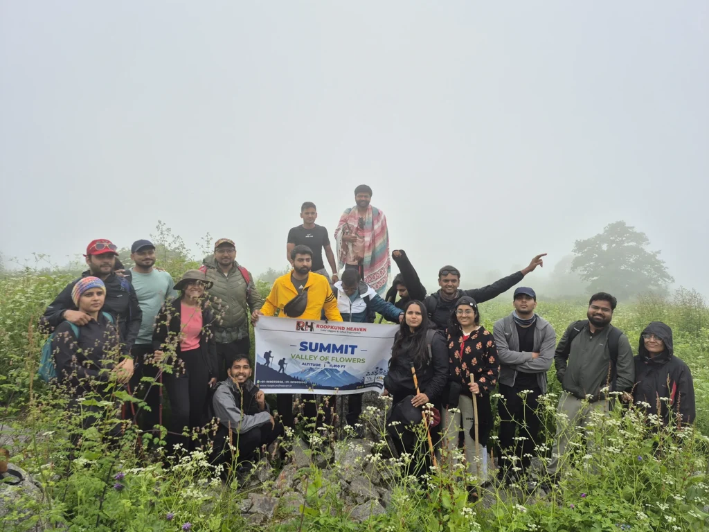
Pangarchulla Peak Trek Overview
Clear trek details, booking dates, inclusions, and rental options.
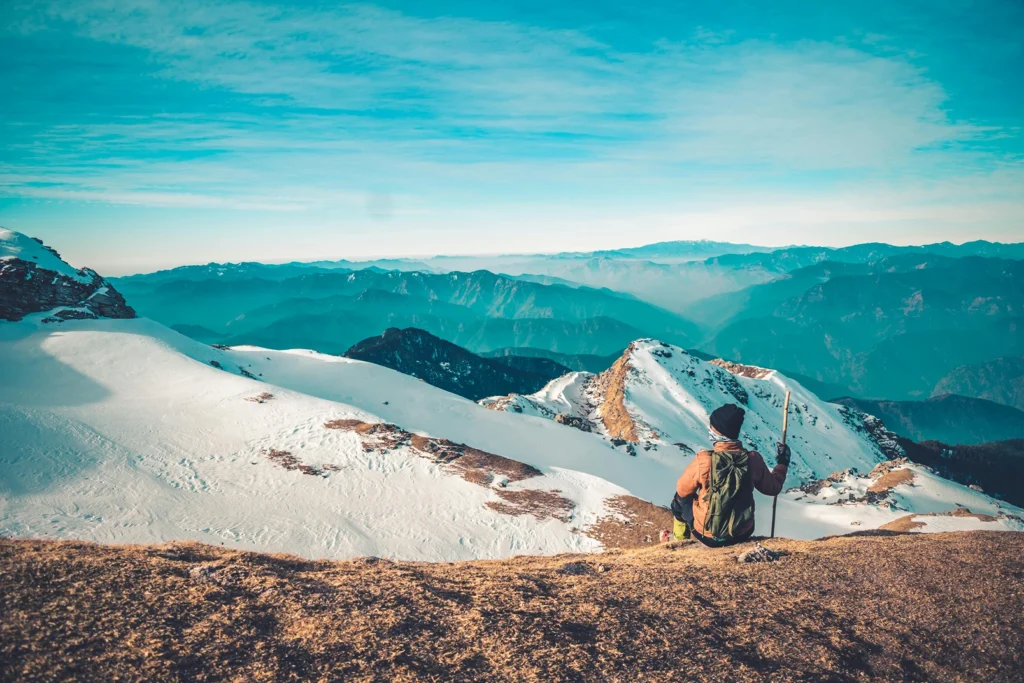
There is a difference between a trek and a summit. Most people who walk in the Himalayas know the difference in theory. After Pangarchulla, they know it in their legs, their lungs, and somewhere deeper than both.
A trek takes you through the mountains. A summit takes you above them. Pangarchulla Peak sits at 15,069 feet in the Garhwal Himalayas of Uttarakhand, a sharp pyramid of rock and snow visible from several surrounding valleys and from the famous Kuari Pass ridge nearby. It is not the highest peak in the region. It is not the most technically demanding summit in the Himalayas. But it sits at the exact intersection of what is possible without mountaineering qualifications and what genuinely feels like climbing, not trekking.
Why Trekkers Love It
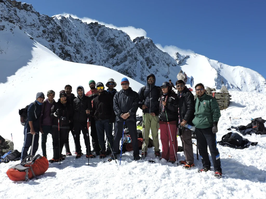
Six snow ridges stand between Khullara camp and the Pangarchulla summit. Six. Each one requiring careful footing on packed snow and scree. The final push to the summit from the last ridge is a steep, relentless climb at 60-degree incline that takes every ounce of fitness you have built over weeks of training. At the top, the Garhwal Himalayas open in a 360-degree sweep that stops experienced trekkers mid-sentence when they try to describe it.
Nanda Devi. India’s second-highest peak, filling the eastern skyline. Dronagiri, Kamet, Hathi Ghoda, Ghori Parbat, Chaukhamba, Neelkanth, Trishul. All of them visible from the summit at once. Not as distant shapes on a horizon. As actual mountains, close and massive and covered in glaciers that catch the morning light.
That view, from that summit, after that climb, is what defines the Pangarchulla Peak Trek. The Pangarchulla Peak Trek is a 6-day, 34-km route that starts at Rishikesh, drives to Joshimath, climbs through the same forests and meadows as the Kuari Pass Trek for the first three days, then diverges on Day 4 in the most significant way possible: instead of turning for a pass at 12,516 feet, you turn for a summit at 15,069 feet.
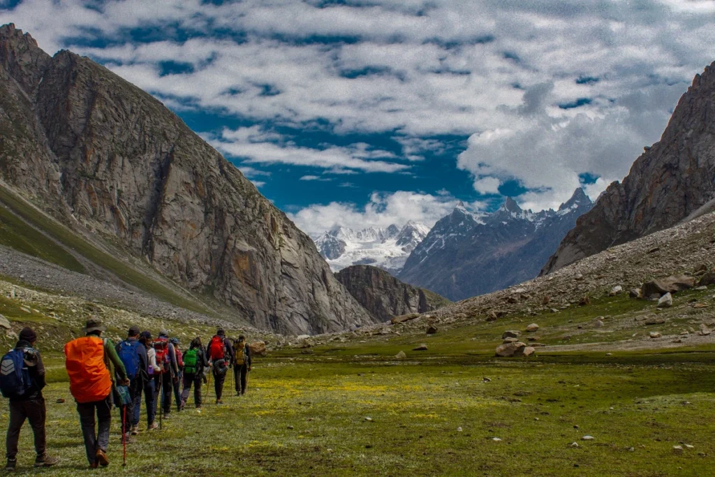
The first three days are shared with the Kuari Pass route. From Tugasi, the trail climbs through thick oak and rhododendron forest to Guling at 9,650 feet. From Guling, it continues through thinning forest to Khullara alpine meadows at 11,014 feet, where the first serious mountain views open, Dronagiri and Hathi Ghoda rising directly ahead, Nanda Devi visible beyond.
This is where Kuari Pass ends and Pangarchulla begins. Day 4 leaves Khullara before dawn. The summit is 4,000 vertical feet above. You cross six snow ridges. You climb steep scree and packed snow. You use crampons on the final sections. You summit at 15,069 feet and stand on top of a peak, not a pass, a peak, with the full Garhwal Himalayas spread below in every direction.
Then you descend the same 4,000 feet back to Khullara. And the next day you walk 10 kilometres down to Tugasi and drive back to Joshimath.
The trail involves steep snow slopes, use of crampons and ice axes on summit day, and significant altitude gain, making prior trekking experience highly recommended. This is not the right trek for someone who has never walked in the high Himalayas before. But for someone who has done Kedarkantha, or Kuari Pass, or any high-altitude route above 12,000 feet, and wants to know what a real summit feels like, Pangarchulla is precisely that step. It is a perfect introductory peak in case you want to up your trekking game by a notch or three. It is also a preparatory peak for those who want to take up climbing bigger and higher mountains.
Day 5 is the long descent from Khullara through Guling to Tugasi, 10 kilometres of downhill trekking followed by the short drive to Joshimath. Day 6 is the drive back to Rishikesh.
The trek is graded moderate to difficult. The first three days are moderate, forest walks and meadow climbs with gradual altitude gain. Day 4, summit day, is where the difficulty earns its rating. The summit day involves a long trek of 10 to 12 hours with steep snow slopes, rocky sections, and high altitude, making it the toughest part of the trek.
The right person for this trek is someone who has already done at least one high-altitude Himalayan trek above 12,000 feet, is physically fit enough to sustain 12 hours of hard trekking in a single day, and is genuinely ready to experience a summit rather than a pass. Someone who wants to stop saying “I walked to the top” and start saying “I climbed to the top,” because the difference, on Pangarchulla, is not semantic. The total distance is 34 kilometres over 6 days. Daily trekking distances range from 4 km on shorter days to 14 km on summit day. The cumulative altitude gain from Tugasi to Pangarchulla summit is nearly 8,000 vertical feet, with 4,000 of those gained and lost on a single day.
If you are ready to cross six snow ridges and stand on a summit at 15,069 feet with the entire Garhwal skyline below you, there is no reason to wait.
Day wise plan
Follow an exhilarating Himalayan expedition from Joshimath to Pangarchulla Peak while trekking through ancient forests, alpine meadows, snow-covered ridges, technical summit terrain, and breathtaking mountain landscapes across the Garhwal Himalayas.
Leave Rishikesh by 6 AM. The road follows the Alaknanda River upstream through the Garhwal valley, passing through Devprayag, Rudraprayag, Karnaprayag, and Nandprayag, four of the five Panch Prayag confluences where rivers meet and merge. The drive is long but never dull. The Alaknanda is loud and green. The valley walls grow steeper with every kilometre. The towns get smaller. The mountains get closer.
Joshimath arrives by late afternoon at 6,150 feet, the last proper town before the high Himalayan routes begin. Settle into your hotel. Eat well. Hydrate seriously. Tomorrow the trekking begins and for the next four days it does not stop.
Tip: Withdraw cash in Rishikesh or Joshimath. No ATMs beyond this point. Mobile network disappears after Tugasi. Download offline maps before leaving.
The morning drive from Joshimath to Tugasi takes 45 minutes through a mountain road descending to the small Garhwali village at 7,545 feet where the road ends and the trail begins.
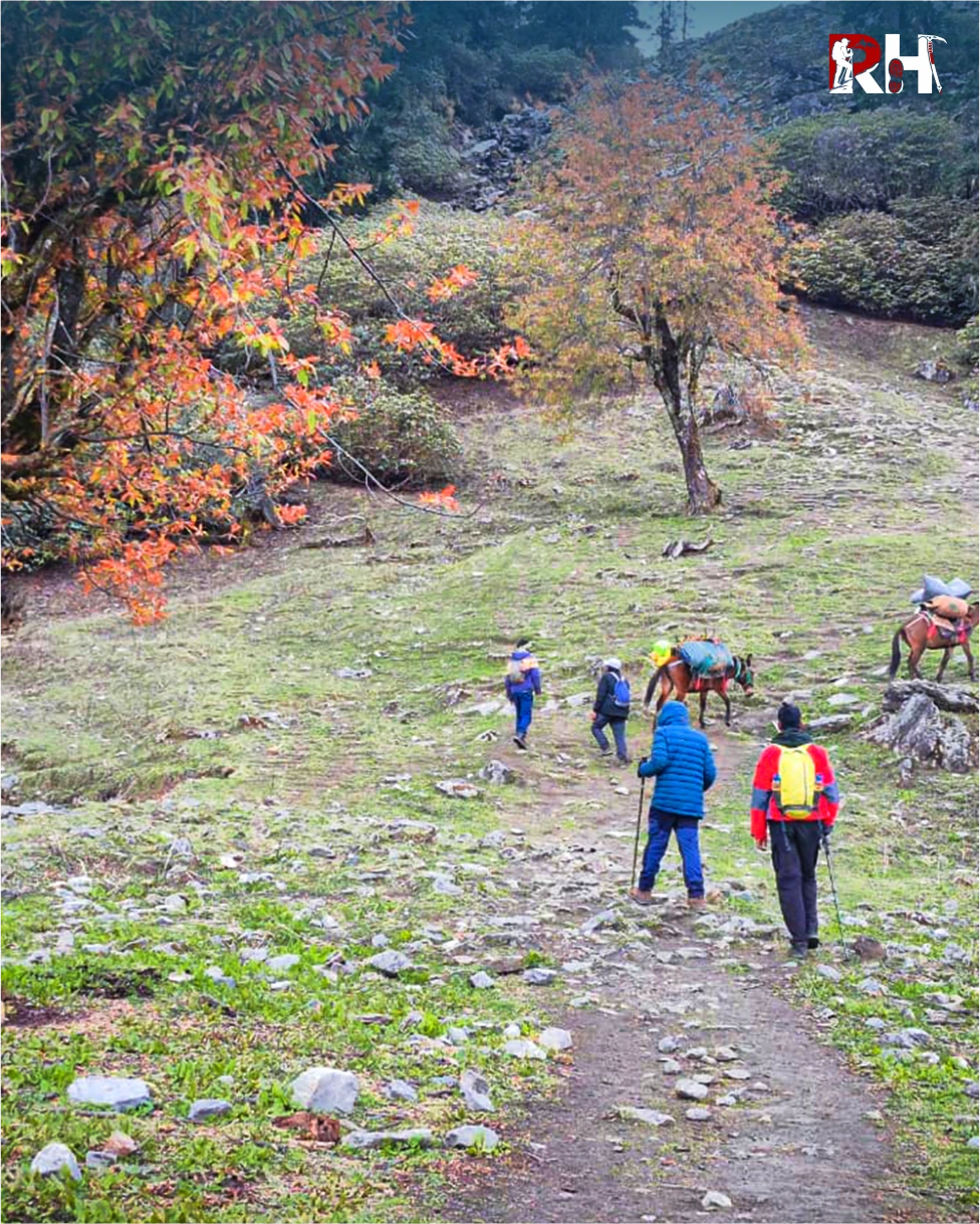
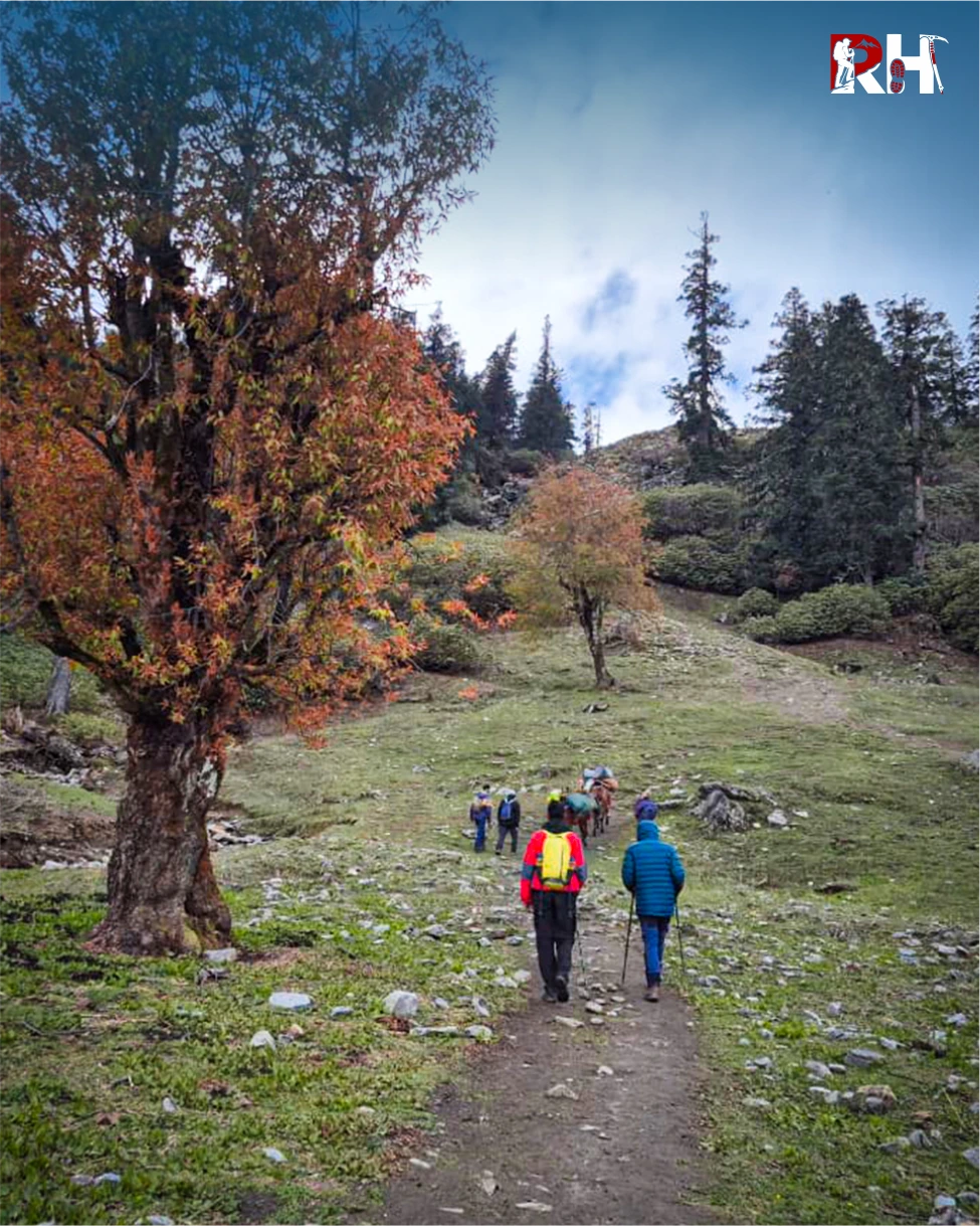
The climb from Tugasi to Guling follows the same route as the Kuari Pass Trek: through thick oak and rhododendron forest, with the gradient steady and manageable. In spring, rhododendron blooms cover the hillside in red and pink. The forest is cool, shaded, alive with birdsong.
After 4 kilometres and 5 hours of climbing through one of the most beautiful approach forests in the Garhwal, Guling camp arrives at 9,650 feet. A clearing surrounded by trees, with the first distant views of peaks to the north.
The trail out of Guling climbs through thinning forest. The trees get smaller and more widely spaced. After 2 hours, the treeline ends. Open alpine meadow stretches ahead, and the mountains appear in full.
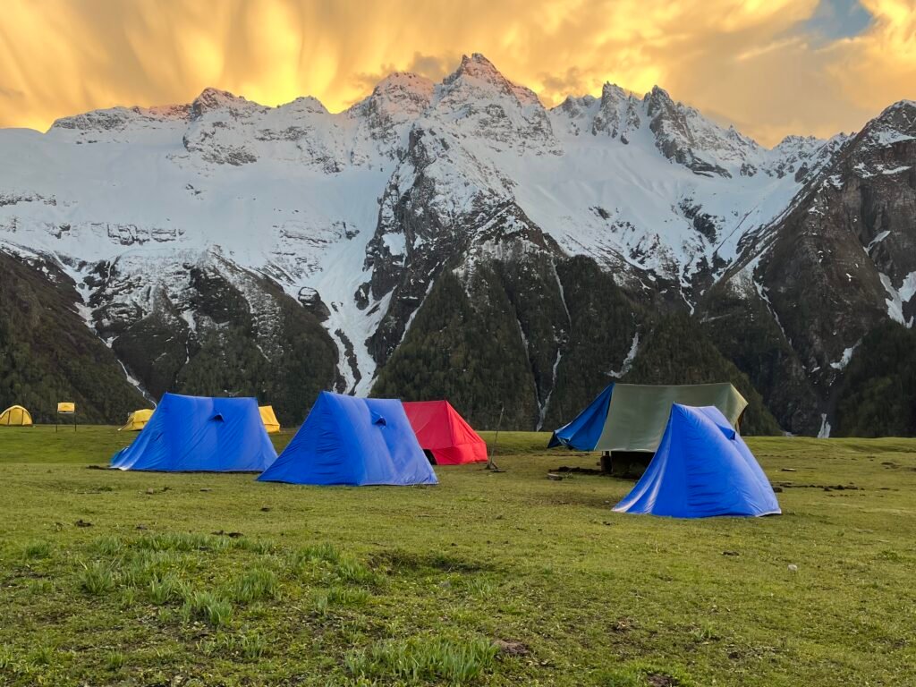
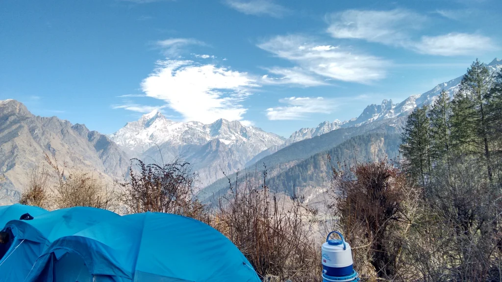
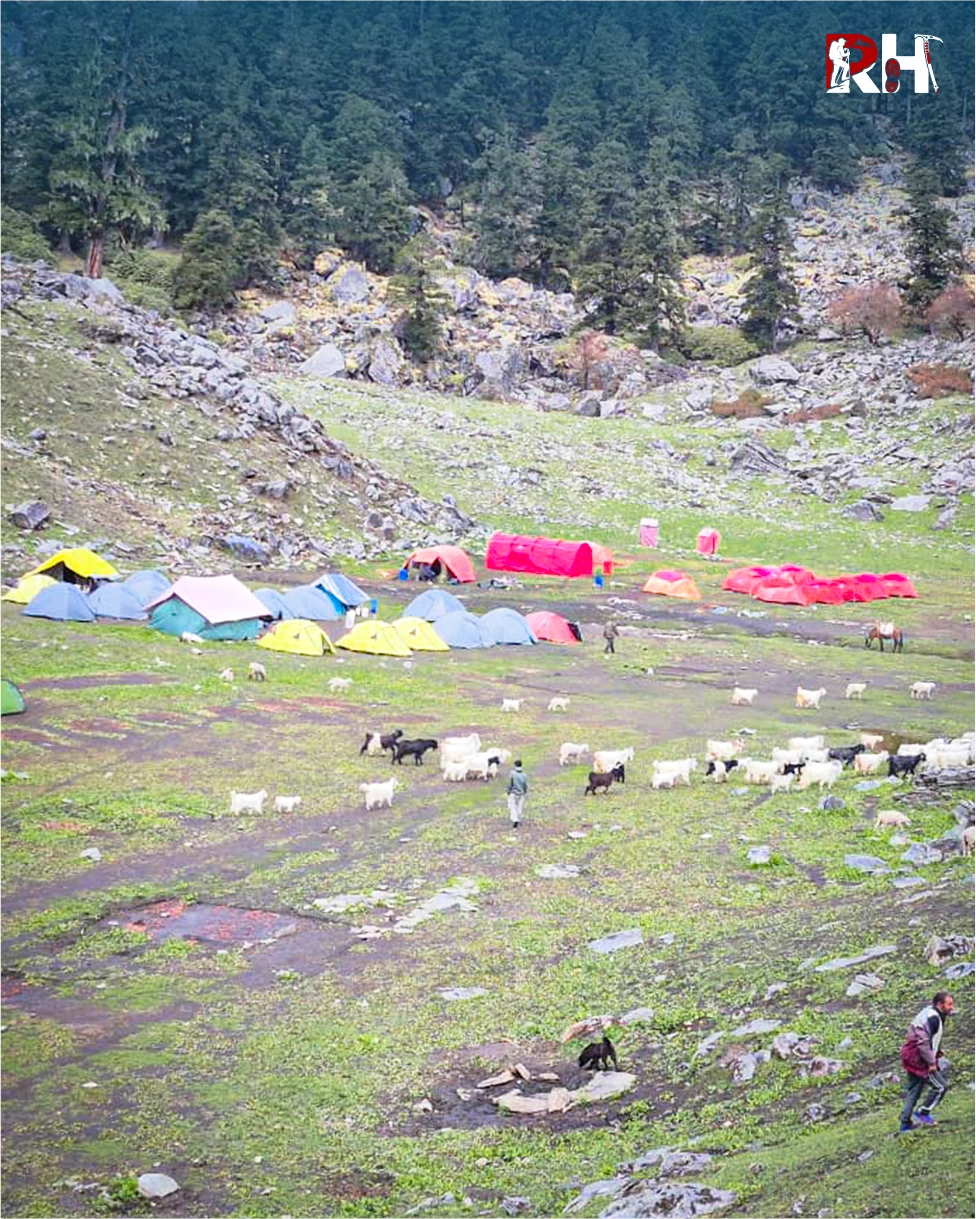
Dronagiri and Hathi Ghoda directly ahead. The Nanda Devi massif visible beyond the northern ridgeline. Khullara meadow opens at 11,014 feet, a wide high-altitude bugyal with mountain views in every direction. This is the last camp before the summit. Everything from here requires complete attention.
Arrive early. Use the afternoon to rest, hydrate thoroughly, and check every item in your summit kit. Down jacket, balaclava, crampons, gloves, headtorch with fresh batteries, trekking poles, 2 litres of water in an insulated sleeve. Eat a proper dinner. Sleep by 8 PM.
Get dressed in full summit layers. Every layer. Down jacket, balaclava, gloves, crampons on boots. Headtorch on. Walk out of camp into darkness and cold air that feels different at 11,000 feet than it does anywhere else.
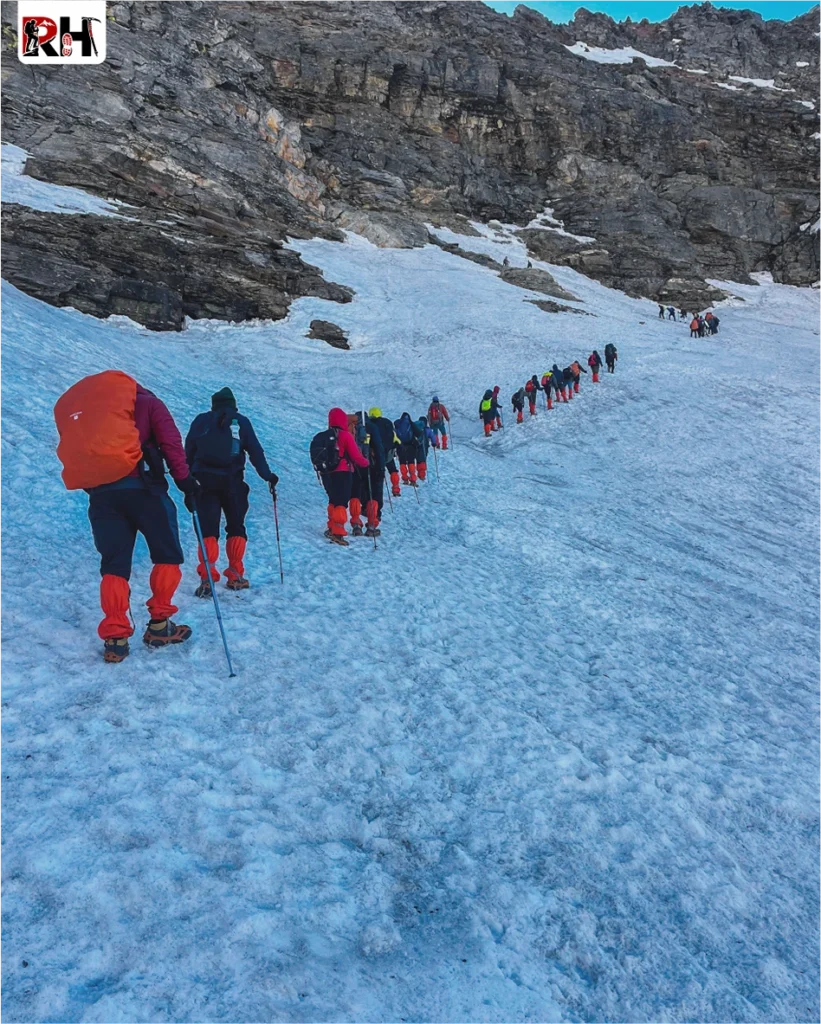
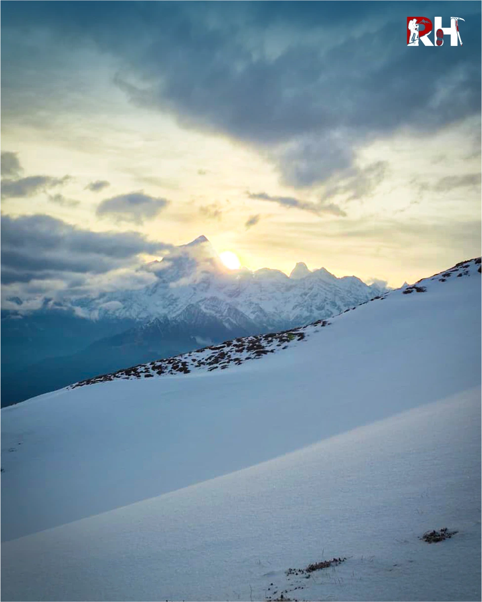
The trail begins across Khullara meadow and then hits the first ridge. Snow from the first step. Your crampons bite into packed snow as the gradient increases. The headtorch shows 10 feet of trail ahead and nothing else. The stars above are brilliant and cold. Somewhere ahead, 4,000 feet above, is the summit.
Six ridges stand between you and it. The first two ridges are steep but manageable, rhythm-climbing that warms your muscles and settles your breathing. By the third ridge, the altitude is making itself known. Your pace slows. Each step requires more effort than the last. The snow deepens. The exposure increases. On your left and right, the ridge drops away steeply.
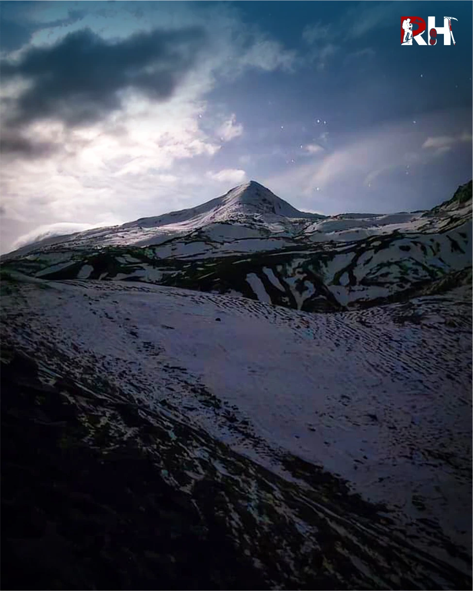
Traversing the second, third, and fourth snow ridges may take an hour and a half. Once you reach the top of the fourth ridge, a clear perspective of the summit climb from the base of Pangarchulla Peak can be seen. From the fourth ridge, the summit is visible for the first time. A steep pyramid of snow and rock rising 300 to 350 metres above you. It looks close. It is not close.
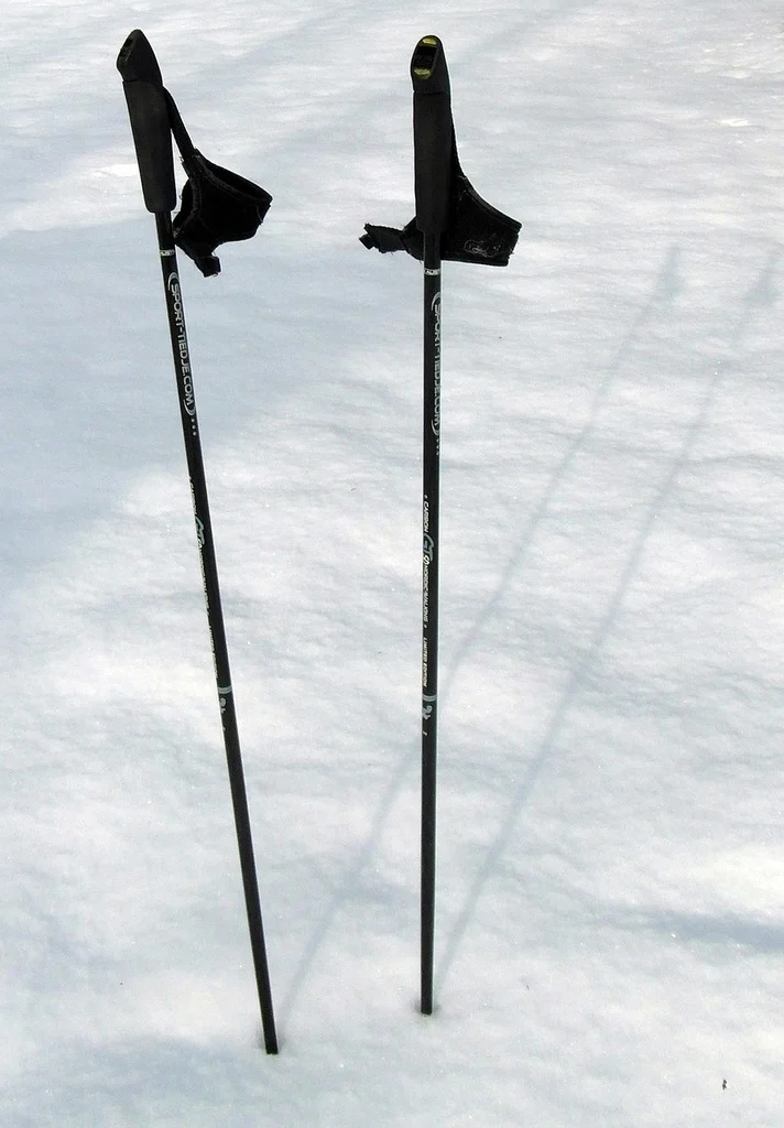
The fifth ridge leads to the base of the actual summit climb. The sixth is a stone’s throw from the fifth but takes 45 minutes to reach. And from the top of the sixth ridge, the final ascent begins. This is the hardest section of the entire trek. A 60-degree incline on packed snow and rock. Your crampons are essential here. Your poles are essential here. Your fitness from weeks of training is essential here. Step by step, methodically, without rushing, without pausing too long, the summit ridge gets closer.
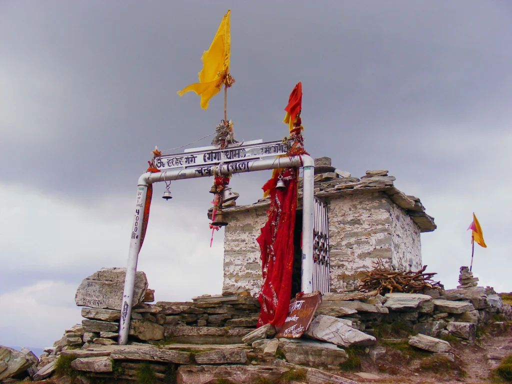
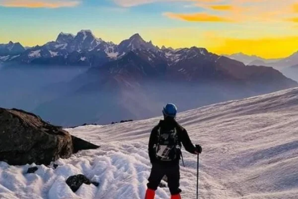
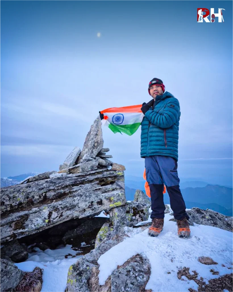
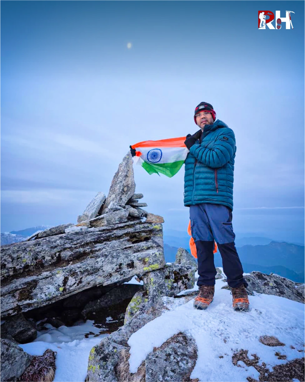
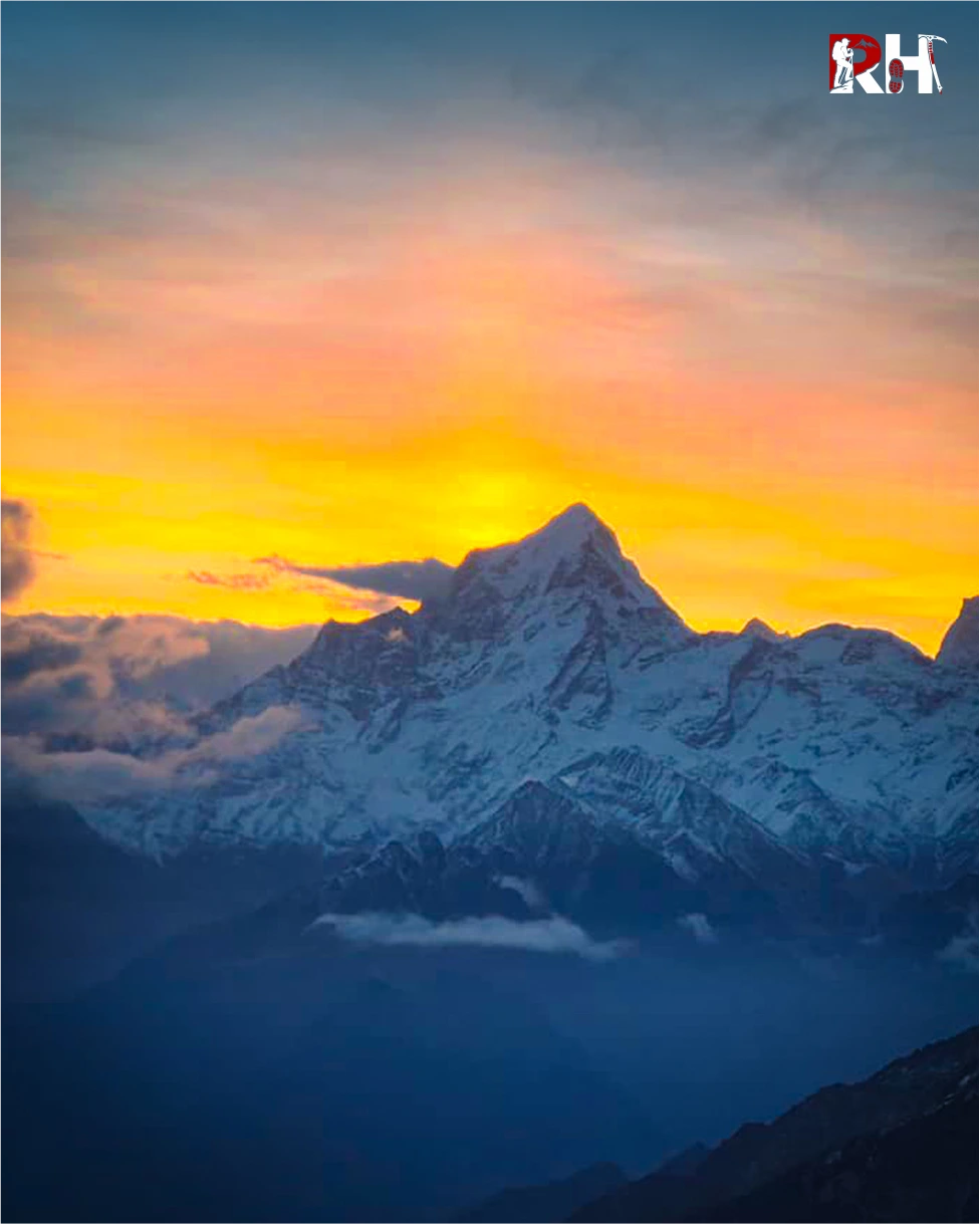
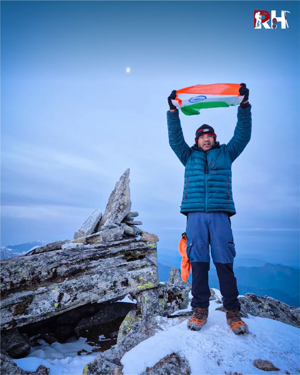
And then you are on it. Pangarchulla Peak at 15,069 feet. A true summit. Below you in every direction, the Garhwal Himalayas.
Nanda Devi to the east, India’s second-highest peak, a wall of snow and ice that fills the horizon. Dronagiri and Changabang to the northeast. Kamet, India’s third-highest peak, to the north. Hathi Ghoda, Ghori Parbat, Mana behind them. Chaukhamba’s four summits to the west. Neelkanth and Trishul completing the circle. And far below, the meadows of Khullara where you woke up in darkness four hours ago. This is what a summit feels like. This is why people train for months and drive nine hours and wake up at 3 AM. Not for the altitude number. For the view that can only exist from above everything.
Stay as long as your body allows. Then begin the descent. The descent from Pangarchulla is long and demanding. Six ridges back down, 14 kilometres total, arriving at Khullara by late afternoon after 12 hours of continuous trekking. Your knees will remember the descent. Your legs will feel the 4,000 feet of altitude loss. Use your poles on every step down.
The descent from Khullara retraces Days 2 and 3 in reverse, downhill now through alpine meadow, thinning forest, dense oak and rhododendron, and finally to Tugasi village at the roadhead. After yesterday’s 12-hour push, 10 kilometres of downhill trekking feels manageable in distance but demanding on tired knees. Use your poles from the first step. Take it steadily.
Arrive at Tugasi by early afternoon. The short drive to Joshimath takes 45 minutes. Check into your hotel, shower properly, eat a full meal. The trekking is done.
The final day reverses the Day 1 drive. Joshimath to Karnaprayag, Rudraprayag, Devprayag, and into Rishikesh by evening. Arrive between 5 PM and 7 PM. Book your onward travel with at least a 2-hour buffer for delays.
The Pangarchulla Peak Trek is over. But the memory of standing at 15,069 feet on a real summit with the Garhwal Himalayas in every direction, after crossing six snow ridges in the dark, stays in a different part of you than other memories. The part where you keep what you had to actually earn.
Inclusion & exclusion
This section includes complete details about accommodation, meals, permits, transportation, camping equipment, trekking gear, summit support, trek leadership, and services included in the Pangarchulla Peak Trek package, along with personal expenses and items not covered in the overall trek cost.
Inclusions
Exclusions
- Bag Offloading Charges: ₹1,400 per bag
- Maximum Weight Limit: 10 kg per bag
Best Time to Visit Pangarchulla Peak Trek
If there is one season when Pangarchulla is at its absolute best, it is spring. But the trek operates in two distinct windows, and the experience in each is different enough to warrant understanding both before you book.
April to May: Primary Season — The Summit Window
By mid-March to end of April, all the snow that fell during the winter has settled. The base becomes compact and stable. So if you are aiming for the summit, this is the time to do it.
This is the season that defines Pangarchulla’s reputation. Compact, stable snow on the summit ridges. Crampons bite correctly. The trail is established. Summit success rates are at their highest of the entire year. April delivers the best combination of conditions: firm snow for the summit ridges, rhododendron forests in full red bloom on the lower trail, comfortable daytime temperatures at Khullara, and clear skies in the early morning that make the summit panorama extraordinary.
May is also viable but conditions shift. After April, the snow starts to melt. And those giant boulders resurface. Once that happens, it is not a snow climb anymore, it becomes a full-on boulder scramble. May trekkers find the lower sections greener and warmer, but the summit approach becomes more physically taxing as snow gives way to loose rock.
Daytime temperature at Khullara: 5°C – 12°C
Night temperature at Khullara: -2°C – 5°C
Summit morning temperature: -5°C to -10°C
Snow coverage: Deep and stable on upper ridges
Crampons: Essential
Summit success rate: Highest of the year
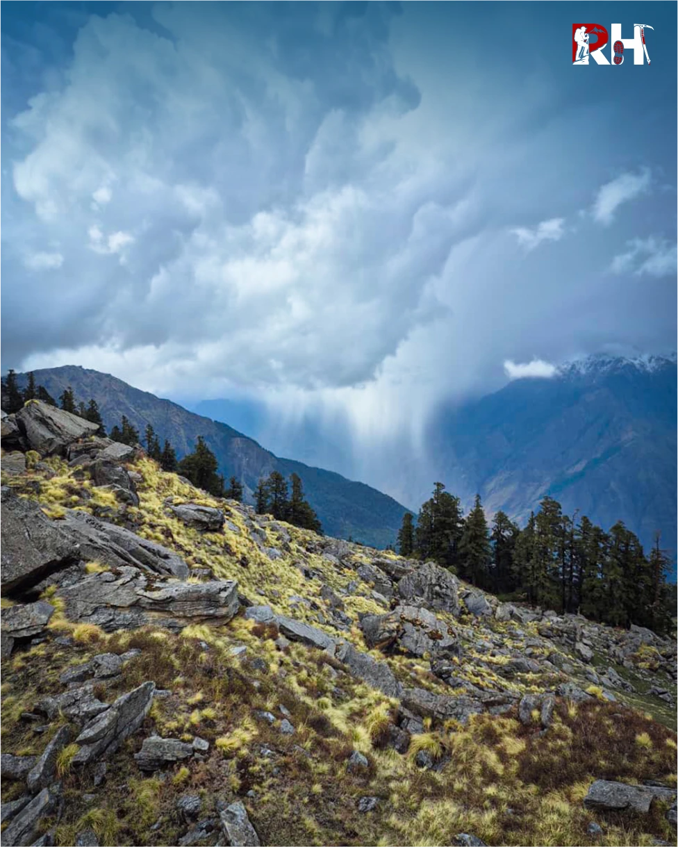
October to November: Autumn Clear Season
The post-monsoon window offers the clearest mountain views of the year. The skies are deep blue, visibility is exceptional, and the panorama from the summit on a clear October day is arguably the finest of any season.
Snow begins returning to the upper ridges from late October onward. Early October may involve boulder terrain on the summit approach; late October and November bring new snowfall that stabilises conditions again.
Daytime temperature at Khullara: 3°C – 10°C
Night temperature at Khullara: -5°C – 0°C
Summit morning temperature: -8°C – -12°C
Snow coverage: Variable. Minimal in early October, increasing through November
Crowds: Low
December to February: Winter (Not Recommended)
Before mid-March, snow on the upper sections is loose and fluffy. There is no base. You cannot get good grip. Opening a trail becomes next to impossible.
Winter temperatures at Khullara drop to -10°C to -15°C with wind chill. The summit ridges are buried under unpredictable, unconsolidated snow. Most trekkers are unprepared for these extreme conditions, which is why Pangarchulla is not recommended in winter.
Most operators run the Kuari Pass route instead during winter, which delivers extraordinary views at a manageable difficulty.
July to September: Monsoon (Closed)
Heavy rainfall, unstable trails, landslide risk on the approach road from Rishikesh. The trek does not operate during monsoon.
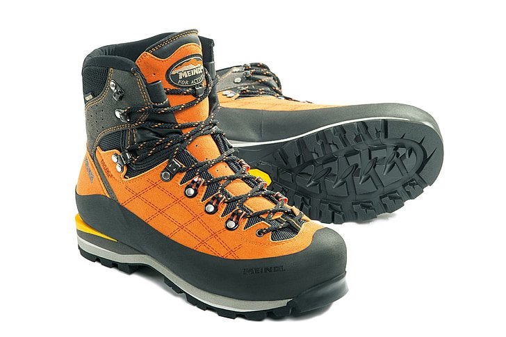
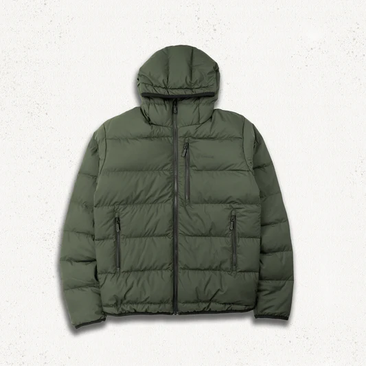
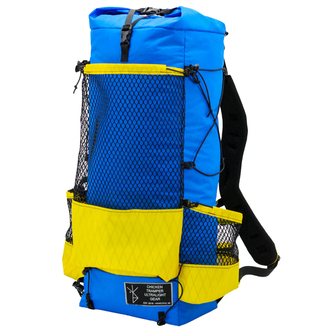
Things to Carry
Pack for the summit, not the meadow. At 3 AM on Day 4 at 15,000 feet in April, the temperature will be -8°C or lower with wind chill. Every item on this list exists for a reason.
Clothing
Footwear
Equipment
Health & Hygiene
Documents & Finance
How to Reach Pangarchulla Peak Trek Base Camp
The Pangarchulla Peak Trek starts from Tugasi village, 14 km from Joshimath. Rishikesh is the main transit hub.
Reach Dehradun
By Air: The nearest airport is Jolly Grant Airport in Dehradun, 21 km from Rishikesh. From the airport, take a taxi or cab to Rishikesh (45 minutes).
By Train: Rishikesh Railway Station and Haridwar Junction (24 km) are well-connected to Delhi, Mumbai, and other major cities.
By Road: Direct Volvo buses connect Rishikesh to Delhi (240 km, 6-7 hours), Dehradun (45 km, 1.5 hours), and Haridwar (24 km, 1 hour).
Policy
| Policy Point | Details |
|---|---|
| Booking Confirmation | Your seat is considered confirmed only after the required advance payment is received. |
| Balance Payment | The remaining amount must be cleared before departure or as per the reporting instructions shared by the team. |
| Transport Selection | Pickup from Dehradun is applicable only if that option is selected at the time of booking. |
| ID Requirement | Every participant should carry a valid government photo ID for verification and trek administration. |
| Operational Changes | In case of weather, road, or safety concerns, the itinerary may be adjusted for the well-being of the group. |
| Cancellation Window | Charge / Refund |
|---|---|
| More than 30 days before departure | Minimal processing deduction may apply; remaining amount can be refunded or adjusted as per booking terms. |
| 15 to 30 days before departure | Partial cancellation charge applicable; remaining balance may be refunded or transferred to a future batch if approved. |
| 7 to 14 days before departure | Higher cancellation charge applies because transport, permits, and staffing arrangements are usually already blocked. |
| Less than 7 days before departure | Booking is generally non-refundable due to final operational commitments. |
| No show / Trek departure missed | No refund is usually applicable once reporting is missed without prior written coordination. |
Important: Trek departures and route decisions always remain subject to weather, road access, local administration, and safety conditions. Final operational decisions are taken in the interest of the group.
FAQ's
The trek is rated moderate to difficult. The trail involves steep snow slopes, use of crampons and ice axes on summit day, and significant altitude gain, making prior trekking experience highly recommended. The first three days are moderate, forest and meadow walks. Summit day is where the difficulty earns its rating: 12 hours, six snow ridges, crampons, and 4,000 feet of altitude gain and loss in a single day.
The maximum altitude is 15,069 feet (4,593 meters) at Pangarchulla Peak. Khullara camp is at 11,014 ft, Guling at 9,650 ft, and Joshimath at 6,150 ft. The total altitude gain from Tugasi to the summit is nearly 7,500 vertical feet.
April to mid-May for the best summit conditions: compact, stable snow on the ridges, rhododendron forests in bloom, and the highest summit success rates of the year. October to November for clear post-monsoon skies and exceptional mountain views. For a safe and rewarding experience, explore Pangarchulla Peak from March to June when conditions are most favourable. Avoid December-February (unstable snow) and July-September (monsoon).
6 days from Rishikesh to Rishikesh, including travel days. The actual trekking happens over 4 days (Days 2-5). Add 1-2 buffer days for potential weather delays.
Without prior high-altitude trek experience and excellent physical preparation, this trek is almost impossible to do. You should have completed at least one high-altitude Himalayan trek above 12,000 feet before attempting Pangarchulla. The summit day involves crampons, steep snow ridges, and 12 hours of continuous effort at altitude.
The 360-degree summit panorama at 15,069 ft including Nanda Devi, Dronagiri, Kamet, Chaukhamba, Hathi Ghoda, and Trishul; the six snow ridges on summit day; the pre-dawn start from Khullara in headtorches; crampons and technical terrain on the final summit push; Khullara alpine meadows with direct Nanda Devi views; and rhododendron forests in spring bloom.
Joshimath: 5°C to 15°C during the day. Guling camp: 0°C to 8°C at night. Khullara camp: -2°C to 5°C at night in spring, -8°C to -12°C in autumn. Summit morning at Pangarchulla: -8°C to -15°C with wind chill depending on season. Full winter layering including 700-fill down jacket and balaclava is non-negotiable.
Acclimatization happens gradually over three days from Joshimath (6,150 ft) to Guling (9,650 ft) to Khullara (11,014 ft) before the summit push to 15,069 ft. Drink 3-4 litres of water daily. Walk slowly. Diamox is recommended, consult your doctor before the trek. Report any AMS symptoms (headache, nausea, dizziness, breathlessness at rest) immediately to your trek leader.
Yes. The climb demands a few good trekking skills including the use of gaiters, microspikes, roping up, working together as a team, ascending and descending on steep gradients, and walking on snow. Crampons are mandatory for the summit day approach. They are provided by the trek operator.
BSNL works in Joshimath. Beyond Tugasi, assume no network for 4-5 days. Occasional signal at Khullara is possible but not reliable. Download offline maps before leaving Rishikesh.
Indian nationals: Forest permits for the Chamoli district trekking zone are required and included in trek packages. Foreign nationals: Check with local authorities for any special permits required.
Kuari Pass is a pass at 12,516 ft; Pangarchulla is a summit at 15,069 ft. The first three days of both treks are identical, both starting from Tugasi, climbing through Guling to Khullara. On Day 4, Kuari Pass takes you to a ridge with extraordinary views and back. Pangarchulla takes you 2,553 feet higher to a genuine summit, with crampons, six snow ridges, a 12-hour day, and a view that only exists from a place where you are above, not between, the mountains.
The trek from Khullara Camp to Pangarchulla Peak summit starts with a gradual ascent from the campsite, following a well-defined trail through alpine meadows and rocky terrain. As you gain elevation, the trail becomes steeper and more challenging, with sections of scree slopes and loose rocks. The final stretch to the summit involves a steep climb, possibly with some scrambling over rocks. You leave at 3-4 AM, cross six snow ridges, reach the summit after 6-8 hours of climbing, and descend back to Khullara. Total: 12 hours, 14 kilometres, 4,000 feet of gain and loss.
No. Solo trekking is not permitted and not safe. The summit involves technical terrain requiring crampons, roping in sections, and experienced guides who know the ridge route. The approach is remote with no emergency services. Organised group treks with certified leaders are the only responsible way to attempt this peak.
Rental gear for this trek